Category:Hundleby
Aller à la navigation
Aller à la recherche
localité britannique du comté anglais de Lincolnshire  | |||||
| Téléverser des médias | |||||
| Nature de l’élément | |||||
|---|---|---|---|---|---|
| Lieu | East Lindsey, Lincolnshire, Midlands de l'Est, Angleterre | ||||
 | |||||
Sous-catégories
Cette catégorie comprend seulement la sous-catégorie ci-dessous.
S
Média dans la catégorie « Hundleby »
Cette catégorie comprend 50 fichiers, dont les 50 ci-dessous.
-
 A former Masonic Lodge, Spilsby - geograph.org.uk - 4150544.jpg 1 600 × 1 200 ; 435 kio
-
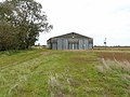 Barn by Hundleby - geograph.org.uk - 1021156.jpg 640 × 480 ; 89 kio
-
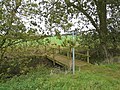 Bridleway near Hundleby - geograph.org.uk - 1021100.jpg 640 × 480 ; 148 kio
-
 Bridleway south of Wood Hill - geograph.org.uk - 3612401.jpg 1 600 × 1 064 ; 421 kio
-
 Church Lane Hundleby, Spilsby - geograph.org.uk - 4150345.jpg 1 600 × 1 200 ; 454 kio
-
 Church Lane, Hundleby - geograph.org.uk - 3491362.jpg 640 × 480 ; 84 kio
-
 Church Lane, Hundleby - geograph.org.uk - 4089040.jpg 640 × 426 ; 113 kio
-
 Church Lane, Hundleby, Spilsby - geograph.org.uk - 4150347.jpg 1 600 × 1 200 ; 429 kio
-
 East through Hundleby - geograph.org.uk - 3006167.jpg 640 × 447 ; 50 kio
-
 Entering Hundleby from the west - geograph.org.uk - 3006161.jpg 640 × 406 ; 67 kio
-
 Farm track off Main Road - geograph.org.uk - 3491363.jpg 640 × 480 ; 90 kio
-
 Footpath at St Mary's, Hundleby - geograph.org.uk - 4150354.jpg 1 600 × 1 200 ; 529 kio
-
 Footpath leading to Spilsby - geograph.org.uk - 4150352.jpg 1 600 × 1 200 ; 458 kio
-
 Footpath to Hundleby - geograph.org.uk - 1021114.jpg 480 × 640 ; 111 kio
-
 Former Wesleyan Chapel, Hundleby - geograph.org.uk - 4150369.jpg 1 600 × 1 200 ; 413 kio
-
 Historic centre of Spilsby, aerial 2017 (2) - geograph.org.uk - 5503104.jpg 427 × 640 ; 83 kio
-
 Historic centre of Spilsby, aerial 2017 - geograph.org.uk - 5503101.jpg 640 × 427 ; 101 kio
-
 Hundleby Equestrian Centre - geograph.org.uk - 4129662.jpg 640 × 427 ; 61 kio
-
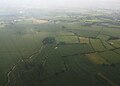
 Hundleby, aerial 2016 - geograph.org.uk - 5229782.jpg 502 × 640 ; 78 kio
-
 Junction of footpaths north of Keal Carr - geograph.org.uk - 3618162.jpg 1 600 × 1 064 ; 514 kio
-
 Keal Carr - geograph.org.uk - 1020937.jpg 640 × 480 ; 63 kio
-
 Keal Carr - geograph.org.uk - 1021126.jpg 640 × 480 ; 101 kio
-
 Main Road (B1195) - geograph.org.uk - 3491367.jpg 640 × 480 ; 49 kio
-
 Main Road (B1195), Hundleby - geograph.org.uk - 3491361.jpg 640 × 480 ; 57 kio
-
 Main Road, Hundleby - geograph.org.uk - 4088913.jpg 640 × 426 ; 87 kio
-
 Main Road, Hundleby - geograph.org.uk - 4088930.jpg 640 × 426 ; 122 kio
-
 Main Road, Hundleby - geograph.org.uk - 786040.jpg 640 × 480 ; 121 kio
-
 Main Road, Hundleby - geograph.org.uk - 786045.jpg 640 × 480 ; 126 kio
-

-

-

-
 Parish Rooms, Hundleby - geograph.org.uk - 4089052.jpg 640 × 426 ; 110 kio
-
 Post Office, Hundleby - geograph.org.uk - 627489.jpg 640 × 480 ; 79 kio
-
 Raithby by Spilsby, aerial 2016 - geograph.org.uk - 5229769.jpg 640 × 427 ; 46 kio
-
 Raithby by Spilsby, aerial 2016 - geograph.org.uk - 5229911.jpg 427 × 640 ; 54 kio
-
 River Lymn NW of Partney Bridge, aerial 2016 - geograph.org.uk - 5011618.jpg 360 × 640 ; 33 kio
-
 River Lymn NW of Partney Bridge, aerial 2016 - geograph.org.uk - 5011623.jpg 640 × 458 ; 41 kio
-
 Spilsby, aerial 2017 (2) - geograph.org.uk - 5503112.jpg 640 × 427 ; 63 kio
-
 Spilsby, aerial 2017 - geograph.org.uk - 5503109.jpg 640 × 427 ; 86 kio
-

-

-

-
 Terrace of houses in Hundleby - geograph.org.uk - 4129628.jpg 640 × 427 ; 67 kio
-
 The Hundleby Inn - geograph.org.uk - 3491359.jpg 640 × 480 ; 47 kio
-
 The Hundleby Inn, Hundleby, Spilsby - geograph.org.uk - 4150357.jpg 1 600 × 1 200 ; 379 kio
-
 The Hundleby Inn, Hundleby, Spilsby - geograph.org.uk - 4150359.jpg 1 200 × 1 600 ; 362 kio
-
 Track and footpath to Vale Farm - geograph.org.uk - 3633543.jpg 2 256 × 1 504 ; 1,84 Mio
-

-
 Village of Hundleby - geograph.org.uk - 4089048.jpg 426 × 640 ; 98 kio
-
 War Memorial at Hundleby, Spilsby - geograph.org.uk - 4150351.jpg 1 200 × 1 600 ; 581 kio


_-_geograph.org.uk_-_5503104.jpg)


_-_geograph.org.uk_-_3491367.jpg)
,_Hundleby_-_geograph.org.uk_-_3491361.jpg)


_-_geograph.org.uk_-_5503112.jpg)


