Category:Hutton-le-Hole
Vai alla navigazione
Vai alla ricerca
village and civil parish in the Ryedale district of North Yorkshire, England  | |||||
| Carica un file multimediale | |||||
| Istanza di | |||||
|---|---|---|---|---|---|
| Luogo | Ryedale, North Yorkshire, Yorkshire e Humber, Inghilterra | ||||
 | |||||
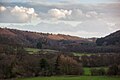
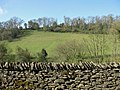
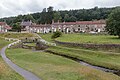
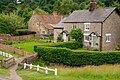
English: Hutton-le-Hole is a very small village and civil parish in the Ryedale district of North Yorkshire, England, about seven miles north west of Pickering. Hutton-le-Hole is a Honeypot village. Sheep roam the streets at will.
Sottocategorie
Questa categoria contiene le 7 sottocategorie indicate di seguito, su un totale di 7.
H
- Hutton-le-Hole Pinfold (2 F)
- Hutton-le-Hole War Memorial (4 F)
R
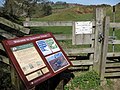
- Ryedale Folk Museum (75 F)
S
T
- The Crown, Hutton-le-Hole (12 F)
File nella categoria "Hutton-le-Hole"
Questa categoria contiene 200 file, indicati di seguito, su un totale di 479.
(pagina precedente) (pagina successiva)-
 'Hammer and Hand' at Hutton le Hole - geograph.org.uk - 4339119.jpg 4 320 × 3 240; 4,22 MB
-
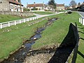
 A bridge over the beck - geograph.org.uk - 2005601.jpg 800 × 600; 264 KB
-
 A choice of tea shops - geograph.org.uk - 1522748.jpg 640 × 326; 47 KB
-
 A gate on the lane - geograph.org.uk - 5587394.jpg 4 320 × 3 240; 4,41 MB
-
 Absailing near Lingmoor House - geograph.org.uk - 215530.jpg 459 × 640; 118 KB
-
 Across the beck - geograph.org.uk - 5583989.jpg 4 320 × 3 240; 5,05 MB
-
 Advertising cart at the craft workshops - geograph.org.uk - 2354063.jpg 768 × 1 024; 271 KB
-
 Along the field edge - geograph.org.uk - 5585005.jpg 4 320 × 3 240; 4,09 MB
-
 Alongside the beck - geograph.org.uk - 5583998.jpg 4 320 × 3 240; 3,94 MB
-
 An ongoing project - geograph.org.uk - 4338347.jpg 4 304 × 2 356; 2,79 MB
-
 Approaching Hutton le Hole - geograph.org.uk - 2701913.jpg 640 × 427; 227 KB
-
 Austin Head - geograph.org.uk - 5347680.jpg 1 024 × 768; 208 KB
-
 Autumn glow - Douthwaite Dale - geograph.org.uk - 3731511.jpg 1 024 × 578; 195 KB
-
 Bales by the path - geograph.org.uk - 5585006.jpg 4 320 × 3 240; 2,95 MB
-
 Barmens Lane - geograph.org.uk - 2363423.jpg 1 536 × 2 048; 1,35 MB
-
 Barmoor and beyond from above Lowna Road - geograph.org.uk - 4179464.jpg 1 500 × 1 003; 854 KB
-
 Barmoor, north of Hutton-le Hole - geograph.org.uk - 2361931.jpg 2 048 × 1 463; 845 KB
-
 Barmoor, through the bars - geograph.org.uk - 2363418.jpg 2 048 × 1 536; 1,17 MB
-
 Barn remains - geograph.org.uk - 3550772.jpg 1 024 × 768; 816 KB
-
 Bear left at the waymarker - geograph.org.uk - 4339092.jpg 4 320 × 3 240; 3,36 MB
-
 Beck confluence - geograph.org.uk - 5583993.jpg 4 320 × 3 240; 3,49 MB
-
 Big view south over Ryedale - geograph.org.uk - 3013809.jpg 1 024 × 768; 493 KB
-
 Black sheep on the roadside, near Hutton-le-Hole - geograph.org.uk - 4518315.jpg 1 024 × 788; 296 KB
-
 Black sheep, Hutton-le-Hole - geograph.org.uk - 2166337.jpg 640 × 480; 123 KB
-
 Blackthorn by the kissing gate - geograph.org.uk - 2361961.jpg 1 536 × 2 048; 1,19 MB
-
 Blakey Road - geograph.org.uk - 2354264.jpg 2 048 × 1 536; 971 KB
-
 Blakey Road - geograph.org.uk - 2629632.jpg 1 024 × 768; 148 KB
-
 Blakey Road - geograph.org.uk - 3121917.jpg 1 024 × 768; 278 KB
-
 Blakey Road heading north - geograph.org.uk - 3126357.jpg 640 × 480; 51 KB
-
 Blakey Road wends it way over the moor near Hutton Knowl - geograph.org.uk - 3090675.jpg 1 600 × 1 198; 392 KB
-
 Bottomfields Lane (1) - geograph.org.uk - 5587380.jpg 4 320 × 3 240; 4,2 MB
-
 Bottomfields Lane (2) - geograph.org.uk - 5587383.jpg 4 320 × 3 240; 4,03 MB
-
 Bottomfields Lane (3) - geograph.org.uk - 5587386.jpg 4 320 × 3 240; 4,27 MB
-
 Bottomfields Lane (4) - geograph.org.uk - 5587387.jpg 4 320 × 3 240; 4,46 MB
-
 Bottomfields Lane (5) - geograph.org.uk - 5587393.jpg 4 320 × 3 240; 4,94 MB
-
 Bottomfields Lane - geograph.org.uk - 1031920.jpg 640 × 388; 208 KB
-
 Bottomfields Lane - geograph.org.uk - 1522832.jpg 640 × 480; 83 KB
-
 Bracken covered bank off Blakey Road - geograph.org.uk - 3126355.jpg 640 × 480; 120 KB
-
 Bridge on The Green - geograph.org.uk - 5583971.jpg 4 320 × 3 240; 4,03 MB
-
 Bridge over Hutton Beck - geograph.org.uk - 1523146.jpg 640 × 480; 129 KB
-
 Bridge over Hutton Beck - geograph.org.uk - 1544753.jpg 640 × 427; 144 KB
-
 Bridge over the beck, Hutton le Hole - geograph.org.uk - 1522736.jpg 640 × 480; 102 KB
-
 Bridleway meets lane (1) - geograph.org.uk - 5586314.jpg 4 320 × 3 240; 4,11 MB
-
 Bridleway meets lane (2) - geograph.org.uk - 5586315.jpg 4 320 × 3 240; 4,28 MB
-
 Bridleway meets lane (3) - geograph.org.uk - 5586316.jpg 4 320 × 3 240; 4,59 MB
-
 Bridleway meets lane (4) - geograph.org.uk - 5587376.jpg 4 320 × 3 240; 4,19 MB
-
 Burnley House, Hutton-le-Hole - geograph.org.uk - 4517783.jpg 1 024 × 768; 147 KB
-
 Burnley House, Hutton-le-Hole - geograph.org.uk - 497635.jpg 640 × 480; 74 KB
-

-
 Car Boot Sale, Hutton-le-Hole - geograph.org.uk - 497357.jpg 640 × 480; 99 KB
-
 Car park and trees, Hutton-le-Hole - geograph.org.uk - 4522548.jpg 459 × 640; 136 KB
-
 Car Park at Hutton-le-Hole - geograph.org.uk - 105039.jpg 640 × 437; 61 KB
-
 Car park, Hutton le Hole - geograph.org.uk - 2498187.jpg 3 296 × 2 472; 1,87 MB
-
 Car park, Yan Brow - geograph.org.uk - 4522557.jpg 640 × 416; 63 KB
-
 Caravan Park entrance, Westfield Lodge - geograph.org.uk - 4058128.jpg 1 600 × 1 200; 622 KB
-
 Cattle Grid clutter - geograph.org.uk - 4049007.jpg 1 024 × 768; 656 KB
-
 Cattle grid in Ridings Wood - geograph.org.uk - 4563536.jpg 1 600 × 1 198; 1,06 MB
-
 Cattle grid north of Hutton-le-Hole - geograph.org.uk - 4563802.jpg 1 600 × 1 066; 1 009 KB
-
 Cattle grid on Moor Lane - geograph.org.uk - 2355286.jpg 1 024 × 768; 178 KB
-
 Cattle grid on Yan Brow - geograph.org.uk - 2360138.jpg 1 024 × 768; 269 KB
-
 Charabanc to Hutton-le-Hole - geograph.org.uk - 497732 (cropped).jpg 288 × 288; 26 KB
-
 Charabanc to Hutton-le-Hole - geograph.org.uk - 497732.jpg 640 × 480; 80 KB
-
 Christmas Day at Hutton-le-Hole - geograph.org.uk - 1090887.jpg 640 × 427; 72 KB
-
 Climbing Austin Head (1) - geograph.org.uk - 5584010.jpg 4 320 × 3 240; 4,52 MB
-
 Climbing Austin Head (2) - geograph.org.uk - 5584013.jpg 4 320 × 3 240; 4,82 MB
-
 Combined harvester above Hutton le Hole - geograph.org.uk - 2701911.jpg 640 × 455; 254 KB
-
 Come to grief - geograph.org.uk - 3630604.jpg 1 600 × 1 121; 716 KB
-
 Confluence of Hutton Beck and Fairy Call Beck - geograph.org.uk - 2352825.jpg 2 048 × 1 536; 603 KB
-
 Cooling Off - geograph.org.uk - 5839855.jpg 5 139 × 3 428; 3,33 MB
-
 Cottage on the green - geograph.org.uk - 1522772.jpg 640 × 480; 85 KB
-
 Cottage, Hutton-le-Hole - geograph.org.uk - 3126347.jpg 640 × 480; 83 KB
-

-
 Cottages by the beck - geograph.org.uk - 1522789.jpg 418 × 640; 88 KB
-
 Cottages, Hutton-le-Hole - geograph.org.uk - 4029345.jpg 640 × 480; 84 KB
-
 Cottages, Hutton-le-Hole - geograph.org.uk - 4029352.jpg 640 × 480; 88 KB
-
 Cottages, Hutton-le-Hole - geograph.org.uk - 4032355.jpg 640 × 480; 93 KB
-
 Cottages, Hutton-le-Hole - geograph.org.uk - 4764204.jpg 640 × 441; 159 KB
-
 Cottages, Hutton-le-Hole - geograph.org.uk - 4787513.jpg 640 × 374; 134 KB
-
 Craft and gift shop, Hutton-le-Hole - geograph.org.uk - 3124991.jpg 640 × 480; 50 KB
-
 Craft workshops, Hutton-le-Hole - geograph.org.uk - 2354059.jpg 1 024 × 768; 196 KB
-
 Cyclists on Moor Lane - geograph.org.uk - 2352030.jpg 1 600 × 1 200; 512 KB
-
 Daleside at Hutton Common - geograph.org.uk - 1523156.jpg 640 × 480; 100 KB
-
 Deeply incised sunken way - geograph.org.uk - 3013794.jpg 1 024 × 768; 706 KB
-
 Densely shaded sunken way - geograph.org.uk - 3550798.jpg 1 024 × 768; 596 KB
-
 Disused quarry - geograph.org.uk - 5587378.jpg 4 320 × 3 240; 3,74 MB
-
 Douthwaite Dale - geograph.org.uk - 4338345.jpg 4 320 × 3 240; 4 MB
-
 Douthwaite Dale - geograph.org.uk - 5354943.jpg 3 240 × 4 320; 4,48 MB
-
 Douthwaite Dale from Yoadwath Bank - geograph.org.uk - 3361411.jpg 4 000 × 3 000; 2,91 MB
-
 Douthwaitedale - ground fog - geograph.org.uk - 4256593.jpg 1 500 × 851; 131 KB
-
 Douthwaitedale autumn display - geograph.org.uk - 4721553.jpg 1 024 × 576; 202 KB
-
 Douthwaitedale from the north - geograph.org.uk - 4773055.jpg 1 024 × 683; 157 KB
-
 Dry stone wall and valley side - geograph.org.uk - 2353964.jpg 1 024 × 768; 308 KB
-
 Early Morning view to the Nab - geograph.org.uk - 2714856.jpg 3 264 × 2 448; 1,04 MB
-
 Easter Monday at Loskey Bridge - geograph.org.uk - 2378118.jpg 640 × 401; 107 KB
-
 England in the wasteland - geograph.org.uk - 201988.jpg 640 × 390; 44 KB
-
 Entering Hutton-le-Hole - geograph.org.uk - 2988267.jpg 1 024 × 690; 269 KB
-

-
 Entrance to the Spaunton Estate - geograph.org.uk - 2354276.jpg 1 024 × 768; 262 KB
-
 Facilities, Ryedale Folk Museum - geograph.org.uk - 4058130.jpg 1 600 × 1 600; 1,1 MB
-
 Fairy Call Beck - geograph.org.uk - 2353983.jpg 1 024 × 768; 279 KB
-
 Fairy Call Beck - geograph.org.uk - 2360154.jpg 1 536 × 2 048; 1,09 MB
-
 Fairy Call Beck flows into Hutton Beck - geograph.org.uk - 2353977.jpg 2 048 × 1 536; 803 KB
-
 Fairy Call Bridge - geograph.org.uk - 2765093.jpg 1 024 × 683; 675 KB
-
 Farm building, The Lund - geograph.org.uk - 3124977.jpg 640 × 480; 71 KB
-
 Farm buildings at The Lund - geograph.org.uk - 2988270.jpg 1 024 × 703; 170 KB
-
 Farndale Turning on the Blakey Road - geograph.org.uk - 3790540.jpg 1 024 × 683; 353 KB
-
 Fence and bridge over Fairy Call Beck - geograph.org.uk - 213809.jpg 640 × 480; 114 KB
-
 Fence around the green - geograph.org.uk - 2352371.jpg 2 048 × 1 536; 661 KB
-
 Footbridge over Hutton Beck - geograph.org.uk - 2352745.jpg 1 024 × 736; 286 KB
-
 Footbridge over Hutton Beck - geograph.org.uk - 4032342.jpg 640 × 480; 95 KB
-
 Footbridge over Hutton Beck - geograph.org.uk - 4032349.jpg 640 × 480; 105 KB
-
 Footbridge over Hutton Beck - geograph.org.uk - 4294561.jpg 1 799 × 1 199; 450 KB
-
 Footbridge over Hutton Beck, Hutton le Hole - geograph.org.uk - 5341861.jpg 1 024 × 768; 140 KB
-

-
 Footbridge over the Hutton Beck - geograph.org.uk - 5637013.jpg 1 211 × 1 010; 203 KB
-
 Footbridge, Hutton le Hole - geograph.org.uk - 1206380.jpg 480 × 640; 71 KB
-
 Footbridge, Hutton-le-Hole - geograph.org.uk - 4764213.jpg 640 × 425; 171 KB
-
 Footpath Hutton Ridge - geograph.org.uk - 3939942.jpg 2 686 × 1 919; 942 KB
-
 Footpath near Grouse Hall - geograph.org.uk - 1915923.jpg 2 048 × 1 536; 1,62 MB
-
 Footpath to the Hutton ridge. - geograph.org.uk - 5030886.jpg 640 × 352; 43 KB
-
 Footpath towards gate - geograph.org.uk - 4058246.jpg 1 600 × 1 200; 854 KB
-
 Footpath, Oxclose Wood - geograph.org.uk - 2166345.jpg 640 × 480; 111 KB
-
 Footprints in the snow - geograph.org.uk - 4339100.jpg 4 320 × 3 240; 3,32 MB
-
 Fordson tractor, Hutton-le-hole, North Yorkshire.jpg 1 099 × 846; 467 KB
-
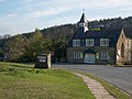
 Former Church in Hutton Le Hole, Yorkshire - geograph.org.uk - 4631051.jpg 636 × 1 000; 652 KB
-
 Former schoolhouse - geograph.org.uk - 3468565.jpg 1 024 × 768; 532 KB
-
 Former village school at Hutton le Hole - geograph.org.uk - 6141382.jpg 1 600 × 1 067; 278 KB
-
 Four ways to go (1) - geograph.org.uk - 5586297.jpg 4 320 × 3 240; 5,77 MB
-
 Four ways to go (2) - geograph.org.uk - 5586306.jpg 4 320 × 3 240; 5,08 MB
-
 Four ways to go (3) - geograph.org.uk - 5586309.jpg 4 320 × 3 240; 5,49 MB
-
 Four ways to go (4) - geograph.org.uk - 5586311.jpg 4 320 × 3 240; 5,42 MB
-
 Foxgloves by the road - geograph.org.uk - 4049006.jpg 1 024 × 768; 682 KB
-
 Gate on the Tabular Hills Walk - geograph.org.uk - 2352298.jpg 1 600 × 1 188; 654 KB
-

-
 Grassy track towards Bottomfield Lane - geograph.org.uk - 3013800.jpg 1 024 × 768; 602 KB
-

-
 Gray Lane heading north - geograph.org.uk - 3126462.jpg 640 × 480; 98 KB
-
 Grazing south of Lowna Road - geograph.org.uk - 4522550.jpg 640 × 414; 79 KB
-
 Grazing, Hutton-le-Hole - geograph.org.uk - 4029338.jpg 640 × 480; 93 KB
-
 Green at Hutton le Hole - geograph.org.uk - 2701917.jpg 640 × 386; 181 KB
-
 Grouse Hall - geograph.org.uk - 1522521.jpg 640 × 480; 77 KB
-
 Grouse Hall - geograph.org.uk - 4773059.jpg 1 024 × 661; 143 KB
-
 Grouse Hall Farm with Douthwaite Dale beyond - geograph.org.uk - 2714865.jpg 3 264 × 2 448; 1,34 MB
-
 Harome Manor House - geograph.org.uk - 6139326.jpg 4 079 × 2 716; 2,54 MB
-
 Heading east along Lowna Road - geograph.org.uk - 2658227.jpg 800 × 600; 210 KB
-
 Heading north towards Loskey Bridge - geograph.org.uk - 2656845.jpg 800 × 600; 211 KB
-
 Heather moorland near Hutton-le-Hole - geograph.org.uk - 4029341.jpg 640 × 480; 86 KB
-
 Heather on Spaunton Moor - geograph.org.uk - 3117665.jpg 1 024 × 728; 235 KB
-
 Hedgerow abundance - geograph.org.uk - 5587388.jpg 4 320 × 3 240; 5,29 MB
-
 High summer view - geograph.org.uk - 3550785.jpg 1 024 × 565; 410 KB
-
 Hills at the south of Hutton-le-Hole - geograph.org.uk - 2363831.jpg 2 048 × 1 536; 771 KB
-
 HLH snow.JPG 1 600 × 1 200; 766 KB
-
 Hollow way descending from The Nab - geograph.org.uk - 5354949.jpg 3 240 × 4 320; 3,09 MB
-
 Hot competition^ - geograph.org.uk - 4339136.jpg 4 130 × 2 160; 1,64 MB
-
 House at Hutton-le-Hole - geograph.org.uk - 2363055.jpg 2 048 × 1 536; 1,09 MB
-
 House in Hutton Le Hole, Yorkshire - geograph.org.uk - 4631023.jpg 1 400 × 933; 1,22 MB
-
 House in Hutton Le Hole, Yorkshire - geograph.org.uk - 4631040.jpg 1 400 × 925; 1,24 MB
-
 House in hutton.jpg 3 200 × 2 368; 2,71 MB
-
 House, Hutton Common - geograph.org.uk - 4529367.jpg 640 × 445; 68 KB
-
 Houses at Hutton le Hole - geograph.org.uk - 2701916.jpg 640 × 427; 186 KB
-
 Houses at Hutton le Hole - geograph.org.uk - 2701924.jpg 640 × 403; 187 KB
-
 Houses at Hutton le Hole - geograph.org.uk - 2701927.jpg 640 × 455; 225 KB
-
 Houses in Hutton Le Hole, Yorkshire - geograph.org.uk - 4631042.jpg 1 400 × 933; 1,5 MB
-
 Houses in Hutton Le Hole, Yorkshire - geograph.org.uk - 4631044.jpg 1 400 × 933; 1,31 MB
-
 Houses, Hutton Le Hole, Yorkshire - geograph.org.uk - 4631056.jpg 1 400 × 933; 1,24 MB
-
 Hutton Beck - geograph.org.uk - 1522756.jpg 480 × 640; 77 KB
-
 Hutton Beck - geograph.org.uk - 1522804.jpg 480 × 640; 84 KB
-
 Hutton Beck - geograph.org.uk - 1523137.jpg 480 × 640; 150 KB
-
 Hutton Beck - geograph.org.uk - 2351978.jpg 1 600 × 1 200; 642 KB
-
 Hutton Beck - geograph.org.uk - 2352764.jpg 1 024 × 623; 243 KB
-
 Hutton Beck - geograph.org.uk - 2361990.jpg 781 × 1 024; 252 KB
-
 Hutton Beck - geograph.org.uk - 4339141.jpg 4 320 × 3 240; 4,42 MB
-
 Hutton Beck - geograph.org.uk - 5100265.jpg 2 399 × 1 599; 552 KB
-
 Hutton Beck - geograph.org.uk - 910116.jpg 427 × 640; 367 KB
-
 Hutton Beck after a thaw - geograph.org.uk - 3313887.jpg 1 024 × 683; 478 KB
-
 Hutton Beck and the old Schoolhouse - geograph.org.uk - 1605200.jpg 640 × 457; 88 KB
-
 Hutton Beck and two former schools - geograph.org.uk - 2352788.jpg 1 536 × 2 048; 749 KB
-
 Hutton Beck emerges - geograph.org.uk - 2351987.jpg 1 200 × 1 600; 733 KB
-
 Hutton Beck in Hutton-le-Hole - geograph.org.uk - 3495538.jpg 640 × 480; 82 KB
-
 Hutton Beck, Hutton Le Hole, Yorkshire - geograph.org.uk - 4631054.jpg 1 400 × 933; 1,29 MB
-
 Hutton Beck, Hutton Le Hole, Yorkshire - geograph.org.uk - 4631059.jpg 1 400 × 933; 1,33 MB
-
 Hutton Beck, Hutton Le Hole, Yorkshire - geograph.org.uk - 4631061.jpg 1 400 × 933; 1,56 MB
-
 Hutton Beck, Hutton-le-Hole - geograph.org.uk - 4032348.jpg 480 × 640; 93 KB
-
 Hutton Beck, Hutton-le-Hole - geograph.org.uk - 4032351.jpg 480 × 640; 92 KB
-
 Hutton Beck, Hutton-le-Hole - geograph.org.uk - 497672.jpg 640 × 480; 106 KB
-
 Hutton Beck, Hutton-le-Hole - geograph.org.uk - 908390.jpg 427 × 640; 325 KB
-
 Hutton le Hole - geograph.org.uk - 1605306.jpg 640 × 489; 101 KB
-
 Hutton le Hole - geograph.org.uk - 2498190.jpg 3 296 × 2 472; 1,88 MB
-
 Hutton le Hole - geograph.org.uk - 2701920.jpg 640 × 494; 256 KB
-
 Hutton le Hole - geograph.org.uk - 5347664.jpg 1 024 × 768; 183 KB
-
 Hutton le Hole - geograph.org.uk - 5347668.jpg 1 024 × 768; 219 KB
-
 Hutton le Hole - geograph.org.uk - 5347689.jpg 1 024 × 768; 172 KB
-
 Hutton Le Hole - geograph.org.uk - 5839865.jpg 5 472 × 3 648; 6,63 MB
-
 Hutton le Hole - panoramio (1).jpg 3 072 × 2 304; 2,79 MB
-
 Hutton le Hole - panoramio (2).jpg 3 072 × 2 304; 2,79 MB
-
 Hutton le Hole - panoramio (3).jpg 3 072 × 2 304; 2,85 MB
-
 Hutton le Hole - panoramio.jpg 3 072 × 2 304; 2,71 MB
-
 Hutton le hole 124113.jpg 2 700 × 1 519; 5,09 MB
-
 Hutton le hole C9676.jpg 2 400 × 1 600; 5,6 MB
-
 Hutton le hole JF2.jpg 3 080 × 2 309; 5,3 MB


_-_geograph.org.uk_-_5587380.jpg)
_-_geograph.org.uk_-_5587383.jpg)
_-_geograph.org.uk_-_5587386.jpg)
_-_geograph.org.uk_-_5587387.jpg)
_-_geograph.org.uk_-_5587393.jpg)


_-_geograph.org.uk_-_5586314.jpg)
_-_geograph.org.uk_-_5586315.jpg)
_-_geograph.org.uk_-_5586316.jpg)
_-_geograph.org.uk_-_5587376.jpg)


.jpg)


_-_geograph.org.uk_-_5584010.jpg)
_-_geograph.org.uk_-_5584013.jpg)


_-_geograph.org.uk_-_5586297.jpg)
_-_geograph.org.uk_-_5586306.jpg)
_-_geograph.org.uk_-_5586309.jpg)
_-_geograph.org.uk_-_5586311.jpg)


.jpg)
.jpg)
.jpg)


