Category:Hyde, Bedfordshire
Vai alla navigazione
Vai alla ricerca
civil parish in Bedfordshire, UK  | |||||
| Carica un file multimediale | |||||
| Istanza di | |||||
|---|---|---|---|---|---|
| Luogo | Central Bedfordshire, Bedfordshire, Est dell'Inghilterra, Inghilterra | ||||
 | |||||
Sottocategorie
Questa categoria contiene le 5 sottocategorie indicate di seguito, su un totale di 5.
File nella categoria "Hyde, Bedfordshire"
Questa categoria contiene 200 file, indicati di seguito, su un totale di 244.
(pagina precedente) (pagina successiva)-
 3 Pheasants at Luton Hoo - geograph.org.uk - 694317.jpg 640 × 480; 115 KB
-

-

-
 A lake off the River Lea - geograph.org.uk - 3859802.jpg 640 × 480; 50 KB
-
-
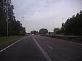
 A1081 London Road - geograph.org.uk - 3292837.jpg 3 072 × 2 304; 1,48 MB
-
 A1081 London Road - geograph.org.uk - 3292847.jpg 3 072 × 2 304; 1,52 MB
-
 A1081 London Road - geograph.org.uk - 3292849.jpg 3 072 × 2 304; 1,51 MB
-
 A1081 London Road - geograph.org.uk - 3292850.jpg 3 072 × 2 304; 1,53 MB
-
 A1081 London Road - geograph.org.uk - 3292855.jpg 3 072 × 2 304; 1,47 MB
-
 A1081 London Road - geograph.org.uk - 3292868.jpg 3 072 × 2 304; 1,33 MB
-
 A1081 London Road - geograph.org.uk - 3297496.jpg 3 072 × 2 304; 1,35 MB
-
 Airport Way, Slip End - geograph.org.uk - 2559974.jpg 1 600 × 1 200; 556 KB
-
 Approaching Pepperstock Bridge - geograph.org.uk - 3293510.jpg 3 072 × 2 304; 1,4 MB
-
 B653 Lower Harpenden Road at Chiltern Green Viaduct - geograph.org.uk - 5610664.jpg 4 608 × 3 072; 1,75 MB
-
 B653 Lower Harpenden Road ^ Chiltern Green Viaduct - geograph.org.uk - 5609661.jpg 4 608 × 3 072; 1,91 MB
-
 B653 Lower Harpenden Road, East Hyde - geograph.org.uk - 5609657.jpg 4 608 × 3 072; 1,87 MB
-
 B653 Lower Harpenden Road, East Hyde - geograph.org.uk - 5609668.jpg 4 608 × 3 072; 1,72 MB
-
 B653 Lower Harpenden Road, East Hyde - geograph.org.uk - 5610953.jpg 4 608 × 3 072; 1,89 MB
-
 B653 Lower Harpenden Road, Luton - geograph.org.uk - 5723077.jpg 3 475 × 2 606; 6,91 MB
-
 B653 Lower Harpenden Road, Luton - geograph.org.uk - 5723080.jpg 3 638 × 2 728; 5,03 MB
-
 B653 Lower Harpenden Road, Luton - geograph.org.uk - 5723083.jpg 3 972 × 2 836; 6,31 MB
-
 B653 Lower Harpenden Road, Luton - geograph.org.uk - 5723088.jpg 4 608 × 3 456; 2,46 MB
-
 B653 Lower Harpenden Road, New Mill End - geograph.org.uk - 5609649.jpg 4 608 × 3 072; 1,89 MB
-
 B653 Lower Harpenden Road, New Mill End - geograph.org.uk - 5686839.jpg 4 608 × 3 072; 2,02 MB
-
 B653 Lower Harpenden Road, New Mill End - geograph.org.uk - 5686848.jpg 4 608 × 3 072; 1,88 MB
-
 B653 Lower Harpenden Road, New Mill End - geograph.org.uk - 5686852.jpg 4 608 × 3 072; 1,85 MB
-
 B653 Lower Harpenden Road, New Mill End - geograph.org.uk - 5702524.jpg 4 608 × 3 072; 1,96 MB
-
 Beech trees - geograph.org.uk - 6293982.jpg 1 024 × 768; 302 KB
-
 Bikes beside The Upper Lee Valley Walk - geograph.org.uk - 6293968.jpg 1 024 × 768; 249 KB
-
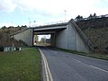
 Bridge over the M1 - geograph.org.uk - 4699329.jpg 640 × 358; 30 KB
-
 Bridleway off Chiltern Green Road - geograph.org.uk - 5609591.jpg 4 608 × 3 072; 2,06 MB
-
 Bush Pasture from the air - geograph.org.uk - 3188952.jpg 640 × 480; 71 KB
-
 By Dane Street Farm - geograph.org.uk - 4634653.jpg 2 246 × 1 648; 1,06 MB
-
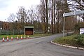
 Central Bedfordshire sign - geograph.org.uk - 3297519.jpg 2 905 × 2 177; 1,41 MB
-
 Charlie's Restaurant ^ Bar - geograph.org.uk - 3292717.jpg 3 072 × 2 304; 1,38 MB
-
 Charlie's Restaurant ^ Bar - geograph.org.uk - 3298788.jpg 3 072 × 2 304; 1,31 MB
-
 Charlie's Restaurant ^ Bar - geograph.org.uk - 3858710.jpg 640 × 459; 59 KB
-
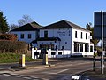
 Charlie's, Harpenden - geograph.org.uk - 4649266.jpg 640 × 480; 117 KB
-
 Chiltern Green Road - geograph.org.uk - 4635250.jpg 2 200 × 1 580; 886 KB
-
 Chiltern Green Road - geograph.org.uk - 5298373.jpg 2 304 × 1 728; 848 KB
-
 Chiltern Green Road - geograph.org.uk - 5609595.jpg 4 608 × 3 072; 1,89 MB
-
 Chiltern Green Road - geograph.org.uk - 5609598.jpg 4 608 × 3 072; 1,85 MB
-
 Chiltern Green Road Railway Bridge - geograph.org.uk - 5608873.jpg 4 608 × 3 072; 1,85 MB
-
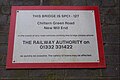 Chiltern Green Road Railway Bridge sign - geograph.org.uk - 5608874.jpg 3 946 × 2 628; 4,24 MB
-
 Chiltern Green Road ^ footpath - geograph.org.uk - 5703399.jpg 4 608 × 3 072; 1,95 MB
-
 Chiltern Green Road ^ footpath - geograph.org.uk - 5703406.jpg 4 608 × 3 072; 1,93 MB
-
 Chiltern Green Road, Dane Street - geograph.org.uk - 5703464.jpg 4 608 × 3 072; 1,84 MB
-
 Chiltern Green Road, Dane Street - geograph.org.uk - 5703705.jpg 4 608 × 3 072; 1,98 MB
-
 Chiltern Green Road, New Mill End - geograph.org.uk - 5608880.jpg 4 608 × 3 072; 1,84 MB
-
 Chiltern Green Road, New Mill End - geograph.org.uk - 5609118.jpg 4 608 × 3 072; 1,93 MB
-
 Chiltern Green Road, New Mill End - geograph.org.uk - 5609609.jpg 4 608 × 3 072; 1,9 MB
-
 Chiltern Green Road, New Mill End - geograph.org.uk - 5609614.jpg 4 608 × 3 072; 2,07 MB
-
 Chiltern Green Road, New Mill End - geograph.org.uk - 5609631.jpg 4 608 × 3 072; 1,86 MB
-
 Chiltern Green Road, New Mill End - geograph.org.uk - 5609642.jpg 4 608 × 3 072; 1,97 MB
-
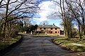
 Chiltern Hall - geograph.org.uk - 2510505.jpg 2 000 × 1 500; 397 KB
-
 Chiltern Hall sign - geograph.org.uk - 5703646.jpg 4 608 × 3 072; 1,77 MB
-
 Chiltern Way - geograph.org.uk - 2168407.jpg 640 × 480; 83 KB
-
 Chiltern Way - geograph.org.uk - 2168414.jpg 640 × 480; 94 KB
-
 Chiltern Way - geograph.org.uk - 2168429.jpg 640 × 480; 56 KB
-
 Common Footman at Luton Hoo - geograph.org.uk - 5840812.jpg 2 105 × 2 840; 606 KB
-
 Cooters End Lane sign - geograph.org.uk - 3299998.jpg 2 989 × 2 240; 2,29 MB
-
 Cooters End Lane sign - geograph.org.uk - 3308407.jpg 3 072 × 2 304; 1,57 MB
-
 Cooters End Lane, East Hyde - geograph.org.uk - 3299996.jpg 3 072 × 2 304; 1,46 MB
-
 Cooters End Lane, East Hyde - geograph.org.uk - 3308424.jpg 3 072 × 2 304; 1,35 MB
-
 Copt Hall Lane - geograph.org.uk - 2510337.jpg 2 000 × 1 512; 591 KB
-
 Copt Hall Postbox - geograph.org.uk - 5686725.jpg 4 608 × 3 072; 1,92 MB
-
 Copt Hall Postbox - geograph.org.uk - 5686732.jpg 2 579 × 3 882; 7,54 MB
-
 Copt Hall Postbox - geograph.org.uk - 5686879.jpg 2 618 × 3 942; 6,76 MB
-
 Copt Hall Road Railway Bridge sign - geograph.org.uk - 5686642.jpg 4 608 × 3 072; 1,85 MB
-
 Copt Hall Road sign - geograph.org.uk - 5686561.jpg 4 608 × 3 072; 1,9 MB
-
 Copt Hall Road sign - geograph.org.uk - 5686871.jpg 4 608 × 3 072; 1,95 MB
-
 Copt Hall Road sign - geograph.org.uk - 5702514.jpg 3 973 × 2 646; 6,24 MB
-
 Copt Hall Road, New Mill End - geograph.org.uk - 5686570.jpg 4 608 × 3 072; 1,85 MB
-
 Copt Hall Road, New Mill End - geograph.org.uk - 5686576.jpg 4 608 × 3 072; 1,87 MB
-
 Copt Hall Road, New Mill End - geograph.org.uk - 5686752.jpg 4 608 × 3 072; 1,85 MB
-
 Copt Hall Road, New Mill End - geograph.org.uk - 5686776.jpg 4 608 × 3 072; 1,84 MB
-
 Copt Hall Road, New Mill End - geograph.org.uk - 5686863.jpg 4 608 × 3 072; 1,9 MB
-
 Cottage on West Hyde Road - geograph.org.uk - 5297342.jpg 2 304 × 1 728; 821 KB
-

-
 Dane Street at Emergency Gate 5 - geograph.org.uk - 5703626.jpg 3 686 × 2 581; 4,56 MB
-
 Dane Street Cottages - geograph.org.uk - 2510471.jpg 2 000 × 1 494; 670 KB
-
 Dane Street, Dane Street - geograph.org.uk - 5703474.jpg 4 608 × 3 072; 1,8 MB
-
 Dane Street, Dane Street - geograph.org.uk - 5703636.jpg 4 000 × 2 667; 7,29 MB
-
 Dane Street, Dane Street - geograph.org.uk - 5703696.jpg 4 608 × 3 072; 2,01 MB
-
 Dane Street, Dane Street - geograph.org.uk - 5703722.jpg 4 608 × 3 072; 1,85 MB
-
 Entrance off the B653 Lower Harpenden Road - geograph.org.uk - 5688812.jpg 4 608 × 3 072; 1,99 MB
-
 Entrance to Bridge Valley Nursery - geograph.org.uk - 2528497.jpg 2 000 × 1 493; 301 KB
-
 Entrance to Chiltern Hall - geograph.org.uk - 5703640.jpg 4 608 × 3 072; 1,93 MB
-
 Entrance to East Hyde Village Hall - geograph.org.uk - 5609723.jpg 4 608 × 3 072; 1,9 MB
-
 Entrance to Luton Sea Cadets - geograph.org.uk - 5723110.jpg 4 608 × 3 456; 2,54 MB
-
 Entrance to the Upper Lea Valley Walk - geograph.org.uk - 5723107.jpg 4 608 × 3 456; 2,51 MB
-
 Farm Road, West Hyde - geograph.org.uk - 5725785.jpg 4 608 × 3 456; 2,42 MB
-
 Farmhouse, New Mill End Farm - geograph.org.uk - 4649327.jpg 640 × 428; 98 KB
-
 Farmland looking towards London Luton Airport - geograph.org.uk - 5609620.jpg 4 608 × 3 072; 1,85 MB
-
 Farmland near East Hyde - geograph.org.uk - 3859795.jpg 640 × 480; 68 KB
-
 Farmland off Farr's Lane - geograph.org.uk - 3859806.jpg 640 × 480; 63 KB
-
 Farmland, East Hyde - geograph.org.uk - 4792286.jpg 640 × 426; 45 KB
-
 Farmland, Kinsbourne Green - geograph.org.uk - 3858729.jpg 640 × 480; 80 KB
-
 Farmland, Newlands Farm - geograph.org.uk - 3858754.jpg 640 × 480; 81 KB
-
 Farr's Lane - geograph.org.uk - 3859810.jpg 640 × 480; 91 KB
-
 Fernell's Wood - geograph.org.uk - 4792289.jpg 640 × 332; 37 KB
-
 Field by Chiltern Green Road, New Mill End - geograph.org.uk - 5298370.jpg 2 304 × 1 728; 825 KB
-
 Field by Thrales End Road, East Hyde - geograph.org.uk - 5298366.jpg 2 304 × 1 728; 865 KB
-
 Field by Thrales End Road, East Hyde - geograph.org.uk - 5298367.jpg 2 304 × 1 728; 958 KB
-
 Field by Thrales End Road, Harpenden - geograph.org.uk - 5298365.jpg 2 304 × 1 728; 893 KB
-
 Field next to London Luton Airport - geograph.org.uk - 5703612.jpg 4 608 × 3 072; 2,03 MB
-
 Fields opposite Forge Cottage - geograph.org.uk - 2510593.jpg 2 000 × 1 504; 386 KB
-
 Fields South of Luton Airport - geograph.org.uk - 5282524.jpg 4 608 × 3 456; 5,93 MB
-
 Footpath off Chiltern Green Road - geograph.org.uk - 5703401.jpg 3 300 × 2 668; 4,22 MB
-
 Footpath off Chiltern Green Road - geograph.org.uk - 5703407.jpg 3 502 × 2 329; 2,36 MB
-
 Footpath off West Hyde Road - geograph.org.uk - 5700995.jpg 3 857 × 2 569; 7,77 MB
-
 Footpath off West Hyde Road - geograph.org.uk - 5701014.jpg 4 608 × 3 072; 2 MB
-
 Footpath off West Hyde Road - geograph.org.uk - 5701015.jpg 4 608 × 3 072; 2 MB
-
 Footpath to East Hyde - geograph.org.uk - 2528503.jpg 2 000 × 1 499; 379 KB
-
 Footpath to Farr's Lane - geograph.org.uk - 5609618.jpg 4 608 × 3 072; 1,83 MB
-
 Gibraltar Farm - geograph.org.uk - 3858743.jpg 640 × 464; 52 KB
-
 Gipsy Lane at the junction of Airport Way - geograph.org.uk - 2559963.jpg 1 600 × 1 200; 494 KB
-
 Grassy track - geograph.org.uk - 4792288.jpg 640 × 426; 43 KB
-
-

-
-
 Gypsy Lane, Luton - geograph.org.uk - 5311561.jpg 2 048 × 1 536; 1,27 MB
-
 Heaps by track to Someries Farm - geograph.org.uk - 4649367.jpg 640 × 480; 142 KB
-
 Hide in a field near to Chiltern Green - geograph.org.uk - 3429032.jpg 4 320 × 3 240; 5,63 MB
-
 House on London Road, Slip End - geograph.org.uk - 2558583.jpg 1 600 × 1 200; 593 KB
-
 House on Lower Harpenden Road (B653) - geograph.org.uk - 3859751.jpg 640 × 480; 81 KB
-
 Houses off Luton Road (A1081) - geograph.org.uk - 3858701.jpg 640 × 480; 75 KB
-
 Hyde Mills, Wheathampstead - geograph.org.uk - 97414.jpg 640 × 381; 147 KB
-
 Hyde, Copt Hall Road - geograph.org.uk - 805725.jpg 640 × 480; 70 KB
-
 Hyde, Copt Hall Road railway bridges - geograph.org.uk - 805709.jpg 640 × 480; 125 KB
-
 Junction at Chiltern Green - geograph.org.uk - 3429018.jpg 4 320 × 3 240; 5 MB
-
 Kidney Wood - geograph.org.uk - 2817231.jpg 480 × 640; 203 KB
-
 Kidney Wood - geograph.org.uk - 2817240.jpg 480 × 640; 217 KB
-
 Kidney Wood - geograph.org.uk - 2817242.jpg 480 × 640; 244 KB
-
 Kidney Wood - geograph.org.uk - 2817246.jpg 640 × 480; 231 KB
-
 Kidney Wood - geograph.org.uk - 2817252.jpg 480 × 640; 252 KB
-
 Kidney Wood - geograph.org.uk - 2817264.jpg 640 × 480; 232 KB
-
 Kidney Wood - geograph.org.uk - 2817268.jpg 480 × 640; 226 KB
-
 Kidney Wood - geograph.org.uk - 2817274.jpg 640 × 480; 228 KB
-
 Kidney Wood - geograph.org.uk - 2817278.jpg 480 × 640; 241 KB
-
 Kidney Wood - geograph.org.uk - 2817283.jpg 640 × 480; 249 KB
-
 Kidney Wood - geograph.org.uk - 2817288.jpg 640 × 480; 226 KB
-
 Kidney Wood - geograph.org.uk - 2817294.jpg 480 × 640; 235 KB
-
 Kidney Wood - geograph.org.uk - 2817298.jpg 480 × 640; 237 KB
-
 Kidney Wood - geograph.org.uk - 2817305.jpg 480 × 640; 186 KB
-
 Kidney Wood Roundabout Roadsign - geograph.org.uk - 3292861.jpg 2 952 × 2 212; 1,63 MB
-
 Lane and house near to perimeter of Luton airport - geograph.org.uk - 3430572.jpg 4 320 × 3 240; 4,64 MB
-
 Lane to Chiltern Green - geograph.org.uk - 2510488.jpg 2 000 × 1 510; 669 KB
-
 Lane towards Chiltern Green - geograph.org.uk - 2510354.jpg 2 000 × 1 503; 425 KB
-
 Lane towards Copt Hall - geograph.org.uk - 3859746.jpg 640 × 480; 111 KB
-
 Leaving New Mill End - geograph.org.uk - 3859759.jpg 640 × 480; 62 KB
-
 Lime Tree Avenue, West Hyde - geograph.org.uk - 5725837.jpg 4 608 × 3 456; 2,7 MB
-
 London Road (A1081) - geograph.org.uk - 3858758.jpg 640 × 465; 89 KB
-
 London Road south of Luton - geograph.org.uk - 5840431.jpg 3 264 × 2 448; 3,25 MB
-
 Lower Harpenden Road (B653) - geograph.org.uk - 3859740.jpg 640 × 480; 83 KB
-
 Lower Harpenden Road (B653) - geograph.org.uk - 3859742.jpg 640 × 480; 97 KB
-
 Lower Harpenden Road (B653) - geograph.org.uk - 3859753.jpg 640 × 480; 99 KB
-
 Lower Harpenden Road at the junction of Thrales End Road - geograph.org.uk - 5297340.jpg 2 304 × 1 728; 868 KB
-
 Luton , New Airport Way A1081 - geograph.org.uk - 6113659.jpg 6 000 × 4 000; 2,81 MB
-
 Luton , New Airport Way A1081 - geograph.org.uk - 6113662.jpg 6 000 × 4 000; 6,98 MB
-
 Luton , New Airport Way A1081 - geograph.org.uk - 6113663.jpg 6 000 × 4 000; 7,22 MB
-
 Luton Hoo - geograph.org.uk - 5840739.jpg 3 264 × 2 448; 4,15 MB
-
 Luton Sea Cadets sign - geograph.org.uk - 5723086.jpg 3 918 × 2 939; 5,59 MB
-
 New Mill End Farmhouse - geograph.org.uk - 5701737.jpg 4 608 × 3 072; 1,82 MB
-
 New Mill End George VI Postbox - geograph.org.uk - 5702522.jpg 3 627 × 2 570; 4,27 MB
-

-
 New Mill End, West Hyde Road - geograph.org.uk - 2178234.jpg 640 × 480; 64 KB
-
 Newmill End sign - geograph.org.uk - 3297497.jpg 2 304 × 3 072; 1,31 MB
-
 Off the B653 Lower Harpenden Road, East Hyde - geograph.org.uk - 5610958.jpg 4 608 × 3 072; 1,78 MB
-
 Open Countryside - geograph.org.uk - 1404946.jpg 640 × 480; 71 KB
-
 Path by Chiltern Green Road, New Mill End - geograph.org.uk - 5298372.jpg 2 304 × 1 728; 865 KB
-
 Path round Deacon's Spring - geograph.org.uk - 2528522.jpg 2 000 × 1 495; 411 KB
-
 Pepperstock Bridge - geograph.org.uk - 3293512.jpg 3 072 × 2 304; 1,34 MB
-
 Railway Bridge - geograph.org.uk - 1396302.jpg 640 × 480; 88 KB
-
 Railway bridge, New Mill End - geograph.org.uk - 2528487.jpg 2 000 × 1 504; 316 KB
-
 Railway bridges over Copt Hall Road - geograph.org.uk - 4649348.jpg 640 × 480; 189 KB
-
 Railway near Luton Airport from the air - geograph.org.uk - 3447331.jpg 480 × 640; 136 KB
-
 Railway viaduct over River Lee - geograph.org.uk - 3364832.jpg 1 920 × 2 560; 1,08 MB
-
 Railway viaduct, East Hyde - geograph.org.uk - 3859769.jpg 640 × 480; 70 KB
-
 River Lea at Chiltern Green Viaduct - geograph.org.uk - 5609700.jpg 4 608 × 3 072; 1,84 MB
-
 River Lea at Chiltern Green Viaduct - geograph.org.uk - 5609705.jpg 2 497 × 3 745; 3,27 MB
-
 River Lea at Chiltern Green Viaduct - geograph.org.uk - 5610663.jpg 2 565 × 3 848; 4,93 MB
-
 River Lee at East Hyde - geograph.org.uk - 2177245.jpg 640 × 480; 63 KB
-
 River Lee at East Hyde - geograph.org.uk - 2178129.jpg 640 × 480; 77 KB
-
 Road climbs steeply above New Mill End - geograph.org.uk - 3430554.jpg 4 320 × 3 240; 4,57 MB
-
 Road to Copt Hall passes under railway - geograph.org.uk - 3364840.jpg 2 560 × 1 920; 1,09 MB
-
 Road towards Chiltern Green - geograph.org.uk - 3859749.jpg 640 × 480; 101 KB
-
 Roadsign on Chiltern Green Road - geograph.org.uk - 5703472.jpg 2 578 × 3 880; 3,95 MB
-
 Roadsign on Chiltern Green Road - geograph.org.uk - 5704332.jpg 2 618 × 3 942; 6,35 MB
-
 Roadsign on the B653 Lower Harpenden Road - geograph.org.uk - 5723094.jpg 4 608 × 3 456; 2,54 MB
-
 Roadsigns on Chiltern Green Road - geograph.org.uk - 5609600.jpg 3 857 × 2 569; 5,53 MB
-
 Roadsigns on Chiltern Green Road - geograph.org.uk - 5609621.jpg 3 550 × 2 668; 5,79 MB
-
 Roadsigns on Chiltern Green Road - geograph.org.uk - 5609670.jpg 4 608 × 3 072; 1,85 MB
-
 Roadsigns on Chiltern Green Road - geograph.org.uk - 5703731.jpg 3 684 × 2 453; 6,09 MB
-
 Roadsigns on the A1081 London Road - geograph.org.uk - 3297520.jpg 3 072 × 2 304; 1,7 MB
-
 Roadsigns on the A1081 Luton Road - geograph.org.uk - 3289970.jpg 2 304 × 3 072; 1,42 MB
-
 Roadsigns on the B653 Lower Harpenden Road - geograph.org.uk - 5686823.jpg 4 608 × 3 072; 1,79 MB
-
 Sewage Farm in the Lea Valley - geograph.org.uk - 4737514.jpg 640 × 432; 80 KB
-
 Sewage Farm in the Lea Valley - geograph.org.uk - 4737517.jpg 640 × 426; 63 KB

_-_geograph.org.uk_-_3859729.jpg)
_-_geograph.org.uk_-_3859800.jpg)

_-_geograph.org.uk_-_3859725.jpg)


_-_geograph.org.uk_-_3859798.jpg)


_-_geograph.org.uk_-_3859738.jpg)


_-_geograph.org.uk_-_3859751.jpg)
_-_geograph.org.uk_-_3858701.jpg)


_-_geograph.org.uk_-_3858758.jpg)

_-_geograph.org.uk_-_3859740.jpg)
_-_geograph.org.uk_-_3859742.jpg)
_-_geograph.org.uk_-_3859753.jpg)


