Category:Iitate, Fukushima
Zur Navigation springen
Zur Suche springen
한국어: 이타테 촌
Русский: Иитате
Українська: Іїтате
Ort in der Präfektur Fukushima, Japan | |||||
| Medium hochladen | |||||
| Ist ein(e) | |||||
|---|---|---|---|---|---|
| Ort |
| ||||
| Rechtsform |
| ||||
| Datum der Gründung, Erstellung, Entstehung, Erbauung |
| ||||
| Schlüsselereignis | |||||
| Einwohnerzahl |
| ||||
| Fläche |
| ||||
| Ersetzt |
| ||||
| offizielle Website | |||||
 | |||||
Unterkategorien
Es werden 3 von insgesamt 3 Unterkategorien in dieser Kategorie angezeigt:
In Klammern die Anzahl der enthaltenen Kategorien (K), Seiten (S), Dateien (D)
Medien in der Kategorie „Iitate, Fukushima“
Folgende 36 Dateien sind in dieser Kategorie, von 36 insgesamt.
-
 Emblem of Iitate, Fukushima.jpg 100 × 103; 4 KB
-
 Iitate in Fukushima Prefecture Ja.svg 640 × 552; 16 KB
-
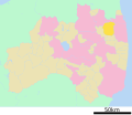
 Iitate in Fukushima Prefecture.png 1.281 × 901; 52 KB
-
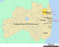
 Location of Itate town, Fukushima prefecture, Japan.svg 844 × 676; 25 KB
-
 20100605真野ダム.jpg 1.280 × 960; 347 KB
-
 A Dosimeter in Japan.jpg 3.154 × 4.205; 2,83 MB
-
 Acoop Iitate Shop.jpg 1.600 × 899; 132 KB
-
 Akira Gunji 20120609 6.jpg 300 × 225; 68 KB
-
 Changes in gamma ray dose rate at a monitoring station near the Iitate Village hall.jpg 1.512 × 1.371; 150 KB
-
 Decontamination waste - Iitate, Fukushima.png 1.627 × 1.078; 2,05 MB
-
 Emblem of Iitate, Fukushima.svg 300 × 300; 256 Bytes
-
 Flag of Iitate Fukushima.JPG 391 × 232; 11 KB
-
 Flag of Iitate, Fukushima.svg 900 × 600; 311 Bytes
-
 FukushimaOutlyingRadiationPlot-Log-Mar19.png 1.200 × 464; 86 KB
-
 Gamma ray dose rate maps of Fukushima Prefecture.jpg 4.219 × 1.710; 1,05 MB
-
 HayamaKo.jpg 640 × 480; 60 KB
-
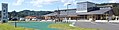
 Iitate village koryu center 2017.jpg 4.352 × 3.264; 1,04 MB
-
 Iitate Village Office Fukushima prefecture Japan.JPG 1.280 × 589; 711 KB
-
 Iitate vs Fukushima evacuation zones large.png 730 × 548; 105 KB
-
 Iitate vs Fukushima evacuation zones large.svg 700 × 552; 39 KB
-
 Iitate vs Fukushima evacuation zones zoomed.png 502 × 570; 85 KB
-
 JA SS Iitate SS.jpg 1.600 × 1.066; 261 KB
-
 Michihiko Kano 20110907-1.jpg 300 × 225; 94 KB
-
 Michihiko Kano 20110907-2.jpg 300 × 225; 90 KB
-
 Michihiko Kano 20110907-3.jpg 300 × 225; 71 KB
-
 Michihiko Kano 20110907-4.jpg 300 × 225; 70 KB
-
 Michihiko Kano 20110907-5.jpg 300 × 225; 76 KB
-
 Michihiko Kano 20110907-6.jpg 300 × 225; 66 KB
-
 Michinoeki Madeikan.jpg 4.219 × 1.061; 1,74 MB
-
 Norio Kanno and Akira Gunji 20120609.jpg 300 × 225; 71 KB
-
 Population distribution of Iitate, Fukushima, Japan.svg 512 × 256; 22 KB
-
 Radioactivity levels around Fukushima-Daiichi, March 15-16.png 685 × 398; 43 KB
-
 Shukuhaku taiken kan kikori.jpg 4.352 × 3.264; 1,03 MB
-
 Sonmin no mori ai no sawa.jpg 4.352 × 3.264; 2,45 MB
-
 Watatsumi shrine of Iitate village.jpg 4.352 × 3.264; 2,19 MB
-
 気象監視装置 空間放射線量監視装置 (7587003174).jpg 4.352 × 3.264; 3,63 MB


.jpg)