Category:Ilmington
Aller à la navigation
Aller à la recherche
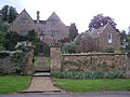
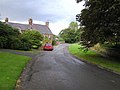
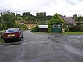
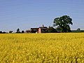
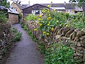
English: Ilmington is a village and civil parish about northwest of Shipston-on-Stour and 8 miles south of Stratford-on-Avon and is at the foot of the Ilmington Downs, which are the highest place in Warwickshire. Residents of the village are called "Ilmingtonians".
village britannique  | |||||
| Téléverser des médias | |||||
| Nature de l’élément | |||||
|---|---|---|---|---|---|
| Lieu | Stratford-on-Avon, Warwickshire, Midlands de l'Ouest, Angleterre | ||||
| Population |
| ||||
| Superficie |
| ||||
| site officiel | |||||
 | |||||
Sous-catégories
Cette catégorie comprend 8 sous-catégories, dont les 8 ci-dessous.
C
- Compton Scorpion Manor (7 F)
F
- Foxcote House, Warwickshire (14 F)
H
- Howard Arms, Ilmington (8 F)
I
- Ilmington War Memorial (2 F)
T
- The Red Lion, Ilmington (7 F)
Média dans la catégorie « Ilmington »
Cette catégorie comprend 386 fichiers, dont les 200 ci-dessous.
(page précédente) (page suivante)-
 The Dower House - geograph.org.uk - 273648.jpg 640 × 480 ; 92 kio
-
 The Dower House, Ilmington - geograph.org.uk - 1467286.jpg 640 × 479 ; 66 kio
-
 A fine tree - geograph.org.uk - 1925727.jpg 4 000 × 3 000 ; 3,57 Mio
-
 Across the field - geograph.org.uk - 2341898.jpg 4 288 × 3 216 ; 2,62 Mio
-
 Across the ploughed field - geograph.org.uk - 2342172.jpg 4 288 × 3 216 ; 2,9 Mio
-
 Across the road (1) - geograph.org.uk - 2341870.jpg 3 216 × 4 288 ; 5,8 Mio
-
 Across the road (2) - geograph.org.uk - 2341890.jpg 4 288 × 3 216 ; 7,43 Mio
-
 Across the road - geograph.org.uk - 1985070.jpg 4 000 × 3 000 ; 3,41 Mio
-
 All fall down - geograph.org.uk - 2315025.jpg 4 288 × 3 216 ; 3,47 Mio
-
 Almost at the bottom of the hill - geograph.org.uk - 2341741.jpg 4 288 × 3 216 ; 5,03 Mio
-
 Almost ready to reap - geograph.org.uk - 1983728.jpg 4 000 × 3 000 ; 4,04 Mio
-
 Armscote Road - geograph.org.uk - 6289624.jpg 640 × 480 ; 64 kio
-
 Armscote Road, Ilmington - geograph.org.uk - 6289619.jpg 800 × 600 ; 93 kio
-
 Back Street, Ilmington - geograph.org.uk - 1467257.jpg 640 × 479 ; 60 kio
-
 Back Street, Ilmington - geograph.org.uk - 1467278.jpg 640 × 479 ; 55 kio
-
 Back Street, Ilmington - geograph.org.uk - 1467299.jpg 640 × 479 ; 49 kio
-
 Ballards Lane, Ilmington - geograph.org.uk - 1468407.jpg 640 × 479 ; 74 kio
-
 Barley Field - geograph.org.uk - 2544237.jpg 640 × 480 ; 92 kio
-
 Beautiful Old House in Ilmington - geograph.org.uk - 5405918.jpg 800 × 600 ; 139 kio
-
 Bend in Stratford Bank - geograph.org.uk - 6289607.jpg 800 × 600 ; 84 kio
-
 Bend in the road near Compton Scorpion farm - geograph.org.uk - 6270814.jpg 1 024 × 768 ; 267 kio
-
 Berryfield Farm (1) - geograph.org.uk - 2339424.jpg 4 288 × 3 216 ; 2,92 Mio
-
 Berryfield Farm (2) - geograph.org.uk - 2339425.jpg 4 288 × 3 216 ; 3,49 Mio
-
 Berryfield Farm - geograph.org.uk - 1874092.jpg 2 000 × 1 502 ; 217 kio
-
 Bridleway becomes byway - geograph.org.uk - 2339422.jpg 4 288 × 3 216 ; 4,34 Mio
-
 Bridleway branch - geograph.org.uk - 1925086.jpg 4 000 × 3 000 ; 2,11 Mio
-
 Bridleway crosses road - geograph.org.uk - 1985041.jpg 4 000 × 3 000 ; 3,85 Mio
-
 Bridleway on Ebrington Hill - geograph.org.uk - 6267513.jpg 2 592 × 1 944 ; 1,84 Mio
-
 Bridleway on Ilmington Hill - geograph.org.uk - 1925119.jpg 4 000 × 3 000 ; 4,02 Mio
-
 Bridleway to Darlingscott - geograph.org.uk - 1925698.jpg 3 000 × 4 000 ; 3,44 Mio
-
 Bridleway to Ilmington Downs - geograph.org.uk - 1946344.jpg 2 000 × 1 500 ; 160 kio
-
 Bridleway to Newbold (1) - geograph.org.uk - 2339433.jpg 4 288 × 3 216 ; 3,82 Mio
-
 Bridleway up the hill - geograph.org.uk - 1985027.jpg 4 000 × 3 000 ; 3,74 Mio
-
 Brown and pleasant land - geograph.org.uk - 1985030.jpg 4 000 × 3 000 ; 1,98 Mio
-
 Buildings along footpath, Ilmington - geograph.org.uk - 4415140.jpg 800 × 450 ; 146 kio
-
 Buildings at Compton Scorpion Farm - geograph.org.uk - 4424968.jpg 640 × 428 ; 92 kio
-
 Bungalows on Armscote Road, Ilmington - geograph.org.uk - 6289614.jpg 800 × 600 ; 89 kio
-
 Bungalows on Armscote Road, Ilmington - geograph.org.uk - 6289807.jpg 5 184 × 3 888 ; 3,27 Mio
-
 Campden Hill, Ilmington - geograph.org.uk - 1468371.jpg 640 × 479 ; 68 kio
-
 Campden Hill, Ilmington - geograph.org.uk - 2803317.jpg 800 × 600 ; 137 kio
-
 Carp pond near Berryfield Farm - geograph.org.uk - 1873783.jpg 2 000 × 1 492 ; 201 kio
-
 Cattle grazing east of Ilmington - geograph.org.uk - 6289621.jpg 800 × 600 ; 86 kio
-
 Climb the hill - geograph.org.uk - 2341714.jpg 4 288 × 3 216 ; 3,05 Mio
-
 Colourful bloom - geograph.org.uk - 1983846.jpg 4 000 × 3 000 ; 2,18 Mio
-
 Combines at Harolds Farm - geograph.org.uk - 176984.jpg 640 × 480 ; 68 kio
-
 Communication masts - geograph.org.uk - 1986524.jpg 4 000 × 3 000 ; 3,2 Mio
-
 Communication masts on Ebrington Hill - geograph.org.uk - 1925855.jpg 4 000 × 3 000 ; 1,76 Mio
-
 Communication masts on Ebrington Hill - geograph.org.uk - 1925863.jpg 4 000 × 3 000 ; 2,65 Mio
-
 Communication Masts on Ilmington Hill - geograph.org.uk - 1925108.jpg 4 000 × 3 000 ; 2,1 Mio
-
 Communications mast (1) - geograph.org.uk - 1925635.jpg 3 000 × 4 000 ; 2,24 Mio
-
 Communications Mast (2) - geograph.org.uk - 1925647.jpg 3 000 × 4 000 ; 1,75 Mio
-
 Compton Scorpion Farm - geograph.org.uk - 1889822.jpg 4 000 × 3 000 ; 2,94 Mio
-
 Compton Scorpion Farm - geograph.org.uk - 1889855.jpg 4 000 × 3 000 ; 3,54 Mio
-
 Compton Scorpion Farm - geograph.org.uk - 4661658.jpg 1 024 × 680 ; 284 kio
-
 Compton Scorpion Farm - geograph.org.uk - 6071625.jpg 1 024 × 768 ; 153 kio
-
 Compton Scorpion House - geograph.org.uk - 4424981.jpg 640 × 480 ; 100 kio
-
 Converted barn at Compton Scorpion Manor - geograph.org.uk - 4414961.jpg 800 × 450 ; 95 kio
-
 Country cottage - geograph.org.uk - 1925081.jpg 3 000 × 4 000 ; 3,09 Mio
-
 Country junction - geograph.org.uk - 1984201.jpg 4 000 × 3 000 ; 3,73 Mio
-
 Country south of Ilmington - geograph.org.uk - 4157947.jpg 2 592 × 1 944 ; 1,65 Mio
-
 Cross Leys Ilmington - geograph.org.uk - 2286818.jpg 640 × 480 ; 59 kio
-
 Detail of bridleway gate opening system - geograph.org.uk - 1925274.jpg 1 500 × 2 007 ; 160 kio
-
 Dismantled railway near Ilmington - geograph.org.uk - 5368219.jpg 1 024 × 768 ; 376 kio
-
 Down the hill - geograph.org.uk - 1985048.jpg 4 000 × 3 000 ; 3,86 Mio
-
 Down the valley - geograph.org.uk - 1986488.jpg 4 000 × 3 000 ; 2,96 Mio
-
 Downs House - geograph.org.uk - 3917084.jpg 640 × 480 ; 112 kio
-
 Drive to Berryfield Farm - geograph.org.uk - 5367489.jpg 1 024 × 768 ; 260 kio
-
 Drive to Compton Scorpion Manor - geograph.org.uk - 4660426.jpg 800 × 531 ; 130 kio
-
 Driveway to Cathole - geograph.org.uk - 176987.jpg 640 × 480 ; 96 kio
-
 Dry arable farmland - geograph.org.uk - 4663103.jpg 800 × 531 ; 133 kio
-
 Dunstall Buildings - geograph.org.uk - 1987888.jpg 4 000 × 3 000 ; 2,32 Mio
-
 Dunstall Buildings Barn near Foxcote House - geograph.org.uk - 1924459.jpg 2 000 × 1 503 ; 249 kio
-
 Ebrington Hill Farm - geograph.org.uk - 1925271.jpg 4 000 × 3 000 ; 1,69 Mio
-
 Election notice, Ilmington - geograph.org.uk - 4416759.jpg 450 × 800 ; 58 kio
-
 Elizabeth II postbox on Armscote Road, Ilmington - geograph.org.uk - 6289806.jpg 2 873 × 3 898 ; 2,61 Mio
-
 Enclosed bridleway (1) - geograph.org.uk - 1925795.jpg 4 000 × 3 000 ; 3,5 Mio
-
 Enclosed bridleway (2) - geograph.org.uk - 1925800.jpg 4 000 × 3 000 ; 2,76 Mio
-
 Entrance drive to Cross Leys Farm, Ilmington - geograph.org.uk - 1884320.jpg 2 000 × 1 498 ; 247 kio
-
 Entrance driveway - geograph.org.uk - 1985619.jpg 4 000 × 3 000 ; 3,49 Mio
-
 Entrance gateway - geograph.org.uk - 1985044.jpg 4 000 × 3 000 ; 4,5 Mio
-
 Entrance to The Old Wharf, Ilmington - geograph.org.uk - 1901969.jpg 2 000 × 1 506 ; 197 kio
-
 Estate office - geograph.org.uk - 1987884.jpg 4 000 × 3 000 ; 3,07 Mio
-
 Fallen tree - geograph.org.uk - 1988196.jpg 4 000 × 3 000 ; 4,44 Mio
-
 Family memorial (geograph 7424283).jpg 1 069 × 1 600 ; 537 kio
-
 Farm buildings, Manor Farm - geograph.org.uk - 6289612.jpg 800 × 600 ; 133 kio
-
 Farm track as footpath near Ilmington - geograph.org.uk - 1924228.jpg 1 500 × 1 988 ; 283 kio
-
 Farmland at Ilmington - geograph.org.uk - 5368225.jpg 1 024 × 768 ; 256 kio
-
 Farmland beside Stratford Road - geograph.org.uk - 5367331.jpg 1 024 × 768 ; 270 kio
-
 Farmland bridleway - geograph.org.uk - 4663101.jpg 800 × 531 ; 178 kio
-
 Farmland in SE corner of gridsquare - geograph.org.uk - 1874034.jpg 2 000 × 1 507 ; 252 kio
-
 Farmland near Compton Scorpion Farm - geograph.org.uk - 4661680.jpg 800 × 531 ; 124 kio
-
 Farmland near The Cottages - geograph.org.uk - 4661675.jpg 800 × 531 ; 160 kio
-
 Farmland near York Farm - geograph.org.uk - 4162918.jpg 2 592 × 1 944 ; 1,63 Mio
-
 Farmland north of Ilmington - geograph.org.uk - 4162915.jpg 2 592 × 1 944 ; 1,62 Mio
-
 Farmland south of Compton Scorpion Farm - geograph.org.uk - 4661660.jpg 800 × 531 ; 121 kio
-
 Fence and footpath - geograph.org.uk - 4662112.jpg 1 024 × 680 ; 355 kio
-
 Field beside Mickleton Road - geograph.org.uk - 5306430.jpg 1 024 × 768 ; 254 kio
-
 Field near Harolds Farm - geograph.org.uk - 4424897.jpg 640 × 428 ; 83 kio
-
 Field near Southfield - geograph.org.uk - 4424915.jpg 640 × 428 ; 61 kio
-
 Field of Stratford Bank - geograph.org.uk - 6289606.jpg 800 × 600 ; 111 kio
-
 Field of winter cereal - geograph.org.uk - 5367365.jpg 1 024 × 768 ; 245 kio
-
 Find the path - geograph.org.uk - 2341755.jpg 4 288 × 3 216 ; 6,75 Mio
-
 Folly Farm, Ilmington - geograph.org.uk - 1467264.jpg 640 × 367 ; 83 kio
-
 Footpath crosses bridleway (1) - geograph.org.uk - 1925252.jpg 4 000 × 3 000 ; 1,97 Mio
-
 Footpath crosses bridleway (1) - geograph.org.uk - 1988171.jpg 4 000 × 3 000 ; 4,08 Mio
-
 Footpath crosses bridleway (2) - geograph.org.uk - 1925256.jpg 4 000 × 3 000 ; 2,67 Mio
-
 Footpath crosses bridleway (2) - geograph.org.uk - 1988177.jpg 4 000 × 3 000 ; 4,12 Mio
-
 Footpath crosses bridleway (3) - geograph.org.uk - 1925260.jpg 4 000 × 3 000 ; 3,5 Mio
-
 Footpath crosses bridleway (4) - geograph.org.uk - 1925262.jpg 4 000 × 3 000 ; 1,68 Mio
-
 Footpath crosses bridleway - geograph.org.uk - 1988183.jpg 4 000 × 3 000 ; 4,36 Mio
-
 Footpath east of Ilmington - geograph.org.uk - 4416822.jpg 800 × 450 ; 104 kio
-
 Footpath from Foxcote House entrance gates - geograph.org.uk - 6071629.jpg 1 024 × 768 ; 140 kio
-
 Footpath into Ilmington - geograph.org.uk - 4415064.jpg 800 × 450 ; 213 kio
-
 Footpath marker on the lane to Ilmington - geograph.org.uk - 1974470.jpg 2 000 × 1 500 ; 186 kio
-
 Footpath meets bridleway - geograph.org.uk - 1925566.jpg 4 000 × 3 000 ; 4,01 Mio
-
 Footpath meets road - geograph.org.uk - 1889848.jpg 4 000 × 3 000 ; 3,66 Mio
-
 Footpath meets road - geograph.org.uk - 1985083.jpg 3 000 × 4 000 ; 4,16 Mio
-
 Footpath meets road - geograph.org.uk - 1986494.jpg 4 000 × 3 000 ; 3,12 Mio
-
 Footpath near Longdon Manor - geograph.org.uk - 4662110.jpg 1 024 × 680 ; 332 kio
-
 Footpath over the hill - geograph.org.uk - 2341707.jpg 4 288 × 3 216 ; 2,95 Mio
-
 Footpath to Admington from Ilmington - geograph.org.uk - 1923903.jpg 2 000 × 1 496 ; 197 kio
-
 Footpath to Admington from Ilmington - geograph.org.uk - 1924201.jpg 2 000 × 1 496 ; 192 kio
-
 Footpath to Berryfields Lane^ - geograph.org.uk - 1884306.jpg 2 000 × 1 496 ; 206 kio
-
 Footpath to Darlingscott and view east - geograph.org.uk - 1924329.jpg 2 000 × 1 503 ; 197 kio
-
 Footpath to Ilmington^ - geograph.org.uk - 1884260.jpg 2 000 × 1 495 ; 237 kio
-
 Footpath to Longdon Manor - geograph.org.uk - 1889852.jpg 4 000 × 3 000 ; 3,36 Mio
-
 Footpath towards Campden Road - geograph.org.uk - 6270798.jpg 768 × 1 024 ; 292 kio
-
 Footpath towards Longdon Manor - geograph.org.uk - 1946589.jpg 2 000 × 1 506 ; 214 kio
-
 Footpath up Knowlands Hill - geograph.org.uk - 1925296.jpg 2 000 × 1 505 ; 222 kio
-
 Footpaths leave the road - geograph.org.uk - 2314999.jpg 4 288 × 3 216 ; 3,2 Mio
-
 Former chapel, Middle Street, Ilmington - geograph.org.uk - 3410806.jpg 480 × 640 ; 51 kio
-
 Fountain, Ilmington - geograph.org.uk - 1468461.jpg 640 × 479 ; 91 kio
-
 Four ways to pass - geograph.org.uk - 1890305.jpg 4 000 × 3 000 ; 3,68 Mio
-
 Foxcote Farm (1) - geograph.org.uk - 1925065.jpg 4 000 × 3 000 ; 2,65 Mio
-
 Foxcote Farm (2) - geograph.org.uk - 1925074.jpg 4 000 × 3 000 ; 3,05 Mio
-
 Foxcote, Farm and House - geograph.org.uk - 1925092.jpg 4 000 × 3 000 ; 2,25 Mio
-
 Frog Lane, Ilmington - geograph.org.uk - 1468470.jpg 640 × 479 ; 69 kio
-
 Front Street, Ilmington - geograph.org.uk - 1468397.jpg 640 × 479 ; 79 kio
-
 Front Street, Ilmington - geograph.org.uk - 1468399.jpg 640 × 479 ; 62 kio
-
 Front Street, Ilmington - geograph.org.uk - 1468811.jpg 640 × 479 ; 65 kio
-
 Front Street, Ilmington - geograph.org.uk - 1468825.jpg 640 × 479 ; 59 kio
-
 Front Street, Ilmington - geograph.org.uk - 1468872.jpg 640 × 479 ; 66 kio
-
 Garage at Front Street, Ilmington - geograph.org.uk - 1468834.jpg 640 × 479 ; 80 kio
-
 Gate at Middle Street, Ilmington - geograph.org.uk - 1468396.jpg 640 × 479 ; 78 kio
-
 Gloucestershire farmland - geograph.org.uk - 1890332.jpg 4 000 × 3 000 ; 3,37 Mio
-
 Grassland, Caleys Fields - geograph.org.uk - 6289609.jpg 800 × 600 ; 95 kio
-
 Green lane - geograph.org.uk - 2346451.jpg 4 288 × 3 216 ; 2,98 Mio
-
 Grump Street - geograph.org.uk - 273657.jpg 640 × 480 ; 103 kio
-
 Harolds Farm (1) - geograph.org.uk - 1983838.jpg 4 000 × 3 000 ; 2,98 Mio
-
 Harolds Farm (2) - geograph.org.uk - 1983839.jpg 4 000 × 3 000 ; 3,19 Mio
-
 Harolds Farm (3) - geograph.org.uk - 1983842.jpg 4 000 × 3 000 ; 3,2 Mio
-
 Headland footpath - geograph.org.uk - 4661707.jpg 800 × 531 ; 159 kio
-
 Heavily pollarded willow trees - geograph.org.uk - 1896238.jpg 2 000 × 1 493 ; 184 kio
-

-
 Highest point in Warwickshire, 261 metres - geograph.org.uk - 2622553.jpg 2 000 × 1 491 ; 530 kio
-
 Highwall Spinney from near Ilmington - geograph.org.uk - 2047573.jpg 4 288 × 3 216 ; 2,54 Mio
-
 Highwall Spinney from near Longdon Manor - geograph.org.uk - 1889830.jpg 4 000 × 3 000 ; 2,05 Mio
-
 Hill Farm, Ilmington - geograph.org.uk - 1468911.jpg 640 × 479 ; 82 kio
-
 Hillside house - geograph.org.uk - 1986469.jpg 4 000 × 3 000 ; 3,41 Mio
-
 Hillside house - geograph.org.uk - 1986470.jpg 4 000 × 3 000 ; 2,42 Mio
-
 Horses houses - geograph.org.uk - 2346454.jpg 4 288 × 3 216 ; 2,84 Mio
-
 Horses on Cross Leys Farm - geograph.org.uk - 1884288.jpg 2 000 × 1 509 ; 210 kio
-
 Hurdlers Lane, Ilminfton - geograph.org.uk - 1468373.jpg 640 × 479 ; 65 kio
-
 Ilmington - geograph.org.uk - 4426035.jpg 640 × 428 ; 87 kio
-
 Ilmington cricket club on a Sunday afternoon - geograph.org.uk - 1924281.jpg 2 000 × 1 508 ; 196 kio
-
 Ilmington Downs transmitter masts - geograph.org.uk - 5054627.jpg 2 000 × 1 052 ; 1,03 Mio
-
 Ilmington East telecommunications tower - geograph.org.uk - 1924097.jpg 1 500 × 1 999 ; 220 kio
-
 Ilmington East telecommunications tower - geograph.org.uk - 1925316.jpg 1 500 × 2 008 ; 206 kio
-
 Ilmington footpath - geograph.org.uk - 3410825.jpg 640 × 480 ; 58 kio
-
 Ilmington from the east - geograph.org.uk - 4416774.jpg 800 × 450 ; 100 kio
-
 Ilmington Hill from Crimscote Downs - geograph.org.uk - 2338506.jpg 4 288 × 3 216 ; 1,98 Mio
-
 Ilmington primary school - geograph.org.uk - 2341397.jpg 4 288 × 3 216 ; 2,11 Mio
-

-
 Ilmington sewage works (1) - geograph.org.uk - 2323586.jpg 4 288 × 3 216 ; 4,25 Mio
-
 Ilmington sewage works (2) - geograph.org.uk - 2323588.jpg 4 288 × 3 216 ; 3,12 Mio
-
 Ilmington Sewage works - geograph.org.uk - 2286809.jpg 640 × 428 ; 117 kio
-
 Ilmington short-cut - geograph.org.uk - 1468798.jpg 640 × 479 ; 98 kio
-
 Ilmington Sports Field - geograph.org.uk - 3410836.jpg 640 × 480 ; 72 kio
-
 Ilmington Thatched Cottage (geograph 5747370).jpg 1 600 × 1 235 ; 551 kio
-
 Ilmington view - geograph.org.uk - 2047567.jpg 4 288 × 3 216 ; 2,71 Mio
-
 Ilmington village - geograph.org.uk - 6267524.jpg 2 592 × 1 944 ; 1,52 Mio
-
 Ilmington-Middle Street (geograph 5747378).jpg 1 600 × 1 200 ; 542 kio
-
 In the wood - geograph.org.uk - 1986480.jpg 4 000 × 3 000 ; 4,49 Mio
-
 Inscription, roadside fountain, Ilmington - geograph.org.uk - 1468467.jpg 640 × 476 ; 77 kio
-
 Inscription, Simon Greenwood - geograph.org.uk - 1468413.jpg 640 × 479 ; 76 kio
-
 Inscription, The Ilmington Pound - geograph.org.uk - 1468887.jpg 640 × 479 ; 102 kio
-
 Interesting garden on edge of village - geograph.org.uk - 4415069.jpg 800 × 450 ; 193 kio
-
 Into open fields - geograph.org.uk - 2047563.jpg 4 288 × 3 216 ; 2 Mio
-
 Into the wood - geograph.org.uk - 1985052.jpg 4 000 × 3 000 ; 4,26 Mio
-
 Into the wood - geograph.org.uk - 1986474.jpg 4 000 × 3 000 ; 4,02 Mio
-
 Into the woods - geograph.org.uk - 1987879.jpg 4 000 × 3 000 ; 4,23 Mio
-
 Isolated waymark - geograph.org.uk - 1985050.jpg 4 000 × 3 000 ; 5,07 Mio
-
 Jubilee stone - geograph.org.uk - 1983704.jpg 4 000 × 3 000 ; 4,35 Mio
-
 Jubilee Stone, Ilmington - geograph.org.uk - 1468879.jpg 479 × 640 ; 162 kio
-
 Junction of the ways (1) - geograph.org.uk - 1890391.jpg 4 000 × 3 000 ; 4,17 Mio
-
 Junction of the ways (2) - geograph.org.uk - 1890430.jpg 4 000 × 3 000 ; 3,32 Mio
-
 Knowlands Hill - geograph.org.uk - 1925291.jpg 2 000 × 1 507 ; 215 kio
-
 Ladder stile - geograph.org.uk - 2341731.jpg 4 288 × 3 216 ; 4,52 Mio
-
 Lake in the wood - geograph.org.uk - 1985061.jpg 4 000 × 3 000 ; 3,35 Mio
-
 Leys' Coppice - geograph.org.uk - 2339423.jpg 4 288 × 3 216 ; 3,52 Mio


_-_geograph.org.uk_-_2341870.jpg)
_-_geograph.org.uk_-_2341890.jpg)


_-_geograph.org.uk_-_2339424.jpg)
_-_geograph.org.uk_-_2339425.jpg)


_-_geograph.org.uk_-_2339433.jpg)


_-_geograph.org.uk_-_1925635.jpg)
_-_geograph.org.uk_-_1925647.jpg)


_-_geograph.org.uk_-_1925795.jpg)
_-_geograph.org.uk_-_1925800.jpg)


.jpg)


_-_geograph.org.uk_-_1925252.jpg)
_-_geograph.org.uk_-_1988171.jpg)
_-_geograph.org.uk_-_1925256.jpg)
_-_geograph.org.uk_-_1988177.jpg)
_-_geograph.org.uk_-_1925260.jpg)
_-_geograph.org.uk_-_1925262.jpg)


_-_geograph.org.uk_-_1925065.jpg)
_-_geograph.org.uk_-_1925074.jpg)


_-_geograph.org.uk_-_1983838.jpg)
_-_geograph.org.uk_-_1983839.jpg)
_-_geograph.org.uk_-_1983842.jpg)


_-_geograph.org.uk_-_2323586.jpg)
_-_geograph.org.uk_-_2323588.jpg)


.jpg)


.jpg)


_-_geograph.org.uk_-_1890391.jpg)
_-_geograph.org.uk_-_1890430.jpg)


