Category:Indian Territory
Aller à la navigation
Aller à la recherche
ensemble de terres octroyées aux Amérindiens par le gouvernement des États-Unis au XIXe siècle  خريطة التقسيم الإداري لوصف الإقليم الهندي | |||||
| Téléverser des médias | |||||
| Nature de l’élément |
| ||||
|---|---|---|---|---|---|
| Lieu | Oklahoma, É.-U. | ||||
| Date de fondation ou de création |
| ||||
| Date de dissolution, d'abolition ou de démolition |
| ||||
| Remplace | |||||
| Remplacé par |
| ||||
| À ne pas confondre avec | |||||
 | |||||
English: The term Indian Territory in Native American and United States history has several meanings.
- As a generic term, Indian Territory or Indian Country are used to describe an evolving land area set aside by the U.S. Government for the relocation of Native American tribes from their ancestral homelands to land grants in the 'new' western lands of the Louisiana Purchase (1803), purchased from Napoleon.
- As a specific term, Indian Territory was an Unorganized territory whose general borders were initially set by the Indian Intercourse Act of 1834. The borders of Indian Territory were reduced in size as the US Congress created Territories for later admission as States. It ceased upon Oklahoma statehood in 1907.
Sous-catégories
Cette catégorie comprend 11 sous-catégories, dont les 11 ci-dessous.
Média dans la catégorie « Indian Territory »
Cette catégorie comprend 36 fichiers, dont les 36 ci-dessous.
-
 Mapa Terytorium Indiańskiego w XIX wieku.png 427 × 585 ; 64 kio
-
 Indian Country-Territory 1834.jpg 949 × 551 ; 78 kio
-

-
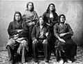
 Delegates from 34 tribes in front of Creek Council House, Indian Territory, 1880 - NARA - 519141.jpg 3 000 × 2 415 ; 1,85 Mio
-
 Typical family and winter home in Indian Territory, by Underwood & Underwood.jpg 2 625 × 1 318 ; 1,23 Mio
-
 American Indian Soldiers (7222837630).jpg 750 × 1 050 ; 273 kio
-
 American Indian Soldiers (7222837722).jpg 750 × 1 050 ; 171 kio
-
 Arbuckle Bros. (3093823768).jpg 356 × 600 ; 202 kio
-
-

-
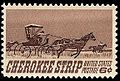 Cherokee strip 1968 U.S. stamp.1.jpg 287 × 194 ; 41 kio
-
 CherokeeLotteryLandDeed.jpg 2 000 × 2 432 ; 1,6 Mio
-
 Choctaw Nation Native American Men.jpg 500 × 709 ; 270 kio
-

-
 Indian centennial (Oklahoma) 1948 U.S. stamp.1.jpg 409 × 275 ; 80 kio
-

-

-

-
 Map of the Indian Terrority corrected according to the latest surveys - NARA - 102278784.jpg 9 704 × 12 075 ; 16,46 Mio
-
-
 NezPerce.1877.jpg 768 × 595 ; 75 kio
-

-
 President Theodore Roosevelt Speaking from a Railroad Observation Car (15013237379).jpg 796 × 1 000 ; 565 kio
-
 President Theodore Roosevelt Speaking in Muskogee, Indian Territory (15013338960).jpg 809 × 1 000 ; 681 kio
-
 PSX 20190629 175158.jpg 856 × 1 308 ; 302 kio
-
 Reynolds's Political Map of the United States 1856.jpg 7 813 × 7 090 ; 19,76 Mio
-
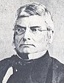 Robert McDonald Jones.jpg 200 × 258 ; 14 kio
-
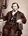 Sampson-Folsom.jpg 374 × 495 ; 150 kio
-
 Schurz Have Patience With Indians.jpg 900 × 1 287 ; 340 kio
-
 Alice davis brown.jpg 288 × 416 ; 117 kio
-

-
 John R. Thomas.jpg 293 × 374 ; 97 kio
-
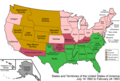 United States 1862-1863-02.png 1 000 × 677 ; 117 kio
-
 US Indian Police badge.png 219 × 255 ; 31 kio
-
 Worcester.jpg 2 084 × 2 929 ; 2,38 Mio
-
 शहस्त्रबाहु मंदिर ग्वालियर, मध्य प्रदेश.jpg 2 080 × 4 608 ; 4,36 Mio


.jpg)
.jpg)
.jpg)

_-_NARA_-_102279305.jpg)


.JPG)
_1948_U.S._stamp.1.jpg)

.jpg)
_-_NARA_-_102278691_(page_1).jpg)


.jpg)
.jpg)


.jpg)


Catégories :
- History of Native Americans in the United States
- Historical regions of the United States
- United States in the 19th century
- Indian reservations in the United States
- Wild West
- 1834 establishments in the United States
- Pre-statehood history of Kansas
- Pre-statehood history of Nebraska
- Pre-statehood history of Missouri
- Pre-statehood history of Colorado
- Pre-statehood history of North Dakota
- Pre-statehood history of South Dakota
- Pre-statehood history of Montana
- Pre-statehood history of Wyoming
- Oklahoma in the 1830s
- Former territories of the United States
- 1907 disestablishments in the United States
- 19th-century Native American history
- Pre-statehood history of Oklahoma