Category:Interstate 45
Salta a la navigazzion
Và a cercà
 | numer: | (fourty-five) |
|---|---|---|
| Interstate Highways: | 25 · 26 · 27 · 29 · 30 · 35 · 37 · 39 · 40 · 41 · 42 · 43 · 44 · 45 · 49 · 55 · 57 · 59 · 64 · 65 |
autostrada statunitense   | |||||
| Carega su un fail audio / video | |||||
| L'è un(a) | |||||
|---|---|---|---|---|---|
| Sit | |||||
| Sistema autostradałe | |||||
| Conetesto co |
| ||||
| Prupetare | |||||
| Mantegnesto da | |||||
| Data de creazzion o de fondazzion |
| ||||
| Longhesa |
| ||||
| Caolìnea |
| ||||
 | |||||
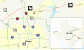
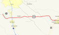
English: Media related to Interstate 45, a 284.913-mile (458.523 km) Interstate Highway in Texas, United States, that connects Texas State Highway 87 in Galveston with Interstate 30/Interstate 345/U.S. Route 6 and U.S. Route 75 in Dallas.
Sotocategorie
Quella categoria chì la gh'ha 5 sot-categorie chì de sota, su un numer complessiv de 5.
Fail in la categoria "Interstate 45"
Quella categoria chì la gh'ha denter 24 i fail riportad chì de sota, su un total de 24.
-

-
-
 45intoI-10 2.jpg 800 × 600; 545 KByte
-
 Dallas, Texas 1955 Yellow Book.jpg 800 × 943; 264 KByte
-
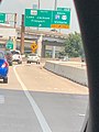
 EXIT 43B Tellepsen St.jpeg 3 024 × 4 032; 1,82 MByte
-
 EXIT 44A Elgin - Lockwood Cullen Blvd.jpeg 3 024 × 4 032; 1,13 MByte
-
 EXIT 45 SH 288 Lake Jackson, Freeport & US 59 + I 69 Cleveland, Victoria.jpeg 3 024 × 4 032; 1,75 MByte
-
 EXIT 46 St Joseph Pkwy, Pease St, & Emancipation Ave.jpeg 3 024 × 4 032; 1,53 MByte
-
 EXIT 46B SH 288 South Lake Jackson, Freeport & IH 69, US 59 South Victoria.jpeg 3 024 × 4 032; 1,04 MByte
-
 EXIT 47B Houston Ave, Memorial Dr 1 MILE.jpeg 3 024 × 4 032; 829 KByte
-
 FEMA - 15803 - Photograph by Ed Edahl taken on 09-21-2005 in Texas.jpg 3 000 × 2 000; 1,44 MByte
-
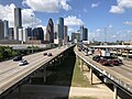
 Houston from I-45.JPG 1 280 × 960; 136 KByte
-
 Houston skyline through a cracked windshield - panoramio.jpg 3 648 × 2 736; 3,11 MByte
-
 Houston, Texas 1955 Yellow Book.jpg 497 × 451; 222 KByte
-
 I-45 & Louetta Rita Evacuation.jpg 614 × 819; 252 KByte
-
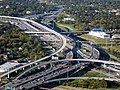
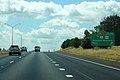 Int45sRoad-Exit112-TX75-TX19 (35592032414).jpg 2 400 × 1 600; 1,62 MByte
-
 Interstate 45 map.png 2 128 × 1 286; 35 KByte
-
 Map of Farm to Market Road 1960 (FM 1960).svg 1 449 × 859; 1,46 MByte
-
 New Causeway, Galveston.jpg 1 024 × 95; 52 KByte
-
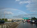 Rainbow Houston TX.jpg 2 592 × 1 944; 1,46 MByte
-
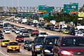
 Rita evacuees from Houston Texas September 21 2005.jpg 3 000 × 2 000; 1,42 MByte
-
 Texas 242 map.svg 870 × 516; 156 KByte
-
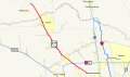 Texas 249 map.svg 870 × 516; 235 KByte
-
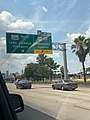
 TX21wRoadSign-Int45nsUS190Signs (36258588572).jpg 2 400 × 1 600; 1,57 MByte
_near_Exit_64_on_the_north_edge_of_Houston,_Harris_County,_Texas_from_an_airplane_landing_at_George_Bush_Intercontinental_Airport.jpg)
_from_the_ramp_between_westbound_Interstate_10_and_southbound_Interstate_45_in_Houston,_Harris_County,_Texas.jpg)


.jpg)
.svg)


.jpg)