Category:Isla Espíritu Santo, Baja California Sur
Vai alla navigazione
Vai alla ricerca
English: Isla Espíritu Santo, BCS
Mexican island in the Gulf of California  | |||||
| Carica un file multimediale | |||||
| Istanza di | |||||
|---|---|---|---|---|---|
| Luogo | Bassa California del Sud, Messico | ||||
| Situato sul mare / lago / fiume | |||||
| Larghezza |
| ||||
| Lunghezza |
| ||||
| Popolazione |
| ||||
| Superficie |
| ||||
| Altezza sul mare |
| ||||
 | |||||
File nella categoria "Isla Espíritu Santo, Baja California Sur"
Questa categoria contiene 75 file, indicati di seguito, su un totale di 75.
-
 Admiralty Chart No 3327 Cape San Lucas To Espiritu Santo and Sta. Margarita Is, Published 1903.jpg 24 091 × 16 255; 56,63 MB
-
 Baja California Sur (20702834694).jpg 2 272 × 1 704; 1,41 MB
-
 Baja California Sur (21032456983).jpg 1 280 × 960; 208 KB
-
 Baja California Sur (21032459213).jpg 1 600 × 1 200; 1,26 MB
-
 Baja California Sur (21033599054).jpg 2 272 × 1 704; 1,31 MB
-
 Baja California Sur (21035404364).jpg 800 × 600; 92 KB
-
 Baja California Sur (21333743341).jpg 2 816 × 2 112; 2,04 MB
-
 Baja California Sur (21467828789).jpg 1 760 × 1 168; 253 KB
-
 Baja California Sur (21470143330).jpg 1 280 × 895; 136 KB
-
 Baja California Sur (21632009806).jpg 800 × 600; 96 KB
-
 Baja California Sur (21654651045).jpg 800 × 600; 102 KB
-
 Baja California Sur (21655415048).jpg 1 600 × 1 200; 1,37 MB
-
 Baja California Sur (21656389549).jpg 1 280 × 960; 206 KB
-
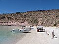
 Beach in the south-west part.JPG 3 264 × 2 448; 2,74 MB
-
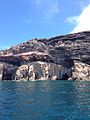 Cave and rocks.JPG 2 448 × 3 264; 2,77 MB
-
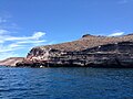
 Caves and mountains.JPG 3 264 × 2 448; 2,69 MB
-
 Caves and shore.JPG 3 264 × 2 448; 2,7 MB
-
 Cliff and shore.JPG 2 448 × 3 264; 2,41 MB
-
 Cliff from the reef.JPG 2 448 × 3 264; 2,55 MB
-
 Closer view of the Espiritu Santo Island.JPG 2 448 × 3 264; 2,51 MB
-
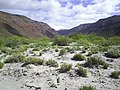
 Desert and shore.JPG 3 264 × 2 448; 2,66 MB
-
 Ensenada el Embudo.JPG 3 264 × 2 448; 2,65 MB
-
 Ensenada Grande Bay.JPG 3 264 × 2 448; 2,78 MB
-
 Espiritu Santo Island Cliffs.jpg 640 × 480; 129 KB
-
 Espiritu Santo Island.JPG 3 264 × 2 448; 2,62 MB
-
 Espiritu santo partida.JPG 3 839 × 1 268; 1,92 MB
-
 Espiritu Santo view.JPG 2 448 × 3 264; 2,4 MB
-
 Frontal north view.JPG 3 264 × 2 448; 2,48 MB
-
 Golfo de California, Baja California Sur (20473816904).jpg 1 760 × 1 168; 170 KB
-
 Holy Spirit Island.JPG 2 448 × 3 264; 2,35 MB
-
 Isla Espiritu Santo (ASTER).jpg 1 332 × 1 605; 168 KB
-
 Isla Espiritu Santo, Baja California Sur (432543841).jpg 1 200 × 1 600; 335 KB
-
 Isla Espiritu Santo, Baja California, Image of the Day DVIDS846268.jpg 1 800 × 1 800; 2,02 MB
-
 Isla Espíritu Santo and Isla Partida (5378264191).jpg 4 272 × 2 848; 3,34 MB
-
 Isla Espíritu Santo view from Playa Tecolote.JPG 2 448 × 3 013; 1,45 MB
-
 Isla Espíritu Santo.jpg 4 160 × 2 340; 3,32 MB
-
 Island and shore.JPG 3 264 × 2 448; 2,57 MB
-
 Island and Shore.JPG 2 448 × 3 264; 2,59 MB
-
 ISS031-E-31595 - View of Earth.jpg 4 288 × 2 848; 1,19 MB
-
 Iss067e286000 lrg.jpg 5 568 × 3 712; 3,06 MB
-
 Iss067e286000.jpg 720 × 480; 256 KB
-
 La Gallina Island.JPG 2 770 × 2 448; 1,36 MB
-
 La lobera or los Islotes.JPG 2 448 × 3 264; 1,7 MB
-
 La lobera.JPG 3 264 × 2 448; 3,13 MB
-
 La Mascara.JPG 2 448 × 3 264; 2,68 MB
-
 La playa de Isla Espíritu Santo - panoramio.jpg 2 144 × 1 424; 1,22 MB
-
 Lobera in the north.JPG 3 264 × 2 448; 2,48 MB
-
 Los Islotes.JPG 3 264 × 2 448; 3,27 MB
-
 Mountains and beach.JPG 3 264 × 2 448; 2,96 MB
-
 Mountains and rocks.JPG 3 264 × 2 448; 3,33 MB
-
 Mountains near to a reef.JPG 2 448 × 3 264; 2,59 MB
-
 Mountains of the shore.JPG 2 448 × 3 264; 2,82 MB
-
 North part Los Islotes.JPG 2 448 × 3 264; 1,66 MB
-
 North rocks.JPG 3 264 × 2 448; 2,99 MB
-
 North View fo the arc.JPG 2 448 × 3 264; 2,37 MB
-
 Parte norte y formaciones rocosas.JPG 3 264 × 2 448; 2,83 MB
-
 Parte sur de la Isla.JPG 3 264 × 2 448; 2,44 MB
-
 Punta Maru.JPG 2 286 × 3 255; 1,57 MB
-
 Rock formartion in Punta Tijeretas.JPG 2 448 × 3 264; 2,83 MB
-
 Rock formations and lansdscape.JPG 3 264 × 2 448; 1,28 MB
-
 Rock formations close to Ensenada Grande Bay.JPG 2 448 × 3 264; 2,64 MB
-
 Rock formations in the deep part of the island.JPG 3 264 × 2 448; 2,81 MB
-
 Rock formations in the north part of the Island.JPG 2 448 × 3 264; 2,6 MB
-
 Rock formations in the noth.JPG 3 264 × 2 448; 2,75 MB
-
 Rock formations of the Islad.JPG 2 435 × 2 699; 1,52 MB
-
 Rocks near the main caves.JPG 2 448 × 3 264; 2,66 MB
-
 The arc from Espritu Santo.JPG 2 448 × 3 264; 3,09 MB
-
 The Arc of La paz.JPG 3 264 × 2 448; 2,99 MB
-
 View form Punta Tijeretas.JPG 2 448 × 3 264; 2,62 MB
-
 View from Isla Espiritu Santo.JPG 3 264 × 2 448; 2,69 MB
-
 View of a cliff from "La Gallina Island".JPG 2 448 × 3 264; 2,6 MB
-
 View of the Island Espiritu Santo.JPG 3 264 × 2 448; 2,67 MB
-
 View of the island's rocks.JPG 2 448 × 3 264; 2,52 MB
-
 View of the Island.JPG 3 264 × 2 448; 2,59 MB
-
 Worn cliff.JPG 2 448 × 3 264; 2,61 MB

.jpg)
.jpg)
.jpg)
.jpg)
.jpg)
.jpg)
.jpg)
.jpg)
.jpg)
.jpg)
.jpg)
.jpg)


.jpg)

.jpg)
.jpg)

.jpg)


