Category:Jacob le Maire
Zur Navigation springen
Zur Suche springen
niederländischer Seefahrer und Entdecker  | |||||
| Medium hochladen | |||||
| Name in Muttersprache |
| ||||
|---|---|---|---|---|---|
| Geburtsdatum | etwa 1585 Antwerpen | ||||
| Sterbedatum | 31. Dezember 1616 Indischer Ozean | ||||
| Land der Staatsangehörigkeit | |||||
| Tätigkeit | |||||
| Vater | |||||
| Geschwister |
| ||||
| |||||
Medien in der Kategorie „Jacob le Maire“
Folgende 34 Dateien sind in dieser Kategorie, von 34 insgesamt.
-
 1619 Schouten map close-up (Niuas, Futuna and Alofi islands).jpg 796 × 462; 200 KB
-
 AMH-6924-KB Map of the world and chart of New Guinea.jpg 2.400 × 1.712; 961 KB
-
 AMH-7750-KB Map of the Le Maire Strait between Vuurland and Statenland.jpg 2.400 × 1.858; 990 KB
-
 AMH-8120-KB Bird's eye view of Leeuweneiland and Porto Desire.jpg 1.604 × 2.400; 708 KB
-
 AMH-8121-KB Map of the Le Maire Strait.jpg 2.400 × 1.775; 713 KB
-

-
 AMH-8123-KB View of Cocos Island and Traitors' Island.jpg 1.992 × 2.400; 840 KB
-
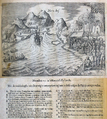
 AMH-8124-KB Reception of the crew of the Eendracht on Cocoseiland.jpg 1.995 × 2.400; 1,01 MB
-
 AMH-8125-KB View of the island of Hoorn in the Pacific Ocean.jpg 1.956 × 2.400; 999 KB
-
 AMH-8126-KB Chart mapping part of the route taken by Schouten and Le Maire.jpg 2.400 × 1.034; 425 KB
-
 AMH-8127-KB Map of New Guinea and Gilolo.jpg 2.400 × 1.834; 714 KB
-
 AMH-8611-NA Map of the Le Maire Strait and the Magelhaen Strait.jpg 2.400 × 1.854; 736 KB
-
 AMH-8636-NA Map of the Le Maire Strait.jpg 1.761 × 2.400; 344 KB
-
 AMH-8637-NA Coastal views along the Le Maire Strait.jpg 2.400 × 1.878; 679 KB
-
 AMH-8638-NA Small map of Valentine's Bay in the Le Maire Strait.jpg 2.400 × 1.874; 551 KB
-

-
 Cocos en Verraderseiland 00000229.png 707 × 729; 1,17 MB
-
 De Eendracht en de Hoorn bij het vertrek uit Hoorn.png 2.160 × 1.319; 1,34 MB
-

-
 Het eiland Moa en Insou Nieuw Guinea after a print from 1726 Van Keulen.jpg 2.155 × 1.672; 3,1 MB
-
 Hoornse eilanden 00000234.png 724 × 808; 1,32 MB
-

-
 Jacob Le Maire from Antonio de Herrera India Occidentales.png 1.312 × 1.553; 8,52 MB
-
 Kaap Hoorn uit de Australische Navigatien (detail).png 318 × 247; 199 KB
-
 Kaap Hoorn uit de Australische Navigatien.png 2.460 × 1.888; 2,46 MB
-

-
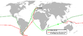
 Le Maire en Schouten - Reis via Kaap Hoorn naar Indie 1615-1616.png 1.021 × 474; 60 KB
-

-
-

-
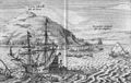
 Port Desire 00000208.png 718 × 814; 1,33 MB
-
 Schouten,Spielbergen.png 1.425 × 625; 47 KB
-
 View of Cocos Island and Traitors' Island (better quality).jpg 2.568 × 1.626; 3,19 MB
-
 Willem Blaeu - Tabula Magellanica 1635.jpg 2.037 × 1.579; 3,2 MB
.jpg)


.png)


.png)

,_RP-P-OB-75.472.jpg)


.jpg)


.jpg)
