Category:Jeffreyston
Vai alla navigazione
Vai alla ricerca
community in Pembrokeshire, Wales   | |||||
| Carica un file multimediale | |||||
| Istanza di | |||||
|---|---|---|---|---|---|
| Luogo | Pembrokeshire, Galles | ||||
| Popolazione |
| ||||
| Superficie |
| ||||
| sito web ufficiale | |||||
 | |||||
Cymraeg: Pentref, plwyf (a chymuned) yn ne Sir Benfro yw Jeffreyston. Nid ymddengys fod enw Cymraeg iddo. Saif i'r gogledd-orllewin o dref Dinbych y Pysgod ac i'r gogledd o'r briffordd A477. Awgryma'r fynwent gron o gwmpas yr eglwys, a gysegrwyd i Sant Jeffrey, fod y safle yn gynnar iawn.
Sottocategorie
Questa categoria contiene un'unica sottocategoria, indicata di seguito.
J
File nella categoria "Jeffreyston"
Questa categoria contiene 69 file, indicati di seguito, su un totale di 69.
-
 2010 Wales Pembrokeshire Community Jeffreyston map.svg 512 × 393; 1 018 KB
-
 2024 Wales Pembrokeshire Community Jeffreyston map.svg 512 × 393; 1,19 MB
-
 A4075 At Cross Hands - geograph.org.uk - 1413309.jpg 640 × 480; 137 KB
-
 A4075 At Cross Hands - geograph.org.uk - 1416433.jpg 640 × 480; 74 KB
-
-
 A4075 near the B4586 turnoff - geograph.org.uk - 4326497.jpg 1 600 × 1 062; 354 KB
-
 Across the Stepping Stones - geograph.org.uk - 3612700.jpg 1 224 × 918; 533 KB
-
 Bethel Baptist Chapel near Loveston - geograph.org.uk - 2609519.jpg 1 024 × 680; 136 KB
-
 Bishop's Bridge - geograph.org.uk - 218712.jpg 640 × 480; 82 KB
-
 Bishop's Bridge - geograph.org.uk - 2608954.jpg 1 024 × 680; 220 KB
-
 Canaston Bowl - geograph.org.uk - 4806575.jpg 1 600 × 1 032; 172 KB
-
 Car in carpark of Cresselly Arms - geograph.org.uk - 2766787.jpg 3 264 × 2 448; 4,3 MB
-
 Car park and beer garden combined - geograph.org.uk - 3622056.jpg 1 224 × 918; 543 KB
-

-
 Cresselly Arms, Creswell Quay - geograph.org.uk - 5805018.jpg 1 280 × 960; 499 KB
-
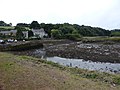
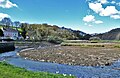
 Cresswell Quay - geograph.org.uk - 4485056.jpg 2 274 × 1 820; 896 KB
-
 Cresswell Quay - geograph.org.uk - 4920687.jpg 4 425 × 2 860; 2,44 MB
-
 Cresswell Quay - geograph.org.uk - 4920728.jpg 1 600 × 932; 438 KB
-
 Cresswell Quay - phonebox - geograph.org.uk - 5096483.jpg 2 576 × 1 932; 1,25 MB
-
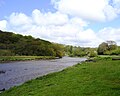
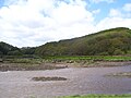
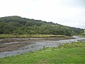
 Cresswell River - geograph.org.uk - 5525490.jpg 1 280 × 851; 563 KB
-
 Dancing in front of Cresselly Arms - geograph.org.uk - 2766822.jpg 3 264 × 2 448; 4,66 MB
-
 Detail of milestone - geograph.org.uk - 219044.jpg 640 × 480; 100 KB
-
 Farmland above Redberth - geograph.org.uk - 2608405.jpg 1 024 × 680; 211 KB
-
 Farmland near Jeffreyston - geograph.org.uk - 2608934.jpg 1 024 × 680; 227 KB
-
 Field near Loveston - geograph.org.uk - 2609526.jpg 1 024 × 680; 302 KB
-
 Ford Bridge on the B4586 - geograph.org.uk - 4326500.jpg 1 600 × 1 079; 683 KB
-
 Ford Bridge, Loveston - geograph.org.uk - 4489989.jpg 2 576 × 1 932; 1,12 MB
-
 Ford Bridge, Loveston - geograph.org.uk - 4489992.jpg 2 576 × 1 932; 1,08 MB
-
 Ford Bridge, Loveston - river - geograph.org.uk - 4489995.jpg 1 932 × 2 576; 1,06 MB
-
 Ford Lane at Jeffreyston - geograph.org.uk - 4326531.jpg 1 600 × 1 062; 371 KB
-
 Gate and drive, Moor Farm - geograph.org.uk - 2609401.jpg 1 024 × 680; 208 KB
-
 House on the A4075 near Hungerford Farm - geograph.org.uk - 4326493.jpg 1 600 × 1 480; 440 KB
-
 Inside the Cresselly Arms - geograph.org.uk - 5805033.jpg 1 280 × 960; 344 KB
-

-
 Jeffreyston House - geograph.org.uk - 4489976.jpg 2 576 × 1 932; 980 KB
-
 Jeffreyston School - geograph.org.uk - 22737.jpg 640 × 480; 19 KB
-
 Just outside Jeffreyston (3182328789).jpg 3 264 × 2 448; 3,77 MB
-
 Lane to Cresselly, Creswell Quay - geograph.org.uk - 5525403.jpg 1 280 × 851; 548 KB
-
 Local Information Board, Jeffreyston - geograph.org.uk - 1414592.jpg 640 × 480; 178 KB
-
 Loveston - letter box with canopy - geograph.org.uk - 4489997.jpg 2 576 × 1 932; 1,13 MB
-
 Marketgate Crossroads - geograph.org.uk - 2608940.jpg 1 024 × 680; 222 KB
-
 Oak tree beside the road - geograph.org.uk - 2609503.jpg 1 024 × 680; 260 KB
-
 Old circular AA Sign in Cresswell Quay - geograph.org.uk - 6076793.jpg 961 × 1 033; 230 KB
-
 Old cross - called a 'Coffin Rest', Jeffreyston - geograph.org.uk - 5102090.jpg 2 576 × 1 932; 1,15 MB
-
 Old cross - called a 'Coffin Rest', Jeffreyston - geograph.org.uk - 5102093.jpg 2 576 × 1 932; 1,17 MB
-
 Old cross - called a 'Coffin Rest', Jeffreyston - geograph.org.uk - 5102094.jpg 2 576 × 1 932; 1,18 MB
-

-

-

-
 Ordnance Survey Cut Mark - geograph.org.uk - 3997562.jpg 480 × 640; 111 KB
-
 Ordnance Survey Cut Mark - geograph.org.uk - 5339155.jpg 640 × 392; 83 KB
-
 Ordnance Survey Cut Mark - geograph.org.uk - 5339336.jpg 640 × 394; 113 KB
-
 Ordnance Survey Rivet - geograph.org.uk - 5339345.jpg 640 × 497; 143 KB
-
 Public Lavatories Cresswell Quay, Kilgetty, Pembrokeshire - geograph.org.uk - 2277787.jpg 2 304 × 1 536; 1,08 MB
-
 Pylons at Jeffreyston - geograph.org.uk - 2609999.jpg 1 024 × 680; 224 KB
-
 Resurfaced road - geograph.org.uk - 2608937.jpg 1 024 × 680; 191 KB
-
 Road junction at Cresselly - geograph.org.uk - 2608951.jpg 1 024 × 680; 223 KB
-
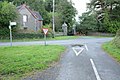 Road junction at Lanesend - geograph.org.uk - 2608948.jpg 1 024 × 680; 269 KB
-
 Road sign from yesteryear - geograph.org.uk - 3620956.jpg 3 264 × 2 448; 4,26 MB
-
 Rough grazing near Loveston - geograph.org.uk - 2609983.jpg 1 024 × 680; 300 KB
-
 Ruins at Cresswell Quay - geograph.org.uk - 4485046.jpg 2 576 × 1 932; 1,25 MB
-
 Site Access warning - geograph.org.uk - 2608424.jpg 1 024 × 680; 296 KB
-
 Stepping stones - geograph.org.uk - 2766750.jpg 3 264 × 2 448; 4,98 MB
-
 Stepping Stones at Cresswell Quay - geograph.org.uk - 5096487.jpg 2 576 × 1 932; 1,26 MB
-
 The A4075 at Cross Hands - geograph.org.uk - 4326436.jpg 1 600 × 1 062; 404 KB
-
 The Stepping Stones at Cresswell Quay - geograph.org.uk - 3612697.jpg 1 224 × 918; 527 KB
-
 Yerbeston Gate - geograph.org.uk - 2609417.jpg 1 024 × 680; 195 KB
-
 Yerbeston Mountain Farm on the A4075 - geograph.org.uk - 4326452.jpg 1 600 × 1 062; 396 KB
-
 Road through the woods - geograph.org.uk - 576168.jpg 640 × 480; 136 KB


.jpg)


