Category:Kahl am Main
Salti al navigilo
Salti al serĉilo
komunumo en Bavario, Germanio    | |||||
| Alŝuti plurmedion | |||||
| Estas |
| ||||
|---|---|---|---|---|---|
| Parto de |
| ||||
| Loko | Distrikto Aschaffenburg, Malsupra Frankonio, Bavario, Germanio | ||||
| Estro |
| ||||
| Loĝantaro |
| ||||
| Areo |
| ||||
| Supermara alteco |
| ||||
| oficiala retejo | |||||
 | |||||
Subkategorioj
Ĉi tiu kategorio havas la 23 jenajn subkategoriojn, el 23 entute.
*
2
- 2017 in Kahl am Main (21 D)
A
B
- Bahnhof Kahl (Main) (35 D)
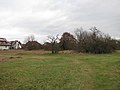
- Birkenkopf (Spessart) (1 D)
C
- Christnersee (2 D)
D
- Degen-Weg (12 D)
F
- Freigericht-Ost (1 D)
- Freigericht-West (2 D)
H
- Heinrich Kopp (company) (8 D)
K
- Kahl in Kahl am Main (6 D)
L
- Lange Hecke (9 D)
- Lindensee (1 D)
M
- Main in Kahl am Main (2 D)
N
- Nachtweidesee (Kahl am Main) (2 D)
P
- Prischoß (12 D)
S
- Schloßsee (Kahl am Main) (1 D)
W
- Weihertannensee (1 D)
Dosieroj en kategorio “Kahl am Main”
La jenaj 74 dosieroj estas en ĉi tiu kategorio, el 74 entute.
-
 Alzenauer Straße 19, 1, Kahl a. Main, Landkreis Aschaffenburg.jpg 3 456 × 2 592; 4,46 MB
-
 Alzenauer Straße 68, 1, Kahl a. Main, Landkreis Aschaffenburg.jpg 3 456 × 2 592; 3,35 MB
-
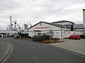
 Bahnhof Kahl Kopp-Heide, 1, Kahl a. Main, Landkreis Aschaffenburg.jpg 3 456 × 2 592; 3,56 MB
-
 Bahnhofstraße 49, 5, Kahl a. Main, Landkreis Aschaffenburg.jpg 3 456 × 2 592; 4,54 MB
-
 Bahnhofstraße 49, 6, Kahl a. Main, Landkreis Aschaffenburg.jpg 3 456 × 2 592; 4,12 MB
-
 Bahnhofstraße 49, 7, Kahl a. Main, Landkreis Aschaffenburg.jpg 3 456 × 2 592; 4,61 MB
-
 Bahnhofstraße 49, 8, Kahl a. Main, Landkreis Aschaffenburg.jpg 3 456 × 2 592; 4,07 MB
-
 Bahnhofstraße 49, 1, Kahl a. Main, Landkreis Aschaffenburg.jpg 3 456 × 2 592; 3,96 MB
-
 Bahnhofstraße, 1, Kahl a. Main, Landkreis Aschaffenburg.jpg 3 456 × 2 592; 3,58 MB
-
 Bodendenkmal D-6-5920-0001, 1, Kahl a. Main, Landkreis Aschaffenburg.jpg 3 456 × 2 592; 5,54 MB
-
 Bodendenkmal D-6-5920-0001, 2, Kahl a. Main, Landkreis Aschaffenburg.jpg 3 456 × 2 592; 4,97 MB
-
 Bodendenkmal D-6-5920-0001, 3, Kahl a. Main, Landkreis Aschaffenburg.jpg 3 456 × 2 592; 4,17 MB
-
 Bodendenkmal D-6-5920-0036, 1, Kahl a. Main, Landkreis Aschaffenburg.jpg 3 456 × 2 592; 5,04 MB
-
 Bodendenkmal D-6-5920-0036, 2, Kahl a. Main, Landkreis Aschaffenburg.jpg 3 456 × 2 592; 3,83 MB
-
 Bodendenkmal D-6-5920-0040, 1, Kahl a. Main, Landkreis Aschaffenburg.jpg 3 456 × 2 592; 4,57 MB
-
 Bodendenkmal D-6-5920-0046, 1, Kahl a. Main, Landkreis Aschaffenburg.jpg 3 456 × 2 592; 5,38 MB
-
 Bodendenkmal D-6-5920-0047, 1, Kahl a. Main, Landkreis Aschaffenburg.jpg 3 456 × 2 592; 4,02 MB
-
 Bodendenkmal D-6-5920-0049, 1, Kahl a. Main, Landkreis Aschaffenburg.jpg 3 456 × 2 592; 5,92 MB
-
 Bodendenkmal D-6-5920-0049, 2, Kahl a. Main, Landkreis Aschaffenburg.jpg 3 456 × 2 592; 4,25 MB
-
 Bodendenkmal D-6-5920-0092, 1, Kahl a. Main, Landkreis Aschaffenburg.jpg 3 456 × 2 592; 4,13 MB
-
 Bushaltestelle Heide, 1, Kahl a. Main, Landkreis Aschaffenburg.jpg 3 456 × 2 592; 3,98 MB
-
 Bushaltestelle Heide, 2, Kahl a. Main, Landkreis Aschaffenburg.jpg 3 456 × 2 592; 4,65 MB
-
 Bushaltestelle In den Vierzehnmorgen, 1, Kahl a. Main, Landkreis Aschaffenburg.jpg 3 456 × 2 592; 4,74 MB
-
 Bushaltestelle Kopp, 1, Kahl a. Main, Landkreis Aschaffenburg.jpg 3 456 × 2 592; 5,12 MB
-
 Bushaltestelle Kopp, 2, Kahl a. Main, Landkreis Aschaffenburg.jpg 2 592 × 3 456; 4,72 MB
-
 Bushaltestelle Kopp, 3, Kahl a. Main, Landkreis Aschaffenburg.jpg 3 456 × 2 592; 4,61 MB
-
 Bushaltestelle Seniorenresidenz, 1, Kahl a. Main, Landkreis Aschaffenburg.jpg 3 456 × 2 592; 4,48 MB
-
 Bushaltestelle Seniorenresidenz, 2, Kahl a. Main, Landkreis Aschaffenburg.jpg 3 456 × 2 592; 4,06 MB
-
 Christnersee, 1, Kahl a. Main, Landkreis Aschaffenburg.jpg 3 456 × 2 592; 5,87 MB
-
 Christnersee, 2, Kahl a. Main, Landkreis Aschaffenburg.jpg 3 456 × 2 592; 5,92 MB
-
 Damjanichstrasse, Auf Wiedersehen, Partnerstädte, 2022 Budakalász.jpg 1 704 × 2 272; 972 KB
-
 Damjanichstrasse, Herzlich willkommen, Partnerstädte, 2022 Budakalász.jpg 1 704 × 2 272; 1,43 MB
-
 De kahl in europe.jpg 655 × 600; 86 KB
-
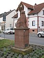
 Denkmal, 1, Freigerichter Straße, Kahl a. Main, Landkreis Aschaffenburg.jpg 3 456 × 2 592; 5,5 MB
-
 Denkmal, 2, Freigerichter Straße, Kahl a. Main, Landkreis Aschaffenburg.jpg 3 456 × 2 592; 6,19 MB
-
 Die Alzenauer Sande 2.jpg 4 096 × 2 304; 6,19 MB
-
 Freigerichter Straße, 1, Kahl a. Main, Landkreis Aschaffenburg.jpg 3 456 × 2 592; 4,82 MB
-
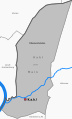
 Gemeinde Kahl am Main (Details).svg 1 197 × 1 977; 842 KB
-
 Gemeinde Kahl am Main.png 911 × 1 502; 42 KB
-
 Gemeinde Kahl am Main.svg 1 197 × 1 977; 74 KB
-
 Hanauer Landstraße 34, 1, Kahl a. Main, Landkreis Aschaffenburg.jpg 3 456 × 2 592; 4,05 MB
-
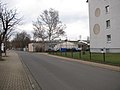
 Hanauer Landstraße, 1, Kahl a. Main, Landkreis Aschaffenburg.jpg 3 456 × 2 592; 3,61 MB
-
 Hanauer Landstraße, 2, Kahl a. Main, Landkreis Aschaffenburg.jpg 3 456 × 2 592; 4,32 MB
-
 Hanauer Landstraße, 3, Kahl a. Main, Landkreis Aschaffenburg.jpg 3 456 × 2 592; 3,45 MB
-
 Kahl am Main Lange Hecke 2017.JPG 5 456 × 3 632; 5,17 MB
-
 Kahl am Main.svg 1 197 × 1 978; 71 KB
-
 KAHL MAIN nieder.png 480 × 360; 5 KB
-
 KAHL MAIN nieder.svg 512 × 427; 21 KB
-
 Kahler Hexeneiche.JPG 1 224 × 1 632; 935 KB
-
 Kahler See Privatufer.JPG 1 632 × 1 224; 927 KB
-
 Kilometerstein, 1, Alzenauer Straße 28, Kahl a. Main, Landkreis Aschaffenburg.jpg 3 456 × 2 592; 4,66 MB
-
 Kilometerstein, 2, Alzenauer Straße 28, Kahl a. Main, Landkreis Aschaffenburg.jpg 3 456 × 2 592; 3,59 MB
-
 Königsberger Straße, 1, Kahl a. Main, Landkreis Aschaffenburg.jpg 3 456 × 2 592; 3,93 MB
-
 Lange Hecke 4, 1, Kahl a. Main, Landkreis Aschaffenburg.jpg 3 456 × 2 592; 3,36 MB
-
 Lange Hecke 8, 1, Kahl a. Main, Landkreis Aschaffenburg.jpg 3 456 × 2 592; 5,45 MB
-
 Möbelhaus Bessenbacher, 1, Portenstraße 16, Kahl a. Main, Landkreis Aschaffenburg.jpg 3 456 × 2 592; 3,51 MB
-
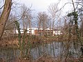
 Paul-Gerhardt-Schule, 1, Kahl a. Main, Landkreis Aschaffenburg.jpg 3 456 × 2 592; 3,33 MB
-
 Paul-Gerhardt-Schule, 2, Kahl a. Main, Landkreis Aschaffenburg.jpg 3 456 × 2 592; 3,86 MB
-
 Paul-Gerhardt-Schule, 3, Kahl a. Main, Landkreis Aschaffenburg.jpg 3 456 × 2 592; 4,56 MB
-
 Querstraße, 1, Kahl a. Main, Landkreis Aschaffenburg.jpg 3 456 × 2 592; 3,78 MB
-
 Sandhas, 1, Kahl a. Main, Landkreis Aschaffenburg.jpg 2 592 × 3 456; 3,61 MB
-
 Sandweg, 1, Kahl a. Main, Landkreis Aschaffenburg.jpg 3 456 × 2 592; 4,01 MB
-
 Schulbushaltestelle Paul-Gerhardt-Schule, 1, Kahl a. Main, Landkreis Aschaffenburg.jpg 3 456 × 2 592; 4,39 MB
-
 See Freigericht Ost - Kahler Campingsee, 1, Kahl a. Main, Landkreis Aschaffenburg.jpg 3 456 × 2 592; 5,67 MB
-
 Seestraße 3, 1, Kahl a. Main, Landkreis Aschaffenburg.jpg 3 456 × 2 592; 3 MB
-
 Seestraße 5, 1, Kahl a. Main, Landkreis Aschaffenburg.jpg 3 456 × 2 592; 3,36 MB
-
 Seestraße, 1, Kahl a. Main, Landkreis Aschaffenburg.jpg 3 456 × 2 592; 3,32 MB
-
 Singulus, 1, Kahl a. Main, Landkreis Aschaffenburg.jpg 3 456 × 2 592; 4,99 MB
-
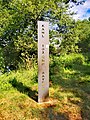 Tiefster Punkt Bayerns.jpg 2 736 × 3 648; 6,58 MB
-
 Trafoturm, 1, Freigerichter Straße, Kahl a. Main, Landkreis Aschaffenburg.jpg 3 456 × 2 592; 5,26 MB
-
 Twin town sign and trilingual welcome sign, 2018 Budakalász.jpg 1 704 × 2 272; 965 KB
-
 Wappen Kahl neu.png 131 × 160; 21 KB
-
 Wappen Kahl.png 171 × 184; 43 KB
-
 Wappen Kahl.svg 544 × 581; 14 KB


.svg)


