Category:Kangilinnguit
Zur Navigation springen
Zur Suche springen
Siedlung in Grönland  | |||||
| Medium hochladen | |||||
| Ist ein(e) | |||||
|---|---|---|---|---|---|
| Ort | Kommuneqarfik Sermersooq, Grönland, Königreich Dänemark | ||||
| Höhe über dem Meeresspiegel |
| ||||
| IATA-Flughafencode |
| ||||
| ICAO-Flughafencode |
| ||||
 | |||||
Medien in der Kategorie „Kangilinnguit“
Folgende 7 Dateien sind in dieser Kategorie, von 7 insgesamt.
-
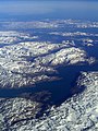 Flughöhe, ~10300 mNN - panoramio.jpg 1.200 × 1.600; 418 KB
-
 Grönland. Südwest-Küste - panoramio.jpg 1.200 × 1.600; 427 KB
-
 Grønnedal.jpg 1.006 × 672; 95 KB
-
 HVBJ til kaj.jpg 800 × 289; 78 KB
-
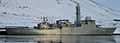
 Inspektionsskib i Grønnedal.jpg 1.224 × 1.185; 121 KB
-
 Kangilinnguit-population-dynamics.png 1.000 × 250; 12 KB
-
 Kangilinnguit.jpg 1.494 × 1.000; 150 KB


