Category:Keinton Mandeville
Aller à la navigation
Aller à la recherche
English: Keinton Mandeville is a village and civil parish in Somerset, England, situated west of Castle Cary in the South Somerset district. The village has a population of 991. It is next to Barton St David.
localité britannique du comté anglais de Somerset  | |||||
| Téléverser des médias | |||||
| Nature de l’élément | |||||
|---|---|---|---|---|---|
| Lieu | South Somerset, Somerset, Angleterre du Sud-Ouest, Angleterre | ||||
 | |||||
Média dans la catégorie « Keinton Mandeville »
Cette catégorie comprend 44 fichiers, dont les 44 ci-dessous.
-
 B3153 west of Keinton Mandeville - geograph.org.uk - 5607591.jpg 1 600 × 1 201 ; 833 kio
-
 Blue Lias Quarry Westfield Farm - geograph.org.uk - 2890111.jpg 640 × 480 ; 94 kio
-
 Bus shelter in Keinton Mandeville - geograph.org.uk - 5607576.jpg 1 600 × 1 200 ; 710 kio
-
 Church Street Keinton Mandeville - geograph.org.uk - 1805597.jpg 640 × 447 ; 78 kio
-
 Common Lane - geograph.org.uk - 5694995.jpg 1 024 × 768 ; 233 kio
-
 Cottages at Combe Hill House - geograph.org.uk - 5896364.jpg 1 024 × 782 ; 186 kio
-
 Cottages at Westfield Farm - geograph.org.uk - 2889898.jpg 640 × 480 ; 88 kio
-
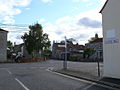
 Crossroads at Keinton Mandevlle - geograph.org.uk - 5896365.jpg 1 024 × 768 ; 163 kio
-
 Crossroads Keinton Mandeville (geograph 2890159).jpg 640 × 480 ; 67 kio
-

-
 Farmland near Keinton Mandeville - geograph.org.uk - 2868850.jpg 640 × 376 ; 42 kio
-
 Farmland near Keinton Mandeville - geograph.org.uk - 5695011.jpg 1 024 × 768 ; 218 kio
-
 Gate near Keinton Mandeville - geograph.org.uk - 1734502.jpg 640 × 481 ; 138 kio
-
 High Street, Keinton Mandeville - geograph.org.uk - 5650723.jpg 1 024 × 683 ; 294 kio
-
 Houses on High Street - geograph.org.uk - 5470103.jpg 1 024 × 782 ; 154 kio
-
 Keinton Mandeville church (geograph 3889324).jpg 4 320 × 3 240 ; 5,49 Mio
-
 Keinton Mandeville church.jpg 640 × 480 ; 85 kio
-
 Keinton Stores - geograph.org.uk - 5470092.jpg 1 024 × 798 ; 126 kio
-
 Lake View Sedimentary - geograph.org.uk - 167865.jpg 640 × 426 ; 137 kio
-
 Lakeview Quarry - geograph.org.uk - 165761.jpg 426 × 640 ; 112 kio
-
 Macmillan Way West - geograph.org.uk - 5694999.jpg 1 024 × 768 ; 306 kio
-
 Near Newcombe Farm - geograph.org.uk - 5184411.jpg 640 × 382 ; 29 kio
-
 Near Newlands Farm - geograph.org.uk - 4862510.jpg 640 × 426 ; 46 kio
-
 New House, Southmead Farm - geograph.org.uk - 5694977.jpg 1 024 × 821 ; 180 kio
-
 Newcombe Farm - geograph.org.uk - 5557787.jpg 640 × 426 ; 40 kio
-
 Newcombe Farm - geograph.org.uk - 5634093.jpg 640 × 427 ; 197 kio
-

-

-
 Ordnance Survey Flush Bracket 10718 - geograph.org.uk - 3928804.jpg 4 000 × 3 000 ; 3,31 Mio
-
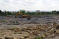 Quarry in Keinton Mandeville (geograph 3371233).jpg 640 × 426 ; 82 kio
-
 Quarry Inn, Keinton Mandeville - geograph.org.uk - 5470178.jpg 1 024 × 756 ; 167 kio
-
 Rail overbridge on Common Lane - geograph.org.uk - 5694988.jpg 1 024 × 842 ; 245 kio
-
 Railway Bridge, Common Lane - geograph.org.uk - 2890176.jpg 640 × 487 ; 132 kio
-
 Sharp bend on Common Lane - geograph.org.uk - 5695138.jpg 1 024 × 768 ; 313 kio
-

-
 Stone wall by the road at Coombe Hill House - geograph.org.uk - 5607571.jpg 1 600 × 1 000 ; 700 kio
-
 The B3153 through Keinton Mandeville (geograph 2760848).jpg 800 × 600 ; 123 kio
-
 The Quarry Inn, Keinton Mandeville - geograph.org.uk - 5607584.jpg 1 600 × 1 198 ; 811 kio
-
 Tributary of the River Cary - geograph.org.uk - 5853447.jpg 1 024 × 681 ; 152 kio
-
 Unnamed tributary of the River Cary - geograph.org.uk - 5822010.jpg 1 024 × 681 ; 93 kio
-
 View to Keinton Mandeville Church - geograph.org.uk - 5557788.jpg 640 × 447 ; 45 kio
-
 Yard at Westfield Farm - geograph.org.uk - 5896361.jpg 1 024 × 763 ; 201 kio
-
 Keinton Mandeville - geograph.org.uk - 376895.jpg 640 × 427 ; 308 kio
-
 Railway Bridge across Common Lane - geograph.org.uk - 542778.jpg 640 × 480 ; 112 kio


.jpg)


.jpg)


.jpg)


.jpg)


