Category:Kelheim
Zur Navigation springen
Zur Suche springen
Stadt in Bayern, Deutschland    | |||||
| Medium hochladen | |||||
| Ist ein(e) |
| ||||
|---|---|---|---|---|---|
| Ist Teil von |
| ||||
| Ort | Landkreis Kelheim, Niederbayern, Bayern, Deutschland | ||||
| Liegt am oder im Gewässer | |||||
| Einwohnerzahl |
| ||||
| Fläche |
| ||||
| Höhe über dem Meeresspiegel |
| ||||
| offizielle Website | |||||
 | |||||
Unterkategorien
Es werden 16 von insgesamt 16 Unterkategorien in dieser Kategorie angezeigt:
In Klammern die Anzahl der enthaltenen Kategorien (K), Seiten (S), Dateien (D)
Medien in der Kategorie „Kelheim“
Folgende 63 Dateien sind in dieser Kategorie, von 63 insgesamt.
-
 Wappen Kelheim.svg 172 × 192; 49 KB
-
 WappenKelheim.png 184 × 200; 8 KB
-
 Auf dem Michelsberg oberhalb der Stadt Kelheim befindet sich die Befreiungshalle.jpg 5.184 × 3.456; 6,55 MB
-
 Buch.jpg 4.000 × 3.000; 3,05 MB
-
De-Kelheim.ogg 2,1 s; 19 KB
-
 Donau fließt auch neben Kelheim.jpg 5.184 × 3.456; 6,93 MB
-
 DSC02093 - Kelheim (30911424851).jpg 1.333 × 2.000; 374 KB
-
 DSC02140 - Kelheim (31022331556).jpg 1.333 × 2.000; 587 KB
-
 DSC02143 - Kelheim (31022330596).jpg 2.000 × 1.333; 1,05 MB
-
 DSC02144 - Kelheim (31058093155).jpg 1.333 × 2.000; 763 KB
-
 Faun, Auerkalkstein, Werk von Gautam im Skulpturengarten von A. Röhrl.jpg 5.458 × 3.648; 17,98 MB
-
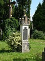
 Grabmal von 1877 - panoramio.jpg 2.120 × 2.816; 1,06 MB
-
 Grabmalarchitektur von 1912 - panoramio.jpg 2.120 × 2.816; 1,33 MB
-
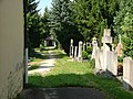 Grabmale - panoramio (3).jpg 2.816 × 2.120; 1,47 MB
-
 Hochwasser 1845 - panoramio.jpg 2.816 × 2.120; 1,64 MB
-
 Hochwasser im Jahre 1845 - panoramio.jpg 2.816 × 2.120; 1,54 MB
-
 Kapelle - panoramio (48).jpg 2.816 × 2.120; 542 KB
-
 KELDORADO Aquagymnastik.JPG 299 × 224; 33 KB
-
 KELDORADO Außen "Der Tag beginnt".jpg 800 × 450; 67 KB
-
 KELDORADO Außenansicht Rutsche.JPG 800 × 531; 87 KB
-
 KELDORADO Rutsche "black hole".JPG 3.264 × 4.912; 449 KB
-
 KELDORADO Schwimmbecken.jpg 800 × 533; 95 KB
-
 KELDORADO Wettkampf.JPG 800 × 600; 92 KB
-
LL-Q188 (deu)-Ionenlaser-Kelheim.wav 1,3 s; 113 KB
-
 Kelheim - Lage im Landkreis.png 148 × 185; 25 KB
-
 Kelheim - panoramio.jpg 2.816 × 2.120; 1,07 MB
-
 Kelheim 2014 Mattes (11).JPG 3.648 × 2.056; 3,02 MB
-
 Kelheim 2014 Mattes (18).JPG 2.592 × 1.944; 2,93 MB
-
 Kelheim 2014 Mattes (19).JPG 2.592 × 1.944; 2,78 MB
-
 Kelheim 2014 Mattes (2).JPG 2.592 × 1.944; 2,86 MB
-
 Kelheim 2014 Mattes (3).JPG 2.056 × 3.648; 3,4 MB
-
 Kelheim 2014 Mattes (41).JPG 2.592 × 1.944; 3 MB
-
 Kelheim 2014 Mattes (43).JPG 2.592 × 1.944; 2,98 MB
-
 Kelheim 2014 Mattes (5).JPG 2.056 × 3.648; 2,6 MB
-
 Kelheim 2014 Mattes (60).JPG 2.592 × 1.944; 2,96 MB
-
 Kelheim 2014 Mattes (62).JPG 2.592 × 1.944; 2,62 MB
-
 Kelheim 2014 Mattes (71).JPG 1.944 × 2.592; 1,86 MB
-
 Kelheim 2015.jpg 4.000 × 3.000; 1,8 MB
-
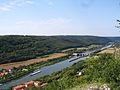
 Kelheim and Saal an der Donau, Germany.jpg 2.592 × 1.944; 1,84 MB
-
 Kelheim Bahnhof 1975.jpg 800 × 496; 82 KB
-
 Kelheim in KEH.svg 576 × 664; 590 KB
-
 KELHEIM nieder.png 480 × 360; 5 KB
-
 KELHEIM nieder.svg 512 × 427; 21 KB
-
 Kelheim, dezembro de 2003 - panoramio - Kell Kell (1).jpg 638 × 850; 642 KB
-
 Kelheim, dezembro de 2003 - panoramio - Kell Kell (2).jpg 850 × 638; 309 KB
-
 Kelheim, dezembro de 2003 - panoramio - Kell Kell.jpg 850 × 638; 587 KB
-
 Kelheim, dezembro de 2003 - panoramio.jpg 850 × 638; 576 KB
-
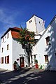
 Kelheim, Ludwigsplatz - geo.hlipp.de - 25009.jpg 640 × 427; 70 KB
-
 Kelheim- Blick zur Befreiungshalle - geo.hlipp.de - 35454.jpg 426 × 640; 149 KB
-
 Kelheimer Hütte Jackelberg.jpg 1.600 × 1.200; 1,62 MB
-
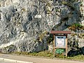
 Keltenwall bei Weltenburg - geo.hlipp.de - 26018.jpg 480 × 640; 126 KB
-
 Kreative Sitzgruppe - panoramio.jpg 2.060 × 1.337; 1.007 KB
-
 Kreis Kelheim, outubro de 2011 - panoramio (1).jpg 1.276 × 850; 649 KB
-
 Kreis Kelheim, outubro de 2011 - panoramio.jpg 1.276 × 850; 840 KB
-
 Lohstadt, Landscape - panoramio.jpg 1.600 × 1.200; 416 KB
-
 Mauerwerk - panoramio.jpg 2.816 × 2.120; 955 KB
-
 Obelisk - panoramio (3).jpg 2.120 × 2.816; 954 KB
-
 SchleuseKelheim(Gronsdorsf)NiederbayernRheinMainDonauKanal.jpg 2.048 × 1.536; 1,65 MB
-
 Scotopteryx bipunctaria.jpg 1.699 × 1.177; 393 KB
-
 Urdonausohle.jpg 2.081 × 1.561; 726 KB
-
 Von 1903 - panoramio.jpg 2.120 × 2.816; 1,38 MB
-
 Von 1917 - panoramio.jpg 2.120 × 2.816; 1,42 MB
-
 Wanderweg bei Weltenburg - geo.hlipp.de - 26046.jpg 480 × 640; 126 KB


.jpg)
.jpg)
.jpg)
.jpg)


.jpg)


.jpg)


.JPG)
.JPG)
.JPG)
.JPG)
.JPG)
.JPG)
.JPG)
.JPG)
.JPG)
.JPG)
.JPG)


.jpg)
.jpg)


.jpg)


.jpg)
NiederbayernRheinMainDonauKanal.jpg)


