Category:Kellingley Colliery
Zur Navigation springen
Zur Suche springen
coal mine in North Yorkshire, England, UK  | |||||
| Medium hochladen | |||||
| Ist ein(e) | |||||
|---|---|---|---|---|---|
| Ort | Kellingley, Beal, Selby, North Yorkshire (Unitary Authority), North Yorkshire, Yorkshire and the Humber, England | ||||
| Betreiber |
| ||||
| Startzeitpunkt |
| ||||
| Endzeitpunkt |
| ||||
 | |||||
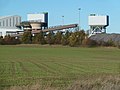
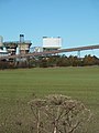
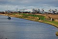
Kellingley Colliery is a large deep cast coal mine lying in both West Yorkshire and North Yorkshire inbetween Knottingley and Kellingley.
Unterkategorien
Diese Kategorie enthält folgende Unterkategorie:
In Klammern die Anzahl der enthaltenen Kategorien (K), Seiten (S), Dateien (D)
Medien in der Kategorie „Kellingley Colliery“
Folgende 40 Dateien sind in dieser Kategorie, von 40 insgesamt.
-
 A colliery in the back garden - geograph.org.uk - 448651.jpg 640 × 429; 135 KB
-

-
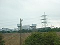
 Alternative power (geograph 5647191).jpg 4.608 × 3.072; 3,68 MB
-
 Calder Grange - geograph.org.uk - 5169.jpg 640 × 480; 72 KB
-
 Coal stack - geograph.org.uk - 4826892.jpg 1.024 × 768; 157 KB
-
 Disused conveyor, Kellingley Colliery - geograph.org.uk - 4550795.jpg 1.024 × 768; 115 KB
-
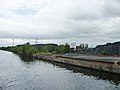 Disused wharf, Kellingley Colliery - geograph.org.uk - 4550797.jpg 1.024 × 768; 109 KB
-
 Entrance to Kellingley regeneration scheme, Beal Lane - geograph.org.uk - 6003246.jpg 2.560 × 1.920; 2,39 MB
-
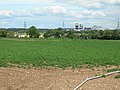 Farmland near Nearpark Farm - geograph.org.uk - 2476394.jpg 1.600 × 1.200; 488 KB
-
 Kellingley (Selby) Colliery - geograph.org.uk - 2017388.jpg 800 × 600; 165 KB
-
 Kellingley across the A645 (geograph 5065687).jpg 640 × 480; 73 KB
-
 Kellingley Colliery (geograph 3792636).jpg 1.280 × 960; 137 KB
-
 Kellingley Colliery (geograph 4021931).jpg 3.956 × 2.746; 2,42 MB
-
 Kellingley Colliery (geograph 4118219).jpg 1.600 × 1.062; 565 KB
-
 Kellingley Colliery (geograph 4826669).jpg 1.024 × 768; 170 KB
-
 Kellingley Colliery - geograph.org.uk - 2143848.jpg 800 × 600; 180 KB
-
 Kellingley Colliery - geograph.org.uk - 3737475.jpg 640 × 480; 60 KB
-
 Kellingley Colliery - geograph.org.uk - 3739476.jpg 640 × 480; 72 KB
-
 Kellingley Colliery - geograph.org.uk - 448662.jpg 640 × 429; 147 KB
-
 Kellingley Colliery - geograph.org.uk - 5170.jpg 640 × 480; 62 KB
-
 Kellingley Colliery - geograph.org.uk - 579893.jpg 640 × 460; 87 KB
-
 Kellingley Colliery - rear entrance - geograph.org.uk - 3239920.jpg 640 × 480; 54 KB
-

-
 Kellingley Colliery and giant hogweed (geograph 3737455).jpg 480 × 640; 65 KB
-
 Kellingley Colliery from Stubbs Bridge (geograph 6299498).jpg 640 × 476; 76 KB
-
 Kellingley Colliery from the Common Lane level crossing - geograph.org.uk - 5143539.jpg 1.600 × 1.200; 392 KB
-
 Kellingley Colliery from the M62.jpg 2.627 × 1.237; 349 KB
-
 Kellingley Colliery geograph 001.jpg 640 × 285; 34 KB
-
 Kellingley Colliery, from the Aire ^ Calder - geograph.org.uk - 4550787.jpg 1.024 × 614; 105 KB
-
 Kellingley.jpg 2.256 × 1.496; 1,55 MB
-
 Miners Memorial Garden, Overton (geograph 5518749).jpg 640 × 480; 97 KB
-
 Nearly a year on (geograph 5217740).jpg 1.024 × 768; 115 KB
-
 New and old power (geograph 4021937).jpg 3.456 × 4.608; 2,79 MB
-
 Potato field off Womersley Lane - geograph.org.uk - 2477820.jpg 1.024 × 768; 184 KB
-
 Redundant tracks at Kellingley (geograph 4826586).jpg 1.024 × 768; 135 KB
-
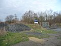
 Sudforth Lane entrance, Kellingley Colliery (geograph 2477979).jpg 1.024 × 768; 95 KB
-
 The Aire and Calder Canal - geograph.org.uk - 668536.jpg 640 × 364; 55 KB
-
 The changing face of energy (geograph 5647211).jpg 3.760 × 2.480; 2,31 MB
-
 The ghost of Kellingley Colliery - geograph.org.uk - 5220930.jpg 1.024 × 768; 98 KB
-
 Two years on (geograph 5647181).jpg 4.608 × 3.072; 1,45 MB


.jpg)


_Colliery_-_geograph.org.uk_-_2017388.jpg)
.jpg)
.jpg)
.jpg)
.jpg)
.jpg)


.jpg)
.jpg)


.jpg)
.jpg)
.jpg)

.jpg)
.jpg)

.jpg)

.jpg)