Category:Kelmarsh
Aller à la navigation
Aller à la recherche
English: Kelmarsh is a village in the West Northamptonshire district of the county of Northamptonshire in England. Kelmarsh Hall is its principal building. The former railway tunnel at Kelmarsh is now open as part of the Brampton Valley Way.
village britannique  | |||||
| Téléverser des médias | |||||
| Nature de l’élément | |||||
|---|---|---|---|---|---|
| Lieu | West Northamptonshire, Northamptonshire, Midlands de l'Est, Angleterre | ||||
| Population |
| ||||
| Superficie |
| ||||
 | |||||
Sous-catégories
Cette catégorie comprend 4 sous-catégories, dont les 4 ci-dessous.
K
- Kelmarsh railway station (3 F)
- Kelmarsh Tunnel (7 F)
S
- St Denys' church, Kelmarsh (3 F)
Média dans la catégorie « Kelmarsh »
Cette catégorie comprend 206 fichiers, dont les 200 ci-dessous.
(page précédente) (page suivante)-
 A skilled rider on a Roman tethrippon.jpg 1 600 × 1 200 ; 820 kio
-
 A14 - A508 overbridge - geograph.org.uk - 3577811.jpg 640 × 480 ; 63 kio
-
 A14 - westbound lay-by near Johnson's Covert - geograph.org.uk - 3577825.jpg 640 × 480 ; 55 kio
-
 A14 approaching junction 2 eastbound - geograph.org.uk - 1818485.jpg 640 × 480 ; 81 kio
-
 A14 at junction 2 - geograph.org.uk - 1818492.jpg 640 × 480 ; 92 kio
-
 A14 bridge near Kelmarsh - geograph.org.uk - 5863225.jpg 1 024 × 768 ; 236 kio
-
 A14 climbing towards Kelmarsh - geograph.org.uk - 3577806.jpg 640 × 480 ; 55 kio
-
 A14 Crossing Over a Minor Road - geograph.org.uk - 3815138.jpg 640 × 480 ; 314 kio
-
 A14 crossing the Brampton Valley Way - geograph.org.uk - 5317051.jpg 800 × 694 ; 148 kio
-
 A14 curving into the Ise valley - geograph.org.uk - 3577803.jpg 640 × 480 ; 57 kio
-
 A14 east of A508 junction - geograph.org.uk - 5079668.jpg 640 × 480 ; 50 kio
-
 A14 east of junction 2 - geograph.org.uk - 1818502.jpg 640 × 480 ; 150 kio
-
 A14 east of the A508 junction - geograph.org.uk - 3577816.jpg 640 × 480 ; 57 kio
-
 A14 Eastbound - geograph.org.uk - 2374441.jpg 1 024 × 683 ; 136 kio
-
 A14 eastbound at the A508 exit - geograph.org.uk - 3577809.jpg 640 × 480 ; 57 kio
-
 A14 eastbound nears Junction 2 - geograph.org.uk - 5078468.jpg 640 × 481 ; 57 kio
-
 A14 junction 2, A508 overbridge - geograph.org.uk - 1818495.jpg 640 × 480 ; 168 kio
-
 A14 near Johnson's Covert - geograph.org.uk - 3577819.jpg 640 × 480 ; 56 kio
-
 A14 near Kelmarsh - geograph.org.uk - 3815141.jpg 640 × 480 ; 335 kio
-
 A14 near Rectory Farm - geograph.org.uk - 5079663.jpg 640 × 481 ; 66 kio
-
 A14 underpass - geograph.org.uk - 2667199.jpg 640 × 427 ; 112 kio
-
 A14 westbound - geograph.org.uk - 4332963.jpg 640 × 480 ; 57 kio
-
 A14 Westbound, near Johnson's Covert - geograph.org.uk - 3821875.jpg 640 × 480 ; 286 kio
-
 A508 at Kelmarsh - Northamptonshire - geograph.org.uk - 4919938.jpg 3 072 × 2 304 ; 2,69 Mio
-
 A508 north of Kelmarsh - geograph.org.uk - 4308059.jpg 1 280 × 849 ; 152 kio
-
 A508 north of Kelmarsh - geograph.org.uk - 5286246.jpg 480 × 640 ; 42 kio
-
 Air shaft for Kelmarsh tunnel - geograph.org.uk - 5639237.jpg 640 × 480 ; 32 kio
-
 Airshaft of the Kelmarsh Tunnel - geograph.org.uk - 5317038.jpg 800 × 724 ; 189 kio
-
 Approaching A14 from north - geograph.org.uk - 446272.jpg 640 × 477 ; 99 kio
-
 April afternoon at Kelmarsh - Northamptonshire - geograph.org.uk - 4921682.jpg 3 072 × 2 304 ; 2,24 Mio
-
 Barn near Rabbithill Spinney - geograph.org.uk - 5317017.jpg 800 × 589 ; 125 kio
-
 Brampton Valley Way (National Cycle Route 6) - geograph.org.uk - 4331399.jpg 640 × 480 ; 107 kio
-
 Brampton Valley Way - geograph.org.uk - 2875664.jpg 640 × 427 ; 139 kio
-
 Brampton Valley Way - geograph.org.uk - 2878451.jpg 640 × 427 ; 161 kio
-
 Brampton Valley Way - geograph.org.uk - 2878453.jpg 640 × 427 ; 145 kio
-
 Brampton Valley Way - geograph.org.uk - 4595152.jpg 480 × 640 ; 102 kio
-
 Brampton Valley Way - geograph.org.uk - 4595153.jpg 480 × 640 ; 85 kio
-
 Brampton Valley Way - geograph.org.uk - 4595154.jpg 640 × 480 ; 112 kio
-
 Brampton Valley Way approaching Kelmarsh Tunnel - geograph.org.uk - 5863209.jpg 1 024 × 768 ; 301 kio
-
 Brampton Valley Way near Arthingworth - geograph.org.uk - 5863187.jpg 1 024 × 768 ; 303 kio
-
 Brampton Valley Way near Clipston - geograph.org.uk - 5863182.jpg 1 024 × 768 ; 362 kio
-
 Brampton Valley Way near Kelmarsh - geograph.org.uk - 5863224.jpg 1 024 × 768 ; 278 kio
-
 Bridge along the Brampton Valley Way - geograph.org.uk - 3507483.jpg 4 000 × 3 000 ; 4,93 Mio
-
 Bridleway to Clipston - geograph.org.uk - 2875681.jpg 640 × 427 ; 152 kio
-
 Case IH 2388 combine, Easterby trailer, rapeseed harvest near Kelmarsh, Northamptonshire.jpg 3 434 × 1 811 ; 1,7 Mio
-
 Clipston Farmland - geograph.org.uk - 2991051.jpg 640 × 480 ; 54 kio
-
 Cottages at Kelmarsh - Northamptonshire - geograph.org.uk - 4920376.jpg 3 072 × 2 304 ; 2,32 Mio
-
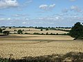 Crop field near Haselbech Grange - geograph.org.uk - 4333021.jpg 640 × 480 ; 77 kio
-
 Disused railway bridge - geograph.org.uk - 4331400.jpg 640 × 480 ; 140 kio
-
 Disused Railway Bridge. - geograph.org.uk - 327999.jpg 640 × 480 ; 124 kio
-
 Dozing lambs - geograph.org.uk - 5316817.jpg 800 × 480 ; 167 kio
-
 Eastbound A14 - geograph.org.uk - 3815128.jpg 640 × 480 ; 269 kio
-
 Eastbound A14 near Kelmarsh - geograph.org.uk - 3815160.jpg 640 × 480 ; 277 kio
-
 Eastbound A14, Harborough Road Bridge - geograph.org.uk - 3815158.jpg 640 × 480 ; 295 kio
-
 Eastern outskirts of Kelmarsh - Northamptonshire - geograph.org.uk - 4921673.jpg 3 072 × 2 304 ; 2,42 Mio
-
 Emergency Refuge Area, A14 near Kelmarsh - geograph.org.uk - 3815157.jpg 640 × 480 ; 313 kio
-
 Emergency Refuge Area, eastbound A14 - geograph.org.uk - 3815163.jpg 640 × 480 ; 276 kio
-
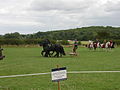
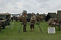
 English Heritage Festival of History (2).jpg 2 256 × 1 496 ; 1,29 Mio
-
 Entering Kelmarsh - geograph.org.uk - 4331492.jpg 640 × 480 ; 102 kio
-
 Ermine Street Guard (2).jpg 1 496 × 2 256 ; 1,16 Mio
-
 Farm and House near A508 and A14 - geograph.org.uk - 395083.jpg 640 × 480 ; 51 kio
-

-
 Farmland east of the A508 - geograph.org.uk - 4332953.jpg 640 × 480 ; 107 kio
-
 Farmland near Clipston - geograph.org.uk - 4160042.jpg 640 × 480 ; 122 kio
-
 Farmland near Kelmarsh (1) - geograph.org.uk - 4160051.jpg 640 × 480 ; 159 kio
-
 Farmland near Kelmarsh (2) - geograph.org.uk - 4160055.jpg 640 × 375 ; 99 kio
-
 Farmland off the Brampton Valley Way - geograph.org.uk - 2873994.jpg 640 × 427 ; 121 kio
-
 Farmland towards Langborough Wood - geograph.org.uk - 4331436.jpg 640 × 480 ; 72 kio
-
 Farmland towards Lodge Ground Spinney - geograph.org.uk - 4331428.jpg 640 × 480 ; 106 kio
-
 Farmland with sheep - geograph.org.uk - 4433713.jpg 640 × 480 ; 103 kio
-
 Festival of History (2).jpg 2 256 × 1 496 ; 1,56 Mio
-
 Festival of History PAS table (2).jpg 2 256 × 1 496 ; 1,47 Mio
-
 Field near New Covert, Kelmarsh - geograph.org.uk - 4595158.jpg 640 × 480 ; 81 kio
-
 Flowerbed at Kelmarsh Hall - geograph.org.uk - 3612126.jpg 1 024 × 680 ; 275 kio
-
 Gardens at Kelmarsh Hall - geograph.org.uk - 3612111.jpg 1 024 × 680 ; 323 kio
-
 Geooff Egan and handling collection (2).jpg 1 496 × 2 256 ; 460 kio
-
 Giant thistle - geograph.org.uk - 2053887.jpg 426 × 640 ; 88 kio
-
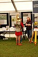
 Girl Power (2).jpg 686 × 711 ; 236 kio
-
 Gladiator prepares to enter the arena (2).jpg 953 × 1 328 ; 594 kio
-
 Grassy area by Harborough Road near Kelmarsh - geograph.org.uk - 6202539.jpg 1 978 × 1 448 ; 1,87 Mio
-
 Grazing, Kelmarsh - geograph.org.uk - 4331489.jpg 640 × 480 ; 77 kio
-
 Hands on Roman (2).jpg 1 496 × 2 256 ; 1,44 Mio
-
 Harborough Road (A508) - geograph.org.uk - 4331427.jpg 640 × 480 ; 84 kio
-
 Harborough Road (A508) - geograph.org.uk - 4331430.jpg 640 × 480 ; 81 kio
-
 Harborough Road (A508) - geograph.org.uk - 4332957.jpg 640 × 480 ; 87 kio
-
 Harborough Road (A508) - geograph.org.uk - 4332966.jpg 640 × 480 ; 75 kio
-
 Heading for Kelmarsh - Northamptonshire - geograph.org.uk - 4922415.jpg 3 072 × 2 304 ; 2,69 Mio
-
 Heading south on Harborough Road (A508) - geograph.org.uk - 4331433.jpg 640 × 480 ; 98 kio
-
 Hillside grazing, Kelmarsh - geograph.org.uk - 4331493.jpg 640 × 480 ; 95 kio
-
 Homes at Kelmarsh - Northamptonshire - geograph.org.uk - 4921663.jpg 3 072 × 2 304 ; 2,18 Mio
-
 In sight of Kelmarsh - Northamptonshire - geograph.org.uk - 4922033.jpg 3 072 × 2 304 ; 2,37 Mio
-
 Inside Kelmarsh Tunnel - geograph.org.uk - 5317034.jpg 800 × 598 ; 107 kio
-
 Interacting with the locals (2).jpg 1 496 × 2 256 ; 1,17 Mio
-
 Junction at Kelmarsh 1 - Northamptonshire - geograph.org.uk - 4920332.jpg 3 072 × 2 304 ; 3,15 Mio
-
 Junction at Kelmarsh 2 - Northamptonshire - geograph.org.uk - 4920345.jpg 3 072 × 2 304 ; 3,11 Mio
-
 Just like Sharpe (2).jpg 2 256 × 1 496 ; 1,37 Mio
-
 Kelmarsh a Bateman legacy - Northamptonshire - geograph.org.uk - 4920369.jpg 3 072 × 2 304 ; 2,87 Mio
-
 Kelmarsh for centuries - Northamptonshire - geograph.org.uk - 4919953.jpg 3 072 × 2 304 ; 3,44 Mio
-
 Kelmarsh Hall - geograph.org.uk - 5363978.jpg 2 000 × 1 333 ; 1,86 Mio
-
 Kelmarsh Hall from St Denys - Northamptonshire - geograph.org.uk - 4919943.jpg 3 072 × 2 304 ; 2,82 Mio
-
 Kelmarsh Hall the days we're open - Northamptonshire - geograph.org.uk - 4920107.jpg 3 072 × 2 304 ; 1,79 Mio
-
 Kelmarsh Hall though not today - Northamptonshire - geograph.org.uk - 4920115.jpg 3 072 × 2 304 ; 2,37 Mio
-
 Kelmarsh no more echoes - Northamptonshire - geograph.org.uk - 4922402.jpg 3 072 × 2 304 ; 2,73 Mio
-
 Kelmarsh over not through 1 - Northamptonshire - geograph.org.uk - 4922045.jpg 3 072 × 2 304 ; 3,17 Mio
-
 Kelmarsh over not through 2 - Northamptonshire - geograph.org.uk - 4922052.jpg 3 072 × 2 304 ; 2,41 Mio
-
 Kelmarsh to Harrington - Northamptonshire - geograph.org.uk - 4922038.jpg 3 072 × 2 304 ; 1,9 Mio
-
 Kelmarsh Top Lodge - Northamptonshire - geograph.org.uk - 4922389.jpg 3 072 × 2 304 ; 2,17 Mio
-
 Kelmarsh Tunnel - geograph.org.uk - 4595155.jpg 640 × 480 ; 134 kio
-
 Kelmarsh Tunnel, south portal - geograph.org.uk - 5863219.jpg 1 024 × 768 ; 293 kio
-
 Kelmarsh turbines - geograph.org.uk - 5536708.jpg 640 × 640 ; 57 kio
-
 Kelmarsh-Harborough Road - geograph.org.uk - 2991044.jpg 640 × 480 ; 68 kio
-
 Lay-by on the eastbound A14 - geograph.org.uk - 3577801.jpg 640 × 480 ; 58 kio
-
 Layby on Westbound A14, near Johnson's Covert - geograph.org.uk - 3820647.jpg 640 × 480 ; 267 kio
-
 Lion man- grrrr (2).jpg 1 045 × 1 971 ; 976 kio
-
 Lodge and gates, Kelmarsh - geograph.org.uk - 4160098.jpg 640 × 481 ; 170 kio
-
 Lodges to Kelmarsh Hall 1 - Northamptonshire - geograph.org.uk - 4920212.jpg 3 072 × 2 304 ; 2,68 Mio
-
 Lodges to Kelmarsh Hall 2 - Northamptonshire - geograph.org.uk - 4920321.jpg 3 072 × 2 304 ; 2,99 Mio
-
 Maidwell - geograph.org.uk - 324814.jpg 640 × 480 ; 131 kio
-
 Memorial at Kelmarsh - Northamptonshire - geograph.org.uk - 4919947.jpg 3 072 × 2 304 ; 3,03 Mio
-
 Midshires Covert gate - Northamptonshire - geograph.org.uk - 4923719.jpg 3 072 × 2 304 ; 2,22 Mio
-
 Midshires Way near Kelmarsh - Northamptonshire - geograph.org.uk - 4923710.jpg 3 072 × 2 304 ; 3,23 Mio
-
 Minor road near Kelmarsh - geograph.org.uk - 2619974.jpg 2 592 × 1 944 ; 1,38 Mio
-
 Minor road towards Arthingworth - geograph.org.uk - 4331485.jpg 640 × 480 ; 71 kio
-
 Minor road towards Harrington - geograph.org.uk - 4332946.jpg 640 × 480 ; 91 kio
-
 North portal of Kelmarsh tunnel - geograph.org.uk - 5639284.jpg 640 × 480 ; 66 kio
-
 North portal of the Kelmarsh Tunnel - geograph.org.uk - 5317019.jpg 800 × 573 ; 180 kio
-
 On the march (2).jpg 2 256 × 1 496 ; 1,49 Mio
-
 Once a school Kelmarsh 1 - Northamptonshire - geograph.org.uk - 4920402.jpg 3 072 × 2 304 ; 2,58 Mio
-
 Once a school Kelmarsh 2 - Northamptonshire - geograph.org.uk - 4920411.jpg 3 072 × 2 304 ; 2,83 Mio
-
 Parking area on Harborough Road, Kelmarsh - geograph.org.uk - 6202538.jpg 2 034 × 1 526 ; 1,99 Mio
-
 Parking area on Harborough Road, Kelmarsh - geograph.org.uk - 6296473.jpg 2 026 × 1 514 ; 1,54 Mio
-
 PAS table (2).jpg 1 496 × 2 256 ; 1,16 Mio
-
 Path in New Covert, Kelmarsh - geograph.org.uk - 4595160.jpg 640 × 480 ; 124 kio
-
 Path in New Covert, Kelmarsh - geograph.org.uk - 4595162.jpg 480 × 640 ; 123 kio
-
 Path in New Covert, Kelmarsh - geograph.org.uk - 4595164.jpg 480 × 640 ; 136 kio
-
 Path in New Covert, Kelmarsh - geograph.org.uk - 4595165.jpg 480 × 640 ; 114 kio
-
 Path near New Covert, Kelmarsh - geograph.org.uk - 4595157.jpg 480 × 640 ; 142 kio
-
 Picnic area^ - geograph.org.uk - 617474.jpg 640 × 480 ; 111 kio
-
 Pink haze - geograph.org.uk - 4308063.jpg 1 280 × 826 ; 90 kio
-
 Playing Hangman (2).jpg 1 496 × 2 256 ; 1,23 Mio
-
 Playing with Post-Med field finds (2).jpg 2 256 × 1 496 ; 1,76 Mio
-
 Policing the Festival (2).jpg 2 256 × 1 496 ; 1,57 Mio
-
 Poor dragon (2).jpg 2 256 × 1 496 ; 1,71 Mio
-
 Red and green coats (2).jpg 2 256 × 1 496 ; 1,68 Mio
-
 Reenactors at rest (2).jpg 2 256 × 1 496 ; 1,15 Mio
-
 River Ise looking east - geograph.org.uk - 446233.jpg 640 × 477 ; 127 kio
-
 Road to Kelmarsh - geograph.org.uk - 3610742.jpg 1 024 × 680 ; 219 kio
-
 Roman hopping (2).jpg 373 × 399 ; 114 kio
-
 Roman photoshoot (2).jpg 1 496 × 2 256 ; 1,47 Mio
-
 Roman soldier discussing landscape archaeology (2).jpg 1 496 × 2 256 ; 1,15 Mio
-
 Roman soldiers retiring (2).jpg 513 × 416 ; 131 kio
-
 Romans (2).jpg 622 × 413 ; 146 kio
-
 Romans wind down (2).jpg 1 496 × 2 256 ; 1,42 Mio
-
 Saint George v the Dragon (2).jpg 856 × 466 ; 247 kio
-
 Seat along the Brampton Valley Way - geograph.org.uk - 5316887.jpg 800 × 599 ; 163 kio
-
 Shield work (2).jpg 1 496 × 2 256 ; 1,57 Mio
-
 Slip road from A508 to westbound A14 - geograph.org.uk - 2071419.jpg 640 × 480 ; 56 kio
-
 South portal of the Kelmarsh Tunnel - geograph.org.uk - 5317046.jpg 800 × 517 ; 184 kio
-
 Spring has sprung at Kelmarsh - Northamptonshire - geograph.org.uk - 4920359.jpg 3 072 × 2 304 ; 2,68 Mio
-

-
 Stile on Path Looking Towards Clipston - geograph.org.uk - 5922645.jpg 1 960 × 4 032 ; 3,95 Mio
-
 Still water at Kelmarsh - Northamptonshire - geograph.org.uk - 4921685.jpg 3 072 × 2 304 ; 3,89 Mio
-
 The A14 at junction 2, near Kelmarsh - geograph.org.uk - 2619971.jpg 2 592 × 1 944 ; 1,19 Mio
-
 The A14 crosses the Brampton Valley Way - geograph.org.uk - 5639261.jpg 640 × 480 ; 45 kio
-
 The Arthingworth road - geograph.org.uk - 2619956.jpg 2 592 × 1 944 ; 1,96 Mio
-
 The Brampton Valley Way - geograph.org.uk - 6293900.jpg 1 024 × 768 ; 280 kio
-
 The Hawk and Owl Trust. - geograph.org.uk - 437877.jpg 640 × 480 ; 115 kio
-
 The road to Kelmarsh - geograph.org.uk - 2619957.jpg 2 592 × 1 944 ; 1,52 Mio
-
 Towards Haselbech - geograph.org.uk - 5536706.jpg 640 × 640 ; 124 kio
-
 Track near Kelmarsh - geograph.org.uk - 5863229.jpg 1 024 × 768 ; 265 kio
-
 Tree in grassland - geograph.org.uk - 4331425.jpg 640 × 480 ; 71 kio
-
 Trees by Harborough Road, Great Oxendon - geograph.org.uk - 6365319.jpg 1 526 × 2 034 ; 730 kio
-
 View Along Lane Towards Wind Turbines - geograph.org.uk - 5922639.jpg 4 032 × 1 960 ; 3,35 Mio
-
 View to Arthingworth - geograph.org.uk - 2873928.jpg 640 × 427 ; 79 kio
-
 Way to Arthingworth - Harrington, Northamptonshire - geograph.org.uk - 4924071.jpg 3 072 × 2 304 ; 3,16 Mio
-
 Westbound A14 - geograph.org.uk - 3820650.jpg 640 × 480 ; 275 kio
-
 Westbound A14 approaching Junction 2 - geograph.org.uk - 3821880.jpg 640 × 480 ; 280 kio
-
 Westbound A14 at Junction 2 - geograph.org.uk - 3821886.jpg 640 × 480 ; 246 kio
-
 Wheat field and Shipley Wood - geograph.org.uk - 3610743.jpg 1 024 × 680 ; 241 kio
-
 Winding down post-battle (2).jpg 2 256 × 1 496 ; 1,72 Mio
-
 Yelvertoft and its wind farm - geograph.org.uk - 3640821.jpg 3 264 × 2 448 ; 3,53 Mio
-
 A14 goes over Brampton Valley Way - geograph.org.uk - 375235.jpg 640 × 406 ; 53 kio
-
 A508 northbound - geograph.org.uk - 377197.jpg 640 × 480 ; 84 kio
-
 Approaching Kelmarsh tunnel from the north - geograph.org.uk - 446268.jpg 640 × 477 ; 143 kio
-
 Brampton Valley Way south of A14 - geograph.org.uk - 446278.jpg 640 × 477 ; 113 kio
-
 Bridleway to Clipston - geograph.org.uk - 446235.jpg 640 × 477 ; 115 kio
-
 Detour available - geograph.org.uk - 446255.jpg 640 × 477 ; 99 kio
-
 Empty Road. - geograph.org.uk - 328063.jpg 640 × 392 ; 74 kio
-
 Footpath across Open Countryside. - geograph.org.uk - 360007.jpg 640 × 480 ; 87 kio
-
 Former Rectory, Kelmarsh - geograph.org.uk - 46127.jpg 640 × 480 ; 184 kio
-
 Green Lane Crossing, Brampton Valley Way - geograph.org.uk - 375242.jpg 640 × 394 ; 91 kio
-
 Haselbech - geograph.org.uk - 324775.jpg 640 × 480 ; 103 kio
-
 Kelmarsh - geograph.org.uk - 324771.jpg 640 × 354 ; 60 kio
-
 Kelmarsh - geograph.org.uk - 327655.jpg 640 × 480 ; 109 kio
-
 Lane west of Kelmarsh - geograph.org.uk - 194613.jpg 480 × 640 ; 72 kio
-
 Looking east towards Arthingworth Lodge - geograph.org.uk - 446247.jpg 640 × 477 ; 103 kio
-
 Maidwell - geograph.org.uk - 325045.jpg 640 × 480 ; 123 kio
-
 Maidwell Primary School - geograph.org.uk - 103634.jpg 640 × 385 ; 81 kio
-
 New-house Farm - geograph.org.uk - 183167.jpg 640 × 480 ; 111 kio
-
 Open Country. - geograph.org.uk - 356436.jpg 640 × 480 ; 109 kio


_-_geograph.org.uk_-_4331399.jpg)


.jpg)

.jpg)

_-_geograph.org.uk_-_4331397.jpg)


_-_geograph.org.uk_-_4160051.jpg)
_-_geograph.org.uk_-_4160055.jpg)


.jpg)
.jpg)


.jpg)

.jpg)
.jpg)


.jpg)
_-_geograph.org.uk_-_4331427.jpg)
_-_geograph.org.uk_-_4331430.jpg)
_-_geograph.org.uk_-_4332957.jpg)
_-_geograph.org.uk_-_4332966.jpg)

_-_geograph.org.uk_-_4331433.jpg)


.jpg)


.jpg)


.jpg)


.jpg)


.jpg)


.jpg)
.jpg)
.jpg)
.jpg)
.jpg)
.jpg)


.jpg)
.jpg)
.jpg)
.jpg)
.jpg)
.jpg)
.jpg)

.jpg)


.jpg)


