Category:Kelsale cum Carlton
Aller à la navigation
Aller à la recherche
English: Kelsale cum Carlton is a civil parish in the East Suffolk district, in the county of Suffolk, England.
Article Wikipédia principal : Kelsale cum Carlton.

localité britannique du comté anglais de Suffolk | |||||
| Téléverser des médias | |||||
| Nature de l’élément | |||||
|---|---|---|---|---|---|
| Nommé(e) en référence à | |||||
| Lieu | East Suffolk, Suffolk, Angleterre de l'Est, Angleterre | ||||
 | |||||
Sous-catégories
Cette catégorie comprend 10 sous-catégories, dont les 10 ci-dessous.
C
- Curlew Green (19 F)
D
- Dorley's Corner (24 F)
E
- East Green, Kelsale cum Carlton (14 F)
K
N
- North Green, Suffolk (21 F)
S
- Skoulding's Mill (4 F)
V
Média dans la catégorie « Kelsale cum Carlton »
Cette catégorie comprend 467 fichiers, dont les 200 ci-dessous.
(page précédente) (page suivante)-
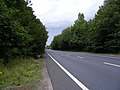
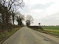
 A12 ahead, approaching from the B1121 at Kelsale - geograph.org.uk - 2280501.jpg 760 × 570 ; 149 kio
-
 A12 Main Road - geograph.org.uk - 2018709.jpg 3 072 × 2 304 ; 1,28 Mio
-
 A12 Main Road - geograph.org.uk - 2280517.jpg 760 × 570 ; 286 kio
-
 A12 Saxmundham Bypass - geograph.org.uk - 2341685.jpg 3 072 × 2 304 ; 1,29 Mio
-
 A12 Saxmundham Bypass - geograph.org.uk - 3717546.jpg 3 072 × 2 304 ; 1,32 Mio
-
 A12 Saxmundham Bypass, Carlton - geograph.org.uk - 5349505.jpg 4 608 × 3 072 ; 1,8 Mio
-
 A12 Saxmundham Bypass, Kelsale Cum Carlton - geograph.org.uk - 1433047.jpg 3 072 × 2 304 ; 1,4 Mio
-
 Approaching North Green Level Crossing - geograph.org.uk - 5157880.jpg 640 × 480 ; 82 kio
-
 Approaching North Green Level Crossing - geograph.org.uk - 5157895.jpg 640 × 480 ; 91 kio
-
 B1121 Main Road - geograph.org.uk - 2288629.jpg 3 072 × 2 304 ; 1,28 Mio
-
 B1121 Main Road, Saxmundham - geograph.org.uk - 3285888.jpg 3 072 × 2 304 ; 1,69 Mio
-
 B1121 Main Road, Saxmundham - geograph.org.uk - 3285892.jpg 3 072 × 2 304 ; 1,3 Mio
-
 B1122 Main Road ^ Milepost - geograph.org.uk - 3486112.jpg 3 072 × 2 304 ; 1,51 Mio
-
 Barley Crop - geograph.org.uk - 2484893.jpg 2 304 × 3 072 ; 1,65 Mio
-
 Barley Field near the footpath to Gardeners Belt - geograph.org.uk - 2484996.jpg 3 072 × 2 304 ; 1,43 Mio
-
 Bell House sign - geograph.org.uk - 5851795.jpg 4 608 × 3 456 ; 3,76 Mio
-
 Bench off Carlton Road - geograph.org.uk - 4229121.jpg 3 072 × 2 304 ; 2,04 Mio
-
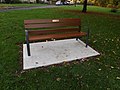 Bench off Carlton Road - geograph.org.uk - 4229132.jpg 3 072 × 2 304 ; 1,86 Mio
-
 Bluebells, Carlton churchyard - geograph.org.uk - 6444603.jpg 1 600 × 1 064 ; 618 kio
-
 Bridge over the River Fromus - geograph.org.uk - 4399260.jpg 3 072 × 2 304 ; 1,86 Mio
-
 Bridge Street, Kelsale - geograph.org.uk - 5851599.jpg 4 608 × 3 456 ; 4,07 Mio
-
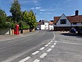 Bridge Street, Kelsale - geograph.org.uk - 5851700.jpg 4 608 × 3 456 ; 3,9 Mio
-
 Bridge Street, Kelsale - geograph.org.uk - 5851910.jpg 4 608 × 3 456 ; 3,9 Mio
-
 Bridge ^ River Fromus - geograph.org.uk - 4399315.jpg 2 304 × 3 072 ; 3,88 Mio
-
 Buildings at Rookery Farm, Kelsale Cum Carlton - geograph.org.uk - 1818401.jpg 3 072 × 2 304 ; 1,44 Mio
-
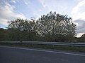 Bushes by the A12, Carlton - geograph.org.uk - 5394365.jpg 2 304 × 1 728 ; 1,43 Mio
-
 Butcher's Road, Kelsale - geograph.org.uk - 6453878.jpg 1 064 × 1 600 ; 627 kio
-
 Carlton Cross on the B1121 Main Road - geograph.org.uk - 4085422.jpg 3 072 × 2 304 ; 1,52 Mio
-
 Carlton Green Carlton Road - geograph.org.uk - 5677265.jpg 3 956 × 3 073 ; 5,28 Mio
-
 Carlton Hall - geograph.org.uk - 2484897.jpg 3 072 × 2 304 ; 1,43 Mio
-
 Carlton Hall from the churchyard - geograph.org.uk - 6295761.jpg 1 600 × 1 064 ; 374 kio
-
 Carlton House sign - geograph.org.uk - 4080425.jpg 2 223 × 2 967 ; 1,18 Mio
-
 Carlton Lane Bridleway - geograph.org.uk - 2223040.jpg 2 304 × 3 072 ; 1,5 Mio
-
 Carlton Lane Bridleway - geograph.org.uk - 2223081.jpg 2 304 × 3 072 ; 1,6 Mio
-
 Carlton Lane Bridleway and Carlton Meres Caravan Park Entrance - geograph.org.uk - 1821976.jpg 3 072 × 2 304 ; 1,67 Mio
-
 Carlton Park Industrial Estate - geograph.org.uk - 2484930.jpg 3 072 × 2 304 ; 1,41 Mio
-
 Carlton Park Industrial Estate - geograph.org.uk - 3711235.jpg 3 072 × 2 304 ; 1,31 Mio
-
 Carlton Park Industrial Estate sign - geograph.org.uk - 4085577.jpg 2 227 × 2 973 ; 1 000 kio
-
 Carlton Park Industrial Estate, Saxmundham - geograph.org.uk - 1904418.jpg 3 072 × 2 304 ; 1,24 Mio
-
 Carlton Park sign - geograph.org.uk - 4399310.jpg 2 253 × 2 995 ; 3,36 Mio
-
 Carlton Road - geograph.org.uk - 2288363.jpg 3 072 × 2 304 ; 1,24 Mio
-
 Carlton Road - geograph.org.uk - 2288369.jpg 3 072 × 2 304 ; 1,33 Mio
-
 Carlton Road - geograph.org.uk - 2288406.jpg 3 072 × 2 304 ; 1,55 Mio
-
 Carlton Road and path to Spinney Close - geograph.org.uk - 3387262.jpg 3 072 × 2 304 ; 1,67 Mio
-
 Carlton Road sign - geograph.org.uk - 3386379.jpg 2 914 × 2 189 ; 1,96 Mio
-
 Carlton Road sign - geograph.org.uk - 4724628.jpg 3 072 × 2 304 ; 1,93 Mio
-
 Carlton, Clay Hills from the main road - geograph.org.uk - 6246268.jpg 1 600 × 1 064 ; 561 kio
-
 Carlton, St Peter's church - geograph.org.uk - 6295753.jpg 1 064 × 1 600 ; 497 kio
-
 Clay Hills - geograph.org.uk - 4736714.jpg 640 × 480 ; 94 kio
-
 Clay Hills Bridge - geograph.org.uk - 1864158.jpg 3 072 × 2 304 ; 1,4 Mio
-
 Clay Hills junction - geograph.org.uk - 2010470.jpg 3 072 × 2 304 ; 1,32 Mio
-
 Clay Hills, a country road with passing places - geograph.org.uk - 2280539.jpg 760 × 570 ; 197 kio
-
 Clayhills Road - geograph.org.uk - 4735627.jpg 640 × 480 ; 91 kio
-
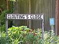 Clouting's Close sign - geograph.org.uk - 3485046.jpg 3 072 × 2 304 ; 1,54 Mio
-
 Cottage by the main road, Carlton - geograph.org.uk - 6294975.jpg 1 600 × 1 064 ; 271 kio
-
 Cultivated fields by Carlton Hall - geograph.org.uk - 2627328.jpg 640 × 480 ; 174 kio
-
 Cut Mark Carlton Post Office - geograph.org.uk - 5677273.jpg 1 182 × 1 634 ; 939 kio
-
 Cycle Lane - geograph.org.uk - 4480507.jpg 1 024 × 768 ; 186 kio
-
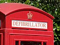 Defibrillator sign - geograph.org.uk - 5851790.jpg 4 608 × 3 456 ; 3,79 Mio
-
 Derelict Barn at Sparkes Farm - geograph.org.uk - 2231656.jpg 3 072 × 2 304 ; 1,34 Mio
-
 Distant Cyclist - geograph.org.uk - 4480514.jpg 768 × 1 024 ; 172 kio
-
 Ditch next to the footpath to Rotten End - geograph.org.uk - 1836202.jpg 2 304 × 3 072 ; 1,67 Mio
-
 Ditch off Rendham Road - geograph.org.uk - 4015955.jpg 3 072 × 2 304 ; 2,4 Mio
-
 Ditch off Rendham Road - geograph.org.uk - 4015958.jpg 3 072 × 2 304 ; 2,33 Mio
-
 Ditch off Rendham Road - geograph.org.uk - 4015960.jpg 2 304 × 3 072 ; 2,15 Mio
-
 Ditch off Rendham Road - geograph.org.uk - 4015961.jpg 2 304 × 3 072 ; 2,16 Mio
-
 Ditch off Rendham Road - geograph.org.uk - 4015965.jpg 2 304 × 3 072 ; 2,32 Mio
-
 Dorleys Corner Lane - geograph.org.uk - 1267273.jpg 3 072 × 2 304 ; 1,53 Mio
-
 Dry bed of River Fromus, from Tiggins Lane, Kelsale - geograph.org.uk - 6445266.jpg 1 600 × 1 064 ; 618 kio
-
 East Green Roadsign - geograph.org.uk - 2290773.jpg 480 × 640 ; 133 kio
-
 Eastgreen Crossing - geograph.org.uk - 6453871.jpg 1 600 × 1 064 ; 415 kio
-
 Entering Carlton Meres Caravan Park - geograph.org.uk - 2231848.jpg 3 072 × 2 304 ; 1,51 Mio
-
 Entrance to Carlton Park Industrial Estate, Suffolk - geograph.org.uk - 2891224.jpg 1 600 × 805 ; 369 kio
-
 Entrance to Denny's Farm, Saxmundham - geograph.org.uk - 2280604.jpg 760 × 570 ; 293 kio
-
 Entrance to Hall Farm - geograph.org.uk - 2292335.jpg 3 072 × 2 304 ; 1,42 Mio
-
 Entrance to Kelsale C.E.V.C. Primary School - geograph.org.uk - 4450701.jpg 3 072 × 2 304 ; 1,81 Mio
-
 Entrance to Kelsale C.E.V.C. Primary School - geograph.org.uk - 4450739.jpg 2 228 × 2 962 ; 3,79 Mio
-

-
 Entrance to Rubblestone ^ Boundary Farms - geograph.org.uk - 2290984.jpg 3 072 × 2 304 ; 1,44 Mio
-
 Entrance to Strawberry Place - geograph.org.uk - 5618233.jpg 4 608 × 3 072 ; 1,76 Mio
-
 Eurolabels Ltd - geograph.org.uk - 4080543.jpg 3 072 × 2 304 ; 1,19 Mio
-
 Evening light, Kelsale churchyard - geograph.org.uk - 6461463.jpg 1 064 × 1 600 ; 353 kio
-
 Farm Track And Footpath - geograph.org.uk - 4384244.jpg 1 024 × 768 ; 211 kio
-
 Farmland and hedgerow - geograph.org.uk - 4735624.jpg 640 × 480 ; 59 kio
-
 Farmland beside the River Fromus - geograph.org.uk - 4672743.jpg 640 × 480 ; 67 kio
-
 Farmland near Hill Farm - geograph.org.uk - 4735632.jpg 640 × 480 ; 60 kio
-
 Farmland near Redhouse Farm - geograph.org.uk - 4736692.jpg 640 × 401 ; 39 kio
-
 Farmyard near the footpath to Carlton Church - geograph.org.uk - 2484855.jpg 3 072 × 2 304 ; 1,45 Mio
-
 Farmyard near the footpath to Carlton Church - geograph.org.uk - 2484859.jpg 3 072 × 2 304 ; 1,47 Mio
-
 Field and woodland, Carlton Green - geograph.org.uk - 2504301.jpg 640 × 480 ; 236 kio
-
 Field Drain next to Carlton Lane - geograph.org.uk - 2223043.jpg 3 072 × 2 304 ; 1,63 Mio
-
-
 Field of Barley - geograph.org.uk - 2484891.jpg 3 072 × 2 304 ; 1,39 Mio
-
 Field off Sandy Lane - geograph.org.uk - 2534489.jpg 3 072 × 2 304 ; 1,38 Mio
-
 Fields and woods north of Kelsale - geograph.org.uk - 6460855.jpg 1 600 × 1 064 ; 202 kio
-
 Fields at Kelsale Hall Farm - geograph.org.uk - 2231732.jpg 3 072 × 2 304 ; 1,39 Mio
-
 Fields east of Tiggins Lane - geograph.org.uk - 6475120.jpg 1 600 × 1 064 ; 240 kio
-
 Fields next to the footpath to Rotten End - geograph.org.uk - 1836183.jpg 3 072 × 2 304 ; 1,42 Mio
-
 Fields north of Tiggins Lane, Kelsale - geograph.org.uk - 6460864.jpg 1 600 × 1 064 ; 303 kio
-
 Fields off Clay Hills - geograph.org.uk - 1864205.jpg 3 072 × 2 304 ; 1,29 Mio
-
 Footbridge between fields - geograph.org.uk - 1836140.jpg 2 304 × 3 072 ; 1,42 Mio
-
 Footbridge on the footpath to Carlton Road - geograph.org.uk - 2485003.jpg 2 304 × 3 072 ; 1,55 Mio
-
 Footbridge on the footpath to Carlton Road - geograph.org.uk - 2485004.jpg 2 304 × 3 072 ; 1,56 Mio
-
 Footbridge on the footpath to Rosemary Lane - geograph.org.uk - 3720463.jpg 2 304 × 3 072 ; 1,82 Mio
-
 Footbridge on the footpath to St.Peter's Church - geograph.org.uk - 2484584.jpg 2 304 × 3 072 ; 1,56 Mio
-
 Footbridge over The River Fromus - geograph.org.uk - 2010619.jpg 2 304 × 3 072 ; 1,46 Mio
-
 Footbridge over The River Fromus - geograph.org.uk - 2010635.jpg 2 304 × 3 072 ; 1,5 Mio
-
 Footpath - geograph.org.uk - 4383851.jpg 1 024 × 768 ; 262 kio
-
 Footpath - geograph.org.uk - 4384245.jpg 1 024 × 768 ; 233 kio
-
 Footpath - geograph.org.uk - 4480527.jpg 1 024 × 768 ; 376 kio
-
 Footpath - geograph.org.uk - 4574105.jpg 1 024 × 768 ; 240 kio
-
 Footpath - geograph.org.uk - 4574107.jpg 768 × 1 024 ; 259 kio
-
 Footpath along field boundary - geograph.org.uk - 2277888.jpg 760 × 570 ; 147 kio
-
 Footpath amendment Notice on Kelsale footpath No.17 - geograph.org.uk - 2593781.jpg 2 304 × 3 072 ; 1,61 Mio
-
 Footpath amendment Notice on Kelsale footpath No.17 - geograph.org.uk - 2593782.jpg 3 072 × 2 304 ; 1,38 Mio
-
 Footpath And Field Boundary - geograph.org.uk - 4384247.jpg 1 024 × 768 ; 227 kio
-
 Footpath between oilseed rape fields - geograph.org.uk - 5841980.jpg 1 280 × 850 ; 587 kio
-
 Footpath crossing the Gull Stream - geograph.org.uk - 6295521.jpg 1 064 × 1 600 ; 604 kio
-
 Footpath following the Gull Stream - geograph.org.uk - 6295764.jpg 1 600 × 1 064 ; 756 kio
-
 Footpath junction - geograph.org.uk - 2484873.jpg 3 072 × 2 304 ; 1,58 Mio
-
 Footpath Off Minor Road - geograph.org.uk - 4574260.jpg 1 024 × 768 ; 329 kio
-
 Footpath railway crossing - geograph.org.uk - 5069652.jpg 4 288 × 2 848 ; 5,89 Mio
-
 Footpath sign on entrance to Kelsale Hall - geograph.org.uk - 2231684.jpg 2 304 × 3 072 ; 1,43 Mio
-
 Footpath southwards off Clayhill Road - geograph.org.uk - 6181406.jpg 1 600 × 1 200 ; 494 kio
-
 Footpath Steps from the A12 Saxmundham Bypass - geograph.org.uk - 2261240.jpg 2 304 × 3 072 ; 1,66 Mio
-
 Footpath Steps to the A12 Saxmundham Bypass - geograph.org.uk - 2261231.jpg 2 304 × 3 072 ; 1,48 Mio
-
 Footpath Steps to the A12 Saxmundham Bypass - geograph.org.uk - 2261243.jpg 2 304 × 3 072 ; 1,62 Mio
-
 Footpath to Brook Farm Road - geograph.org.uk - 3712423.jpg 2 304 × 3 072 ; 2,06 Mio
-
 Footpath to Carlton Church - geograph.org.uk - 2484870.jpg 3 072 × 2 304 ; 1,51 Mio
-
 Footpath to Carlton Church - geograph.org.uk - 2484881.jpg 3 072 × 2 304 ; 1,61 Mio
-
 Footpath to Carlton Church - geograph.org.uk - 2484888.jpg 3 072 × 2 304 ; 1,34 Mio
-
 Footpath to Carlton Church - geograph.org.uk - 2484909.jpg 3 072 × 2 304 ; 1,32 Mio
-
 Footpath to Carlton Church - geograph.org.uk - 2484910.jpg 3 072 × 2 304 ; 1,51 Mio
-
 Footpath to Carlton Church - geograph.org.uk - 2534119.jpg 3 072 × 2 304 ; 1,67 Mio
-
 Footpath to Carlton Church - geograph.org.uk - 3711227.jpg 3 072 × 2 304 ; 1,5 Mio
-
 Footpath to Carlton Church - geograph.org.uk - 3711248.jpg 3 072 × 2 304 ; 2,11 Mio
-
 Footpath to Carlton Green - geograph.org.uk - 2261221.jpg 3 072 × 2 304 ; 1,49 Mio
-
 Footpath to Carlton Lane ^ Rendham Road ^ entrance to Lonely Farm - geograph.org.uk - 1818461.jpg 3 072 × 2 304 ; 1,42 Mio
-
 Footpath to Carlton Park, Carlton Hall ^ St.Peter's Church - geograph.org.uk - 2483999.jpg 3 072 × 2 304 ; 1,47 Mio
-
 Footpath to Carlton Road - geograph.org.uk - 2484021.jpg 2 304 × 3 072 ; 1,63 Mio
-
 Footpath to Carlton Road - geograph.org.uk - 2484039.jpg 2 304 × 3 072 ; 1,66 Mio
-
 Footpath to Carlton Road - geograph.org.uk - 2484040.jpg 2 304 × 3 072 ; 1,36 Mio
-
 Footpath to Carlton Road - geograph.org.uk - 2484907.jpg 2 304 × 3 072 ; 1,52 Mio
-
 Footpath to Carlton Road - geograph.org.uk - 2485019.jpg 2 304 × 3 072 ; 1,66 Mio
-
 Footpath to Carlton Road - geograph.org.uk - 2485020.jpg 3 072 × 2 304 ; 1,45 Mio
-
 Footpath to Carlton Road - geograph.org.uk - 3711250.jpg 3 072 × 2 304 ; 1,46 Mio
-
 Footpath to Church Lane - geograph.org.uk - 2010614.jpg 3 072 × 2 304 ; 1,53 Mio
-
 Footpath to Clay Hills - geograph.org.uk - 2288665.jpg 3 072 × 2 304 ; 1,52 Mio
-
 Footpath to Clay Hills - geograph.org.uk - 2288666.jpg 3 072 × 2 304 ; 1,51 Mio
-
 Footpath to Clay Hills - geograph.org.uk - 3196884.jpg 3 072 × 2 304 ; 1,44 Mio
-
 Footpath to Gardeners Belt - geograph.org.uk - 2484994.jpg 3 072 × 2 304 ; 1,46 Mio
-
 Footpath to Honeypot Lane - geograph.org.uk - 2056800.jpg 3 072 × 2 304 ; 1,67 Mio
-
 Footpath to Honeypot Lane - geograph.org.uk - 2290853.jpg 2 304 × 3 072 ; 1,5 Mio
-
 Footpath to Kelsale Road ^ A12 Main Road ^ entrance to Hall Farm - geograph.org.uk - 2261247.jpg 3 072 × 2 304 ; 1,37 Mio
-
 Footpath to Lonely Farm ^ Rendham Road - geograph.org.uk - 2134544.jpg 3 072 × 2 304 ; 1,31 Mio
-
 Footpath to Lonely Farm ^ Rendham Road - geograph.org.uk - 2141860.jpg 3 072 × 2 304 ; 1,56 Mio
-
 Footpath to Lonely Farm ^ Rendham Road - geograph.org.uk - 2231836.jpg 3 072 × 2 304 ; 1,4 Mio
-
 Footpath to Lonely Farm ^ Rendham Road - geograph.org.uk - 2231843.jpg 3 072 × 2 304 ; 1,51 Mio
-
 Footpath to Lowes Hill - geograph.org.uk - 1864178.jpg 3 072 × 2 304 ; 1,31 Mio
-
 Footpath to Lowes Hill - geograph.org.uk - 2526996.jpg 3 072 × 2 304 ; 1,62 Mio
-
 Footpath to Lowes Hill - geograph.org.uk - 2526999.jpg 3 072 × 2 304 ; 1,48 Mio
-
 Footpath to Lowes Hill - geograph.org.uk - 2527001.jpg 3 072 × 2 304 ; 1,32 Mio
-
 Footpath to North Entrance - geograph.org.uk - 3196861.jpg 2 304 × 3 072 ; 1,3 Mio
-
 Footpath to North Entrance - geograph.org.uk - 3196863.jpg 3 072 × 2 304 ; 1,37 Mio
-
 Footpath to North Entrance - geograph.org.uk - 3196867.jpg 3 072 × 2 304 ; 1,42 Mio
-
 Footpath to North Entrance - geograph.org.uk - 3196881.jpg 3 072 × 2 304 ; 1,61 Mio
-
 Footpath to Peakhill Farm - geograph.org.uk - 2290768.jpg 3 072 × 2 304 ; 1,56 Mio
-
 Footpath to Rendham Road (U2507) - geograph.org.uk - 2341666.jpg 3 072 × 2 304 ; 1,66 Mio
-
 Footpath to Rendham Road (U2507) - geograph.org.uk - 2341671.jpg 3 072 × 2 304 ; 1,66 Mio
-
 Footpath to Rendham Road (U2507) - geograph.org.uk - 2341675.jpg 2 304 × 3 072 ; 1,34 Mio
-
 Footpath to Rendham Road - geograph.org.uk - 1836191.jpg 2 304 × 3 072 ; 1,37 Mio
-
 Footpath to Rendham Road - geograph.org.uk - 1836207.jpg 2 304 × 3 072 ; 1,45 Mio
-
 Footpath to Rendham Road - geograph.org.uk - 2231864.jpg 3 072 × 2 304 ; 1,52 Mio
-
 Footpath to Rendham Road - geograph.org.uk - 2231873.jpg 3 072 × 2 304 ; 1,47 Mio
-
 Footpath to Rosemary Lane - geograph.org.uk - 2288343.jpg 3 072 × 2 304 ; 1,37 Mio
-
 Footpath to Rosemary Lane - geograph.org.uk - 2288562.jpg 1 980 × 2 640 ; 1,98 Mio
-
 Footpath to Rosemary Lane - geograph.org.uk - 2484030.jpg 2 304 × 3 072 ; 1,51 Mio
-
 Footpath to Rosemary Lane - geograph.org.uk - 2484032.jpg 2 304 × 3 072 ; 1,63 Mio
-
 Footpath to Rosemary Lane - geograph.org.uk - 2484036.jpg 2 304 × 3 072 ; 1,64 Mio
-
 Footpath to Rosemary Lane - geograph.org.uk - 3720443.jpg 2 206 × 2 944 ; 2,16 Mio
-
 Footpath to Rosemary Lane - geograph.org.uk - 3720462.jpg 2 304 × 3 072 ; 2,18 Mio
-
 Footpath to Rosemary Lane - geograph.org.uk - 3720502.jpg 3 072 × 2 304 ; 1,4 Mio
-
 Footpath to Rotten End - geograph.org.uk - 1836147.jpg 2 304 × 3 072 ; 1,52 Mio
-
 Footpath to Rotten End - geograph.org.uk - 5407980.jpg 4 608 × 3 456 ; 2,04 Mio
-
 Footpath to Sandy Lane - geograph.org.uk - 2484880.jpg 2 304 × 3 072 ; 1,67 Mio
-
 Footpath to Sandy Lane - geograph.org.uk - 2484999.jpg 2 304 × 3 072 ; 1,62 Mio
-
 Footpath to Saxmundham Recreation Ground - geograph.org.uk - 3712380.jpg 3 072 × 2 304 ; 1,44 Mio
-
 Footpath to Spinney Close - geograph.org.uk - 4450733.jpg 3 072 × 2 304 ; 1,9 Mio
-
 Footpath to the A12 Main Road - geograph.org.uk - 2231659.jpg 3 072 × 2 304 ; 1,41 Mio
-
 Footpath to the A12 Main Road - geograph.org.uk - 2282533.jpg 3 072 × 2 304 ; 1,4 Mio
-
 Footpath to the A12 Main Road - geograph.org.uk - 2840188.jpg 3 072 × 2 304 ; 1,63 Mio
-
 Footpath to the A12 Main Road ^ Tiggins Lane - geograph.org.uk - 2282528.jpg 3 072 × 2 304 ; 1,43 Mio
-
 Footpath to the A12 Saxmundham Bypass - geograph.org.uk - 2141857.jpg 2 304 × 3 072 ; 1,59 Mio
-
 Footpath to the A12 Saxmundham Bypass - geograph.org.uk - 2261229.jpg 3 072 × 2 304 ; 1,46 Mio
-
 Footpath to the A12 Saxmundham Bypass - geograph.org.uk - 2321905.jpg 3 072 × 2 304 ; 1,3 Mio
-
 Footpath to the A12 ^ Rendham Road - geograph.org.uk - 2534129.jpg 2 304 × 3 072 ; 1,55 Mio
-
 Footpath to the B1121 Main Road - geograph.org.uk - 4085416.jpg 3 072 × 2 304 ; 1,47 Mio
-
 Footpath to the B1121 Main Road - geograph.org.uk - 4085565.jpg 2 304 × 3 072 ; 1,6 Mio
-
 Footpath to the B1121 North Entrance - geograph.org.uk - 1864175.jpg 3 072 × 2 304 ; 1,27 Mio
-
 Footpath to the U2411 ^ entrance to Redhouse Farm - geograph.org.uk - 2290940.jpg 3 072 × 2 304 ; 1,45 Mio


_-_geograph.org.uk_-_2341666.jpg)
_-_geograph.org.uk_-_2341671.jpg)
_-_geograph.org.uk_-_2341675.jpg)


