Category:Kencot
Aller à la navigation
Aller à la recherche
localité britannique du comté anglais d'Oxfordshire  | |||||
| Téléverser des médias | |||||
| Nature de l’élément | |||||
|---|---|---|---|---|---|
| Lieu | West Oxfordshire, Oxfordshire, Angleterre du Sud-Est, Angleterre | ||||
 | |||||
Sous-catégories
Cette catégorie comprend 3 sous-catégories, dont les 3 ci-dessous.
K
- St George's Church, Kencot (5 F)
- Kencot allotments (4 F)
- Kencot War Memorial (2 F)
Média dans la catégorie « Kencot »
Cette catégorie comprend 132 fichiers, dont les 132 ci-dessous.
-
 "Corpse road" - geograph.org.uk - 591702.jpg 640 × 480 ; 92 kio
-
 Arable land - geograph.org.uk - 4388078.jpg 800 × 450 ; 238 kio
-
 Asthall Farm, Kencot - geograph.org.uk - 1572517.jpg 640 × 480 ; 49 kio
-
 Autumn colour in Broadwell - geograph.org.uk - 1625795.jpg 640 × 480 ; 139 kio
-
 Autumnal look to Kencot - geograph.org.uk - 1530798.jpg 640 × 427 ; 100 kio
-
 Barn at Manor Farm, Broadwell - geograph.org.uk - 1625786.jpg 480 × 640 ; 68 kio
-
 Barns at Broadwell Manor Farm - geograph.org.uk - 1625817.jpg 640 × 480 ; 69 kio
-
 Bridge over the stream - geograph.org.uk - 1571885.jpg 640 × 480 ; 90 kio
-
 Bridleway to Holwell - geograph.org.uk - 1511674.jpg 640 × 427 ; 85 kio
-
 Broadwell Manor Farm - geograph.org.uk - 1606955.jpg 640 × 480 ; 51 kio
-
 Brook between the fields - geograph.org.uk - 1639207.jpg 640 × 480 ; 84 kio
-
 Butlers Court Farm - geograph.org.uk - 2656618.jpg 640 × 478 ; 57 kio
-
 Collapsed wall between fields - geograph.org.uk - 1606842.jpg 640 × 480 ; 86 kio
-
 Control tower, RAF Broadwell - geograph.org.uk - 4388731.jpg 800 × 452 ; 226 kio
-
 Country lane to Broadwell - geograph.org.uk - 4391091.jpg 800 × 450 ; 177 kio
-
 Derelict barn in the snow - geograph.org.uk - 1651115.jpg 640 × 480 ; 67 kio
-
 Derelict shed on Broadwell old airfield - geograph.org.uk - 1467799.jpg 640 × 427 ; 59 kio
-
 Edge of a solar energy installation - geograph.org.uk - 4388749.jpg 800 × 450 ; 231 kio
-
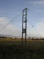 Electricity pylon - geograph.org.uk - 1606875.jpg 480 × 640 ; 49 kio
-
 Entrance to Kencot Solar Farm-RAF Broadwell former WW2 runway - geograph.org.uk - 6147583.jpg 1 925 × 1 444 ; 1,92 Mio
-
 Farm buildings in Kencot - geograph.org.uk - 1571951.jpg 640 × 480 ; 91 kio
-
 Farm buildings just outside Kencot - geograph.org.uk - 6145339.jpg 1 925 × 1 444 ; 2,31 Mio
-
 Farmyard in Kencot - geograph.org.uk - 1571935.jpg 640 × 480 ; 100 kio
-
 Field beside the "corpse road" in Broadwell - geograph.org.uk - 1625825.jpg 640 × 480 ; 95 kio
-
 Field boundary and tree - geograph.org.uk - 1606861.jpg 640 × 480 ; 134 kio
-
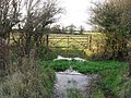
 Field gate heading from Kencot to Alvescot - geograph.org.uk - 1606848.jpg 640 × 480 ; 86 kio
-
 Field gate in Kencot - geograph.org.uk - 1571927.jpg 640 × 480 ; 102 kio
-
 Field gateway on footpath - geograph.org.uk - 1606624.jpg 640 × 480 ; 108 kio
-
 Field gateways and telegraph pole - geograph.org.uk - 1606615.jpg 640 × 480 ; 59 kio
-
 Field in Kencot - geograph.org.uk - 1572026.jpg 640 × 480 ; 67 kio
-
 Field near Kencot - geograph.org.uk - 6145323.jpg 1 925 × 1 444 ; 2,26 Mio
-
 Fields with horses at Asthall Farm - geograph.org.uk - 2656607.jpg 640 × 478 ; 66 kio
-
 Footpath beside the wall - geograph.org.uk - 1606868.jpg 640 × 480 ; 68 kio
-
 Footpath sign in Broadwell - geograph.org.uk - 1572524.jpg 480 × 640 ; 119 kio
-
 Footpath to Alvescot - geograph.org.uk - 1571877.jpg 640 × 480 ; 117 kio
-
 Footpath to Alvescot - geograph.org.uk - 2656603.jpg 640 × 478 ; 82 kio
-
 Former RAF Broadwell airfield from the air - geograph.org.uk - 2323137.jpg 640 × 481 ; 90 kio
-
 Gravestones in Kencot churchyard - geograph.org.uk - 1571937.jpg 640 × 480 ; 119 kio
-
 Heading towards Kencot - geograph.org.uk - 1149398.jpg 640 × 480 ; 72 kio
-
 Junction where roads to Carterton and Alvescot diverge - geograph.org.uk - 6145311.jpg 1 925 × 1 444 ; 1,98 Mio
-
 Kencot Church of England wood cross.jpg 1 080 × 1 620 ; 2,44 Mio
-
 Kencot Cottage in the snow - geograph.org.uk - 1149333.jpg 640 × 480 ; 59 kio
-
 Kencot Cottages - geograph.org.uk - 1625750.jpg 640 × 480 ; 120 kio
-
 Kencot Golden Jubilee seat - geograph.org.uk - 1571907.jpg 640 × 480 ; 125 kio
-
 Kencot House - geograph.org.uk - 1091095.jpg 640 × 480 ; 69 kio
-
 Kencot in the snow - geograph.org.uk - 1149280.jpg 640 × 480 ; 53 kio
-
 Kencot playing field - geograph.org.uk - 1571905.jpg 640 × 480 ; 93 kio
-
 Kencot village green and St. George's Church - geograph.org.uk - 1149326.jpg 640 × 480 ; 55 kio
-
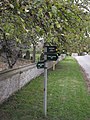
 Kencot village sign - geograph.org.uk - 1091093.jpg 640 × 480 ; 57 kio
-
 Kencot VR wallbox.jpg 720 × 1 280 ; 679 kio
-
 Kencot, Church Green - geograph.org.uk - 381276.jpg 640 × 427 ; 109 kio
-
 Kencot, Ivy Nook - geograph.org.uk - 381258.jpg 640 × 479 ; 151 kio
-
 Line of trees beside the pond - geograph.org.uk - 1476244.jpg 480 × 640 ; 92 kio
-
 Looking north from the footpath - geograph.org.uk - 1606830.jpg 640 × 480 ; 64 kio
-

-
 Path through Broadwell churchyard - geograph.org.uk - 1476203.jpg 640 × 480 ; 106 kio
-
 Path to Kencot playing field - geograph.org.uk - 1571914.jpg 480 × 640 ; 104 kio
-
 Pond in Broadwell - geograph.org.uk - 1606894.jpg 640 × 480 ; 126 kio
-
 Pump in Kencot - geograph.org.uk - 1571948.jpg 480 × 640 ; 125 kio
-
 RAF Broadwell Cold War monitoring post - geograph.org.uk - 6147680.jpg 4 000 × 3 000 ; 4,63 Mio
-
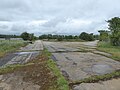 RAF Broadwell former WW2 airfield perimeter track - geograph.org.uk - 6147605.jpg 4 000 × 3 000 ; 4,83 Mio
-
 RAF Broadwell former WW2 airfield perimeter track - geograph.org.uk - 6147632.jpg 4 000 × 3 000 ; 4,82 Mio
-
 RAF Broadwell former WW2 runway - geograph.org.uk - 6147631.jpg 4 000 × 3 000 ; 4,63 Mio
-
 RAF Broadwell former WW2 runway - geograph.org.uk - 6147944.jpg 4 000 × 3 000 ; 4,47 Mio
-
 RAF Broadwell Nissen hut base - geograph.org.uk - 6147664.jpg 4 000 × 3 000 ; 4,78 Mio
-
 RAF Broadwell WW2 control tower - geograph.org.uk - 6145256.jpg 1 925 × 1 444 ; 2,11 Mio
-
 RAF Broadwell WW2 control tower - geograph.org.uk - 6148005.jpg 4 000 × 3 000 ; 4,68 Mio
-

-
 Ram in a field in Kencot - geograph.org.uk - 1571958.jpg 640 × 480 ; 98 kio
-
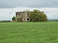
 Remains of an old hut - geograph.org.uk - 1571891.jpg 640 × 480 ; 143 kio
-
 Road across the old airfield - geograph.org.uk - 1467754.jpg 640 × 427 ; 79 kio
-
 Ruined barn by a road junction near Carterton - geograph.org.uk - 294616.jpg 640 × 427 ; 63 kio
-
 Rusty field gate in Kencot - geograph.org.uk - 1572513.jpg 640 × 480 ; 131 kio
-
 Side gate in Broadwell churchyard wall - geograph.org.uk - 1625780.jpg 640 × 480 ; 115 kio
-
 Small stile on the Kencot to Alvescot footpath - geograph.org.uk - 2656614.jpg 478 × 640 ; 108 kio
-
 Snowy approach to Kencot - geograph.org.uk - 1149266.jpg 640 × 480 ; 113 kio
-
 Snowy field at Kencot - geograph.org.uk - 1631459.jpg 640 × 480 ; 83 kio
-
 Snowy Kencot - geograph.org.uk - 1149346.jpg 640 × 480 ; 61 kio
-
 Snowy Kencot - geograph.org.uk - 1631453.jpg 640 × 480 ; 64 kio
-
 Snowy road through Kencot - geograph.org.uk - 1149303.jpg 640 × 480 ; 101 kio
-
 St George's Church, Kencot - geograph.org.uk - 5592573.jpg 3 264 × 2 448 ; 2,78 Mio
-
 Stile on the D'Arcy Dalton Way - geograph.org.uk - 1476214.jpg 640 × 480 ; 99 kio
-
 Stile on the footpath from Kencot to Alvescot - geograph.org.uk - 2656590.jpg 640 × 478 ; 114 kio
-
 Stream between Broadwell and Kencot - geograph.org.uk - 1606885.jpg 480 × 640 ; 139 kio
-
 The Swindon bus passes through Kencot - geograph.org.uk - 358884.jpg 640 × 462 ; 96 kio
-
 There is a stream in all this^ - geograph.org.uk - 1476231.jpg 480 × 640 ; 115 kio
-
 Trace of a bridleway - geograph.org.uk - 4388075.jpg 800 × 450 ; 229 kio
-
 Track across the field - geograph.org.uk - 1485067.jpg 640 × 427 ; 67 kio
-
 Track across the fields - geograph.org.uk - 1606606.jpg 640 × 480 ; 79 kio
-
 Track from the pumping station - geograph.org.uk - 1606947.jpg 640 × 480 ; 72 kio
-
 Track to an old quarry - geograph.org.uk - 4388759.jpg 640 × 360 ; 76 kio
-
 Track to Asthall Farm - geograph.org.uk - 2656598.jpg 640 × 478 ; 77 kio
-
 Track to Kencot Hill Farm - geograph.org.uk - 1564646.jpg 640 × 480 ; 51 kio
-
 Village Green, Kencot - geograph.org.uk - 5592578.jpg 3 264 × 2 448 ; 2,73 Mio
-
 Village hall viewed from the allotments - geograph.org.uk - 570592.jpg 640 × 427 ; 66 kio
-

-
 Village street, Kencot - geograph.org.uk - 1469448.jpg 640 × 427 ; 59 kio
-
 Village street, Kencot - geograph.org.uk - 1469465.jpg 640 × 427 ; 69 kio
-
 Waterlogged field gateway in Kencot - geograph.org.uk - 1625763.jpg 640 × 480 ; 139 kio
-
 Wet and muddy track - geograph.org.uk - 1477932.jpg 640 × 427 ; 57 kio
-
 Wind-blown detritis - geograph.org.uk - 4388734.jpg 800 × 450 ; 215 kio
-
 Wooded area at the northern end of Kencot - geograph.org.uk - 1571974.jpg 640 × 480 ; 138 kio
-
 Approaching Kencot crossroads - geograph.org.uk - 1117336.jpg 640 × 427 ; 95 kio
-
 Barn at Home Farm - geograph.org.uk - 294615.jpg 640 × 427 ; 113 kio
-
 Barn at Kencot - geograph.org.uk - 570596.jpg 640 × 427 ; 54 kio
-
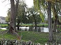
 Bedwell Pond - geograph.org.uk - 381172.jpg 640 × 435 ; 140 kio
-
 Bend in the road in Kencot - geograph.org.uk - 1447120.jpg 640 × 427 ; 95 kio
-
 Bridleway across the old airfield - geograph.org.uk - 1467770.jpg 640 × 427 ; 116 kio
-
 Bridleway to Shilton - geograph.org.uk - 1511741.jpg 640 × 427 ; 91 kio
-
 Bridleway west from the A361 - geograph.org.uk - 636745.jpg 640 × 357 ; 63 kio
-
 Carter Institute, Kencot - geograph.org.uk - 359081.jpg 640 × 480 ; 112 kio
-
 Cleared-up storm damage - geograph.org.uk - 294554.jpg 640 × 427 ; 75 kio
-
 Field near Alvescot - geograph.org.uk - 349156.jpg 640 × 427 ; 109 kio
-
 Field near Bazeland Farm - geograph.org.uk - 324603.jpg 640 × 480 ; 80 kio
-
 Fields between Alvescot and Broadwell - geograph.org.uk - 350389.jpg 640 × 431 ; 156 kio
-
 From Kencot into Broadwell - geograph.org.uk - 589365.jpg 640 × 480 ; 101 kio
-
 Horse at Kencot - geograph.org.uk - 381241.jpg 640 × 471 ; 130 kio
-
 Indian Bean Tree - geograph.org.uk - 482839.jpg 640 × 480 ; 80 kio
-
 Junction with the A361 - geograph.org.uk - 591687.jpg 640 × 480 ; 50 kio
-
 Kencot crossroads - geograph.org.uk - 589361.jpg 640 × 480 ; 100 kio
-
 Kencot road junction - geograph.org.uk - 591781.jpg 640 × 480 ; 131 kio
-
 Kencot, The Malthouse - geograph.org.uk - 381248.jpg 640 × 439 ; 149 kio
-

-
 Manor Farm viewed from Kencot playing field - geograph.org.uk - 591477.jpg 640 × 480 ; 90 kio
-
 New view coming into Kencot - geograph.org.uk - 705434.jpg 640 × 480 ; 66 kio
-
 Pond at Broadwell - geograph.org.uk - 592686.jpg 640 × 480 ; 155 kio
-
 Pond at Broadwell facing East - geograph.org.uk - 592704.jpg 640 × 480 ; 161 kio
-

-
 Road to Broadwell - geograph.org.uk - 622586.jpg 640 × 480 ; 53 kio
-
 The "Corpse Road" as it nears Broadwell - geograph.org.uk - 591723.jpg 640 × 480 ; 103 kio
-
 The B4020 and B4477 go their separate ways - geograph.org.uk - 589359.jpg 640 × 480 ; 76 kio
-
 The stream between Kencot and Broadwell - geograph.org.uk - 381323.jpg 640 × 440 ; 157 kio


_-_geograph.org.uk_-_591465.jpg)


