Category:Kenn, Devon
Vai alla navigazione
Vai alla ricerca
English: Kenn is a village situated in Devon, England, several miles to the south of Exeter, in one of the country's main tourist areas.
village and civil parish in Devon, UK  | |||||
| Carica un file multimediale | |||||
| Istanza di | |||||
|---|---|---|---|---|---|
| Luogo | Teignbridge, Devon, Sud Ovest dell'Inghilterra, Inghilterra | ||||
 | |||||
Sottocategorie
Questa categoria contiene le 7 sottocategorie indicate di seguito, su un totale di 7.
File nella categoria "Kenn, Devon"
Questa categoria contiene 200 file, indicati di seguito, su un totale di 526.
(pagina precedente) (pagina successiva)-
 "Forest dreaming, motherhood revisited" - geograph.org.uk - 239565.jpg 480 × 640; 165 KB
-

-
 A car passing Hannaford House - geograph.org.uk - 6303734.jpg 1 024 × 768; 263 KB
-
 A trio of copses - geograph.org.uk - 581622.jpg 640 × 379; 82 KB
-
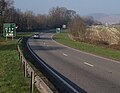
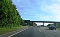
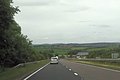 A30 approaching A380 junction - geograph.org.uk - 4035234.jpg 640 × 425; 50 KB
-
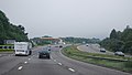
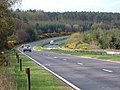
 A38 - A380 junction - geograph.org.uk - 3096446.jpg 640 × 430; 40 KB
-
 A38 and A380 part company - geograph.org.uk - 3879122.jpg 3 646 × 2 399; 1,25 MB
-
 A38 at Exeter racecourse - geograph.org.uk - 3355816.jpg 640 × 480; 77 KB
-
 A38 Below Telegraph Hill - geograph.org.uk - 1368494.jpg 640 × 455; 81 KB
-
 A38 Below Telegraph Hill - geograph.org.uk - 1368502.jpg 640 × 455; 85 KB
-
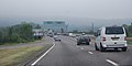
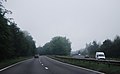
 A38 Devon Expressway near to Kennford - geograph.org.uk - 6108733.jpg 800 × 533; 568 KB
-

-
 A38 Haldon Hill, Exeter side - geograph.org.uk - 91481.jpg 640 × 427; 175 KB
-
 A38 Near Gorsey Cliff - geograph.org.uk - 1368505.jpg 640 × 455; 91 KB
-
 A38 near Kennford - geograph.org.uk - 4765409.jpg 640 × 426; 67 KB
-
 A38 southbound near Kennford - geograph.org.uk - 3096435.jpg 640 × 361; 37 KB
-
 A38 west of Trehill Farm - geograph.org.uk - 3879109.jpg 3 530 × 2 519; 1,17 MB
-
 A38, A379 Turnoff - geograph.org.uk - 1368552.jpg 640 × 455; 92 KB
-
 A38, Approaching A380 - geograph.org.uk - 1368492.jpg 640 × 455; 88 KB
-
 A38, approaching the A380 junction - geograph.org.uk - 3096439.jpg 640 × 321; 34 KB
-

-
 A38, descending Telegraph Hill - geograph.org.uk - 3016692.jpg 640 × 430; 50 KB
-
 A38, Devon Expressway - geograph.org.uk - 3096437.jpg 640 × 430; 36 KB
-
 A38, Exeter Race Course turn off - geograph.org.uk - 3016695.jpg 640 × 394; 36 KB
-
 A38, Great Haldon - geograph.org.uk - 1368448.jpg 640 × 455; 77 KB
-
 A38, Great Haldon - geograph.org.uk - 1368451.jpg 640 × 455; 61 KB
-
 A38, Great Haldon - geograph.org.uk - 1368469.jpg 640 × 455; 60 KB
-
 A38, Great Haldon - geograph.org.uk - 1368473.jpg 640 × 455; 79 KB
-
 A38, Great Haldon - geograph.org.uk - 1368478.jpg 640 × 455; 101 KB
-
 A38, Great Haldon - geograph.org.uk - 1368481.jpg 640 × 455; 97 KB
-
 A38, Kennford turning - geograph.org.uk - 4765412.jpg 640 × 347; 40 KB
-
 A38, southbound - geograph.org.uk - 4761665.jpg 640 × 408; 44 KB
-
 A380 - A38 junction - geograph.org.uk - 3096448.jpg 640 × 430; 34 KB
-
 A380 at the top of Telegraph Hill - geograph.org.uk - 1651531.jpg 640 × 426; 391 KB
-
 A380 at the top of Telegraph Hill - geograph.org.uk - 2291847.jpg 800 × 600; 343 KB
-
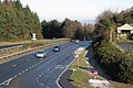
 A380 below Telegraph Hill - geograph.org.uk - 1219082.jpg 640 × 496; 77 KB
-
 A380 carriageways diverge - geograph.org.uk - 3096465.jpg 640 × 396; 30 KB
-
 A380 climbing Telegraph Hill - geograph.org.uk - 3096451.jpg 640 × 430; 69 KB
-
 A380 crosses the A38, Telegraph Hill - geograph.org.uk - 3016691.jpg 640 × 430; 49 KB
-
 A380 east of Round Plantation - geograph.org.uk - 3879134.jpg 3 187 × 2 291; 1,17 MB
-
 A380 in the Haldon Forest - geograph.org.uk - 3096462.jpg 640 × 430; 36 KB
-
 A380 near to Kennford - geograph.org.uk - 6108674.jpg 800 × 533; 693 KB
-
 A380 on Haldon - geograph.org.uk - 3263944.jpg 640 × 480; 101 KB
-
 A380 on Haldon - geograph.org.uk - 6052642.jpg 2 432 × 3 753; 1,24 MB
-
 A380 on Haldon.jpg 640 × 480; 93 KB
-
 A380 overbridge, A38 - geograph.org.uk - 4761666.jpg 640 × 350; 49 KB
-

-
 A380 south of Telegraph Hill - geograph.org.uk - 3879139.jpg 3 423 × 2 403; 1,32 MB
-
 A380 Telegraph Hill - geograph.org.uk - 6108647.jpg 800 × 533; 749 KB
-
 A380, A38 junction - geograph.org.uk - 5321649.jpg 640 × 426; 58 KB
-
 A380, Telegraph Hill - geograph.org.uk - 3096456.jpg 640 × 430; 60 KB
-
 Almost out of the woods - geograph.org.uk - 5688041.jpg 2 048 × 1 368; 1,24 MB
-

-
 Animal Paradise, Clapham - geograph.org.uk - 155248.jpg 640 × 480; 120 KB
-
 Approaching the A380 - geograph.org.uk - 2547048.jpg 640 × 480; 59 KB
-
 Ashton, Haldon Gate - geograph.org.uk - 686995.jpg 640 × 427; 163 KB
-
 Bank, Round O Plantation - geograph.org.uk - 5564104.jpg 1 536 × 2 048; 643 KB
-
 Bare trees at Underdown Cross - geograph.org.uk - 2776167.jpg 600 × 800; 510 KB
-
 Barn, at Yeo's Farm - geograph.org.uk - 1458007.jpg 640 × 480; 99 KB
-
 Barn, on Two Stone Lane - geograph.org.uk - 1458143.jpg 640 × 480; 100 KB
-
 Barns near Clapham - geograph.org.uk - 797924.jpg 640 × 438; 76 KB
-
 Below the Round O on Telegraph Hill - geograph.org.uk - 144880.jpg 640 × 480; 155 KB
-
 Belvedere and cow - geograph.org.uk - 689376.jpg 640 × 594; 56 KB
-
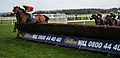
 Best Mate - His Last Race - geograph.org.uk - 1292602.jpg 640 × 480; 102 KB
-
 Big Wood, Kenton - geograph.org.uk - 683032.jpg 640 × 427; 256 KB
-
 Bird of Prey viewpoint, Haldon - geograph.org.uk - 238843.jpg 480 × 640; 126 KB
-

-
 Bridge over River Kenn in Clapham - geograph.org.uk - 2774880.jpg 800 × 600; 435 KB
-
 Bridge over the A38 - geograph.org.uk - 571711.jpg 640 × 480; 108 KB
-
 Bridge over the A380, Telegraph Hill - geograph.org.uk - 3096458.jpg 640 × 430; 25 KB
-
 Bridleway passing Cumberland Wood - geograph.org.uk - 2814873.jpg 600 × 800; 526 KB
-

-
 Bridleway to Exeter Lodge, Mamhead - geograph.org.uk - 4669198.jpg 1 024 × 768; 223 KB
-
 Bridleway, Clapham - geograph.org.uk - 5559856.jpg 3 072 × 2 048; 1,33 MB
-
 Brooke Lodge, Kenn - geograph.org.uk - 3798747.jpg 800 × 600; 150 KB
-
 Brown's farm, near Kenn - geograph.org.uk - 1458138.jpg 640 × 480; 90 KB
-
 Buildings at Exeter Racecourse (geograph 3355810).jpg 640 × 480; 83 KB
-
 Buildings on Old Haldon Hill - geograph.org.uk - 1218971.jpg 640 × 480; 77 KB
-
 Buller's Cross looking southeast - geograph.org.uk - 2663509.jpg 1 024 × 768; 140 KB
-
 Buller's Hill - geograph.org.uk - 239571.jpg 640 × 480; 120 KB
-
 By the Kenn - geograph.org.uk - 1219160.jpg 640 × 422; 68 KB
-

-
 Car park for Taverner's Farm - geograph.org.uk - 2009836.jpg 640 × 480; 234 KB
-
 Cattle by Two Stone Lane - geograph.org.uk - 5922768.jpg 4 278 × 2 653; 2,36 MB
-
 Cattle in the Kenn valley - geograph.org.uk - 5922856.jpg 1 828 × 2 267; 688 KB
-
 Cattle in the Kenn valley - geograph.org.uk - 5922860.jpg 4 288 × 2 848; 2,35 MB
-
 Cattle in the Kenn valley - geograph.org.uk - 5923019.jpg 4 288 × 2 848; 2,12 MB
-
 Cattle pasture above Clapham - geograph.org.uk - 5559866.jpg 2 988 × 1 866; 1,17 MB
-
 Chalet site, Great Haldon - geograph.org.uk - 1651545.jpg 640 × 427; 372 KB
-

-
 Collapsing bank near Kenn - geograph.org.uk - 3846748.jpg 1 920 × 1 252; 769 KB
-
 Coniferous woodland - geograph.org.uk - 1129748.jpg 640 × 480; 220 KB
-
 Contented sheep, Kenn - geograph.org.uk - 1045287.jpg 640 × 568; 161 KB
-
 Cottage beside Kenn Footpath 2 - geograph.org.uk - 571683.jpg 640 × 480; 100 KB
-
 Country north of Kenn - geograph.org.uk - 581685.jpg 640 × 480; 118 KB
-
 Countryside from Holloway Barton - geograph.org.uk - 798299.jpg 640 × 480; 81 KB
-
 Countryside near Brown's Farm - geograph.org.uk - 5918843.jpg 4 288 × 2 848; 2,32 MB
-
 Countryside near Brown's Farm - geograph.org.uk - 5922088.jpg 4 279 × 2 523; 1,81 MB
-
 Crossroads at Buller's Hill Cross - geograph.org.uk - 2654442.jpg 800 × 600; 422 KB
-
 Cumberland Lane - geograph.org.uk - 158548.jpg 640 × 480; 110 KB
-
 Cyclamen at Kenn - geograph.org.uk - 581535.jpg 640 × 487; 72 KB
-
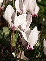 Cyclamen at Kenn - geograph.org.uk - 581570.jpg 486 × 640; 61 KB
-
 Cycle path, Great Haldon - geograph.org.uk - 1218937.jpg 480 × 640; 102 KB
-
 Cycle path, Haldon - geograph.org.uk - 6052698.jpg 4 008 × 2 718; 2,33 MB
-
 Cycle trail crossing road, Haldon - geograph.org.uk - 238832.jpg 640 × 480; 89 KB
-
 Dawlish turning A38 - geograph.org.uk - 2428039.jpg 640 × 400; 58 KB
-
 Deers Hill - geograph.org.uk - 6042350.jpg 4 191 × 2 625; 1,35 MB
-

-
 Derelict petrol station, on the A380, near Kenn - geograph.org.uk - 1716320.jpg 1 024 × 768; 169 KB
-

-
-

-
 Disused main road on Haldon - geograph.org.uk - 160419.jpg 640 × 480; 139 KB
-
 Dragonfly, Haldon Forest - geograph.org.uk - 4588295.jpg 1 920 × 1 510; 493 KB
-
 Ducks on Lake at Bickam House - geograph.org.uk - 801114.jpg 640 × 427; 78 KB
-
 Dunchideock - geograph.org.uk - 164755.jpg 640 × 480; 92 KB
-
 Dunchideock, view near Lawrence Castle - geograph.org.uk - 404156.jpg 640 × 427; 164 KB
-
 Edge of an encampment - geograph.org.uk - 1129751.jpg 640 × 480; 244 KB
-
 Emergency escape lane, A380 Telegraph Hill - geograph.org.uk - 6186549.jpg 1 600 × 1 199; 859 KB
-
 Entering Clapham - geograph.org.uk - 1565580.jpg 640 × 480; 175 KB
-
-
 Entrance to Kenn village - geograph.org.uk - 581602.jpg 640 × 460; 124 KB
-

-
-
 Estate lodge, Lord Haldon Hotel, Clapham - geograph.org.uk - 1458123.jpg 640 × 466; 110 KB
-

-

-
 Exeter A38 , The A38 Trunk Road - geograph.org.uk - 1196427.jpg 640 × 480; 47 KB
-
 Exeter Racecourse - geograph.org.uk - 1129752.jpg 640 × 480; 210 KB
-
 Exeter racecourse - geograph.org.uk - 1537152.jpg 640 × 480; 172 KB
-
 Exeter Racecourse - geograph.org.uk - 18185.jpg 636 × 309; 84 KB
-
 Exeter Racecourse - geograph.org.uk - 5356105.jpg 640 × 393; 37 KB
-
 Exeter Racecourse - geograph.org.uk - 5356106.jpg 640 × 426; 33 KB
-
 Exeter Racecourse turning, A38 - geograph.org.uk - 5321655.jpg 640 × 264; 40 KB
-
 Exeter Road Bridge, A38 - geograph.org.uk - 3096430.jpg 640 × 430; 32 KB
-
 Farm buildings at Brenton - geograph.org.uk - 1565968.jpg 640 × 480; 145 KB
-
 Farm buildings at Holloway Barton - geograph.org.uk - 2774903.jpg 800 × 600; 251 KB
-
 Farm diversification - geograph.org.uk - 1834394.jpg 2 560 × 1 920; 1,04 MB
-
 Farm entrance and fields - geograph.org.uk - 1565980.jpg 640 × 480; 170 KB
-
 Farm Ford at Kennford - geograph.org.uk - 3690019.jpg 3 872 × 2 592; 1,27 MB
-
 Farm road to Brown's Farm - geograph.org.uk - 2654485.jpg 800 × 600; 415 KB
-
 Farmland east of Clapham - geograph.org.uk - 5919186.jpg 4 288 × 2 848; 1,64 MB
-
 Farmland near Clapham - geograph.org.uk - 5922766.jpg 3 474 × 1 895; 851 KB
-
 Field above A38 - geograph.org.uk - 572807.jpg 640 × 480; 97 KB
-
 Field beside Kenn Footpath 2 - geograph.org.uk - 572830.jpg 640 × 480; 142 KB
-
 Field by the River Kenn - geograph.org.uk - 581373.jpg 640 × 480; 142 KB
-
 Field by Two Stone Lane - geograph.org.uk - 5922344.jpg 3 813 × 2 221; 1,82 MB
-
 Field near Kenn - geograph.org.uk - 581652.jpg 640 × 480; 112 KB
-
 Field with bath - geograph.org.uk - 572897.jpg 640 × 480; 127 KB
-
 Field, Splatford - geograph.org.uk - 3581695.jpg 511 × 640; 88 KB
-
 Field, Splatford - geograph.org.uk - 5921863.jpg 4 288 × 2 848; 2,31 MB
-
 Field, Splatford - geograph.org.uk - 5922079.jpg 4 288 × 2 848; 2,18 MB
-
 Fields below Haldon Gate - geograph.org.uk - 3414146.jpg 800 × 600; 138 KB
-
 Fields south of Clapham and Haldon hills - geograph.org.uk - 2774888.jpg 800 × 600; 286 KB
-
 Fields, near Trehill - geograph.org.uk - 1059065.jpg 640 × 480; 78 KB
-
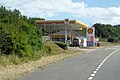
 Filling station by the A38 - geograph.org.uk - 5321663.jpg 640 × 426; 61 KB
-
 Filling station on Telegraph Hill - geograph.org.uk - 6284455.jpg 3 220 × 1 545; 442 KB
-
 Final fence - geograph.org.uk - 663997.jpg 640 × 307; 61 KB
-
 Finger-post, Haldon Gate - geograph.org.uk - 2001900.jpg 480 × 640; 168 KB
-

-
 Foot of Old Haldon Hill - geograph.org.uk - 1218992.jpg 640 × 450; 57 KB
-
 Footpath from Haldon Gate - geograph.org.uk - 6053651.jpg 2 848 × 4 288; 2,29 MB
-

-
 Ford at Yeo's Farm - geograph.org.uk - 3690029.jpg 3 872 × 2 592; 1,26 MB
-
 Ford on a farm track at Yeo's Farm - geograph.org.uk - 4354041.jpg 640 × 480; 54 KB
-

-
 Forest track to Veitch's Plantation - geograph.org.uk - 6053614.jpg 4 288 × 2 848; 1,44 MB
-
 Forestry by A380, Great Haldon turn - geograph.org.uk - 1651328.jpg 640 × 426; 364 KB
-
 Forestry Commission HQ Bullers Hill Devon - geograph.org.uk - 19414.jpg 640 × 480; 164 KB
-
 Forestry, on Haldon Hills - geograph.org.uk - 1993613.jpg 1 024 × 768; 298 KB
-
 Formal entrance to Trehill House - geograph.org.uk - 1059027.jpg 640 × 480; 149 KB
-
 Former car park, Haldon Forest Park - geograph.org.uk - 1652124.jpg 640 × 480; 626 KB
-
 Former road, Haldon - geograph.org.uk - 3263660.jpg 640 × 480; 133 KB
-
 Former road, Haldon - geograph.org.uk - 3263969.jpg 640 × 480; 146 KB
-
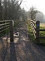
 Gate and field at Clapham - geograph.org.uk - 1565570.jpg 640 × 480; 197 KB
-
 Gate into woods near Kenn - geograph.org.uk - 950982.jpg 640 × 480; 159 KB
-
 GeereArms.png 813 × 934; 61 KB
-
 Goosemoor Barn - geograph.org.uk - 798294.jpg 640 × 480; 77 KB
-
-
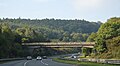
 Great Haldon Bridge, Telegraph Hill - geograph.org.uk - 1218899.jpg 640 × 426; 82 KB
-
 Great Haldon Forest - geograph.org.uk - 1458357.jpg 640 × 480; 100 KB
-
 Gypsy caravans, Haldon Forest - geograph.org.uk - 1458681.jpg 640 × 480; 125 KB
-
 Gypsy encampment, in Haldon Forest - geograph.org.uk - 1458669.jpg 640 × 480; 109 KB
-
 Haldon Chalets Cafe - geograph.org.uk - 1458707.jpg 640 × 480; 62 KB
-
 Haldon Chalets café by the A380 - geograph.org.uk - 1651374.jpg 640 × 427; 383 KB
-
 Haldon Forest - geograph.org.uk - 5185162.jpg 3 072 × 2 048; 2,13 MB
-
 Haldon Forest - geograph.org.uk - 5187341.jpg 2 048 × 2 869; 1,07 MB
-
 Haldon Forest - geograph.org.uk - 5187358.jpg 2 048 × 3 072; 1,77 MB
-
 Haldon Forest and road along the hilltop - geograph.org.uk - 2654438.jpg 800 × 600; 448 KB
-
 Haldon Forest Park, Rangers Centre - geograph.org.uk - 1429267.jpg 640 × 480; 69 KB
-
 Haldon Forest Trail - geograph.org.uk - 1429445.jpg 640 × 480; 118 KB
-
 Haldon Gate - geograph.org.uk - 1226273.jpg 640 × 480; 119 KB
-
 Haldon Gate - geograph.org.uk - 6042377.jpg 4 186 × 2 732; 2,35 MB
-
 Haldon Gate - geograph.org.uk - 687905.jpg 640 × 480; 83 KB
-
 Haldon Quarry - geograph.org.uk - 144881.jpg 640 × 480; 93 KB
-
 Haldon racecourse - geograph.org.uk - 166401.jpg 640 × 480; 128 KB
-
 Haldon View - geograph.org.uk - 572863.jpg 480 × 640; 83 KB
-

-
 Heathland at Exeter Racecourse - geograph.org.uk - 1813645.jpg 640 × 480; 55 KB
-
 Heathland on Haldon - geograph.org.uk - 2977759.jpg 640 × 480; 72 KB


.jpg)


