Category:Kennington, Oxfordshire
Aller à la navigation
Aller à la recherche
localité britannique du comté anglais d'Oxfordshire  | |||||
| Téléverser des médias | |||||
| Nature de l’élément | |||||
|---|---|---|---|---|---|
| Lieu | Vale of White Horse, Oxfordshire, Angleterre du Sud-Est, Angleterre | ||||
| Baigné par | |||||
| site officiel | |||||
 | |||||
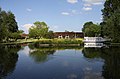
English: Kennington is a village and civil parish in the Vale of White Horse district of the English county of Oxfordshire, just to the south of Oxford. It sits in a narrow stretch of land between the River Thames and the A34 dual carriageway, and is home to around 4,000 people. In 1974 it was transferred from Berkshire.
Sous-catégories
Cette catégorie comprend 9 sous-catégories, dont les 9 ci-dessous.
B
F
I
- Isis Bridge (8 F)
K
- Kennington Railway Bridge (21 F)
S
- Sandford Hydro (6 F)
- Sandford Lasher (8 F)
Média dans la catégorie « Kennington, Oxfordshire »
Cette catégorie comprend 275 fichiers, dont les 200 ci-dessous.
(page précédente) (page suivante)-
 A ditch in Colley's Ladder East - geograph.org.uk - 6294241.jpg 2 700 × 2 025 ; 840 kio
-
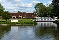
 A former college barge by the Four Pillars Hotel - geograph.org.uk - 3292404.jpg 1 500 × 989 ; 156 kio
-
 A millstone on the site of Iffley Mill - geograph.org.uk - 1253481.jpg 640 × 427 ; 120 kio
-
 A narrowboat in Iffley Lock - geograph.org.uk - 1253460.jpg 640 × 427 ; 83 kio
-
 A party boat on the Thames - geograph.org.uk - 1932950.jpg 1 500 × 1 000 ; 197 kio
-
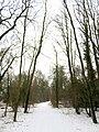
 A path in Bagley Wood - geograph.org.uk - 6294247.jpg 2 700 × 3 600 ; 1,2 Mio
-
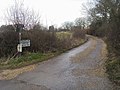
 A Quiet Kennington Road - geograph.org.uk - 3205679.jpg 1 600 × 1 274 ; 455 kio
-
 A Suburban Cul de Sac - geograph.org.uk - 3204307.jpg 2 406 × 1 668 ; 1,26 Mio
-
 A track in Bagley Wood - geograph.org.uk - 6294244.jpg 2 700 × 2 025 ; 758 kio
-
 A track in Bagley Wood - geograph.org.uk - 6294245.jpg 2 700 × 2 025 ; 884 kio
-
 A track in Bagley Wood - geograph.org.uk - 6294246.jpg 2 700 × 2 025 ; 902 kio
-
 A track in Bagley Wood - geograph.org.uk - 6294248.jpg 2 700 × 2 025 ; 846 kio
-
 A track in Bagley Wood - geograph.org.uk - 6294249.jpg 2 025 × 2 700 ; 752 kio
-
 A track in Colley's Ladder East - geograph.org.uk - 6294239.jpg 2 025 × 2 700 ; 802 kio
-
 A track in Colley's Ladder East - geograph.org.uk - 6294240.jpg 2 700 × 2 025 ; 848 kio
-
 A track in Colley's Ladder East - geograph.org.uk - 6294242.jpg 2 700 × 2 025 ; 813 kio
-
 A track in Colley's Ladder East - geograph.org.uk - 6294243.jpg 2 025 × 2 700 ; 826 kio
-
 A track into Bagley Wood - geograph.org.uk - 6294250.jpg 2 700 × 2 025 ; 771 kio
-
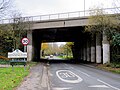
 A34 Bridge (Bagley Wood Road) - geograph.org.uk - 3295071.jpg 640 × 480 ; 397 kio
-
 A34 slip road to Hinksey Hill Interchange - geograph.org.uk - 2534722.jpg 3 648 × 2 736 ; 1,22 Mio
-
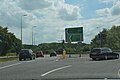
 A34 southbound, west of Little London - geograph.org.uk - 3103502.jpg 640 × 480 ; 58 kio
-
 A423 - geograph.org.uk - 5622147.jpg 640 × 426 ; 53 kio
-
 A423 - geograph.org.uk - 5622148.jpg 640 × 426 ; 58 kio
-
 A423 - geograph.org.uk - 5627119.jpg 640 × 426 ; 52 kio
-
 A423 approaching Kennington Roundabout - geograph.org.uk - 5643527.jpg 640 × 426 ; 43 kio
-
 A423 approaching Kennington Roundabout - geograph.org.uk - 5643528.jpg 640 × 391 ; 41 kio
-
 A423 bridge over River Thames - geograph.org.uk - 2772235.jpg 683 × 1 024 ; 179 kio
-
 A423 bridge parapet over Weirs Mill Stream - geograph.org.uk - 2644643.jpg 683 × 1 024 ; 226 kio
-
 Aerial view of the area around the Lock at Sandford-on-Thames - geograph.org.uk - 3469422.jpg 4 288 × 2 848 ; 4,42 Mio
-
 Alder catkins by the River Thames - geograph.org.uk - 5698641.jpg 2 011 × 2 700 ; 478 kio
-
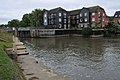 Apartment at Sandford Lock - geograph.org.uk - 2612014.jpg 1 024 × 680 ; 170 kio
-
 Apartment at Sandford Lock - geograph.org.uk - 2612015.jpg 1 024 × 680 ; 205 kio
-
 Approaching Sandford Lock - geograph.org.uk - 3401174.jpg 640 × 427 ; 195 kio
-
 Autumn leaves by Kennington - geograph.org.uk - 1624796.jpg 640 × 427 ; 75 kio
-
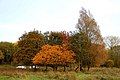
 Autumn trees in Egrove Park - geograph.org.uk - 5613957.jpg 2 025 × 2 700 ; 687 kio
-
 Avicenna Pharmacy on Kennington Road - geograph.org.uk - 5698656.jpg 2 700 × 2 011 ; 385 kio
-
 Benchmark on A423 bridge over The Thames - geograph.org.uk - 2644864.jpg 683 × 1 024 ; 287 kio
-
 Benchmark on A423 bridge over Weirs Mill Stream - geograph.org.uk - 2644602.jpg 683 × 1 024 ; 264 kio
-
 Benchmark on abutment wall of railway bridge - geograph.org.uk - 3862094.jpg 683 × 1 024 ; 275 kio
-
 Benchmark on bridge taking A423 over railway - geograph.org.uk - 2643568.jpg 683 × 1 024 ; 302 kio
-
 Benchmark on ^115 Bagley Wood Road - geograph.org.uk - 3321338.jpg 683 × 1 024 ; 184 kio
-
 Benchmark on ^121 Bagley Wood Road - geograph.org.uk - 3314323.jpg 703 × 1 024 ; 249 kio
-
 Benchmark on ^64 Kennington Road - geograph.org.uk - 3861496.jpg 683 × 1 024 ; 207 kio
-
 Benchmark on ^93 Bagley Wood Road - geograph.org.uk - 3321381.jpg 683 × 1 024 ; 187 kio
-
 Benchmarks on the A423 bridge over Kennington Road - geograph.org.uk - 2644070.jpg 683 × 1 024 ; 299 kio
-
 Best-one store on Kennington Road - geograph.org.uk - 5555186.jpg 1 500 × 1 125 ; 163 kio
-
 Birds along the River Thames - geograph.org.uk - 4531410.jpg 1 024 × 636 ; 282 kio
-
 Black Bridge over the River Thames - geograph.org.uk - 5698640.jpg 2 700 × 2 025 ; 485 kio
-
 Black Bridge over the River Thames - geograph.org.uk - 5698645.jpg 2 700 × 2 025 ; 394 kio
-
 Boat near Sandford - geograph.org.uk - 3400735.jpg 470 × 640 ; 248 kio
-
 Bridge over River Thames for Cowley Works branch - geograph.org.uk - 3862130.jpg 1 024 × 683 ; 190 kio
-
 Bridges of Kennington - geograph.org.uk - 3007885.jpg 1 500 × 1 125 ; 233 kio
-
 Bus stop on Hinksey Hill - geograph.org.uk - 1371228.jpg 640 × 427 ; 77 kio
-
 Cattle grazing at Kennington - geograph.org.uk - 1624809.jpg 640 × 453 ; 85 kio
-
 Cattle in the meadow at Kennington - geograph.org.uk - 1624805.jpg 640 × 427 ; 76 kio
-
 Chandlings Manor School - geograph.org.uk - 1371212.jpg 640 × 413 ; 79 kio
-
 Chilswell Lane - geograph.org.uk - 2165138.jpg 640 × 480 ; 92 kio
-
 Church of St Swithun - geograph.org.uk - 5622131.jpg 640 × 426 ; 52 kio
-
 Contrast at Rose Isle - geograph.org.uk - 3400727.jpg 640 × 427 ; 179 kio
-
 Cycle track by the A423 - geograph.org.uk - 6075163.jpg 2 700 × 2 025 ; 1,08 Mio
-
 Cycle track under the Kennington Roundabout - geograph.org.uk - 6075160.jpg 2 700 × 1 972 ; 434 kio
-
 Cycle track under the Kennington Roundabout - geograph.org.uk - 6075161.jpg 2 700 × 2 009 ; 281 kio
-
 Cycle track-A423 bridge over Kennington Road - geograph.org.uk - 2644184.jpg 1 024 × 683 ; 169 kio
-
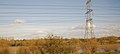
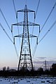 Electricity Pylon at Kennington - geograph.org.uk - 1222594.jpg 427 × 640 ; 61 kio
-
 Electricity Pylon at Kennington - geograph.org.uk - 1624822.jpg 640 × 427 ; 84 kio
-
 Electricity Pylons at Kennington - geograph.org.uk - 1624813.jpg 427 × 640 ; 48 kio
-
 Electricity Pylons at Kennington - geograph.org.uk - 1624818.jpg 640 × 427 ; 42 kio
-
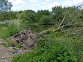 Fallen tree along the River Thames - geograph.org.uk - 4531396.jpg 1 024 × 767 ; 328 kio
-
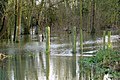
 Flooded cycleway near Kennington - geograph.org.uk - 3834581.jpg 1 500 × 999 ; 318 kio
-
 Flooded cycleway near Kennington - geograph.org.uk - 3834582.jpg 1 500 × 999 ; 262 kio
-
 Flooded cycleway near Kennington - geograph.org.uk - 3834583.jpg 1 500 × 999 ; 345 kio
-
 Flooded field with electricity pylon from Sandford Lane - geograph.org.uk - 3323334.jpg 1 024 × 683 ; 242 kio
-
 Flooded footpath to the River Thames - geograph.org.uk - 3834571.jpg 1 500 × 999 ; 335 kio
-
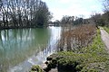
 Flooded meadow by the River Thames - geograph.org.uk - 3834564.jpg 1 500 × 993 ; 289 kio
-
 Flooded meadow by the River Thames - geograph.org.uk - 3834585.jpg 1 500 × 999 ; 253 kio
-
 Flooded Sandford Lane - geograph.org.uk - 3323340.jpg 1 024 × 683 ; 282 kio
-
 Footbridge across Hinksey Stream - geograph.org.uk - 4530497.jpg 1 024 × 686 ; 231 kio
-
 Footbridge along the Thames Path - geograph.org.uk - 4531003.jpg 1 024 × 653 ; 312 kio
-
 Footbridge along the Thames Path - geograph.org.uk - 4531389.jpg 1 024 × 714 ; 237 kio
-
 Footbridge over Hinksey Stream - geograph.org.uk - 3007853.jpg 1 500 × 1 125 ; 289 kio
-
 Footbridge over Hinksey Stream - geograph.org.uk - 5698642.jpg 2 700 × 2 025 ; 483 kio
-
 Footbridge over Hinksey Stream - geograph.org.uk - 871863.jpg 640 × 480 ; 126 kio
-
 Footbridge over Hinskey Stream - geograph.org.uk - 2497369.jpg 640 × 427 ; 160 kio
-
 Footbridge over the backwater - geograph.org.uk - 3292437.jpg 1 500 × 1 000 ; 278 kio
-
 Footbridge over the Hinksey stream - geograph.org.uk - 5666647.jpg 5 202 × 3 465 ; 5,2 Mio
-
 Footbridge over the railway - geograph.org.uk - 5698654.jpg 4 500 × 3 375 ; 951 kio
-
 Footbridge over the railway - geograph.org.uk - 5698655.jpg 2 700 × 2 025 ; 414 kio
-
 Footbridge over the railway at Kennington - geograph.org.uk - 1224781.jpg 640 × 427 ; 108 kio
-
 Footbridge over water flowing to Sandford Pool - geograph.org.uk - 2497358.jpg 640 × 427 ; 184 kio
-
 Footbridge to Fiddler's Elbow - geograph.org.uk - 3292397.jpg 1 500 × 1 000 ; 175 kio
-
 Footbridge to Fiddler's Elbow - geograph.org.uk - 3292410.jpg 1 500 × 1 000 ; 259 kio
-
 Footbridge to Kennington - geograph.org.uk - 3400719.jpg 640 × 468 ; 226 kio
-
 Footpath across the meadow - geograph.org.uk - 5698633.jpg 4 500 × 3 375 ; 859 kio
-

-
 Forest Side Playing Field - geograph.org.uk - 4658436.jpg 1 600 × 1 098 ; 479 kio
-
 Four Pillars Hotel - geograph.org.uk - 3401181.jpg 640 × 432 ; 262 kio
-
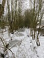 Frozen drain in Kennington - geograph.org.uk - 5698647.jpg 2 025 × 2 700 ; 735 kio
-
 Frozen rose bushes on Christmas Day - geograph.org.uk - 2207736.jpg 1 500 × 1 000 ; 350 kio
-
 Garden on Christmas Day - geograph.org.uk - 2207741.jpg 1 500 × 979 ; 245 kio
-
 Gardens near Kennington Junction - geograph.org.uk - 5666626.jpg 5 202 × 3 465 ; 5,67 Mio
-
 Graffiti on the bridge - geograph.org.uk - 5048864.jpg 1 500 × 1 125 ; 217 kio
-
 Graffiti under the bridge - geograph.org.uk - 5048866.jpg 1 500 × 1 125 ; 177 kio
-
 Graffiti vandalized footbridge at Kennington - geograph.org.uk - 1224835.jpg 640 × 427 ; 65 kio
-
 Greylag geese on the Thames Path - geograph.org.uk - 5698639.jpg 2 700 × 1 990 ; 426 kio
-
 Greylag goose on the Thames Path - geograph.org.uk - 5698638.jpg 2 700 × 2 025 ; 218 kio
-
 Henry Colyear Dawkins in Bagley Wood.jpg 2 448 × 3 264 ; 2,58 Mio
-
 Hinksey Stream - geograph.org.uk - 3007864.jpg 1 500 × 1 125 ; 258 kio
-
 Hinksey Stream - geograph.org.uk - 5698643.jpg 2 700 × 2 025 ; 512 kio
-
 Hinksey Stream and Railway - geograph.org.uk - 332690.jpg 640 × 480 ; 267 kio
-
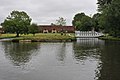 Hotel beside Thames - geograph.org.uk - 2612022.jpg 1 024 × 680 ; 151 kio
-
 House by the Thames on Rose Isle - geograph.org.uk - 6078424.jpg 2 700 × 2 025 ; 746 kio
-
 Houses on Kennington Road - geograph.org.uk - 332661.jpg 640 × 480 ; 70 kio
-
 Houses, Poplar Grove - geograph.org.uk - 3929354.jpg 640 × 302 ; 41 kio
-
 Icicles on Christmas Day - geograph.org.uk - 2207737.jpg 1 500 × 1 000 ; 125 kio
-
 Iffley Lock on the River Thames - geograph.org.uk - 6075164.jpg 2 700 × 2 025 ; 861 kio
-
 Isis Bridge crossing the River Thames - geograph.org.uk - 4530349.jpg 1 024 × 769 ; 288 kio
-
 Isis Bridge crossing the River Thames - geograph.org.uk - 4530411.jpg 1 024 × 768 ; 259 kio
-
 Junction of Upper Road and Kenville Road - geograph.org.uk - 3861527.jpg 1 024 × 683 ; 173 kio
-
 Junction on the Oxford Ring Road, Hinksey - geograph.org.uk - 6064932.jpg 1 920 × 1 280 ; 702 kio
-
 Sandford Lane - geograph.org.uk - 1085531.jpg 640 × 480 ; 116 kio
-
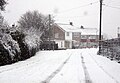
 The Tandem in snow covered Kennington - geograph.org.uk - 1231194.jpg 640 × 451 ; 83 kio
-
 Kennington Crossing - geograph.org.uk - 1345741.jpg 640 × 409 ; 99 kio
-
 Kennington Junction - geograph.org.uk - 1345738.jpg 640 × 421 ; 100 kio
-
 Kennington Methodist Church - geograph.org.uk - 5555190.jpg 1 500 × 1 060 ; 142 kio
-
 Kennington Playgroup and school, The Avenue - geograph.org.uk - 3321772.jpg 1 024 × 683 ; 206 kio
-
 Kennington railway bridge - geograph.org.uk - 5219858.jpg 5 184 × 3 456 ; 6,43 Mio
-
 Kennington Rd - geograph.org.uk - 5622129.jpg 640 × 426 ; 68 kio
-
 Kennington Road - geograph.org.uk - 5628037.jpg 2 700 × 2 025 ; 469 kio
-
 Kennington Road and Egrove Park - geograph.org.uk - 332679.jpg 640 × 480 ; 216 kio
-
 Kennington Road runs under the Ring Road - geograph.org.uk - 5613964.jpg 2 700 × 2 025 ; 678 kio
-
 Kennington Road runs under the Ring Road - geograph.org.uk - 5613972.jpg 2 700 × 2 025 ; 537 kio
-
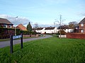
 Kennington Village Centre - geograph.org.uk - 4362254.jpg 640 × 480 ; 86 kio
-
 Kennington Village Hall - geograph.org.uk - 1224764.jpg 640 × 427 ; 66 kio
-
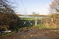
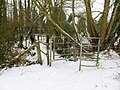
 Kissing gate on the footpath at Kennington - geograph.org.uk - 1624823.jpg 640 × 408 ; 95 kio
-
 Kissing gate on the Thames Path by Black Bridge - geograph.org.uk - 5698646.jpg 2 700 × 2 025 ; 568 kio
-
 Kissing gate to the Kennington - geograph.org.uk - 5698631.jpg 2 700 × 2 025 ; 455 kio
-
 Kissing gate to the river meadow - geograph.org.uk - 5698630.jpg 4 500 × 3 375 ; 1,14 Mio
-
 Looking across Rose Isle - geograph.org.uk - 2497362.jpg 640 × 427 ; 124 kio
-
 Looking south along the River Thames - geograph.org.uk - 4531644.jpg 1 024 × 768 ; 276 kio
-
 Meadow View Road - geograph.org.uk - 3204317.jpg 1 600 × 1 184 ; 509 kio
-
 Memorial Field, Kennington - geograph.org.uk - 871583.jpg 640 × 480 ; 115 kio
-
 Merry Christmas from Rowles Close - geograph.org.uk - 2207735.jpg 1 500 × 1 000 ; 166 kio
-
 Narrowboat on the Thames - geograph.org.uk - 3400676.jpg 640 × 421 ; 210 kio
-
 National Cycle Route 5 in Kennington - geograph.org.uk - 5698626.jpg 2 025 × 2 700 ; 557 kio
-
 National Cycle Route 5 in Kennington - geograph.org.uk - 5698629.jpg 2 700 × 2 025 ; 316 kio
-
 National Cycle Route 5 in Kennington - geograph.org.uk - 5698648.jpg 2 700 × 2 025 ; 660 kio
-
 National Cycle Route 5 in Kennington - geograph.org.uk - 5698649.jpg 2 700 × 2 025 ; 503 kio
-
 National Cycle Route 5 in Kennington - geograph.org.uk - 5698650.jpg 2 700 × 2 025 ; 328 kio
-
 National Grid - geograph.org.uk - 1381261.jpg 640 × 480 ; 97 kio
-
 North of Sandford Lock - geograph.org.uk - 3401177.jpg 640 × 427 ; 215 kio
-
 Overpainted benchmark on ^8 Kennington Road - geograph.org.uk - 2644318.jpg 683 × 1 024 ; 247 kio
-
 Oxford Thames Four Pillars Hotel - geograph.org.uk - 4531420.jpg 1 024 × 690 ; 212 kio
-
 Parapet of Bridge 69.31 with cycle track alongside - geograph.org.uk - 2643576.jpg 1 024 × 683 ; 177 kio
-
 Pillar box at the edge of Bagley Wood - geograph.org.uk - 1498131.jpg 480 × 640 ; 162 kio
-
 Playfield Rd - geograph.org.uk - 5622136.jpg 640 × 426 ; 81 kio
-
 Playfield Road sports pitch - geograph.org.uk - 6033843.jpg 2 700 × 1 679 ; 336 kio
-
 Playfield Road sports pitch - geograph.org.uk - 6033844.jpg 2 700 × 1 758 ; 375 kio
-
 Playfield Road sports pitch - geograph.org.uk - 6033845.jpg 2 700 × 2 025 ; 405 kio
-
 Playfield Road sports pitch - geograph.org.uk - 6033846.jpg 2 700 × 1 804 ; 290 kio
-
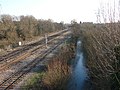
 Ponds by the railway - geograph.org.uk - 3929367.jpg 640 × 430 ; 63 kio
-
 Poplar Grove - geograph.org.uk - 3204296.jpg 2 560 × 1 920 ; 877 kio
-
 Power lines from the railway - geograph.org.uk - 5666633.jpg 5 202 × 3 465 ; 4,77 Mio
-
 Pylon by the Hinksey Stream - geograph.org.uk - 3937200.jpg 640 × 277 ; 49 kio
-
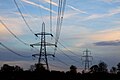
 Pylon in the Thames Valley - geograph.org.uk - 3937197.jpg 640 × 430 ; 51 kio
-
 Pylon in the Thames Valley - geograph.org.uk - 3937202.jpg 640 × 430 ; 63 kio
-
 Pylon in the Thames Valley - geograph.org.uk - 3937204.jpg 640 × 430 ; 72 kio
-
 Pylon in the Thames Valley - geograph.org.uk - 3937205.jpg 640 × 430 ; 54 kio
-
 Pylon in the Thames Valley - geograph.org.uk - 3937208.jpg 640 × 286 ; 34 kio
-
 Pylon in the Thames Valley - geograph.org.uk - 3937210.jpg 640 × 430 ; 49 kio
-
 Railway bridge over the River Thames - geograph.org.uk - 6078423.jpg 2 700 × 2 025 ; 766 kio
-
 Railway bridge over the Thames - geograph.org.uk - 2423716.jpg 1 500 × 1 000 ; 189 kio
-
 Railway Mileage Post at Kennington - geograph.org.uk - 1224823.jpg 640 × 456 ; 154 kio
-
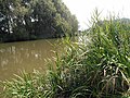 Reeds and river - geograph.org.uk - 3176606.jpg 640 × 480 ; 164 kio
-
 River and railway bridges - geograph.org.uk - 3400686.jpg 640 × 400 ; 216 kio
-
 River Thames at Sandford - geograph.org.uk - 2925233.jpg 5 766 × 1 812 ; 2,55 Mio
-
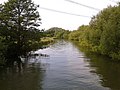
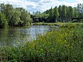
 River Thames near Kennington - geograph.org.uk - 2611627.jpg 1 024 × 680 ; 178 kio
-
 River Thames under the A423 - geograph.org.uk - 3400668.jpg 640 × 427 ; 232 kio
-
 River Thames, looking south from Kennington rail bridge - geograph.org.uk - 5666649.jpg 5 202 × 3 465 ; 4,01 Mio
-

-
 Rose Isle by the River Thames - geograph.org.uk - 5698635.jpg 2 700 × 2 060 ; 545 kio
-
 Rowles Close in Kennington - geograph.org.uk - 5698620.jpg 2 700 × 2 005 ; 377 kio
-
 Sandford Lane - geograph.org.uk - 2612027.jpg 1 024 × 680 ; 316 kio
-
 Sandford Lock - geograph.org.uk - 5218541.jpg 5 184 × 3 456 ; 6,49 Mio
-
 Scrubby woodland - geograph.org.uk - 3937192.jpg 640 × 430 ; 56 kio
-
 Signal OX12 to the main line - geograph.org.uk - 3040081.jpg 1 500 × 1 000 ; 285 kio
-
 Signpost on the National Cycle Network - geograph.org.uk - 1222587.jpg 427 × 640 ; 85 kio
-
 Snow covered Rowles Close - geograph.org.uk - 2207734.jpg 1 500 × 970 ; 171 kio
-
 Snowy Rowles Close - geograph.org.uk - 1222592.jpg 640 × 445 ; 72 kio
-
 South of Kennington railway bridge - geograph.org.uk - 3400711.jpg 640 × 428 ; 230 kio
-
 Southbound freight train at Kennington - geograph.org.uk - 3834586.jpg 1 500 × 999 ; 276 kio
-
 St Swithun's Church in Kennington - geograph.org.uk - 5628041.jpg 2 700 × 2 013 ; 502 kio
-
 St Swithun's Churches - geograph.org.uk - 3205647.jpg 2 307 × 1 710 ; 1,04 Mio
-
 Thames Path at Kennington - geograph.org.uk - 3176603.jpg 640 × 480 ; 170 kio
-
 Thames Path fingerpost near Kennington, Oxfordshire.jpg 4 128 × 3 096 ; 5,47 Mio
-
 Thames Path looking south - geograph.org.uk - 5218509.jpg 5 202 × 3 465 ; 3,99 Mio
-
 Thames path opposite Rose Isle - geograph.org.uk - 5219855.jpg 5 202 × 3 465 ; 2,79 Mio
-
 Thames Path under Littlemore Railway branch bridge - geograph.org.uk - 3862121.jpg 1 024 × 683 ; 240 kio
-
 Thames towpath - geograph.org.uk - 3400696.jpg 640 × 427 ; 188 kio
-

-
 Thatched Cottage in Kennington - geograph.org.uk - 1224915.jpg 640 × 427 ; 85 kio


_-_geograph.org.uk_-_3295071.jpg)


