Category:Keynsham
Zur Navigation springen
Zur Suche springen
Gemeinde in der englischen Grafschaft Somerset  | |||||
| Medium hochladen | |||||
| As en | |||||
|---|---|---|---|---|---|
| Steed | Bath and North East Somerset, Somerset, Süüd Waast Ingelun, Ingelun | ||||
| Iinwenertaal |
| ||||
| Ferlicht detsalew üs | Keynsham (Wikimedia-Dublette, civil parish) | ||||
| amtelk wääbsteed | |||||
 | |||||
Onerkategoriin
Uun detdiar kategorii stun 9 onerkategoriin faan 9 uun't gehial.
A
B
- Bridges Almshouses (10 D)
K
- Keynsham Abbey (6 D)
- Keynsham Humpy Tumps (8 D)
S
- Somerdale Factory (18 D)
T
W
- Wellsway School (1 D)
Meedien uun kategorii "Keynsham"
Uun detdiar kategorii stun jodiar 200 datein faan 638 uun't gehial.
(leetst sidj (turag)) (naist sidj)-
 "Echo Bridge" - geograph.org.uk - 2096853.jpg 2.304 × 1.704; 1,34 MB
-
 'Signs of the Times' - geograph.org.uk - 5686894.jpg 1.704 × 2.304; 1,76 MB
-
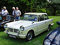 1962 Triumph Herald 1200 (35652331005).jpg 4.896 × 3.672; 7,29 MB
-
 2009 Scania OmniCity.jpg 3.821 × 2.853; 7,65 MB
-
 2010 , A4 Keynsham Bypass - geograph.org.uk - 2068469.jpg 800 × 610; 149 KB
-

-

-
 2010 , Coronation Avenue and view, Keynsham - geograph.org.uk - 2069441.jpg 1.600 × 1.176; 344 KB
-
 2010 , Due east from Charlton Road near Keynsham - geograph.org.uk - 2054970.jpg 1.600 × 1.018; 304 KB
-

-
 2010 , Footpath by the bypass, Keynsham - geograph.org.uk - 2068482.jpg 800 × 548; 226 KB
-

-
 2010 , Old Bristol Road, Keynsham - geograph.org.uk - 2068544.jpg 800 × 560; 163 KB
-
 2010 , Site of old tanyard - geograph.org.uk - 2068511.jpg 800 × 543; 206 KB
-
 20200518 Keynsham.jpg 4.608 × 3.456; 5,29 MB
-
 66 540 Keynsham 2.jpg 4.187 × 2.220; 1,53 MB
-
 66 540 Keynsham.jpg 4.852 × 2.500; 2,06 MB
-
 A backwater railway bridge - geograph.org.uk - 5562451.jpg 2.304 × 1.704; 1,75 MB
-
 A big wheel - but not one to ride on - geograph.org.uk - 5614863.jpg 1.704 × 2.304; 1,48 MB
-
 A burnished figure - geograph.org.uk - 5666159.jpg 1.704 × 2.304; 2,05 MB
-
 A crumbling fence, a natural archway - geograph.org.uk - 5562461.jpg 2.304 × 1.704; 1,64 MB
-
 A footbridge in the middle of the countryside - geograph.org.uk - 5562465.jpg 2.304 × 1.704; 1,8 MB
-
 A gate for the gee-gees - geograph.org.uk - 5689615.jpg 2.304 × 1.704; 1,81 MB
-
 A gentle drop of water - geograph.org.uk - 5560725.jpg 2.304 × 1.704; 1,63 MB
-
 A horse with feathered friends - geograph.org.uk - 5689628.jpg 2.304 × 1.704; 1,27 MB
-
 A minor obstruction - geograph.org.uk - 5614888.jpg 2.304 × 1.704; 1,67 MB
-
 A much-needed coat of paint^ - geograph.org.uk - 4807581.jpg 1.704 × 2.304; 1,74 MB
-
 A new pioneer - geograph.org.uk - 5327023.jpg 1.704 × 2.304; 1,45 MB
-
 A new wrapper - geograph.org.uk - 5329168.jpg 2.304 × 1.704; 1,77 MB
-
 A pair of secateurs may be required - geograph.org.uk - 5686882.jpg 1.704 × 2.304; 2,49 MB
-
 A particular architecture - geograph.org.uk - 5666157.jpg 2.304 × 1.704; 1,67 MB
-
 A pioneer that has lost its way - geograph.org.uk - 4807299.jpg 2.304 × 1.704; 1,53 MB
-
 A private walk over the path - geograph.org.uk - 5666932.jpg 1.704 × 2.304; 2,12 MB
-
 A rough tree - geograph.org.uk - 5615632.jpg 2.304 × 1.704; 1,69 MB
-
 A slide in the civic centre^ - geograph.org.uk - 5667969.jpg 1.704 × 2.304; 1,54 MB
-
 A square of plaques - geograph.org.uk - 5563411.jpg 2.304 × 1.704; 1,8 MB
-
 A stand of birch - geograph.org.uk - 5690314.jpg 1.704 × 2.304; 2 MB
-
 A surprisingly long drop to the river - geograph.org.uk - 5685833.jpg 2.304 × 1.704; 1,77 MB
-
 A Swish of Santas (49200452502).jpg 4.608 × 3.456; 2,97 MB
-
 A tall monument to sweet teeth - geograph.org.uk - 4808801.jpg 1.704 × 2.304; 1.002 KB
-
 A trace of Roman history - geograph.org.uk - 5563402.jpg 2.304 × 1.704; 1,81 MB
-
 A triangle of water covers - geograph.org.uk - 5690306.jpg 1.704 × 2.304; 2,48 MB
-

-
 A well kept cemetery - geograph.org.uk - 5563407.jpg 2.304 × 1.704; 1,77 MB
-
 A&GR headquarters building, Keynsham, ENgland.jpg 3.662 × 2.686; 1,66 MB
-
-
 A4 at Hicks Gate - geograph.org.uk - 4947163.jpg 2.375 × 1.280; 615 KB
-
 A4174 crossing the River Avon, near Hanham - geograph.org.uk - 34002.jpg 640 × 426; 127 KB
-

-
 Across the Chew - geograph.org.uk - 5615621.jpg 2.304 × 1.704; 1,68 MB
-

-
 Aerial view of Keynsham - geograph.org.uk - 4784440.jpg 3.264 × 2.448; 4,5 MB
-
 AJN Stadium.jpg 960 × 640; 162 KB
-
 Albert Mill (geograph 5706647).jpg 2.848 × 4.288; 1,48 MB
-
 Albert Mill - geograph.org.uk - 5666924.jpg 2.304 × 1.704; 1,62 MB
-
 Albert Mill by the Chew - geograph.org.uk - 5614873.jpg 1.704 × 2.304; 2,22 MB
-
 Albert Mill, Keynsham - geograph.org.uk - 5614860.jpg 1.704 × 2.304; 1,45 MB
-
 Albert Mill, Keynsham.jpg 3.072 × 2.304; 3,97 MB
-
 Albert Mill, still with running water - geograph.org.uk - 5615604.jpg 1.704 × 2.304; 1,78 MB
-
 All the way to the Avon - geograph.org.uk - 4821722.jpg 2.304 × 1.704; 1,8 MB
-
 Almost submerged - geograph.org.uk - 4807473.jpg 2.304 × 1.704; 1,81 MB
-
 An airy apartment - geograph.org.uk - 4808793.jpg 2.304 × 1.704; 1,46 MB
-
 An entrance to Keynsham railway station - geograph.org.uk - 3175297.jpg 640 × 530; 123 KB
-
 An entrance to Middle Tyning - geograph.org.uk - 5689607.jpg 1.704 × 2.304; 1,75 MB
-
 An old bit of forgotten road - geograph.org.uk - 5560674.jpg 2.304 × 1.704; 1,69 MB
-
 An un-named lane - geograph.org.uk - 5614930.jpg 1.704 × 2.304; 2,16 MB
-
 An unofficial car graveyard^ - geograph.org.uk - 5685789.jpg 2.304 × 1.704; 1,7 MB
-
 Andrews, The Clock House, Keynsham - geograph.org.uk - 3086084.jpg 640 × 422; 76 KB
-
 Another course higher - geograph.org.uk - 3618987.jpg 2.304 × 1.704; 1,31 MB
-
 Approaching Hicks Gate Roundabout - geograph.org.uk - 2934311.jpg 1.024 × 768; 106 KB
-
 Archway in Station Road, Keynsham - geograph.org.uk - 1730606.jpg 574 × 640; 156 KB
-
 Ashton Way car park - geograph.org.uk - 4623237.jpg 3.264 × 2.448; 1,68 MB
-
-
 Avon Valley Adventure ^ Wildlife Park - geograph.org.uk - 6238560.jpg 4.000 × 3.000; 2,61 MB
-
 Avon Valley Country Park landing stage - geograph.org.uk - 4486688.jpg 1.024 × 768; 161 KB
-
 B3116 approaching Keynsham - geograph.org.uk - 1268765.jpg 640 × 490; 147 KB
-
 Backs to the wall - geograph.org.uk - 5666941.jpg 2.304 × 1.704; 1,75 MB
-
 Balanced up high - geograph.org.uk - 3619090.jpg 2.304 × 1.704; 1,24 MB
-
 Bath Hill primary school.jpg 5.727 × 3.807; 2,7 MB
-
 Bath Road, Keynsham - geograph.org.uk - 4947094.jpg 2.601 × 1.344; 1,13 MB
-
 Benchmark on Keynsham public hall - geograph.org.uk - 5667248.jpg 1.704 × 2.304; 1,84 MB
-
 Beware of the stream - geograph.org.uk - 5546090.jpg 2.304 × 1.704; 1,61 MB
-
 Birch Court, Keynsham - geograph.org.uk - 5707155.jpg 4.250 × 2.359; 971 KB
-
 Birthday bench - geograph.org.uk - 5689774.jpg 2.304 × 1.704; 1,76 MB
-
 Blooming nice in Keynsham - geograph.org.uk - 5562472.jpg 2.304 × 1.704; 1,74 MB
-
 Boat moored at Park Corner - geograph.org.uk - 4486436.jpg 1.024 × 768; 119 KB
-
 Boat moored on the River Avon - geograph.org.uk - 5570951.jpg 6.000 × 4.000; 5,23 MB
-
 Boats and weir, Hanham Mills - geograph.org.uk - 3563994.jpg 640 × 453; 75 KB
-
 Boats moored at Broad Mead, River Avon - geograph.org.uk - 4484155.jpg 1.024 × 768; 144 KB
-
 Boatyard at Keynsham - geograph.org.uk - 551433.jpg 426 × 640; 96 KB
-
 Boatyard crane, Broadmead industrial estate - geograph.org.uk - 4484159.jpg 768 × 1.024; 404 KB
-
 Boundary stone on the run down to Hicks Gate roundabout - geograph.org.uk - 5686888.jpg 1.704 × 2.304; 2,18 MB
-
 Brass band - geograph.org.uk - 2708319.jpg 2.304 × 1.704; 1,66 MB
-
 Bridge at Londonderry Wharf, Keynsham - geograph.org.uk - 1754022.jpg 1.024 × 766; 456 KB
-
 Bridge benchmark - geograph.org.uk - 5560737.jpg 1.704 × 2.304; 1,5 MB
-
 Bridge carrying Keynsham Bypass (A4) - geograph.org.uk - 1742960.jpg 1.024 × 766; 331 KB
-
 Bridge over Stockwood Vale Stream - geograph.org.uk - 5706434.jpg 4.288 × 2.848; 1,76 MB
-
 Bridge over the river Chew - geograph.org.uk - 187748.jpg 480 × 640; 149 KB
-
 Bridge over the River Chew - geograph.org.uk - 2096844.jpg 2.304 × 1.704; 1,53 MB
-
 Bright tree - geograph.org.uk - 3619077.jpg 1.704 × 2.304; 2,05 MB
-
 Bristol MMB «A5 Wyevale Garden Centre.jpg 2.400 × 1.600; 1,23 MB
-
 Bristol Road in Keynsham - geograph.org.uk - 2933867.jpg 1.024 × 719; 143 KB
-
 Bristol Road, Keynsham - geograph.org.uk - 3175228.jpg 640 × 499; 108 KB
-
 Broadlands School.jpg 640 × 480; 112 KB
-
 Broadmead Lane Industrial Estate - geograph.org.uk - 5571113.jpg 6.000 × 4.000; 6,11 MB
-
 Broadmead roundabout, Keynsham - geograph.org.uk - 4947106.jpg 1.920 × 940; 413 KB
-
 Broadway through Hurn - geograph.org.uk - 5689746.jpg 2.304 × 1.704; 1,65 MB
-
 Brookleaze - geograph.org.uk - 5706405.jpg 4.251 × 2.486; 1,55 MB
-
 Burned and abandoned - geograph.org.uk - 5685794.jpg 2.304 × 1.704; 1,76 MB
-
 Byroad to Chewton Keynsham - geograph.org.uk - 1269267.jpg 640 × 498; 182 KB
-
 Byway ruts - geograph.org.uk - 2980756.jpg 3.648 × 2.736; 4,62 MB
-
 Byway to Burnett - geograph.org.uk - 4822856.jpg 2.304 × 1.704; 1,58 MB
-
 Cadbury's chocolate factory near Keynsham - geograph.org.uk - 1878439.jpg 1.500 × 975; 103 KB
-

-

-
 Car park at the Keynsham Waitrose - geograph.org.uk - 4747857.jpg 2.560 × 1.920; 1,78 MB
-
 Changing times at the gates - geograph.org.uk - 4807303.jpg 2.304 × 1.704; 1,66 MB
-
 Charlton Bottom - geograph.org.uk - 1309077.jpg 640 × 473; 172 KB
-
 Charlton Bottom - geograph.org.uk - 5547942.jpg 2.304 × 1.704; 1,47 MB
-
 Charlton Road - geograph.org.uk - 5707245.jpg 4.271 × 2.227; 1,49 MB
-
 Chew Cottages - geograph.org.uk - 5614850.jpg 2.304 × 1.704; 1,7 MB
-
 Chewton Place - geograph.org.uk - 5615642.jpg 2.304 × 1.704; 1,72 MB
-
 Chewton Place Owl Tower - panoramio.jpg 3.456 × 4.608; 4,87 MB
-
 Chewton View - panoramio.jpg 3.571 × 1.662; 964 KB
-
 Child's funfair wheel - geograph.org.uk - 2708323.jpg 2.304 × 1.704; 1,26 MB
-
 Circus in town - geograph.org.uk - 3244949.jpg 2.304 × 1.704; 1,22 MB
-
 Cleared for a new look - geograph.org.uk - 2842268.jpg 1.704 × 2.304; 1,73 MB
-
 Cleeve Wood - geograph.org.uk - 4484421.jpg 1.024 × 768; 139 KB
-
 Clock Tower, Keynsham. from south-west.jpg 2.304 × 3.072; 3,55 MB
-
 Colourful construction - geograph.org.uk - 3619087.jpg 1.704 × 2.304; 1,24 MB
-
 Colours along the Chew - geograph.org.uk - 5615627.jpg 2.304 × 1.704; 1,66 MB
-
 Coming down the line - geograph.org.uk - 5562457.jpg 1.704 × 2.304; 2,16 MB
-
 Conservative Club Keynsham.jpg 5.423 × 3.606; 1,88 MB
-

-
 Conygre Farm - geograph.org.uk - 5666904.jpg 2.304 × 1.704; 1,44 MB
-
 Coronation Avenue, Keynsham - geograph.org.uk - 5706834.jpg 4.288 × 2.848; 1,19 MB
-
 Coronation Avenue, Keynsham - geograph.org.uk - 5706864.jpg 4.288 × 2.848; 2,03 MB
-
 Cottages Dapps Hill Keynsham 2.jpg 3.773 × 5.673; 3,06 MB
-
 Cottages, Hanham - geograph.org.uk - 2794320.jpg 2.848 × 2.136; 1,35 MB
-
 Cottages, Hanham Weir. - panoramio.jpg 2.112 × 2.816; 3,79 MB
-
 County Bridge Stone, Keynsham - geograph.org.uk - 6113105.jpg 3.391 × 2.235; 1,24 MB
-
 Cow Parsley in Dapps Hill Wood - panoramio.jpg 3.660 × 2.928; 8,1 MB
-
 Cricket Pitch - geograph.org.uk - 5322807.jpg 640 × 337; 40 KB
-
 Cricket pitch at Somerdale - geograph.org.uk - 2447335.jpg 1.500 × 971; 99 KB
-
 Crossing the Chew - geograph.org.uk - 4822857.jpg 2.304 × 1.704; 1,6 MB
-
 Crown Inn, Keynsham - geograph.org.uk - 3086648.jpg 640 × 432; 85 KB
-
 Crowned not with gold alone - geograph.org.uk - 5666958.jpg 1.704 × 2.304; 1,89 MB
-
 Crownfield is now Crownlake - geograph.org.uk - 3238204.jpg 10.735 × 1.605; 5,48 MB
-
 Dapp's Hill Bridge, Keynsham - 49935288856.jpg 4.608 × 3.456; 8,14 MB
-
 Dapp's Hill Bridge, Keynsham - 49935590512.jpg 4.608 × 3.456; 8,25 MB
-
 Dapp's Hill Bridge, Keynsham.jpg 4.608 × 3.456; 7,14 MB
-
 Dapp's Hill, Keynsham - 49935219266.jpg 4.608 × 3.456; 4,19 MB
-
 Dapp's Hill, Keynsham.jpg 4.608 × 3.456; 4,48 MB
-
 Dappifers house keynsham.jpg 3.637 × 5.470; 3,27 MB
-
 Dappled with water and sunlight - geograph.org.uk - 3619066.jpg 1.704 × 2.304; 1,44 MB
-
 Dapps Hill bridge - geograph.org.uk - 5666933.jpg 2.304 × 1.704; 1,72 MB
-
 Dapps Hill bridge over the Chew - geograph.org.uk - 5666864.jpg 2.304 × 1.704; 1,74 MB
-
 Dapps Hill for the runners - geograph.org.uk - 5666154.jpg 1.704 × 2.304; 1,97 MB
-
 Death dominoes - geograph.org.uk - 5562476.jpg 2.304 × 1.704; 1,69 MB
-
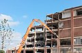
 Demolition in Keynsham - geograph.org.uk - 3241557.jpg 3.766 × 2.171; 667 KB
-
 Demolition of Cadburys in Somerdale, Keynsham - geograph.org.uk - 4649606.jpg 2.131 × 1.389; 1,74 MB
-
 Diamond plate - geograph.org.uk - 5562445.jpg 1.704 × 2.304; 2,38 MB
-
 Did you complete the whole route^ - geograph.org.uk - 5667242.jpg 1.704 × 2.304; 1,95 MB
-
 Dirt hairpin - geograph.org.uk - 5562455.jpg 2.304 × 1.704; 1,65 MB
-
 Do not climb - geograph.org.uk - 6152369.jpg 3.111 × 3.120; 2,67 MB
-
 Down Gooseberry Lane - geograph.org.uk - 5666882.jpg 1.704 × 2.304; 1,88 MB
-
 Drain emptying, south bank, River Avon - geograph.org.uk - 4486465.jpg 1.024 × 768; 206 KB
-
 Durley Hill House (geograph 5707618).jpg 2.903 × 1.677; 868 KB
-
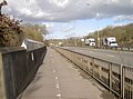
 Durley Hill Keynsham cycle path.jpg 5.184 × 3.456; 7,42 MB
-
 Durley Hill Keynsham in snow.jpg 5.184 × 3.456; 6,57 MB
-
 Durley Hill Keynsham in winter.jpg 5.184 × 3.456; 6,24 MB
-
 Durley Hill Overbridge - geograph.org.uk - 5685811.jpg 2.304 × 1.704; 1,51 MB
-
 Durley Hill, Keynsham - geograph.org.uk - 3175226.jpg 635 × 640; 112 KB
-
 Durley Park - geograph.org.uk - 5994431.jpg 1.024 × 577; 92 KB
-

-
 East of Keynsham from Manor Road - geograph.org.uk - 1267596.jpg 640 × 521; 124 KB
-
 Echo Bridge in Keynsham Memorial Park - panoramio.jpg 3.600 × 2.400; 9,47 MB
-

-
 Entrance to Hurn from Manor Road - geograph.org.uk - 5689624.jpg 2.304 × 1.704; 1,68 MB
-
 Entrance to Keynsham Cricket Club - geograph.org.uk - 5666899.jpg 2.304 × 1.704; 1,72 MB
-
 Entrance to Keynsham RFC - geograph.org.uk - 3175200.jpg 640 × 402; 83 KB
-
 Entrance to Scotland Lane - closed^ - geograph.org.uk - 1930209.jpg 2.304 × 1.704; 1,56 MB
-
 Entrance to the park from Dapps Hill - geograph.org.uk - 5666144.jpg 2.304 × 1.704; 1,73 MB
-
 Factory at Keynsham - geograph.org.uk - 3831652.jpg 1.200 × 803; 840 KB
-
 Factory by the railway - geograph.org.uk - 5322809.jpg 640 × 426; 66 KB
-
 Fair warning - geograph.org.uk - 5561732.jpg 1.704 × 2.304; 2,18 MB
-
 Fairholm glowing in the late afternoon - geograph.org.uk - 5615638.jpg 2.304 × 1.704; 1,6 MB
-

-
 Farmers' Market - geograph.org.uk - 2842256.jpg 2.304 × 1.704; 1,6 MB
-
 Farmland and wood near Queen Charlton - geograph.org.uk - 5707220.jpg 4.264 × 2.672; 2 MB
-
 Field in the Avon Valley - geograph.org.uk - 5994433.jpg 1.024 × 549; 59 KB
-
 Field next to the River Avon - geograph.org.uk - 2447330.jpg 1.500 × 1.000; 140 KB
-
 Fields north of Redlynch Lane - geograph.org.uk - 1269324.jpg 640 × 489; 116 KB
-
 Filling station. Keynsham - geograph.org.uk - 4947066.jpg 3.064 × 1.572; 825 KB
-
 Finishing construction of the new council buildings - geograph.org.uk - 3919434.jpg 2.560 × 1.920; 2,83 MB
-
 Fish pass, Keynsham - geograph.org.uk - 2096832.jpg 2.304 × 1.704; 1,8 MB
-
 Flooded recreation ground, Keynsham - geograph.org.uk - 3240241.jpg 640 × 281; 22 KB
-
 Footbridge across A4175 - geograph.org.uk - 2933877.jpg 1.024 × 678; 212 KB
-
 Footpath through Manor Road Community Woodlands - geograph.org.uk - 5690300.jpg 2.304 × 1.704; 1,6 MB
-
 Footpath to Queen Charlton - geograph.org.uk - 5703154.jpg 4.288 × 2.848; 1,79 MB


.jpg)


.jpg)


.jpg)


_-_geograph.org.uk_-_1742960.jpg)


.jpg)


