Category:Khabomai Islands
Zur Navigation springen
Zur Suche springen
English: Khabomai Islands
日本語: 歯舞群島
Русский: Хабомаи
Kurilen russische Kontrolle   | |||||
| Medium hochladen | |||||
| Ist ein(e) |
| ||||
|---|---|---|---|---|---|
| Ist Teil von |
| ||||
| Ort |
| ||||
| Liegt am oder im Gewässer | |||||
| Einwohnerzahl |
| ||||
 | |||||
Unterkategorien
Es werden 3 von insgesamt 3 Unterkategorien in dieser Kategorie angezeigt:
In Klammern die Anzahl der enthaltenen Kategorien (K), Seiten (S), Dateien (D)
Medien in der Kategorie „Khabomai Islands“
Folgende 54 Dateien sind in dieser Kategorie, von 54 insgesamt.
-
 Akiyuri island 01.jpg 450 × 351; 17 KB
-

-
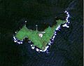
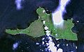
 Anuchina ISS cut.jpg 523 × 448; 68 KB
-
 Dyomina ISS cut.jpg 600 × 379; 62 KB
-
 Goyoumai Channel.JPG 3.072 × 2.048; 2 MB
-
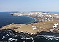
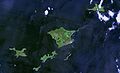 Habomai 01.jpg 1.244 × 758; 103 KB
-
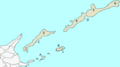
 Habomai Islands Relief Map, SRTM-1.jpg 1.600 × 1.200; 241 KB
-
 Habomai islands-demis.png 291 × 178; 5 KB
-
 Habomai Islands.JPG 1.000 × 630; 300 KB
-
 Habomai-islands PANORAMA.jpg 6.264 × 1.057; 3,5 MB
-
 Habomai-islands PANORAMA.png 6.264 × 1.057; 7,78 MB
-
 Habomai-islands.jpg 900 × 165; 135 KB
-
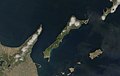
 Habomai-shoto Islands.JPG 3.488 × 2.616; 4,39 MB
-
 Habomai.PNG 384 × 215; 4 KB
-
 Harukari island 01.jpg 476 × 373; 19 KB
-
 Hokkaido Nemuro Br 16cl.GIF 768 × 429; 7 KB
-
 Hokkaido Nemuro Br 16cl.png 768 × 429; 6 KB
-
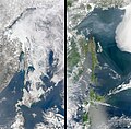
 Hokkaido Season Winter Summer 2008.png 6.216 × 1.968; 10,5 MB
-
 Hoppo.png 384 × 215; 4 KB
-
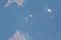
 ISS-39 Sea of Okhotsk.jpg 4.256 × 2.832; 2,66 MB
-
 ISS045-E-84012.JPG 4.928 × 3.280; 1,11 MB
-
 Kaigara island 01.jpg 537 × 375; 14 KB
-
 Kaigarajima lighthouse (cropped).png 1.012 × 655; 391 KB
-
 Kaigarajima lighthouse.png 2.560 × 1.920; 1,97 MB
-
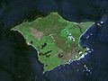
 Kunashir.jpg 987 × 628; 249 KB
-
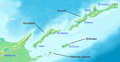 Kuril-Islands-Northern-Territories-of-Japan-Map.png 1.787 × 917; 415 KB
-
 Kuriles Habomai.PNG 365 × 235; 4 KB
-
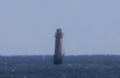
 Lighthouse on the of Kaigara island.jpg 800 × 575; 56 KB
-
 Lighthouse on the of Kaigara Island.jpg 640 × 402; 40 KB
-
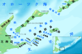 Map of Nemuro-Kunashiri Strait ja.svg 960 × 640; 538 KB
-
 North 4 islands.png 768 × 429; 13 KB
-
 Northern-Territories-of-Japan-Map-日本の北方領土の地図.png 1.787 × 917; 414 KB
-
 Odoke-shima.jpeg 200 × 150; 23 KB
-
 Odoke.jpg 400 × 430; 132 KB
-
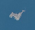
 Oskolki ISS cut.jpg 556 × 635; 110 KB
-
 Photo sights from Tanfilyev Island, Russia.jpg 700 × 525; 21 KB
-
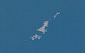
 Polonskogo ISS cut.jpg 1.027 × 769; 283 KB
-
 Sea of Okhotsk Season Winter Summer 2008.jpg 6.256 × 6.126; 8,89 MB
-
 Shibotsu 01.jpg 683 × 513; 45 KB
-
 Signalny Rock.jpg 2.592 × 1.944; 1,09 MB
-
 Taraku 01.jpg 735 × 457; 38 KB
-
 Todo island 01.jpg 389 × 268; 12 KB
-
 USA-M585-118.jpg 3.937 × 3.780; 474 KB
-
 USA-M585-119.jpg 3.937 × 3.780; 307 KB
-
 USA-M585-120.jpg 3.937 × 3.780; 786 KB
-
 USA-M585-121.jpg 3.937 × 3.780; 436 KB
-
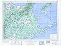 USSR map NK 55-1 Nemuro.jpg 5.000 × 3.801; 5,56 MB
-
 USSR map NK 55-2 Shikotan-tou.jpg 5.000 × 3.918; 1,97 MB
-
 Yuri island 01.jpg 797 × 546; 46 KB
-
 Yuri Island.jpg 550 × 390; 172 KB
-
 Yuriy ISS cut.jpg 724 × 572; 138 KB
-
 Zelyonyy ISS cut.jpg 1.093 × 961; 394 KB
-
 Малая Курыльская града.png 400 × 540; 25 KB
-
 Проливы Курильских островов Юг.png 1.146 × 780; 616 KB


.png)


