Category:Khunjerab Pass
Zur Navigation springen
Zur Suche springen
Gebirgspass, chinesisch-pakistanischer Grenzübergang   | |||||
| Medium hochladen | |||||
| Ist ein(e) | |||||
|---|---|---|---|---|---|
| Ist Teil von | |||||
| Ort |
| ||||
| Überführt | |||||
| Gebirgszug |
| ||||
| Höhe über dem Meeresspiegel |
| ||||
 | |||||
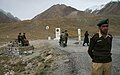
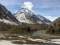
English: The Khunjerab Pass on the Karakoram Highway is a high mountain pass on the northern border of Pakistan and China. It peaks at 4,693 metres (15,397 ft) and makes the highest border crossing of the world. It is also the highest point on the Karakoram Highway. The name comes from the Wakhi for 'Blood Valley'.
Unterkategorien
Es werden 6 von insgesamt 6 Unterkategorien in dieser Kategorie angezeigt:
In Klammern die Anzahl der enthaltenen Kategorien (K), Seiten (S), Dateien (D)
E
- Enroute to Khunjerab Pass (5 D)
K
- Khunjerab Pass (North face) (1 D)
- Khunjerab Pass Checkpost (2 D)
T
- Trucks at Khunjerab Pass (2 D)
Y
- Yaks on Khunjerab Pass (4 D)
Medien in der Kategorie „Khunjerab Pass“
Folgende 7 Dateien sind in dieser Kategorie, von 7 insgesamt.
-
 2007 08 21 China Pakistan Karakoram Highway Khunjerab Pass IMG 7319.jpg 1.024 × 643; 436 KB
-
 2007 08 21 China Pakistan Karakoram Highway Khunjerab Pass IMG 7322.jpg 1.024 × 643; 449 KB
-
 2007 08 21 China Pakistan Karakoram Highway Khunjerab Pass IMG 7324.jpg 1.024 × 643; 358 KB
-
 2007 08 21 China Pakistan Karakoram Highway Khunjerab Pass IMG 7325.jpg 1.024 × 643; 358 KB
-
 KKH - Khunjerab Pass.jpg 2.868 × 2.152; 3,62 MB
-
 KKH to Khunjrab Pass.jpg 5.312 × 2.988; 4,87 MB
-
 Kkh7.jpg 16.800 × 12.600; 58,26 MB


