Category:Kilgetty
Vai alla navigazione
Vai alla ricerca
village in Pembrokeshire, United Kingdom  | |||||
| Carica un file multimediale | |||||
| Istanza di | |||||
|---|---|---|---|---|---|
| Luogo | Pembrokeshire, Galles | ||||
| sito web ufficiale | |||||
 | |||||
Cymraeg: Mae Cilgeti yn bentref mawr yn ne Sir Benfro, rhwng Dinbych-y-Pysgod ac Arberth. Saif ar y briffordd A477.
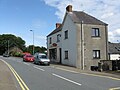
English: Kilgetty is a village near Tenby in Pembrokeshire, Wales. It lies at the crossing of the A477 road between St. Clears and Pembroke Dock and the A478 road between Tenby and Cardigan.
Sottocategorie
Questa categoria contiene un'unica sottocategoria, indicata di seguito.
K
- Kilgetty railway station (6 F)
File nella categoria "Kilgetty"
Questa categoria contiene 13 file, indicati di seguito, su un totale di 13.
-
 Kilgetty - Co-op Supermarket - geograph.org.uk - 1413142.jpg 640 × 480; 153 KB
-
 Kilgetty Post Office - geograph.org.uk - 1413144.jpg 640 × 480; 155 KB
-
 Kilgetty stone pic.jpg 2 048 × 1 360; 2,77 MB
-

-
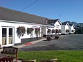 Martin James Health Club - geograph.org.uk - 444822.jpg 640 × 480; 85 KB
-
 Station Road Footpath - geograph.org.uk - 1413161.jpg 640 × 480; 222 KB
-
 White Horse, Kilgetty - geograph.org.uk - 5646351.jpg 800 × 795; 150 KB
-
 Approaching The Roundabout - geograph.org.uk - 1413167.jpg 640 × 480; 145 KB
-
 Ash Park - Main Section - geograph.org.uk - 1413140.jpg 640 × 480; 172 KB
-
 Ash Park - Top Section - geograph.org.uk - 1413135.jpg 640 × 480; 170 KB
-
 Crosslanes Corner - geograph.org.uk - 1413166.jpg 640 × 480; 251 KB
-
 End Of Station Road, Kilgetty - geograph.org.uk - 1413155.jpg 640 × 480; 173 KB
-
 Rail bridge near Saundersfoot station - geograph.org.uk - 509602.jpg 640 × 480; 69 KB


