Category:Kilkhampton
Aller à la navigation
Aller à la recherche
village britannique  | |||||
| Téléverser des médias | |||||
| Nature de l’élément | |||||
|---|---|---|---|---|---|
| Lieu | Cornouailles, Angleterre du Sud-Ouest, Angleterre | ||||
 | |||||
Sous-catégories
Cette catégorie comprend 9 sous-catégories, dont les 9 ci-dessous.
J
K
L
- The London Inn, Kilkhampton (2 F)
P
- Penstowe Castle (5 F)
S
- Sandymouth, Cornwall (13 F)
- Stowe Barton, Kilkhampton (7 F)
T
- Thurdon (1 F)
W
Média dans la catégorie « Kilkhampton »
Cette catégorie comprend 333 fichiers, dont les 200 ci-dessous.
(page précédente) (page suivante)-
 A sharp bend in the A39 south of Collation Farm - geograph.org.uk - 4917038.jpg 1 600 × 800 ; 151 kio
-
 A short stretch of the old road - geograph.org.uk - 5643856.jpg 1 102 × 1 469 ; 877 kio
-
 A stretch of the 'old road' - geograph.org.uk - 5642817.jpg 1 102 × 1 469 ; 827 kio
-
 A windy location - geograph.org.uk - 4141119.jpg 1 024 × 717 ; 125 kio
-
 A39 Atlantic Highway north of Collaton Farm - geograph.org.uk - 5570220.jpg 1 102 × 1 469 ; 553 kio
-
 A39 entering Kilkhampton - geograph.org.uk - 4107080.jpg 1 600 × 1 065 ; 505 kio
-
 A39 entering Kilkhampton seen from junction with B3254 - geograph.org.uk - 6256982.jpg 1 600 × 1 200 ; 758 kio
-
 A39 north of Kilkhampton - geograph.org.uk - 4107067.jpg 1 600 × 1 066 ; 284 kio
-
 Above Higher Northcott - geograph.org.uk - 3304700.jpg 640 × 480 ; 86 kio
-
 Access road to Hessaford Farm - geograph.org.uk - 6255943.jpg 1 600 × 1 199 ; 836 kio
-
 Access road to Lewdon Farm - geograph.org.uk - 6255940.jpg 1 600 × 1 200 ; 1,1 Mio
-
 Access to East Thorne Farm and camping - geograph.org.uk - 6256964.jpg 1 600 × 1 200 ; 941 kio
-
 Across the valley of the Neet towards Budges Farm - geograph.org.uk - 5631857.jpg 1 142 × 857 ; 416 kio
-
 Aerial picture of SS Belem shipwreck - geograph.org.uk - 5610321.jpg 1 920 × 1 080 ; 1,57 Mio
-
 Aerial picture of SS Belem shipwreck - geograph.org.uk - 5610323.jpg 1 920 × 1 080 ; 1,4 Mio
-
 Aerial picture of SS Belem shipwreck - geograph.org.uk - 5610328.jpg 1 920 × 1 080 ; 1,64 Mio
-
 Aldercombe Barton - geograph.org.uk - 407241.jpg 640 × 426 ; 115 kio
-
 Along the lane towards Stibb - geograph.org.uk - 5570227.jpg 1 469 × 1 102 ; 583 kio
-
 Angler's umbrella and chair, Upper Tamar Lake - geograph.org.uk - 410139.jpg 640 × 480 ; 67 kio
-
 Anglers at Upper Tamar Lake - geograph.org.uk - 404747.jpg 640 × 480 ; 171 kio
-
 Anglers on Upper Tamar Lake - geograph.org.uk - 410136.jpg 640 × 480 ; 73 kio
-
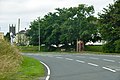
 Approaching Kilkhampton from the east - geograph.org.uk - 421530.jpg 640 × 426 ; 97 kio
-
 Archway into Stowe Barton - geograph.org.uk - 4915562.jpg 1 600 × 1 200 ; 514 kio
-
 At the entrance to Collery Farm - geograph.org.uk - 5570230.jpg 1 469 × 1 102 ; 547 kio
-
 B3254 at Hessaford Farm - geograph.org.uk - 6189994.jpg 3 264 × 1 832 ; 599 kio
-
 Beach at Sandy Mouth Bay - geograph.org.uk - 5641622.jpg 2 122 × 1 591 ; 553 kio
-
 Beach at Sandymouth (1989) - geograph.org.uk - 2108317.jpg 704 × 1 024 ; 207 kio
-
 Between Stratton and Stibb - geograph.org.uk - 2013954.jpg 1 638 × 1 462 ; 653 kio
-
 Bird hide beside Upper Tamar Lake - geograph.org.uk - 2982568.jpg 800 × 600 ; 324 kio
-
 Boiler from the SS Belem shipwreck - geograph.org.uk - 5610092.jpg 4 000 × 3 000 ; 5,17 Mio
-
 Bridge over the Lamberal Water - geograph.org.uk - 839471.jpg 480 × 640 ; 74 kio
-
 Bridleway and track to Killock Farm - geograph.org.uk - 5570217.jpg 1 102 × 1 469 ; 859 kio
-
 Brow of Scadghill - geograph.org.uk - 4141117.jpg 1 024 × 677 ; 111 kio
-
 Buildings at Scadghill Farm - geograph.org.uk - 5632959.jpg 1 306 × 979 ; 518 kio
-
 Carved Pew End, Kilkhampton church - geograph.org.uk - 3605817.jpg 1 740 × 2 850 ; 2,92 Mio
-
 Carved Pew, Kilkhampton church - geograph.org.uk - 3605843.jpg 3 696 × 2 448 ; 2,21 Mio
-
 Carving on south doorway, Kilkhampton Church - geograph.org.uk - 3605855.jpg 3 696 × 2 448 ; 2,24 Mio
-
 Cattle pasture by B3254 - geograph.org.uk - 6398043.jpg 3 264 × 1 832 ; 1,09 Mio
-
 Cattle pasture by the B3254 - geograph.org.uk - 6398015.jpg 3 264 × 1 832 ; 821 kio
-
 Cliffs at the back of Sandymouth Beach - geograph.org.uk - 5642594.jpg 1 346 × 1 795 ; 693 kio
-
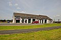
 Co-op supermarket, Kilkhampton - geograph.org.uk - 6257000.jpg 1 600 × 1 200 ; 732 kio
-
 Coast path north of Bude heading to Sandymouth - geograph.org.uk - 1006400.jpg 640 × 469 ; 168 kio
-
 Coastal Path - geograph.org.uk - 253727.jpg 640 × 426 ; 65 kio
-
 Collaton Farm trig point - geograph.org.uk - 5643886.jpg 1 102 × 1 469 ; 769 kio
-
 Contorted rock strata at Sandy Mouth Bay, near Bude, Cornwall - geograph.org.uk - 4718152.jpg 4 000 × 3 000 ; 4,9 Mio
-
 Coombe - geograph.org.uk - 2963675.jpg 640 × 480 ; 102 kio
-
 Coombe Valley above Duckpool.jpg 4 072 × 2 764 ; 6,47 Mio
-
 Coombe Valley looking east from King William's Bridge - geograph.org.uk - 4915547.jpg 1 600 × 1 200 ; 390 kio
-
 Coombe Valley looking west from King William's Bridge - geograph.org.uk - 4915545.jpg 1 600 × 1 200 ; 357 kio
-
 Cornwall , The A39 - geograph.org.uk - 4076658.jpg 4 288 × 2 848 ; 4,59 Mio
-
 Cornwall , The B3254 - geograph.org.uk - 4076711.jpg 4 288 × 2 848 ; 6,17 Mio
-
 Cottage at Kespit - geograph.org.uk - 5572219.jpg 1 469 × 1 102 ; 681 kio
-
 Cottages on the corner - geograph.org.uk - 1801186.jpg 640 × 480 ; 56 kio
-
 Country road south of Thurdon - geograph.org.uk - 5607722.jpg 1 024 × 768 ; 277 kio
-
 Curious cow - geograph.org.uk - 5570218.jpg 1 469 × 1 102 ; 644 kio
-
-
 Cycle track on northern end of Upper Tamar Lake - geograph.org.uk - 2982562.jpg 800 × 600 ; 393 kio
-
 Cycle track on west bank of Upper Tamar Lake - geograph.org.uk - 2982556.jpg 800 × 600 ; 341 kio
-
 Cycle track on west bank of Upper Tamar Lake - geograph.org.uk - 2982573.jpg 600 × 800 ; 350 kio
-
 Daft Dog makes a break for it - geograph.org.uk - 5641618.jpg 1 795 × 1 346 ; 400 kio
-
 Daft Dog tries to reach the SS Belem - geograph.org.uk - 5642579.jpg 1 795 × 1 346 ; 594 kio
-
 Dam and spillway of Upper Tamar Lake - geograph.org.uk - 2982614.jpg 600 × 800 ; 381 kio
-
 Dam on Upper Tamar Lake - geograph.org.uk - 410130.jpg 640 × 480 ; 209 kio
-
 Dipped rock strata at the back of Eliza Beach - geograph.org.uk - 5642591.jpg 1 346 × 1 795 ; 840 kio
-

-
 Drive to East Langford Farm - geograph.org.uk - 5607719.jpg 1 024 × 768 ; 256 kio
-
 Duckpool and Warren Point.jpg 4 064 × 2 816 ; 4,59 Mio
-
 Duckpool at low tide - geograph.org.uk - 6260156.jpg 1 600 × 1 200 ; 689 kio
-
 Dusk falls at Sandy Mouth - geograph.org.uk - 2011871.jpg 3 269 × 2 319 ; 2 Mio
-
 East Langford - geograph.org.uk - 2982537.jpg 800 × 600 ; 403 kio
-
 Empty shop, Kilkhampton - geograph.org.uk - 1367782.jpg 640 × 480 ; 91 kio
-
 Enjoying the sea - Duckpool - geograph.org.uk - 4134901.jpg 1 600 × 1 063 ; 467 kio
-
 Entrance and exit for Pentire Haven Holiday Park - geograph.org.uk - 4917006.jpg 1 600 × 800 ; 157 kio
-
 Entrance to Forda Holiday lodges and cottages - geograph.org.uk - 3598815.jpg 3 696 × 2 448 ; 2,33 Mio
-
 Entrance to Killock Farm Shop from the A39 - geograph.org.uk - 1512050.jpg 640 × 427 ; 53 kio
-
 Entrance to Pentire Haven Holiday Park - geograph.org.uk - 3597272.jpg 3 696 × 2 448 ; 2,24 Mio
-
 Entrance to recycling centre, Hartland Forest, by A39 - geograph.org.uk - 4917042.jpg 1 600 × 1 199 ; 379 kio
-
 Entrance track to Lower Pigsdon Farm - geograph.org.uk - 3599333.jpg 3 696 × 2 448 ; 2,31 Mio
-
 Farm at Forda, North Cornwall - geograph.org.uk - 1165290.jpg 640 × 480 ; 117 kio
-
 Farm track - geograph.org.uk - 5643858.jpg 1 469 × 1 102 ; 564 kio
-
 Farm track near Scadghill Farm - geograph.org.uk - 5632985.jpg 1 469 × 1 102 ; 594 kio
-

-
 Farmland near East Langford Farm - geograph.org.uk - 5607729.jpg 1 024 × 768 ; 248 kio
-
 Field above Hunthill Wood - geograph.org.uk - 5643862.jpg 1 469 × 1 102 ; 595 kio
-

-
 Field by the B3254 - geograph.org.uk - 6398007.jpg 3 238 × 1 738 ; 750 kio
-
 Fields by Killock Farm Shop - geograph.org.uk - 1512048.jpg 640 × 427 ; 78 kio
-
 Flags and sign for Pentire Haven Holiday Park - geograph.org.uk - 4917005.jpg 1 600 × 1 200 ; 174 kio
-
 Floodlit Kilkhampton church - geograph.org.uk - 5608896.jpg 1 024 × 768 ; 158 kio
-
 Flush Bracket on Collaton Trig - geograph.org.uk - 5643891.jpg 1 102 × 1 469 ; 874 kio
-
 Folded strata - Duckpool - geograph.org.uk - 4134877.jpg 1 600 × 1 063 ; 606 kio
-

-
 Footbridge between Tamar Lakes.jpg 3 692 × 2 704 ; 4,88 Mio
-
 Footpath across a meadow - geograph.org.uk - 2013661.jpg 3 648 × 2 736 ; 5,61 Mio
-
 Ford at Forda - geograph.org.uk - 4189071.jpg 3 872 × 2 592 ; 4,88 Mio
-
 Forda Holiday Accommodation - geograph.org.uk - 407269.jpg 640 × 426 ; 146 kio
-
 Forda House near Thurdon - geograph.org.uk - 421221.jpg 640 × 426 ; 95 kio
-
 Forda Lodges - geograph.org.uk - 5599116.jpg 800 × 600 ; 157 kio
-
 Former shortcut - geograph.org.uk - 5570223.jpg 1 469 × 1 102 ; 614 kio
-
 Gated off here - geograph.org.uk - 5643868.jpg 1 469 × 1 102 ; 589 kio
-
 Gateway on the farm track - geograph.org.uk - 5632988.jpg 1 469 × 1 102 ; 565 kio
-
 Gentle slope of Warren Point - geograph.org.uk - 4134896.jpg 1 024 × 680 ; 186 kio
-
 Gough (ofAldercombeKilkhampton) Arms.png 811 × 934 ; 155 kio
-
 Grass field off B3254 road - geograph.org.uk - 3597254.jpg 3 696 × 2 448 ; 2,25 Mio
-
 High Summer in North Cornwall - geograph.org.uk - 2013596.jpg 3 648 × 2 736 ; 5,04 Mio
-
 Holiday chalets at Penstowe Park - geograph.org.uk - 4411602.jpg 640 × 480 ; 178 kio
-
 Honeycomb worms at Northcott mouth beach - geograph.org.uk - 5610391.jpg 4 000 × 3 000 ; 5,11 Mio
-
 Honeycomb worms at Northcott mouth beach - geograph.org.uk - 5610396.jpg 4 000 × 3 000 ; 6,59 Mio
-
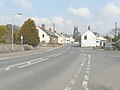
 House and traditional shop front, Kilkhampton - geograph.org.uk - 6256989.jpg 1 600 × 1 066 ; 673 kio
-
-
 Houses in Stibb - geograph.org.uk - 4916984.jpg 1 600 × 1 201 ; 247 kio
-
 I salute you sir - geograph.org.uk - 4141121.jpg 800 × 550 ; 92 kio
-
 Internal structure of a honeycomb worm colony - geograph.org.uk - 5642582.jpg 2 448 × 1 836 ; 2,08 Mio
-
 Kilkhampton , Bridgmans - geograph.org.uk - 4076649.jpg 4 288 × 2 848 ; 5,86 Mio
-
 Kilkhampton , Bridgmans Yard - geograph.org.uk - 4076651.jpg 4 288 × 2 848 ; 6,47 Mio
-
 Kilkhampton , Bridgmans Yard - geograph.org.uk - 4076681.jpg 4 288 × 2 848 ; 6,6 Mio
-
 Kilkhampton , Bridgmans Yard - geograph.org.uk - 4076686.jpg 4 288 × 2 848 ; 5,41 Mio
-
 Kilkhampton , Bridgmans Yard - geograph.org.uk - 4076689.jpg 4 288 × 2 848 ; 5,98 Mio
-
 Kilkhampton , Countryside Scenery - geograph.org.uk - 6399405.jpg 6 000 × 4 000 ; 6,35 Mio
-
 Kilkhampton , Grassy Field - geograph.org.uk - 6399408.jpg 6 000 × 4 000 ; 6,39 Mio
-
 Kilkhampton , Grassy Field - geograph.org.uk - 6399411.jpg 6 000 × 4 000 ; 6,69 Mio
-
 Kilkhampton , NCDC Wayside - geograph.org.uk - 2512442.jpg 4 286 × 2 846 ; 3,92 Mio
-
 Kilkhampton , North Close - geograph.org.uk - 6399410.jpg 5 471 × 3 647 ; 5,01 Mio
-
 Kilkhampton , The A39 - geograph.org.uk - 2512441.jpg 4 280 × 2 836 ; 4,22 Mio
-
 Kilkhampton , The A39 - geograph.org.uk - 4076661.jpg 4 288 × 2 848 ; 4,04 Mio
-
 Kilkhampton , The A39 - geograph.org.uk - 4076700.jpg 4 288 × 2 848 ; 6,78 Mio
-
 Kilkhampton from the east - geograph.org.uk - 3427166.jpg 963 × 699 ; 117 kio
-
 Kilkhampton Junior and Infant School - geograph.org.uk - 1801201.jpg 640 × 480 ; 69 kio
-
 Kilkhampton, St. James' Church - geograph.org.uk - 5744891.jpg 4 816 × 3 214 ; 4,32 Mio
-
 Kilkhampton, St. James' Church - geograph.org.uk - 5744894.jpg 5 500 × 3 670 ; 3,96 Mio
-
 Kilkhampton, St. James' Church, Norman south doorway (detail) 1 - geograph.org.uk - 5744913.jpg 7 016 × 4 681 ; 5,96 Mio
-
 Kilkhampton, St. James' Church, Norman south doorway - geograph.org.uk - 5744910.jpg 4 912 × 7 360 ; 7,1 Mio
-
 Kilkhampton, St. James' Church, The font 1 - geograph.org.uk - 5744900.jpg 4 065 × 6 089 ; 4,88 Mio
-
 Kilkhampton, St. James' Church, The font 2 - geograph.org.uk - 5744905.jpg 4 681 × 7 013 ; 6,3 Mio
-
 Kilkhampton, St. James' Church, The nave - geograph.org.uk - 5744897.jpg 7 360 × 4 912 ; 6,84 Mio
-
 Killock Farm Shop - geograph.org.uk - 1512049.jpg 640 × 427 ; 81 kio
-
 Landslips and unstable ground above Westpark beach - geograph.org.uk - 5642764.jpg 1 795 × 1 346 ; 765 kio
-
 Lane approaching Uppacott Cross - geograph.org.uk - 4141816.jpg 640 × 424 ; 69 kio
-
 Lane near Stowe Barton - geograph.org.uk - 4141123.jpg 800 × 503 ; 106 kio
-
 Lane near Taylor's Cross Farm - geograph.org.uk - 4105912.jpg 1 600 × 1 079 ; 581 kio
-
 Lane passing Stowe Barton - geograph.org.uk - 4141125.jpg 1 024 × 614 ; 145 kio
-
 Lane past Tamar Lake Farm - geograph.org.uk - 3598825.jpg 3 372 × 2 132 ; 4,62 Mio
-
 Lane to Hessaford Farm - geograph.org.uk - 6398065.jpg 3 264 × 1 832 ; 752 kio
-
 Lane to Youlstone Ham Bridge - geograph.org.uk - 4105942.jpg 1 600 × 1 124 ; 398 kio
-
 Lane towards the Tamar Lakes - geograph.org.uk - 3597264.jpg 3 696 × 2 448 ; 2,3 Mio
-
 Lay-by and access to Axford Farm, Kilkhampton - geograph.org.uk - 6257019.jpg 1 600 × 800 ; 492 kio
-
 Lay-by and picnic area on A39 near Collation Farm - geograph.org.uk - 4917017.jpg 1 600 × 1 200 ; 171 kio
-
 Lay-by and picnic area, A39 north of Kilkhampton - geograph.org.uk - 6257028.jpg 1 600 × 889 ; 501 kio
-
 Lewdon Farm - geograph.org.uk - 6398060.jpg 3 264 × 1 832 ; 775 kio
-
 Looking down the length of the shipwreck - geograph.org.uk - 5610360.jpg 4 000 × 3 000 ; 5,04 Mio
-
 Looking north along the A39 - geograph.org.uk - 3428717.jpg 979 × 734 ; 141 kio
-
 Looking north near Tiscott - geograph.org.uk - 5632955.jpg 1 469 × 1 102 ; 572 kio
-
 Looking towards the Coombe Valley - geograph.org.uk - 2013245.jpg 3 532 × 2 474 ; 3,69 Mio
-
 Low tide at Sandy Mouth - geograph.org.uk - 2011828.jpg 2 262 × 1 668 ; 1,28 Mio
-
 Low tide on Sandy Mouth Beach - geograph.org.uk - 5641620.jpg 2 122 × 1 591 ; 575 kio
-
 Low tide on Westpark Beach - geograph.org.uk - 5642595.jpg 2 122 × 1 591 ; 597 kio
-
 Meeting place for Christian worship, Kilkhampton - geograph.org.uk - 6257003.jpg 1 600 × 1 200 ; 828 kio
-
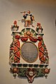
 Memorial to John Warmington, Kilkhampton church - geograph.org.uk - 3611248.jpg 1 976 × 2 712 ; 2,43 Mio
-
 Memorial to Sir Bevill Granville, Kilkhampton - geograph.org.uk - 3611198.jpg 2 052 × 3 048 ; 3,41 Mio
-
 Menachurch Point from the north - geograph.org.uk - 5642578.jpg 1 712 × 1 284 ; 659 kio
-
 Methodist Church, Kilkhampton - geograph.org.uk - 1367765.jpg 640 × 508 ; 108 kio
-
 Milestone - Bideford 18 - geograph.org.uk - 4346560.jpg 480 × 640 ; 132 kio
-
 Milestone - Bideford 19 - geograph.org.uk - 4346595.jpg 480 × 640 ; 149 kio
-
 Milestone and gate by B3254 - geograph.org.uk - 6397984.jpg 3 264 × 1 832 ; 1,12 Mio
-
 Minor road at Stursdon Cross - geograph.org.uk - 6257032.jpg 1 600 × 1 065 ; 613 kio
-
 Monument to John Courtis, Kilkhampton church - geograph.org.uk - 3611187.jpg 2 448 × 3 696 ; 2,19 Mio
-
 Monument to Rev. Joseph Coryndon, Kilkhampton church - geograph.org.uk - 3611220.jpg 2 448 × 3 696 ; 2,16 Mio
-
 Muddy track past Collaton Farm - geograph.org.uk - 5643875.jpg 1 469 × 1 102 ; 686 kio
-
 New Bridge over River Tamar - geograph.org.uk - 2982623.jpg 800 × 600 ; 528 kio
-
 North Cornwall , Cornish Flags - geograph.org.uk - 2512440.jpg 4 268 × 2 818 ; 3,91 Mio
-
 North Cornwall , Cows in a Field - geograph.org.uk - 2512437.jpg 4 288 × 2 848 ; 5,79 Mio
-
 North Cornwall , Field ^ Wind Turbine - geograph.org.uk - 2512443.jpg 4 094 × 2 518 ; 3,22 Mio
-
 Northcott Mouth from above - geograph.org.uk - 5642784.jpg 1 469 × 1 102 ; 677 kio
-
 Northcott mouth looking towards Bude - geograph.org.uk - 5610336.jpg 1 920 × 1 080 ; 1,19 Mio
-
 Northcott mouth looking towards Morwenstowe - geograph.org.uk - 5610341.jpg 1 920 × 1 080 ; 1,31 Mio
-
 Old Milestone by the A39 layby, Barnacott - geograph.org.uk - 5623146.jpg 640 × 444 ; 148 kio
-

-

-

-

-
 Old Milestone by the B3254, north of Rhude Cross - geograph.org.uk - 5623326.jpg 640 × 434 ; 122 kio
-
 Old Milestone by the old A39, north of Bush - geograph.org.uk - 5623148.jpg 1 124 × 1 778 ; 449 kio
-
 Old ^ strong - Duckpool - geograph.org.uk - 4134884.jpg 1 600 × 1 063 ; 589 kio
-
 On the coastpath above Long Rock - geograph.org.uk - 5642761.jpg 1 795 × 1 346 ; 720 kio
-
 On Warren Little Beach - geograph.org.uk - 5642581.jpg 2 122 × 1 591 ; 829 kio
-
 Ordnance Survey Cut Mark - geograph.org.uk - 4450464.jpg 480 × 640 ; 108 kio
-
 Ordnance Survey Cut Mark - geograph.org.uk - 4450471.jpg 480 × 640 ; 135 kio
-
 Ordnance Survey Flush Bracket (12015) - geograph.org.uk - 4450460.jpg 480 × 640 ; 98 kio
-
 Organ, St James the Great church, Kilkhampton - geograph.org.uk - 3611174.jpg 2 448 × 3 696 ; 2,13 Mio
-
 OS benchmark - Stibb, entrance to Collery Farm - geograph.org.uk - 5570232.jpg 979 × 1 306 ; 616 kio
-
 OS benchmark - Stibb, outbuilding at Scadghill Cottage - geograph.org.uk - 5572235.jpg 1 052 × 1 402 ; 716 kio
-
 OS benchmark - Stibb. Kespit Cottage - geograph.org.uk - 5572225.jpg 1 028 × 1 370 ; 760 kio
-
 Outflow from the Upper Tamar Lake - geograph.org.uk - 914825.jpg 640 × 606 ; 109 kio
-
 Parked up - geograph.org.uk - 2031848.jpg 640 × 480 ; 236 kio
-
 Parking ^ Picnic Area, A39 - geograph.org.uk - 4107072.jpg 1 600 × 1 065 ; 223 kio
-
 Passing Stursdon Farm - geograph.org.uk - 4100302.jpg 1 600 × 986 ; 182 kio
-
 Pasture near Thurdon - geograph.org.uk - 405527.jpg 640 × 480 ; 153 kio
-

-
 Penstowe Manor - geograph.org.uk - 4411605.jpg 640 × 480 ; 121 kio
-
 Penstowe Road, Kilkhampton - geograph.org.uk - 6256983.jpg 1 600 × 1 200 ; 1 002 kio


_-_geograph.org.uk_-_2108317.jpg)


_Arms.png)


_1_-_geograph.org.uk_-_5744913.jpg)


_-_geograph.org.uk_-_4450460.jpg)


_Castle_-_geograph.org.uk_-_407228.jpg)

