Category:Killearn
Aller à la navigation
Aller à la recherche
English: Killearn is a village in the Stirling council area of Scotland.
Deutsch: Killearn ist eine Ortschaft im Stirling council in Schottland.
village britannique  | |||||
| Téléverser des médias | |||||
| Nature de l’élément | |||||
|---|---|---|---|---|---|
| Lieu |
| ||||
| Population |
| ||||
 | |||||
Sous-catégories
Cette catégorie comprend 2 sous-catégories, dont les 2 ci-dessous.
B
- Buchanan Monument, Killearn (8 F)
D
- Dumgoyne railway station (2 F)
Média dans la catégorie « Killearn »
Cette catégorie comprend 63 fichiers, dont les 63 ci-dessous.
-
 Aqueduct across Kirkhouse Burn, Killearn - geograph.org.uk - 95172.jpg 640 × 480 ; 196 kio
-
 Arlehaven - geograph.org.uk - 80349.jpg 640 × 480 ; 141 kio
-
 Beech Tree Inn, near Dumgoyne - geograph.org.uk - 161110.jpg 640 × 480 ; 112 kio
-
 Dalnair Farm and Crow Hill - geograph.org.uk - 100051.jpg 640 × 426 ; 132 kio
-
 Garloch Hill cairn - geograph.org.uk - 250170.jpg 640 × 480 ; 90 kio
-
 Glengoyne Distillery (nearer) from the S-W - geograph.org.uk - 467184.jpg 640 × 478 ; 70 kio
-
 Glengoyne Distillery - geograph.org.uk - 446939.jpg 586 × 480 ; 227 kio
-
 Glengoyne Distillery - geograph.org.uk - 446947.jpg 480 × 640 ; 183 kio
-
 Glengoyne Distillery - geograph.org.uk - 9005.jpg 640 × 416 ; 49 kio
-
 Glengoyne Distillery from the S-W - geograph.org.uk - 460187.jpg 640 × 462 ; 78 kio
-
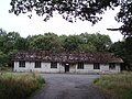
 Killearn Hospital ruins.jpg 2 304 × 1 728 ; 1,86 Mio
-
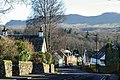 Killearn.jpg 640 × 427 ; 120 kio
-
 Milepost - geograph.org.uk - 578410.jpg 480 × 640 ; 119 kio
-
 Rowan Tree in Patterson's Glen - geograph.org.uk - 258699.jpg 640 × 480 ; 165 kio
-
 Telecom mast, Auchineden Hill - geograph.org.uk - 98846.jpg 640 × 480 ; 120 kio
-
 West Highland Way at Gartness - geograph.org.uk - 79059.jpg 640 × 480 ; 209 kio
-
 West Highland Way Near Dumgoyach - geograph.org.uk - 115645.jpg 640 × 480 ; 140 kio
-
 West Highland Way Near Dumgoyach - geograph.org.uk - 80357.jpg 640 × 480 ; 143 kio
-
 West Highland Way Near Dumgoyach - geograph.org.uk - 80362.jpg 640 × 480 ; 173 kio
-
 An old petrol pump opposite the Black Bull - geograph.org.uk - 1404644.jpg 640 × 480 ; 68 kio
-
 Auchenibert Lane - geograph.org.uk - 341479.jpg 640 × 480 ; 152 kio
-
 Ballagan Tops cairn - geograph.org.uk - 250175.jpg 640 × 480 ; 80 kio
-
 Blane Water Bridge - geograph.org.uk - 460191.jpg 640 × 475 ; 115 kio
-
 Blane Water Bridge - geograph.org.uk - 460202.jpg 640 × 474 ; 122 kio
-
 Blaneswell Pylons - geograph.org.uk - 341482.jpg 640 × 480 ; 59 kio
-
 Bridge Damage - geograph.org.uk - 460193.jpg 640 × 468 ; 123 kio
-
 Cairn Conservatories, near Dumgoyne - geograph.org.uk - 161122.jpg 640 × 480 ; 98 kio
-
 Car park at the Queen's View - geograph.org.uk - 1498450.jpg 640 × 480 ; 108 kio
-
 Carston Farm - geograph.org.uk - 341489.jpg 640 × 480 ; 102 kio
-
 Clachertyfarlie Knowes - geograph.org.uk - 178496.jpg 640 × 480 ; 36 kio
-
 Derelict Buildings - geograph.org.uk - 214464.jpg 640 × 480 ; 148 kio
-
 Drymen Road at Stockiemuir - geograph.org.uk - 148805.jpg 640 × 480 ; 127 kio
-
 Drymen Road at Stockiemuir - geograph.org.uk - 323453.jpg 640 × 480 ; 90 kio
-
 Dumgoyne from Blairgar - geograph.org.uk - 739059.jpg 640 × 480 ; 105 kio
-
 Dumgoyne Woodland - geograph.org.uk - 467193.jpg 546 × 640 ; 95 kio
-
 Ford over the Machar Burn - geograph.org.uk - 393761.jpg 640 × 480 ; 108 kio
-
 Glengoyne - geograph.org.uk - 446972.jpg 640 × 429 ; 346 kio
-
 Glengoyne - geograph.org.uk - 446974.jpg 640 × 480 ; 363 kio
-
 Heron's Court - geograph.org.uk - 341468.jpg 640 × 480 ; 118 kio
-
 High Lettre Farm, Killearn - geograph.org.uk - 95169.jpg 640 × 480 ; 157 kio
-
 Katrine Aqueduct at Killearn - geograph.org.uk - 341474.jpg 640 × 480 ; 145 kio
-
 Killearn church - geograph.org.uk - 40348.jpg 640 × 480 ; 132 kio
-
 Killearn Churches on Remembrance Sunday - geograph.org.uk - 79053.jpg 640 × 480 ; 143 kio
-
 Landing strip - geograph.org.uk - 323017.jpg 640 × 480 ; 96 kio
-
 Last House in Killearn - geograph.org.uk - 79051.jpg 640 × 480 ; 144 kio
-
 Moorland track - geograph.org.uk - 393731.jpg 480 × 640 ; 92 kio
-
 Moorland wall - geograph.org.uk - 393793.jpg 640 × 480 ; 84 kio
-
 Moss Bridge, near Dumgoyne - geograph.org.uk - 161114.jpg 640 × 480 ; 158 kio
-
 Parish Church - geograph.org.uk - 429928.jpg 640 × 429 ; 131 kio
-
 Quinloch Cattle - geograph.org.uk - 460197.jpg 640 × 469 ; 87 kio
-
 Rough Track from Campsies to Killearn - geograph.org.uk - 258713.jpg 640 × 480 ; 119 kio
-
 Single Tree - geograph.org.uk - 461163.jpg 640 × 480 ; 103 kio
-
 Summit of Garloch Hill - geograph.org.uk - 258718.jpg 640 × 480 ; 91 kio
-
 The Whangie - geograph.org.uk - 40341.jpg 640 × 480 ; 138 kio
-
 Towards Quinloch - geograph.org.uk - 460196.jpg 640 × 477 ; 109 kio
-
 Track above the Machar Burn - geograph.org.uk - 393816.jpg 640 × 480 ; 96 kio
-
 Track and woodland at the edge of Machar Glen - geograph.org.uk - 393749.jpg 640 × 480 ; 103 kio
-
 Track to Little Caldon - geograph.org.uk - 336197.jpg 640 × 480 ; 112 kio
-
 Track to Meikle Caldon - geograph.org.uk - 336192.jpg 640 × 480 ; 117 kio
-
 View from Ballagan Tops down Ballagan Burn - geograph.org.uk - 250181.jpg 640 × 480 ; 65 kio
-
 Wall at a stream crossing in rough moorland - geograph.org.uk - 393776.jpg 640 × 480 ; 82 kio
-
 West Highland Way looking North West - geograph.org.uk - 460184.jpg 640 × 457 ; 69 kio
-
 West Highland Way looking South East - geograph.org.uk - 460181.jpg 640 × 464 ; 102 kio


_from_the_S-W_-_geograph.org.uk_-_467184.jpg)


