Category:Killington, Cumbria
Vai alla navigazione
Vai alla ricerca
village and civil parish in Cumbria, UK  | |||||
| Carica un file multimediale | |||||
| Istanza di | |||||
|---|---|---|---|---|---|
| Luogo | South Lakeland, Cumbria, Nord Ovest dell'Inghilterra, Inghilterra | ||||
 | |||||
Sottocategorie
Questa categoria contiene le 2 sottocategorie indicate di seguito, su un totale di 2.
A
B
File nella categoria "Killington, Cumbria"
Questa categoria contiene 200 file, indicati di seguito, su un totale di 218.
(pagina precedente) (pagina successiva)-
 'Light Oaks' - geograph.org.uk - 3534449.jpg 1 024 × 683; 181 KB
-
 'Nether House' - geograph.org.uk - 3579066.jpg 1 024 × 683; 183 KB
-
 A new stile - geograph.org.uk - 748372.jpg 480 × 640; 109 KB
-
 A684 - geograph.org.uk - 3167539.jpg 640 × 360; 205 KB
-
 A684 at Black Horse - geograph.org.uk - 4005823.jpg 640 × 431; 66 KB
-
 A684 below Awshaw Hill - geograph.org.uk - 4005831.jpg 640 × 290; 73 KB
-
 A684-footpath junction near Lilymere - geograph.org.uk - 1885511.jpg 1 024 × 768; 303 KB
-
 Aikrigg - geograph.org.uk - 2297766.jpg 640 × 480; 110 KB
-
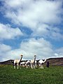 Alpacas at Greenholme - geograph.org.uk - 2439638.jpg 600 × 800; 112 KB
-
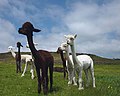 Alpacas at Greenholme - geograph.org.uk - 2441100.jpg 800 × 643; 135 KB
-
 Armistead wind farm - geograph.org.uk - 6274281.jpg 1 280 × 720; 391 KB
-
 Armistead wind farm - geograph.org.uk - 6275888.jpg 1 280 × 1 280; 1,08 MB
-
 Armitstead wind farm spoiling the view - geograph.org.uk - 4087293.jpg 651 × 480; 105 KB
-
 Bank and dry stone wall beside Old Scotch Road - geograph.org.uk - 3533168.jpg 683 × 1 024; 247 KB
-
 Barn at Aikrigg - geograph.org.uk - 3533140.jpg 1 024 × 683; 183 KB
-
 Barn at High Stangerthwaite - geograph.org.uk - 2439780.jpg 640 × 480; 158 KB
-
 Barn off track above Aikrigg - geograph.org.uk - 3579573.jpg 1 024 × 683; 186 KB
-
 Beck House - geograph.org.uk - 2298487.jpg 640 × 480; 72 KB
-
 Beck House - geograph.org.uk - 4523020.jpg 4 732 × 2 750; 1,82 MB
-
 Beech tree beside hill road - geograph.org.uk - 956509.jpg 480 × 640; 146 KB
-
 Bench mark, barn corner at Aikrigg - geograph.org.uk - 2297760.jpg 480 × 640; 143 KB
-
 Bench mark, barn corner at Aikrigg - geograph.org.uk - 2298409.jpg 480 × 640; 150 KB
-
 Bench mark, gatepost at Hallbeck - geograph.org.uk - 2298444.jpg 640 × 480; 138 KB
-
 Bench mark, Killington Reservoir House - geograph.org.uk - 2954634.jpg 480 × 640; 176 KB
-
 Benchmark on 'Light Oaks' - geograph.org.uk - 3534416.jpg 683 × 1 024; 255 KB
-
 Benchmark on 'Nether House' - geograph.org.uk - 3579059.jpg 683 × 1 024; 344 KB
-

-
 Benchmark on barn above Aikrigg - geograph.org.uk - 3579562.jpg 668 × 1 024; 307 KB
-
 Benchmark on barn at Aikrigg - geograph.org.uk - 3533134.jpg 683 × 1 024; 266 KB
-
 Benchmark on corner of sheepfold - geograph.org.uk - 3533594.jpg 683 × 1 024; 253 KB
-
 Benchmark on discarded gatepost lying in field - geograph.org.uk - 3578101.jpg 683 × 1 024; 357 KB
-

-
 Benchmark on gatepost at Springs Wood - geograph.org.uk - 3532843.jpg 683 × 1 024; 218 KB
-

-
 Benchmark on gatepost near Fell View bungalow - geograph.org.uk - 3579079.jpg 683 × 1 024; 282 KB
-
 Benchmark on gatepost on Old Scotch Road - geograph.org.uk - 3533147.jpg 683 × 1 024; 279 KB
-
 Benchmark on Lily Mere House outbuilding - geograph.org.uk - 2744257.jpg 1 024 × 576; 270 KB
-
 Benchmark on outbuilding at Ghyllhouse Style - geograph.org.uk - 1894118.jpg 1 024 × 768; 290 KB
-
 Benchmark on parapet of Killington New Bridge - geograph.org.uk - 3534486.jpg 1 024 × 683; 326 KB
-

-
 Benchmark on rock beside track above Beckside - geograph.org.uk - 3579480.jpg 1 024 × 683; 288 KB
-

-

-
 Benchmark on stone in wall west of Killington - geograph.org.uk - 3532809.jpg 683 × 1 024; 324 KB
-
 Benchmark on stone in wall, Old Scotch Road - geograph.org.uk - 3533681.jpg 1 024 × 683; 356 KB
-
 Benchmark on Three Mile House - geograph.org.uk - 3533053.jpg 683 × 1 024; 260 KB
-
 Benchmark on wall at Capplethwaite Moss - geograph.org.uk - 1852053.jpg 1 024 × 768; 360 KB
-

-
 Benchmark on wall of Old Scotch Road - geograph.org.uk - 3532954.jpg 683 × 1 024; 306 KB
-

-
 Benchmark on wall stone by Corner Plantation - geograph.org.uk - 3532887.jpg 683 × 1 024; 298 KB
-
 Benchmark, Ghyll House Stile barn - geograph.org.uk - 1927091.jpg 1 024 × 768; 298 KB
-
 Benchmark, Nether House, Killington - geograph.org.uk - 2439823.jpg 640 × 480; 206 KB
-

-
 Benchmarked rock on NW side of Old Scotch Road - geograph.org.uk - 3533167.jpg 1 024 × 683; 380 KB
-
 Black Horse - geograph.org.uk - 3382501.jpg 3 872 × 2 592; 3,22 MB
-
 Black Horse - geograph.org.uk - 405251.jpg 640 × 480; 210 KB
-
 Black Horse - geograph.org.uk - 4493820.jpg 4 310 × 2 265; 4,73 MB
-
 Black Horse - geograph.org.uk - 5052856.jpg 5 063 × 3 072; 1,87 MB
-
 Bluebells on Hodgson's Hill - geograph.org.uk - 2439637.jpg 600 × 800; 206 KB
-
 Bowersike House - geograph.org.uk - 2318537.jpg 640 × 480; 44 KB
-
 Bowersike, benchmark - geograph.org.uk - 1904789.jpg 1 024 × 768; 155 KB
-
 Breathe in^ - geograph.org.uk - 5052860.jpg 3 901 × 3 234; 1,62 MB
-
 Bridge on A684 over Cappelthwaite Beck - geograph.org.uk - 1893589.jpg 1 024 × 768; 299 KB
-
 Burn out of Lily Mere - geograph.org.uk - 947027.jpg 640 × 480; 164 KB
-
 By the Priestfield Beck - geograph.org.uk - 3167531.jpg 640 × 360; 225 KB
-
 Cappelthwaite Beck bridge - geograph.org.uk - 1893570.jpg 1 024 × 768; 276 KB
-
 Capplethwaite - geograph.org.uk - 3167544.jpg 640 × 360; 236 KB
-
 Capplethwaite Hall from Shackla Bank - geograph.org.uk - 3382490.jpg 3 872 × 2 592; 4,06 MB
-
 Capplethwaite Moss - geograph.org.uk - 1852044.jpg 1 024 × 768; 183 KB
-
 Carved names by the Lune at Hallbeck - geograph.org.uk - 2298471.jpg 640 × 480; 173 KB
-
 Conifer plantation on Greenham Moss - geograph.org.uk - 2439543.jpg 640 × 480; 93 KB
-
 Cottage at Broad Raine - geograph.org.uk - 2439815.jpg 640 × 480; 130 KB
-
 Cotton grass above Priestfield Wood - geograph.org.uk - 2442277.jpg 720 × 960; 297 KB
-
 Country lane south of Cover Plantation - geograph.org.uk - 3532927.jpg 1 024 × 683; 380 KB
-
 Cutting the grass crop at Killington - geograph.org.uk - 2439641.jpg 640 × 480; 148 KB
-

-

-
 Dry stone wall on road south of Beck House - geograph.org.uk - 3579662.jpg 1 024 × 683; 264 KB
-
 Dry stone wall on side of road to Aikrigg - geograph.org.uk - 3533123.jpg 1 024 × 683; 354 KB
-
 Drybeck Moss with Killington Reservoir beyond - geograph.org.uk - 4494164.jpg 2 509 × 1 699; 2,42 MB
-
 East from the Old Scotch Road - geograph.org.uk - 2297717.jpg 640 × 480; 130 KB
-
 Entrance to Drybeck - geograph.org.uk - 3579687.jpg 1 024 × 683; 307 KB
-
 Entrance to Lilymere House - geograph.org.uk - 1890796.jpg 640 × 480; 147 KB
-
 Farm near Priestfield Beck - geograph.org.uk - 4494175.jpg 3 335 × 2 075; 2,88 MB
-
 Farmland near Grassrigg - geograph.org.uk - 5501704.jpg 640 × 425; 127 KB
-
 Fields near Lily Mere - geograph.org.uk - 2078064.jpg 640 × 480; 107 KB
-
 Footpath above Greenholme - geograph.org.uk - 4505205.jpg 800 × 600; 160 KB
-
 Footpath crossing the A684 - geograph.org.uk - 3191993.jpg 3 872 × 2 592; 3,57 MB
-
 Ford, Burns Beck - geograph.org.uk - 1512028.jpg 640 × 489; 250 KB
-
 Forest boundary, Old Park - geograph.org.uk - 947036.jpg 640 × 480; 106 KB
-
 Gateway at footpath to Audlands - geograph.org.uk - 3533656.jpg 1 024 × 683; 268 KB
-
 Gateway into Burns Beck Moss Nature Reserve - geograph.org.uk - 3533159.jpg 1 024 × 683; 211 KB
-
 Gateway south of 'Fell View' bungalow - geograph.org.uk - 3579105.jpg 1 024 × 683; 263 KB
-
 Ghyll Farm - geograph.org.uk - 2439879.jpg 640 × 480; 150 KB
-
 Ghyll Farm - geograph.org.uk - 2734564.jpg 3 888 × 2 448; 1,33 MB
-
 Grass crop at Stangerthwaite, Killington - geograph.org.uk - 2439790.jpg 640 × 480; 117 KB
-
 Green Park Hill (246m) - geograph.org.uk - 2288409.jpg 640 × 480; 68 KB
-
 Green Park Hill - geograph.org.uk - 4354107.jpg 640 × 480; 66 KB
-
 Greenholme - geograph.org.uk - 2439640.jpg 640 × 480; 84 KB
-
 Greenholme - geograph.org.uk - 4505214.jpg 640 × 480; 126 KB
-
 Hallbeck - geograph.org.uk - 5052862.jpg 4 952 × 3 456; 1,79 MB
-
 Harprigg - geograph.org.uk - 2298852.jpg 640 × 480; 74 KB
-
 Hills Quarry (disused) - geograph.org.uk - 2297736.jpg 640 × 495; 151 KB
-
 Hillside below Kirkbank - geograph.org.uk - 3382509.jpg 3 872 × 2 592; 4,34 MB
-
 Junction at southwest end of Old Scotch Road - geograph.org.uk - 3533689.jpg 1 024 × 683; 213 KB
-
 Killington Hall.jpg 640 × 487; 145 KB
-
 Killington Lake - geograph.org.uk - 225962.jpg 640 × 429; 39 KB
-

-
 Killington New Bridge - geograph.org.uk - 1202250.jpg 640 × 480; 188 KB
-
 Killington New Bridge - geograph.org.uk - 2318530.jpg 640 × 480; 71 KB
-
 Killington New Bridge ^ River Lune - geograph.org.uk - 3654834.jpg 4 272 × 2 848; 7,42 MB
-
 Killington Reservoir - geograph.org.uk - 2954173.jpg 640 × 480; 95 KB
-
 Killington Reservoir - geograph.org.uk - 5287233.jpg 4 557 × 3 033; 7,74 MB
-
 Killington Reservoir - geograph.org.uk - 5287679.jpg 4 186 × 2 786; 5,48 MB
-

-
 Killington Village Cumbria - geograph.org.uk - 150928.jpg 640 × 439; 340 KB
-
 Killington, New Bridge benchmark - geograph.org.uk - 1904735.jpg 640 × 480; 100 KB
-

-
 Lay-by A684 - geograph.org.uk - 2254356.jpg 640 × 480; 44 KB
-
 Lily Mere - geograph.org.uk - 2254346.jpg 640 × 480; 98 KB
-
 Lily Mere through the trees - geograph.org.uk - 3382517.jpg 3 872 × 2 592; 6,55 MB
-
 Lilymere, benchmark on wall - geograph.org.uk - 1885074.jpg 1 024 × 768; 294 KB
-
 Lodge House - Lily Mere Estate - geograph.org.uk - 4494181.jpg 2 572 × 1 760; 2,11 MB
-
 Logging road, Old Park - geograph.org.uk - 947046.jpg 640 × 480; 106 KB
-
 Looking across the valley of Priestfield Beck - geograph.org.uk - 5845844.jpg 1 600 × 1 067; 349 KB
-
 Low Hallbeck - geograph.org.uk - 5052863.jpg 5 184 × 2 789; 1,91 MB
-
 Low Harprigg - geograph.org.uk - 2298526.jpg 640 × 480; 92 KB
-
 Low Stangerthwaite - geograph.org.uk - 2439784.jpg 640 × 480; 136 KB
-
 Meadows near Killington - geograph.org.uk - 2441108.jpg 800 × 600; 153 KB
-
 Middleton Fell and the Lune Valley - geograph.org.uk - 2298404.jpg 640 × 480; 85 KB
-
 Mill on the River Lune - geograph.org.uk - 1512030.jpg 640 × 480; 226 KB
-
 Minor road approaching Killington Bridge - geograph.org.uk - 3579035.jpg 1 024 × 683; 294 KB
-
 Moorland track, Owshaw - geograph.org.uk - 3165386.jpg 640 × 360; 240 KB
-
 New Park and Tarn Moss - geograph.org.uk - 2439531.jpg 640 × 480; 94 KB
-
 New plantation on Capplethwaite Moss - geograph.org.uk - 3380660.jpg 3 872 × 2 592; 3,03 MB
-
 North parapet of Killington New Bridge - geograph.org.uk - 3534553.jpg 1 024 × 683; 282 KB
-

-

-
 Old Scotch Road - geograph.org.uk - 3382535.jpg 3 872 × 2 592; 4,12 MB
-
 Old Scotch Road - geograph.org.uk - 3644076.jpg 640 × 480; 100 KB
-
 Old Scotch Road - geograph.org.uk - 3644087.jpg 640 × 480; 75 KB
-
 Old Scotch Road - geograph.org.uk - 947055.jpg 640 × 480; 81 KB
-
 Old Scotch Road at junction with footpath - geograph.org.uk - 3533036.jpg 1 024 × 683; 179 KB
-
 Old Scotch Road south of Stone Park - geograph.org.uk - 3533222.jpg 1 024 × 683; 238 KB
-
 Park Hill - geograph.org.uk - 2298846.jpg 640 × 480; 149 KB
-
 Pasture near White Hall - geograph.org.uk - 2439851.jpg 705 × 480; 84 KB
-
 Pasture north of Killington New Bridge - geograph.org.uk - 2439847.jpg 800 × 600; 181 KB
-
 Pastures south of Harprigg - geograph.org.uk - 2298838.jpg 640 × 480; 74 KB
-
 Path approaching Killington Reservoir - geograph.org.uk - 3382526.jpg 3 872 × 2 592; 4,77 MB
-
 Path on Tarn Moss - geograph.org.uk - 3382519.jpg 3 872 × 2 592; 6,56 MB
-
 Ponies, Killington - geograph.org.uk - 947030.jpg 640 × 480; 96 KB
-
 Pool, Old Park - geograph.org.uk - 947034.jpg 480 × 640; 124 KB
-
 Private fishing at the head of Killington Reservoir - geograph.org.uk - 3382529.jpg 3 872 × 2 592; 4,84 MB
-

-
 Recently made track on New Park - geograph.org.uk - 4505184.jpg 640 × 480; 97 KB
-
 Renovation of outbuilding on Lily Mere Estate - geograph.org.uk - 2744264.jpg 576 × 1 024; 197 KB
-
 Returns box, Killington - geograph.org.uk - 947023.jpg 480 × 640; 119 KB
-
-
 Road going west from Killington - geograph.org.uk - 3532828.jpg 1 024 × 683; 342 KB
-
 Road south of Springs Wood - geograph.org.uk - 3532864.jpg 1 024 × 683; 347 KB
-
 Road to Killington and larch wood - geograph.org.uk - 956511.jpg 640 × 480; 108 KB
-
 Roadside hedge south of entrance to Beck House - geograph.org.uk - 3579635.jpg 1 024 × 683; 311 KB
-
 Roadsign and Swarther Plantation - geograph.org.uk - 955030.jpg 640 × 480; 71 KB
-
 Rough Fell sheep near Lily Mere - geograph.org.uk - 2439533.jpg 640 × 480; 126 KB
-
 Ruined pele tower, Killington Hall - geograph.org.uk - 2439662.jpg 480 × 640; 197 KB
-
 Ruined pele tower, Killington Hall - geograph.org.uk - 2439770.jpg 640 × 480; 135 KB
-
 Sailing club jetty, Killington Reservoir - geograph.org.uk - 2954184.jpg 640 × 480; 102 KB
-
 Scotch Jeans Climb - geograph.org.uk - 4494168.jpg 3 469 × 2 850; 4,08 MB
-
 Sheep grazing land, Gillsmere Sike - geograph.org.uk - 2297729.jpg 640 × 480; 103 KB
-

-
 Sheepfold beside minor road - geograph.org.uk - 3533611.jpg 1 024 × 683; 241 KB
-
 Signpost at Killington crossroads - geograph.org.uk - 6232724.jpg 1 024 × 1 024; 498 KB
-
 Signpost at the Black Horse - geograph.org.uk - 3382497.jpg 3 872 × 2 592; 5,43 MB
-
 Small stream on Capplethwaite Moss - geograph.org.uk - 3380661.jpg 3 872 × 2 592; 5,49 MB
-
 Start of footpath to Lily Mere House - geograph.org.uk - 5845841.jpg 1 600 × 1 067; 448 KB
-
 Start of the climb from Killington - geograph.org.uk - 6232726.jpg 1 024 × 768; 327 KB
-
 Stone Park - geograph.org.uk - 947051.jpg 640 × 480; 106 KB
-
 Stone Park - geograph.org.uk - 947052.jpg 640 × 480; 158 KB
-
 Tarn Moss - geograph.org.uk - 3382514.jpg 3 872 × 2 592; 4,9 MB
-
 Tarneybank Tarn - geograph.org.uk - 2297730.jpg 640 × 480; 111 KB
-

-
 The bridleway at Owshaw - geograph.org.uk - 2439516.jpg 640 × 480; 108 KB
-
 The builders are in at Lily Mere House - geograph.org.uk - 2954267.jpg 632 × 640; 138 KB
-
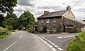
 The cross roads at the Black Horse - geograph.org.uk - 3058136.jpg 640 × 481; 95 KB
-
 The footpath to Greenholme - geograph.org.uk - 2439541.jpg 640 × 480; 74 KB
-
 The former Black Horse at Killington - geograph.org.uk - 6232716.jpg 1 024 × 768; 196 KB
-
 The Howgills from the A684 - geograph.org.uk - 2139936.jpg 640 × 419; 56 KB
-
 The lane to Aikrigg - geograph.org.uk - 2297755.jpg 640 × 480; 149 KB
-
 The Lune at Hallbeck - geograph.org.uk - 2298454.jpg 640 × 480; 146 KB
-
 The Old Scotch Road at Three Mile House - geograph.org.uk - 2297746.jpg 640 × 480; 111 KB
-
 The outlets of Killington Reservoir - geograph.org.uk - 2954179.jpg 640 × 480; 105 KB
-
 The path above Hall Beck near Killington - geograph.org.uk - 2298433.jpg 640 × 480; 204 KB
-
 The Priestfield Beck - geograph.org.uk - 3167537.jpg 640 × 360; 217 KB
-

-
 The River Lune near Broad Raine - geograph.org.uk - 2439795.jpg 640 × 480; 144 KB
-
 The upper reaches of Burns Beck - geograph.org.uk - 2297725.jpg 640 × 480; 95 KB
-
 The valley of Burns Beck - geograph.org.uk - 2297741.jpg 640 × 480; 142 KB
-
 The view from Kirkbank (254m) - geograph.org.uk - 4505190.jpg 800 × 600; 120 KB
-
 Three Mile House - geograph.org.uk - 3533092.jpg 1 024 × 683; 171 KB


_-_geograph.org.uk_-_2288409.jpg)


_-_geograph.org.uk_-_2297736.jpg)


.jpg)


_-_geograph.org.uk_-_4505190.jpg)
