Category:Killylea
Vai alla navigazione
Vai alla ricerca
English: Killylea is a small village in County Armagh, Northern Ireland, to the west of Armagh. In the 2001 Census it had a population of 219 people. It is situated within the Armagh City and District Council area. The village is set on a hill, with St. Mark’s Church of Ireland, built in 1832, at its summit.
village in the United Kingdom  | |||||
| Carica un file multimediale | |||||
| Istanza di | |||||
|---|---|---|---|---|---|
| Luogo | Irlanda del Nord | ||||
 | |||||
File nella categoria "Killylea"
Questa categoria contiene 50 file, indicati di seguito, su un totale di 50.
-
 Arch, Killylea - geograph.org.uk - 3033731.jpg 640 × 480; 66 KB
-
 Church buildings, Killylea - geograph.org.uk - 3033726.jpg 640 × 480; 44 KB
-
 Digby's Bar, Killylea - geograph.org.uk - 3033716.jpg 640 × 480; 56 KB
-
 Digby's Restaurant, Killylea - geograph.org.uk - 3033711.jpg 640 × 480; 55 KB
-
 Killylea, County Armagh - geograph.org.uk - 607031.jpg 640 × 396; 47 KB
-
 Main Street, Killylea - geograph.org.uk - 3033693.jpg 640 × 480; 36 KB
-
 Main Street, Killylea - geograph.org.uk - 3033718.jpg 640 × 480; 47 KB
-
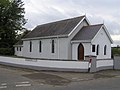
 Methodist Church, Killylea - geograph.org.uk - 3033733.jpg 640 × 480; 45 KB
-
 Orange Hall, Killylea - geograph.org.uk - 3033724.jpg 640 × 480; 41 KB
-
 Spar, Killylea - geograph.org.uk - 3033696.jpg 640 × 480; 44 KB
-
 St Mark's Church Hall - geograph.org.uk - 3033734.jpg 640 × 480; 63 KB
-
 St Mark's Church hall, Killylea - geograph.org.uk - 3033722.jpg 640 × 480; 48 KB
-
 St Mark's Church of Ireland - geograph.org.uk - 3033691.jpg 640 × 480; 43 KB
-
 St Mark's Parish Church, Killylea - geograph.org.uk - 106633.jpg 593 × 445; 107 KB
-
 Toilets, Killylea - geograph.org.uk - 3033729.jpg 640 × 480; 63 KB
-
 Tullycallidy Townland - geograph.org.uk - 618156.jpg 640 × 479; 67 KB
-
 Cormeen Orange Hall - geograph.org.uk - 618157.jpg 640 × 479; 46 KB
-
 Cows at Tonnagh - geograph.org.uk - 606968.jpg 640 × 479; 79 KB
-
 Darton Townland - geograph.org.uk - 607045.jpg 640 × 278; 38 KB
-
 Drum Townland - geograph.org.uk - 606983.jpg 640 × 479; 69 KB
-
 Drumgar Townland - geograph.org.uk - 606979.jpg 640 × 479; 69 KB
-
 Drumsallen Primary School - geograph.org.uk - 600649.jpg 640 × 479; 59 KB
-
 Hemp Hill - geograph.org.uk - 607499.jpg 640 × 479; 58 KB
-

-
 Kennedies townland - geograph.org.uk - 607049.jpg 640 × 479; 62 KB
-
 Killylea Road, County Armagh - geograph.org.uk - 614732.jpg 640 × 479; 59 KB
-
 Killymaddy Methodist Hall - geograph.org.uk - 600661.jpg 640 × 479; 47 KB
-
 Knockaneagh Townland - geograph.org.uk - 607514.jpg 640 × 479; 62 KB
-
 Knockaneagh Townland - geograph.org.uk - 607517.jpg 640 × 479; 56 KB
-
 Lisdown Road - geograph.org.uk - 606958.jpg 640 × 479; 65 KB
-
 Lisdown Townland - geograph.org.uk - 606960.jpg 640 × 479; 60 KB
-
 Lisdrum Townland - geograph.org.uk - 606971.jpg 640 × 287; 38 KB
-
 Lisdrum Townland - geograph.org.uk - 606972.jpg 640 × 479; 47 KB
-
 Lissagally Townland - geograph.org.uk - 618152.jpg 640 × 479; 80 KB
-
 Lissagally Townland - geograph.org.uk - 618153.jpg 640 × 479; 66 KB
-
 Naul Road, Drumgar - geograph.org.uk - 606976.jpg 640 × 479; 63 KB
-
 Near Drum Hill - geograph.org.uk - 607041.jpg 640 × 479; 85 KB
-
 Near Killylea - geograph.org.uk - 607037.jpg 640 × 479; 54 KB
-
 Pigs at gate entrance, Tonnagh - geograph.org.uk - 606964.jpg 640 × 479; 77 KB
-
 Purple Star Orange Hall - geograph.org.uk - 617802.jpg 640 × 479; 83 KB
-
 Purple Star Orange Hall - geograph.org.uk - 617806.jpg 640 × 479; 61 KB
-
 Road at Drumsallan - geograph.org.uk - 600655.jpg 640 × 479; 55 KB
-
 Road at Killylea - geograph.org.uk - 607033.jpg 640 × 479; 78 KB
-
 Road at Killylea - geograph.org.uk - 614729.jpg 640 × 479; 79 KB
-
 Road at The Hollow - geograph.org.uk - 618159.jpg 640 × 479; 63 KB
-
 Road at Tonnagh - geograph.org.uk - 606967.jpg 640 × 291; 32 KB
-
 Road near Drumhill - geograph.org.uk - 607039.jpg 640 × 479; 62 KB
-
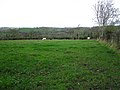
 Sheep near the Hollow - geograph.org.uk - 618162.jpg 640 × 479; 52 KB
-

-
 Tonnagh Townland - geograph.org.uk - 606963.jpg 640 × 479; 54 KB


