Category:Kilree Monastic Site
Aller à la navigation
Aller à la recherche

|
Cet objet est indexé dans l’ Archaeological Survey of Ireland (étude archéologique d’Irlande) sous le numéro SMR N° KK027-044001-
Système d’information géographique du National Monuments Service: Historic Environment Viewer – Base de données. |
|
|
Cet objet est indexé dans l’ Archaeological Survey of Ireland (étude archéologique d’Irlande) sous le numéro SMR N° KK027-044003-
Système d’information géographique du National Monuments Service: Historic Environment Viewer – Base de données. |
|
|
Cet objet est indexé dans l’ Archaeological Survey of Ireland (étude archéologique d’Irlande) sous le numéro SMR N° KK027-044004-
Système d’information géographique du National Monuments Service: Historic Environment Viewer – Base de données. |
monastère en ruines situé en Irlande  | |||||
| Téléverser des médias | |||||
| Nature de l’élément | |||||
|---|---|---|---|---|---|
| Lieu | comté de Kilkenny, Leinster, Irlande | ||||
| Statut patrimonial | |||||
 | |||||
Sous-catégories
Cette catégorie comprend 3 sous-catégories, dont les 3 ci-dessous.
K
- Kilree High cross (4 F)
- Kilree Round tower (14 F)
Média dans la catégorie « Kilree Monastic Site »
Cette catégorie comprend 24 fichiers, dont les 24 ci-dessous.
-
 Buttresses supporting the west gable wall of St Brigid's Church - geograph.org.uk - 4295074.jpg 2 000 × 1 500 ; 1,5 Mio
-
 Cross in Kilree graveyard 2023-10-08.jpg 2 604 × 4 554 ; 4,58 Mio
-
 Footpath to the ruined church and round tower, Kilree - geograph.org.uk - 4179681.jpg 3 072 × 2 304 ; 3,41 Mio
-
 Killree1.jpg 900 × 675 ; 158 kio
-
 Killree2.jpg 675 × 900 ; 105 kio
-
 Killree3.jpg 900 × 675 ; 202 kio
-
 Kilree Church & Round Tower.jpg 801 × 1 200 ; 409 kio
-
 Kilree Church 1.jpg 1 200 × 801 ; 515 kio
-
 Kilree Church 2.jpg 1 200 × 801 ; 523 kio
-
 Kilree Church 2017 09 13.jpg 3 423 × 2 282 ; 7,49 Mio
-
 Kilree Church II 2017 09 13.jpg 3 504 × 2 336 ; 8,44 Mio
-
 Kilree High Cross & Round Tower.jpg 1 200 × 800 ; 394 kio
-
 Kilree High Cross.jpg 1 200 × 805 ; 863 kio
-
 Kilree Round Tower and Church 2017 09 13.jpg 3 344 × 2 120 ; 6,3 Mio
-
 Kilree round tower.jpg 1 280 × 960 ; 1,09 Mio
-
 Kilree ruined church and round tower - geograph.org.uk - 4179636.jpg 2 000 × 1 500 ; 1,2 Mio
-
 Kilree.jpg 3 888 × 2 592 ; 3,93 Mio
-
 KilreeMonastery.jpg 4 608 × 3 440 ; 9,92 Mio
-
 M9 Northbound near Bennettsbridge - geograph.org.uk - 6092345.jpg 800 × 600 ; 592 kio
-
 Scottish and Irish Architecture 528.jpg 2 367 × 3 650 ; 1,08 Mio
-
 Side of tomb in St Brigid's Church - geograph.org.uk - 4295109.jpg 2 000 × 1 402 ; 1,45 Mio
-
 Southbound M9 near Bennettsbridge - geograph.org.uk - 6092344.jpg 800 × 600 ; 509 kio
-
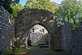
 The chancel arch, St Brigid's Church - geograph.org.uk - 4295099.jpg 2 000 × 1 483 ; 1,61 Mio
-
 The M9 Northbound towards junction 8 - geograph.org.uk - 4794788.jpg 1 200 × 799 ; 250 kio


Catégories :
- Objects of County Kilkenny recorded in the Archaeological Survey of Ireland with known IDs
- Kells, County Kilkenny
- Monasteries in County Kilkenny
- Ruins of Romanesque churches in Ireland
- Round towers in Ireland
- High crosses in Ireland
- Cultural heritage monuments in County Kilkenny
- Early Irish Monasteries
- 10th-century churches in Ireland
- 12th-century churches in Ireland
- Ruins of churches in County Kilkenny