Category:Kingsclere
Vai alla navigazione
Vai alla ricerca
village and civil parish in the county of Hampshire, England  Eglwys y Santes Fair, Kingsclere | |||||
| Carica un file multimediale | |||||
| Istanza di | |||||
|---|---|---|---|---|---|
| Luogo | Basingstoke and Deane, Hampshire, Sud Est dell'Inghilterra, Inghilterra | ||||
| Popolazione |
| ||||
| Considerato essere uguale a | Kingsclere (pagina Wikimedia duplicata, parrocchia civile dell'Inghilterra) | ||||
 | |||||
English: Kingsclere is a large village and civil parish in the county of Hampshire, England. Kingsclere is located near to Watership Down, the setting of Richard Adams' 1972 novel Watership Down.
Sottocategorie
Questa categoria contiene le 4 sottocategorie indicate di seguito, su un totale di 4.
K
- Kingsclere Methodist Chapel (4 F)
P
- Pubs in Kingsclere (10 F)
File nella categoria "Kingsclere"
Questa categoria contiene 200 file, indicati di seguito, su un totale di 453.
(pagina precedente) (pagina successiva)-
 "Portway" Roman Road - geograph.org.uk - 98465.jpg 640 × 481; 24 KB
-
 "The Old Post Office", Kingsclere - geograph.org.uk - 3046567.jpg 640 × 415; 106 KB
-
 20 Swan Street.jpg 408 × 272; 72 KB
-
 A new wood emerges - geograph.org.uk - 2782449.jpg 640 × 480; 101 KB
-
 A room with a view^ - geograph.org.uk - 1947547.jpg 1 600 × 900; 354 KB
-
 A seldom used byway - geograph.org.uk - 3465912.jpg 640 × 425; 88 KB
-
 A tight stile - geograph.org.uk - 3711415.jpg 640 × 425; 155 KB
-
 A wide range of greens - geograph.org.uk - 3711349.jpg 640 × 425; 122 KB
-
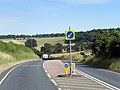
 A339 - direction Basingstoke - geograph.org.uk - 3466511.jpg 640 × 425; 59 KB
-
 A339 - geograph.org.uk - 4815810.jpg 640 × 192; 32 KB
-
 A339 - geograph.org.uk - 4815812.jpg 640 × 324; 44 KB
-
 A339 - geograph.org.uk - 4815814.jpg 640 × 184; 29 KB
-
 A339 - geograph.org.uk - 4815816.jpg 587 × 640; 61 KB
-
 A339 - Hannington turning - geograph.org.uk - 2350557.jpg 640 × 474; 66 KB
-
 A339 - Kingsclere - geograph.org.uk - 1822732.jpg 800 × 598; 85 KB
-
 A339 - north of Kingsclere - geograph.org.uk - 2583615.jpg 640 × 392; 53 KB
-
 A339 at Newbury Road roundabout - geograph.org.uk - 3105406.jpg 640 × 480; 62 KB
-
 A339 at The Star Inn - geograph.org.uk - 3105402.jpg 640 × 480; 67 KB
-
 A339 by-passing Kingsclere - geograph.org.uk - 1822730.jpg 800 × 603; 97 KB
-
 A339 east of Dorrel Wood - geograph.org.uk - 3105418.jpg 640 × 481; 57 KB
-
 A339 looking east - geograph.org.uk - 3105410.jpg 640 × 480; 68 KB
-
 A339 near Cottismore Farm - geograph.org.uk - 3105399.jpg 640 × 480; 58 KB
-
 A339 near Kingsclere - geograph.org.uk - 4151628.jpg 640 × 480; 314 KB
-
 A339 near Kingsclere - geograph.org.uk - 4815809.jpg 640 × 416; 59 KB
-
 A339 near Wolverton - geograph.org.uk - 3105416.jpg 640 × 481; 75 KB
-
 A339 near Wolverton - geograph.org.uk - 4151662.jpg 640 × 480; 345 KB
-
 A339 north of Kingsclere - geograph.org.uk - 4198547.jpg 640 × 480; 259 KB
-
 A339 south of Wolverton - geograph.org.uk - 2915296.jpg 3 426 × 2 520; 1 016 KB
-
 A339 Southbound - geograph.org.uk - 4151681.jpg 640 × 480; 260 KB
-
 A339 west of Home Farm - geograph.org.uk - 2915276.jpg 3 515 × 2 452; 1,19 MB
-
 A339 west of Pitchorn Farm - geograph.org.uk - 3630729.jpg 640 × 446; 65 KB
-
 A339, Coneygrove Copse - geograph.org.uk - 4151667.jpg 640 × 427; 270 KB
-
 A339, crossroads - geograph.org.uk - 2795753.jpg 640 × 377; 41 KB
-
 A339, Eastbound near Wolverton - geograph.org.uk - 4198518.jpg 640 × 480; 282 KB
-
 A339, Kingsclere bypass - geograph.org.uk - 4815811.jpg 640 × 415; 71 KB
-
 A339, southbound - geograph.org.uk - 4815806.jpg 640 × 342; 39 KB
-
 A339, southbound - geograph.org.uk - 4815817.jpg 640 × 354; 43 KB
-
 A339, southbound - geograph.org.uk - 4815819.jpg 640 × 438; 55 KB
-
 A339, turning for Kingsclere - geograph.org.uk - 2795749.jpg 640 × 409; 33 KB
-
 A339, turning for Kingsclere - geograph.org.uk - 2795752.jpg 640 × 416; 55 KB
-
 A339, turning for Wolverton - geograph.org.uk - 2795744.jpg 640 × 480; 66 KB
-
 A339, Wolverton - geograph.org.uk - 4151665.jpg 640 × 480; 370 KB
-
 Above Kingsclere - geograph.org.uk - 361079.jpg 640 × 477; 88 KB
-
 Access track ^ footpath - geograph.org.uk - 5344896.jpg 640 × 433; 103 KB
-
 Across the fields to Cannon Heath Farm - geograph.org.uk - 98464.jpg 640 × 481; 35 KB
-
 Approaching Isle Copse - geograph.org.uk - 3857904.jpg 640 × 399; 72 KB
-

-
 Arable fields above Cannon Heath Farm - geograph.org.uk - 2862129.jpg 640 × 427; 184 KB
-
 Ascending Cannon Heath Down - geograph.org.uk - 5977724.jpg 1 024 × 683; 231 KB
-
 Autumnal view from the downs above Kingsclere.jpg 3 264 × 2 448; 3,54 MB
-
 B3051 - White Hill - geograph.org.uk - 2755895.jpg 800 × 600; 131 KB
-
 B3051 junction with the A339 - geograph.org.uk - 2792551.jpg 3 648 × 2 736; 1,74 MB
-
 B3051 northeast of Kingsclere - geograph.org.uk - 2792088.jpg 3 368 × 2 392; 1,49 MB
-
 B3051 south of Kingsclere - geograph.org.uk - 2792567.jpg 2 970 × 2 198; 1,4 MB
-
 B3051 starts its descent of White Hill - geograph.org.uk - 2792575.jpg 3 425 × 2 442; 976 KB
-
 Basingstoke Road - Kingsclere - geograph.org.uk - 1822715.jpg 800 × 600; 86 KB
-
 Below Freemantle Park Down - geograph.org.uk - 2755939.jpg 640 × 427; 196 KB
-

-
 Block of flats on Strokins Road, Kingsclere, Hampshire, UK, April 2015.jpg 3 008 × 2 000; 2,53 MB
-
 Bloom - George Street - geograph.org.uk - 1822697.jpg 800 × 600; 98 KB
-

-
 Bridleway towards Kingsclere - geograph.org.uk - 2755240.jpg 640 × 420; 208 KB
-
 Building on Winchester Road - geograph.org.uk - 4417918.jpg 800 × 533; 87 KB
-
 Bus shelter on George Street - geograph.org.uk - 3047349.jpg 640 × 427; 122 KB
-
 Bus shelter on George Street - geograph.org.uk - 3047358.jpg 640 × 427; 91 KB
-
 Byway on Week Down - geograph.org.uk - 3465916.jpg 640 × 425; 70 KB
-
 Byway on Week Down - geograph.org.uk - 3465920.jpg 640 × 425; 61 KB
-
 Cannon Avenue by Nuthanger Down - geograph.org.uk - 5617260.jpg 3 264 × 2 448; 4,26 MB
-
 Cannon Avenue Hanger on Watership Down - geograph.org.uk - 5369707.jpg 4 608 × 3 456; 3,42 MB
-
 Cannon Heath Cottages - geograph.org.uk - 1822651.jpg 800 × 551; 91 KB
-
 Cannon Heath Cottages. - geograph.org.uk - 4427526.jpg 640 × 480; 77 KB
-
 Cannon Heath Down - geograph.org.uk - 5977730.jpg 1 024 × 683; 195 KB
-
 Catts Farm, Kingsclere, Newbury, design by H. Launcelot Fedden, in The Building News, July 31, 1908.jpg 14 031 × 10 200; 23,73 MB
-
 Cereal crop alongside the A339 - geograph.org.uk - 3465925.jpg 640 × 425; 68 KB
-
 Cereal crop by the A339 - geograph.org.uk - 3465918.jpg 640 × 425; 75 KB
-
 Chemists in Swan Street - geograph.org.uk - 3342466.jpg 640 × 480; 83 KB
-
 Choice of ways - Cottington's Hill - geograph.org.uk - 2764226.jpg 640 × 480; 96 KB
-
 Clinker's Copse - geograph.org.uk - 173561.jpg 640 × 480; 139 KB
-
 Combe above Kingsclere - geograph.org.uk - 361085.jpg 640 × 477; 85 KB
-
 Coppice Road - geograph.org.uk - 3046776.jpg 640 × 418; 108 KB
-
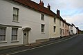 Cottages on George Street - geograph.org.uk - 3046478.jpg 640 × 427; 62 KB
-
 Country lane, Kingsclere, Hampshire - geograph.org.uk - 4841485.jpg 648 × 800; 146 KB
-
 Country lane, Wolverton, Hampshire - geograph.org.uk - 4817328.jpg 573 × 640; 184 KB
-
 Countryside directions - geograph.org.uk - 1822646.jpg 800 × 545; 54 KB
-
 Crabbs Hill - A339 - geograph.org.uk - 2583752.jpg 640 × 421; 104 KB
-
 Crossing the A339 - geograph.org.uk - 3469221.jpg 640 × 425; 61 KB
-
 Cycling into Kingsclere - geograph.org.uk - 1822690.jpg 800 × 531; 92 KB
-
 Defiant tree - geograph.org.uk - 3465873.jpg 640 × 425; 66 KB
-
 Diamond Geezer - geograph.org.uk - 2391576.jpg 2 560 × 1 920; 2,33 MB
-
 Dirty white fence - Rectory Lane - geograph.org.uk - 2755901.jpg 800 × 600; 135 KB
-
 Distant view of Dorrel Wood - geograph.org.uk - 3466419.jpg 640 × 425; 77 KB
-
 Distinct wireless tower - geograph.org.uk - 2754495.jpg 1 024 × 768; 113 KB
-
 Downland, Kingsclere - geograph.org.uk - 910910.jpg 640 × 480; 144 KB
-
 Drake's Brewery, Kingsclere - geograph.org.uk - 4262605.jpg 1 600 × 1 086; 402 KB
-
 Eastern edge of a Park Pale - geograph.org.uk - 2764221.jpg 640 × 480; 83 KB
-
 Edge of Cottington's Hill - geograph.org.uk - 2764175.jpg 640 × 480; 90 KB
-
 Edge of Sandford Wood - geograph.org.uk - 2782499.jpg 640 × 480; 108 KB
-
 Edge of the planted area - geograph.org.uk - 3466409.jpg 640 × 425; 74 KB
-
 Elm Grove, Kingsclere, Hampshire, April 2015.jpg 3 008 × 2 000; 3,07 MB
-
 Emerging winter crop - geograph.org.uk - 2762938.jpg 640 × 480; 95 KB
-
 Emerging winter crop - geograph.org.uk - 3711174.jpg 640 × 425; 98 KB
-
 Enjoying the Wayfarer's Walk - geograph.org.uk - 1822667.jpg 1 024 × 768; 147 KB
-
 Entering Sandford Wood - geograph.org.uk - 2782505.jpg 640 × 480; 97 KB
-

-
 Farm road going east to the B3051 - geograph.org.uk - 4415993.jpg 640 × 427; 51 KB
-
 Farm track ^ footpath - geograph.org.uk - 3711177.jpg 640 × 425; 116 KB
-
 Farm track ^ footpath - geograph.org.uk - 3711179.jpg 640 × 425; 122 KB
-
 Farmland by the A339 - geograph.org.uk - 3466415.jpg 640 × 425; 63 KB
-
 Farmland by the A339 - geograph.org.uk - 3466420.jpg 640 × 425; 69 KB
-
 Farmland by the A339 - geograph.org.uk - 3466425.jpg 640 × 425; 84 KB
-
 Farmland north of Harridens Little Copse - geograph.org.uk - 3711345.jpg 640 × 425; 107 KB
-
 Farmland north of Harridens Little Copse - geograph.org.uk - 3711351.jpg 640 × 425; 128 KB
-
 Farmland south of the A339 - geograph.org.uk - 3465867.jpg 640 × 425; 55 KB
-
 Farmland south of the A339 - geograph.org.uk - 3465891.jpg 640 × 425; 69 KB
-
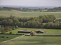
 Farmland, Kingsclere - geograph.org.uk - 1835297.jpg 640 × 480; 129 KB
-
 Farmland, Kingsclere - geograph.org.uk - 1835377.jpg 640 × 480; 132 KB
-
 Farmland, Kingsclere - geograph.org.uk - 1835486.jpg 640 × 480; 158 KB
-
 Farmland, Kingsclere - geograph.org.uk - 1835499.jpg 640 × 480; 154 KB
-
 Farmland, Kingsclere - geograph.org.uk - 6108296.jpg 1 024 × 768; 213 KB
-
 Farmland, Kingsclere - geograph.org.uk - 6108312.jpg 1 024 × 768; 259 KB
-
 Farmland, Kingsclere - geograph.org.uk - 910925.jpg 640 × 480; 139 KB
-
 Farmland, Wolverton, Hampshire - geograph.org.uk - 4810288.jpg 800 × 523; 112 KB
-
 Fast going on the gallops - geograph.org.uk - 4419404.jpg 800 × 533; 65 KB
-
 Fawconer Road - geograph.org.uk - 4428431.jpg 640 × 480; 81 KB
-

-
 Fenced woodland - Cottington's Hill - geograph.org.uk - 2764229.jpg 640 × 480; 124 KB
-
 Field atop Plantation Hill - geograph.org.uk - 2755897.jpg 640 × 480; 80 KB
-
 Field Barn Farm - geograph.org.uk - 173579.jpg 640 × 480; 118 KB
-

-
 Field by Harridens Great Copse - geograph.org.uk - 3711399.jpg 640 × 425; 92 KB
-
 Field corner - Cottington's Hill - geograph.org.uk - 2764179.jpg 640 × 480; 92 KB
-
 Fields by Ailey Lands Copse - geograph.org.uk - 3711176.jpg 640 × 425; 110 KB
-
 Fields by Dean's Plantation - geograph.org.uk - 3711181.jpg 640 × 425; 108 KB
-
 Fields by Long Copse - geograph.org.uk - 3711175.jpg 640 × 425; 105 KB
-
 Fields by the road to Kinsgclere - geograph.org.uk - 5988027.jpg 1 920 × 1 280; 1,03 MB
-
 Fields east of Summerhurst Farm - geograph.org.uk - 3712638.jpg 640 × 425; 100 KB
-
 Fields near Summerhurst Farm - geograph.org.uk - 3711409.jpg 640 × 425; 101 KB
-
 Fields next to Robley Belt - geograph.org.uk - 4427177.jpg 640 × 480; 56 KB
-
 Fields north of Little Knowl Road - geograph.org.uk - 3711171.jpg 640 × 425; 129 KB
-
 Fields, hedge and horizon - geograph.org.uk - 5977754.jpg 1 024 × 683; 209 KB
-
 Fingerpost at the central crossroads of Kingsclere - geograph.org.uk - 3048584.jpg 1 600 × 1 067; 285 KB
-
 Fingerposts on Fox's Lane, Kingsclere - geograph.org.uk - 4881276.jpg 2 048 × 1 536; 1,5 MB
-
 Footpath below Freemantle Park Down - geograph.org.uk - 2755945.jpg 640 × 427; 267 KB
-
 Footpath by gallops approaches road - geograph.org.uk - 4419610.jpg 800 × 533; 131 KB
-
 Footpath by Watchbury Copse - geograph.org.uk - 3706723.jpg 800 × 603; 171 KB
-
 Footpath crossing of racehorse gallops - geograph.org.uk - 4385333.jpg 640 × 480; 172 KB
-
 Footpath going north to gallop - geograph.org.uk - 4417956.jpg 800 × 600; 142 KB
-

-
 Footpath on Cottington's Hill - geograph.org.uk - 2754469.jpg 800 × 600; 212 KB
-
 Footpath reaches road west of Kingsclere - geograph.org.uk - 4419615.jpg 800 × 533; 138 KB
-

-
 Footpath takes right turn at gallops - geograph.org.uk - 4416004.jpg 640 × 427; 102 KB
-
 Footpath to access land - geograph.org.uk - 4417226.jpg 800 × 533; 164 KB
-
 Footpath to Gaily Mill - geograph.org.uk - 4416591.jpg 800 × 533; 145 KB
-
 Footpath toward Strokings Farm - geograph.org.uk - 3048529.jpg 640 × 427; 99 KB
-

-
 Forest track - Sandford Wood - geograph.org.uk - 2782502.jpg 640 × 480; 75 KB
-
 Fox's Lane heading to Sydmonton - geograph.org.uk - 4914479.jpg 1 996 × 1 466; 852 KB
-
 Frith Common - Sandford Woods - geograph.org.uk - 2781880.jpg 640 × 480; 75 KB
-
 Gaily Mill Kingsclere - geograph.org.uk - 5599064.jpg 3 648 × 2 736; 2,01 MB
-
 Gaily Mill Kingsclere - geograph.org.uk - 5599068.jpg 3 648 × 2 736; 1,48 MB
-

-
 Gallops near Kingsclere - geograph.org.uk - 5616601.jpg 3 264 × 2 448; 4,75 MB
-
 Gallops on Cannon Heath Down - geograph.org.uk - 361215.jpg 640 × 477; 84 KB
-
 Gallops on Watership Down - geograph.org.uk - 5616811.jpg 3 264 × 2 448; 4,51 MB
-
 Gallops, Watership Down - geograph.org.uk - 5369577.jpg 4 608 × 3 456; 4,61 MB
-
 Gar Ho, Chinese food in Kingsclere, August 2014.jpg 3 008 × 2 000; 2,1 MB
-

-

-
 George St, Kingsclere - geograph.org.uk - 6444032.jpg 1 800 × 1 200; 385 KB
-
 George Street - geograph.org.uk - 2792558.jpg 3 648 × 2 524; 1,39 MB
-

-
 George Street, Kingsclere - geograph.org.uk - 3048570.jpg 640 × 427; 87 KB
-
 George Street, Kingsclere - geograph.org.uk - 4232003.jpg 1 432 × 1 062; 397 KB
-
 George Street, Kingsclere.jpg 3 896 × 2 693; 7,23 MB
-
 Golf green and farmland, Wolverton - geograph.org.uk - 1775430.jpg 640 × 480; 94 KB
-
 Grass track south west of Kingsclere - geograph.org.uk - 4416584.jpg 800 × 533; 161 KB
-
 Green on Swan Street, Kingsclere - geograph.org.uk - 4914452.jpg 2 048 × 1 536; 1,52 MB
-
 Grit bin at Wolverton Plantation - geograph.org.uk - 2755246.jpg 640 × 427; 211 KB
-
 Half hidden farm barn - geograph.org.uk - 3706769.jpg 800 × 531; 195 KB
-

-
 Harridens Little Copse - geograph.org.uk - 3711185.jpg 640 × 425; 132 KB
-
 Harrow Way at the junction of Kingsclere Road - geograph.org.uk - 5986389.jpg 1 920 × 1 280; 1,17 MB
-
 Hint of a footpath - geograph.org.uk - 3465924.jpg 640 × 425; 74 KB
-
 Hotel in Swan Street - geograph.org.uk - 3342462.jpg 640 × 480; 79 KB
-

-
 Houses on Swan Street, Kingsclere - geograph.org.uk - 4881322.jpg 2 048 × 1 536; 1,48 MB
-
 I'm about to get soaked - geograph.org.uk - 3712622.jpg 640 × 425; 82 KB
-
 I'm surprised - (Mud on Road) - geograph.org.uk - 3857909.jpg 1 024 × 626; 158 KB
-
 I'm taller ^ have more power^ - geograph.org.uk - 3711413.jpg 640 × 433; 97 KB
-
 Junction of Rectory Lane and Hollowshoot Lane - geograph.org.uk - 2545527.jpg 3 648 × 2 538; 1,62 MB
-
 Junction of Swan and George Streets - geograph.org.uk - 3499677.jpg 800 × 600; 108 KB
-
 Junction of Swan St and Bear Hill - geograph.org.uk - 4428422.jpg 640 × 480; 79 KB
-
 Junction of the B3051 and A339 - geograph.org.uk - 3047385.jpg 640 × 427; 78 KB
-
 Junction of the B3051 and A339 - geograph.org.uk - 3047391.jpg 640 × 427; 79 KB
-

-
 Junction on the B3051 - geograph.org.uk - 2702227.jpg 640 × 480; 79 KB
-
 Kingsclere bowls club - geograph.org.uk - 2070054.jpg 640 × 480; 72 KB
-

-
 Kingsclere church - geograph.org.uk - 5599029.jpg 3 648 × 2 736; 1,39 MB


_-_geograph.org.uk_-_3857909.jpg)


