Category:Kingswear
Aller à la navigation
Aller à la recherche
Deutsch: Kingswear ist ein Ort in den South Hams in der südenglischen Grafschaft Devon. Er liegt am Ostufer der Mündung des Dart River und hat rund 1400 Einwohner.
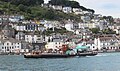
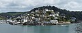
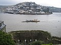
English: Kingswear is a village and civil parish in the South Hams area of the English county of Devon. The village is located on the east bank of the tidal River Dart, close to the river's mouth and opposite the small town of Dartmouth. It lies within the South Devon Area of Outstanding Natural Beauty, and has a population of 1,332.
village britannique  | |||||
| Téléverser des médias | |||||
| Nature de l’élément | |||||
|---|---|---|---|---|---|
| Lieu | South Hams, Devon, Angleterre du Sud-Ouest, Angleterre | ||||
 | |||||
Sous-catégories
Cette catégorie comprend 26 sous-catégories, dont les 26 ci-dessous.
B
- Brownstone Battery, Kingswear (29 F)
C
- Kingswear Castle (22 F)
- Cliffs of Kingswear (23 F)
F
- Froward Point, Devon (33 F)
G
- Greenway Tunnel (7 F)
- Greenway Viaduct (6 F)
H
- Hillhead, Devon (12 F)
I
- Ivy Cove, Kingswear (15 F)
K
- Kingston, Kingswear (3 F)
- Kingswear Regatta (12 F)
L
- Lower Greenway Farm (11 F)
M
- Mew Stone, Kingswear (30 F)
N
- Nethway, Kingswear (14 F)
P
- Pudcombe Cove (52 F)
S
- Scabbacombe Head, Devon (12 F)
- Scabbacombe Sands (56 F)
T
- The Daymark, Kingswear (20 F)
W
- Warren House, Kingswear (7 F)
Média dans la catégorie « Kingswear »
Cette catégorie comprend 2 172 fichiers, dont les 200 ci-dessous.
(page précédente) (page suivante)-
 "Keep out" by Combe Lane - geograph.org.uk - 6177993.jpg 4 288 × 2 848 ; 1 023 kio
-
 "Kingswear Castle" at Dartmouth - geograph.org.uk - 5153063.jpg 4 890 × 2 908 ; 3,66 Mio
-
 75014 Braveheart (3) - geograph.org.uk - 5428765.jpg 4 320 × 3 240 ; 2,32 Mio
-
 A boat on the River Dart - geograph.org.uk - 2394654.jpg 1 024 × 768 ; 219 kio
-
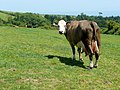
 A field of cattle - geograph.org.uk - 3487037.jpg 640 × 428 ; 79 kio
-
 A foreign visitor - geograph.org.uk - 913258.jpg 640 × 427 ; 81 kio
-
 A fork in paths in Noss Plantation - geograph.org.uk - 4930670.jpg 1 600 × 1 200 ; 636 kio
-
 A junction on the Mount Ridley Road - geograph.org.uk - 2127935.jpg 800 × 600 ; 228 kio
-
 A Meeting of Ways at Higher Greenaway - geograph.org.uk - 5544149.jpg 1 024 × 768 ; 463 kio
-
 A pair of ferries on the Dart - geograph.org.uk - 2102456.jpg 640 × 480 ; 201 kio
-
 A pied wagtail^ - geograph.org.uk - 2510519.jpg 1 681 × 1 122 ; 996 kio
-
 A ploughed field and the coast towards Man Sands - geograph.org.uk - 3781654.jpg 1 024 × 768 ; 202 kio
-
 A pond below The Terrace, Coleton Fishacre, Devon - geograph.org.uk - 5059037.jpg 1 500 × 1 116 ; 582 kio
-
 A rocky point - geograph.org.uk - 3487167.jpg 640 × 480 ; 163 kio
-
 A rocky point - geograph.org.uk - 6298287.jpg 1 024 × 768 ; 355 kio
-
 A rocky point - geograph.org.uk - 6298311.jpg 1 024 × 768 ; 368 kio
-
 A slope with gorse - geograph.org.uk - 6298513.jpg 1 024 × 768 ; 445 kio
-
 A track off Challeycroft Road - geograph.org.uk - 2128030.jpg 800 × 600 ; 302 kio
-
 A train departs from Kingswear - geograph.org.uk - 5393576.jpg 1 024 × 768 ; 190 kio
-
 A view of Kingswear from Dartmouth - geograph.org.uk - 1856125.jpg 640 × 264 ; 51 kio
-
 A view of Kingswear upon leaving the marina - geograph.org.uk - 1966865.jpg 2 608 × 1 952 ; 1,38 Mio
-
 A woodland bench with views of the sea - geograph.org.uk - 928007.jpg 640 × 537 ; 205 kio
-
 A379 - B3205 junction - geograph.org.uk - 3106327.jpg 640 × 374 ; 29 kio
-
 A379 - geograph.org.uk - 3223401.jpg 640 × 430 ; 79 kio
-
 A379 across the River Dart - geograph.org.uk - 2019384.jpg 640 × 480 ; 98 kio
-
 A379 and view of Dartmoor National Park - geograph.org.uk - 2855013.jpg 1 600 × 1 052 ; 314 kio
-
 A379 approaching Brixham Cross - geograph.org.uk - 3106323.jpg 640 × 465 ; 37 kio
-
 A379 climbing towards Hillhead - geograph.org.uk - 4930864.jpg 1 600 × 1 200 ; 433 kio
-
 A379 descending to the River Dart - geograph.org.uk - 3223432.jpg 640 × 430 ; 88 kio
-
 A379 junction ahead - geograph.org.uk - 3014399.jpg 640 × 463 ; 78 kio
-
 A379 leading to Kennels Road, near Lupton Farm - geograph.org.uk - 2854987.jpg 1 600 × 1 143 ; 319 kio
-
 A379 to Higher Ferry - geograph.org.uk - 3223403.jpg 640 × 430 ; 72 kio
-
 A379 to Torbay and Dartmoor National Park - geograph.org.uk - 2855027.jpg 1 600 × 1 200 ; 344 kio
-
 A379 view across to Dartmoor National Park - geograph.org.uk - 2855075.jpg 2 604 × 3 530 ; 4,32 Mio
-
 A379, Bridge Rd - geograph.org.uk - 3223400.jpg 640 × 430 ; 136 kio
-
 A379, southbound - geograph.org.uk - 3106318.jpg 640 × 407 ; 31 kio
-
 Abandoned offices, Lower Noss Point - geograph.org.uk - 4930789.jpg 1 600 × 1 200 ; 372 kio
-
 Above Bayards Cove, Dartmouth - geograph.org.uk - 2608684.jpg 2 272 × 1 704 ; 538 kio
-
 Above Coleton Fishacre - geograph.org.uk - 1390954.jpg 640 × 522 ; 60 kio
-
 Above Scabbacombe Sands - geograph.org.uk - 3547878.jpg 640 × 426 ; 62 kio
-
 Access road for farm buildings at Nethway House - geograph.org.uk - 3779790.jpg 1 152 × 1 536 ; 1,56 Mio
-
 Acer, Coleton Fishacre - geograph.org.uk - 2427406.jpg 476 × 640 ; 84 kio
-
 Acer, Greenway - geograph.org.uk - 2110612.jpg 640 × 480 ; 141 kio
-
 Acer, Greenway - geograph.org.uk - 2110624.jpg 482 × 640 ; 111 kio
-
 Aconite, Monkshood or Wolfsbane ( Aconitum napellus) - geograph.org.uk - 2114442.jpg 1 200 × 1 600 ; 762 kio
-
 Aconite, Monkshood or Wolfsbane ( Aconitum napellus) - geograph.org.uk - 2114451.jpg 1 132 × 1 600 ; 338 kio
-
 Across Old Mill Bay - geograph.org.uk - 2899936.jpg 4 000 × 3 000 ; 4,15 Mio
-
 Across Waterhead Creek, Kingswear - geograph.org.uk - 804612.jpg 480 × 640 ; 110 kio
-
 Adder on coastal footpath - geograph.org.uk - 3487348.jpg 640 × 480 ; 160 kio
-
 Aeonium Arboreum, Coleton Fishacre - geograph.org.uk - 5816806.jpg 2 519 × 2 923 ; 1,76 Mio
-
 Agapanthus, Coleton Fishacre - geograph.org.uk - 3587204.jpg 480 × 640 ; 87 kio
-
 Agatha Christie's Greenway House viewed from the River Dart - geograph.org.uk - 1966918.jpg 2 608 × 1 952 ; 1,25 Mio
-
 Allium hollandicum, Coleton Fishacre - geograph.org.uk - 4534952.jpg 1 920 × 2 560 ; 1,11 Mio
-
 Allium, Coleton Fishacre - geograph.org.uk - 4534943.jpg 1 920 × 2 560 ; 809 kio
-
 Alliums, Coleton Fishacre - geograph.org.uk - 4089674.jpg 1 920 × 1 445 ; 658 kio
-
 Allotments above Houses in Dartmouth - geograph.org.uk - 2656730.jpg 640 × 480 ; 104 kio
-
 Alma Steps Sign, Kingswear.jpg 5 152 × 3 864 ; 5,29 Mio
-
 Alma Steps, Kingswear - geograph.org.uk - 2624741.jpg 640 × 480 ; 115 kio
-
 Aloe, Coleton Fishacre - geograph.org.uk - 5817060.jpg 2 705 × 3 951 ; 1,14 Mio
-
 Along Scabbacombe Head - geograph.org.uk - 79156.jpg 640 × 425 ; 123 kio
-
 Along the shore at Kingswear - geograph.org.uk - 4881117.jpg 640 × 427 ; 114 kio
-
 Anchor Stone - geograph.org.uk - 2573327.jpg 640 × 454 ; 122 kio
-
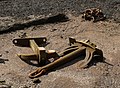 Anchors, Kingswear - geograph.org.uk - 1507780.jpg 640 × 472 ; 137 kio
-
 Ancient Tulip Tree (Liriodendron tulipifera), Coleton Fishacre - geograph.org.uk - 5059178.jpg 1 500 × 2 000 ; 905 kio
-
 Another up stretch on the coastal path - geograph.org.uk - 2509117.jpg 3 872 × 2 592 ; 4,68 Mio
-
 Approaching Galmpton Mill - geograph.org.uk - 3644435.jpg 474 × 640 ; 126 kio
-

-
 Approaching Higher Greenway - geograph.org.uk - 1176817.jpg 469 × 640 ; 99 kio
-
 Approaching Higher Greenway, late summer - geograph.org.uk - 1508271.jpg 525 × 640 ; 141 kio
-
 Approaching Kingswear by ferry - geograph.org.uk - 1092670.jpg 640 × 480 ; 62 kio
-
 Approaching Lower Greenway - geograph.org.uk - 4583451.jpg 800 × 532 ; 134 kio
-
 Approaching Man Sands - geograph.org.uk - 2592083.jpg 640 × 480 ; 86 kio
-
 Approaching Man Sands - geograph.org.uk - 4531189.jpg 800 × 604 ; 153 kio
-
 Approaching Man Sands - geograph.org.uk - 850977.jpg 640 × 480 ; 106 kio
-
 Approaching Man Sands from the south - geograph.org.uk - 2510540.jpg 3 872 × 2 592 ; 4,92 Mio
-
 Approaching the house, Coleton Fishacre - geograph.org.uk - 4398464.jpg 1 920 × 1 367 ; 614 kio
-
 Arable farmland, south of Galmpton - geograph.org.uk - 67277.jpg 640 × 425 ; 131 kio
-
 Archaeological Journal, Volume 3, 0292.png 1 186 × 1 354 ; 860 kio
-
 Archway between walled gardens, Greenway - geograph.org.uk - 2111027.jpg 480 × 640 ; 130 kio
-
 Armaments Railway at Brownstone Battery - geograph.org.uk - 292574.jpg 480 × 640 ; 130 kio
-
 Astrantia, Coleton Fishacre - geograph.org.uk - 5441860.jpg 2 217 × 1 228 ; 489 kio
-
 At Man Sands - geograph.org.uk - 2259036.jpg 640 × 435 ; 69 kio
-
 Atom Heart Mother in reverse - geograph.org.uk - 1337596.jpg 640 × 480 ; 215 kio
-
 Attenti ai gatti - geograph.org.uk - 2055248.jpg 529 × 640 ; 88 kio
-
 Avenue of trees - geograph.org.uk - 3106355.jpg 430 × 640 ; 92 kio
-
 B3205, Croftland Farm - geograph.org.uk - 3111989.jpg 640 × 480 ; 87 kio
-
 B3206 Nethway Cottage - geograph.org.uk - 3111990.jpg 640 × 480 ; 67 kio
-
 Bale and gate above Long Sands - geograph.org.uk - 4140226.jpg 1 920 × 2 287 ; 1,2 Mio
-
 Bales near Coleton Farm - geograph.org.uk - 4146479.jpg 1 920 × 1 229 ; 523 kio
-
 Bales near Coleton Fishacre - geograph.org.uk - 1011082.jpg 640 × 467 ; 62 kio
-
 Bamboo, Coleton Aglow - geograph.org.uk - 6001899.jpg 1 832 × 3 264 ; 1,02 Mio
-
 Bamboo, Coleton Fishacre - geograph.org.uk - 3585477.jpg 480 × 640 ; 114 kio
-
 Banana leaf, Greenway - geograph.org.uk - 2110764.jpg 640 × 480 ; 84 kio
-
 Barley above Outer Froward Point - geograph.org.uk - 3585568.jpg 640 × 452 ; 71 kio
-
 Barley field - geograph.org.uk - 3215726.jpg 640 × 430 ; 61 kio
-
 Barn, Lower Greenway Farm - geograph.org.uk - 6179615.jpg 1 800 × 2 554 ; 1 015 kio
-
 Barnett Class ON939 Frank Spiller Locke from the bow.jpg 768 × 1 024 ; 331 kio
-
 Barnett Class ON939 Frank Spiller Locke starboard side.jpg 1 024 × 512 ; 259 kio
-
 Barnett Class ON939 rudder and starboard propeller.jpg 1 024 × 768 ; 237 kio
-
 Bathroom tile, Coleton Fishacre - geograph.org.uk - 5719032.jpg 4 288 × 2 848 ; 1,85 Mio
-
 Bay at Man Sands - geograph.org.uk - 2592075.jpg 640 × 480 ; 101 kio
-
 Beacon Lane, Kingswear - geograph.org.uk - 3782279.jpg 1 536 × 1 152 ; 1,08 Mio
-
 Beacon Lane, Kingswear - geograph.org.uk - 4529488.jpg 800 × 532 ; 156 kio
-
 Beacon Road Kingswear - geograph.org.uk - 5817899.jpg 640 × 480 ; 93 kio
-
 Bee on delphinium, Coleton Fishacre - geograph.org.uk - 2427446.jpg 480 × 640 ; 70 kio
-
 Bee on Delphinium, Coleton Fishacre - geograph.org.uk - 4535295.jpg 1 461 × 1 860 ; 366 kio
-
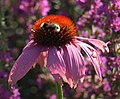 Bee on Echinacea, Coleton Fishacre - geograph.org.uk - 3585645.jpg 640 × 527 ; 67 kio
-
 Bee on Echium, Coleton Fishacre - geograph.org.uk - 5812111.jpg 1 897 × 1 187 ; 437 kio
-
 Bee on flower, Coleton Fishacre - geograph.org.uk - 5489261.jpg 518 × 567 ; 123 kio
-
 Beech leaves, Coleton Fishacre - geograph.org.uk - 2427583.jpg 533 × 640 ; 187 kio
-
 Beech leaves, Greenway - geograph.org.uk - 3841305.jpg 1 920 × 2 298 ; 1,27 Mio
-
 Beech trees near Greenway - geograph.org.uk - 3843499.jpg 1 920 × 2 671 ; 1,78 Mio
-
 Bench overlooking The Warren - geograph.org.uk - 2507555.jpg 3 872 × 2 592 ; 5,57 Mio
-
 Benches, Greenway - geograph.org.uk - 6176495.jpg 2 848 × 4 288 ; 2,35 Mio
-
 Benchmark on stone stile, Greenway Road - geograph.org.uk - 191216.jpg 480 × 640 ; 168 kio
-
 Bend on the A379, Bridge Road - geograph.org.uk - 4588172.jpg 800 × 532 ; 157 kio
-
 Between the hedgebanks at Coleton Barton Farm - geograph.org.uk - 3782235.jpg 1 536 × 1 152 ; 1,08 Mio
-
 Beware of Adders - geograph.org.uk - 1028780.jpg 480 × 640 ; 169 kio
-
 Big fish in a small pond - geograph.org.uk - 3875091.jpg 2 304 × 1 704 ; 1,51 Mio
-
 Bin by path junction, Coleton Fishacre - geograph.org.uk - 6308994.jpg 3 485 × 2 505 ; 975 kio
-
 Bird hide Woodhuish Lane - geograph.org.uk - 2085920.jpg 1 600 × 1 200 ; 822 kio
-
 Black sheep, South West Coast Path - geograph.org.uk - 850860.jpg 533 × 640 ; 143 kio
-
 Blackthorn by the coastal path - geograph.org.uk - 1817318.jpg 640 × 491 ; 81 kio
-
 Blocked track in Noss Plantation - geograph.org.uk - 4930680.jpg 1 200 × 1 600 ; 625 kio
-
 Bluebells, Coleton Fishacre - geograph.org.uk - 6131635.jpg 3 606 × 2 456 ; 1,79 Mio
-
 Bluebells, Coleton Fishacre - geograph.org.uk - 6300171.jpg 4 288 × 2 848 ; 2,6 Mio
-
 Bluebells, Coleton Fishacre - geograph.org.uk - 6300245.jpg 2 789 × 3 336 ; 2,01 Mio
-
 Boat moored to ferry pontoon at Kingswear - geograph.org.uk - 4885878.jpg 427 × 640 ; 87 kio
-
 Boat on the Dart - geograph.org.uk - 3841241.jpg 1 920 × 2 519 ; 1 006 kio
-
 Boat on the Dart - geograph.org.uk - 805021.jpg 495 × 640 ; 90 kio
-
 Boat on the River Dart - geograph.org.uk - 3106464.jpg 640 × 430 ; 55 kio
-
 Boat on the River Dart - geograph.org.uk - 3108706.jpg 640 × 430 ; 49 kio
-
 Boat on the River Dart - geograph.org.uk - 3223434.jpg 640 × 430 ; 63 kio
-
 Boat repair yard on the River Dart - geograph.org.uk - 3701258.jpg 1 987 × 1 482 ; 1,12 Mio
-
 Boathouse, on the River Dart, below Maypool - geograph.org.uk - 1880652.jpg 1 600 × 1 200 ; 604 kio
-
 Boats at Kingswear and Britannia Naval College, Dartmouth - geograph.org.uk - 5221409.jpg 1 600 × 1 200 ; 405 kio
-
 Boats below Long Wood, Kingswear.jpg 3 300 × 2 204 ; 2,13 Mio
-
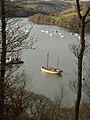
 Boats moored on the River Dart - geograph.org.uk - 3219334.jpg 640 × 430 ; 94 kio
-
 Boats on the River Dart - geograph.org.uk - 1188630.jpg 507 × 640 ; 91 kio
-
 Boats on the River Dart - geograph.org.uk - 1188644.jpg 480 × 640 ; 97 kio
-
 Boats on the river Dart at Harewood - geograph.org.uk - 5099141.jpg 640 × 480 ; 113 kio
-
 Boats, Noss Marina - geograph.org.uk - 4748151.jpg 1 920 × 1 279 ; 608 kio
-
 Boats, River Dart - geograph.org.uk - 3206005.jpg 640 × 430 ; 70 kio
-
 Boats, River Dart - geograph.org.uk - 3229040.jpg 640 × 430 ; 64 kio
-
 Boatyard at Noss - geograph.org.uk - 5030422.jpg 640 × 479 ; 110 kio
-
 Boatyard down a creek off the River - June 2012 - panoramio.jpg 3 000 × 4 000 ; 5,09 Mio
-
 Boatyard on Higher Noss Point - geograph.org.uk - 5134598.jpg 3 783 × 2 854 ; 2,37 Mio
-
 Boatyard, at Higher Noss Point - geograph.org.uk - 1880245.jpg 1 024 × 816 ; 236 kio
-
 Books in the library, Coleton Fishacre - geograph.org.uk - 5719042.jpg 3 531 × 2 394 ; 1,11 Mio
-
 Border and wall, Greenway - geograph.org.uk - 2573362.jpg 640 × 480 ; 138 kio
-
 Both Lower Ferries between Dartmouth ^ Kingswear - geograph.org.uk - 6013444.jpg 5 184 × 2 920 ; 6,69 Mio
-
 Bracken by the Dart Valley Trail - geograph.org.uk - 3223365.jpg 640 × 430 ; 134 kio
-
 Braveheart near Britannia Crossing - geograph.org.uk - 6272088.jpg 2 309 × 1 533 ; 467 kio
-
 Brick wall, Greenway - geograph.org.uk - 2110930.jpg 640 × 480 ; 101 kio
-
 Bridge leading to Higher Noss Point - geograph.org.uk - 4233294.jpg 480 × 640 ; 115 kio
-
 Bridge over Paignton-Kingswear railway - geograph.org.uk - 3397146.jpg 1 024 × 769 ; 115 kio
-

-

-
 Bridge Road Wood - geograph.org.uk - 4930843.jpg 1 600 × 1 200 ; 550 kio
-
 Bridge to the Marina at Lower Noss Point, River Dart - geograph.org.uk - 4930775.jpg 1 600 × 1 200 ; 559 kio
-
 Bridleway approaching Combe Lane - geograph.org.uk - 6177706.jpg 2 848 × 4 288 ; 2,66 Mio
-
 Bridleway near Higher Greenway - geograph.org.uk - 6176661.jpg 2 848 × 4 288 ; 2,07 Mio
-
 Bridleway to Higher Greenway - geograph.org.uk - 6176663.jpg 2 848 × 4 288 ; 2,18 Mio
-
 Bridleway to Higher Greenway - geograph.org.uk - 6177294.jpg 4 288 × 2 848 ; 2,41 Mio
-
 Bridleway, Higher Greenway - geograph.org.uk - 3841533.jpg 1 920 × 1 171 ; 366 kio
-
 Bridleway, Slapper's Hill - geograph.org.uk - 5412552.jpg 2 457 × 1 782 ; 1,15 Mio
-
 Bridleway, Slapper's Hill - geograph.org.uk - 5412570.jpg 1 697 × 974 ; 348 kio
-
 Brim Hill - geograph.org.uk - 2110393.jpg 640 × 475 ; 95 kio
-
 Brim Hill - geograph.org.uk - 6178191.jpg 3 163 × 1 875 ; 888 kio
-
 Brim Hill - geograph.org.uk - 6178514.jpg 3 216 × 1 649 ; 570 kio
-
 Brim Hill, Galmpton - geograph.org.uk - 192516.jpg 640 × 480 ; 105 kio
-
 Brim Hill, Galmpton Creek - geograph.org.uk - 368828.jpg 640 × 480 ; 63 kio
-
 Brim Hill, Junction Greenway Road and Mill Lane - geograph.org.uk - 368880.jpg 640 × 480 ; 108 kio
-
 Britannia Crossing - geograph.org.uk - 3229011.jpg 640 × 430 ; 86 kio
-

-
 Britannia Crossing, Dartmouth Steam Railway - geograph.org.uk - 3229027.jpg 640 × 430 ; 102 kio
-
 Britannia level crossing - geograph.org.uk - 2102493.jpg 640 × 480 ; 189 kio
-
 Britannia Royal Naval College - geograph.org.uk - 2658493.jpg 1 024 × 763 ; 134 kio
-
 Britannia Royal Naval College, Dartmouth - geograph.org.uk - 3699730.jpg 1 997 × 1 496 ; 1,3 Mio
-
 Brixham Rd - geograph.org.uk - 3106344.jpg 640 × 430 ; 55 kio
-
 Brixham Rd - geograph.org.uk - 3106350.jpg 640 × 430 ; 74 kio
-
 Brixham Road, B3205 - geograph.org.uk - 3111987.jpg 640 × 480 ; 104 kio
-
 Brixham Road, Kingswear - geograph.org.uk - 4890766.jpg 640 × 480 ; 52 kio
-
 Brixham Road, Kingswear - geograph.org.uk - 4890774.jpg 640 × 480 ; 61 kio
-
 Broad Road - geograph.org.uk - 6297335.jpg 1 024 × 768 ; 342 kio
-
 Broadmoor Copse, Nethway Wood and surroundings - geograph.org.uk - 2143.jpg 640 × 480 ; 65 kio
-
 Brooklime near Man Sands - geograph.org.uk - 5412968.jpg 2 751 × 2 036 ; 1,07 Mio
-
 Brownstone - Road down to Froward Point - geograph.org.uk - 1011586.jpg 640 × 427 ; 101 kio
-
 Brownstone Battery - geograph.org.uk - 2464073.jpg 1 024 × 768 ; 240 kio
-
 Brownstone Battery - geograph.org.uk - 2464074.jpg 1 024 × 768 ; 239 kio
-
 Brownstone Battery, World War II coastal defence - geograph.org.uk - 4531007.jpg 800 × 532 ; 206 kio
-
 Bug hotel, Coleton Fishacre - geograph.org.uk - 6001587.jpg 1 577 × 2 565 ; 434 kio
-
 Bullocks by Scabbacombe Lane - geograph.org.uk - 5412614.jpg 3 072 × 2 048 ; 1,13 Mio
-
 Bus stop and shelter on Slappers Hill, near Hillhead - geograph.org.uk - 3783421.jpg 1 536 × 1 152 ; 840 kio
-
 Bushes above Scabbacombe Sands - geograph.org.uk - 5412777.jpg 3 072 × 2 048 ; 1,76 Mio
-
 Butterfly above Pudcombe Cove - geograph.org.uk - 2427592.jpg 486 × 640 ; 47 kio
-
 Butterfly on hemp agrimony, Coleton Fishacre - geograph.org.uk - 3587103.jpg 462 × 640 ; 68 kio
-
 Butterfly, Coleton Fishacre - geograph.org.uk - 4116277.jpg 2 507 × 1 873 ; 735 kio
-
 By the Dart at Kingswear - geograph.org.uk - 2054634.jpg 480 × 640 ; 108 kio
-
 By the Dart Valley Trail - geograph.org.uk - 3223385.jpg 640 × 430 ; 132 kio


_-_geograph.org.uk_-_5428765.jpg)


_-_geograph.org.uk_-_2114442.jpg)
_-_geograph.org.uk_-_2114451.jpg)


,_Coleton_Fishacre_-_geograph.org.uk_-_5059178.jpg)


