Category:Kingswood, Kent
Aller à la navigation
Aller à la recherche
English: Kingswood is a village in the Maidstone District of Kent, England and forms part of the civil parish of Broomfield and Kingswood. The main village was constructed in the early 1960s with earlier sporadic development in both Pitt and Gravelly Bottom Roads during the 1920 and 1930's. Kingswood is situated to the south of the more ancient village of Broomfield. The village has a single village shop come post office and no public house. An annual senior citizen outing is arranged by the parish council and paid for from the village precept. The woods surrounding the village has three large craters often mistakenly attributed to World War II bombs, the origin of the craters is unknown.
village britannique (Kent)  | |||||
| Téléverser des médias | |||||
| Nature de l’élément | |||||
|---|---|---|---|---|---|
| Lieu | Broomfield and Kingswood, Maidstone, Kent, Angleterre du Sud-Est, Angleterre | ||||
 | |||||
Média dans la catégorie « Kingswood, Kent »
Cette catégorie comprend 6 fichiers, dont les 6 ci-dessous.
-
 Bridleway from road into Kings Wood - geograph.org.uk - 1189305.jpg 640 × 481 ; 132 kio
-
 Chestnut fencing - geograph.org.uk - 75694.jpg 640 × 480 ; 150 kio
-
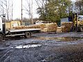
 Entrance to fencing yard on Water Lane - geograph.org.uk - 75692.jpg 640 × 480 ; 142 kio
-
 Kingswood Village Sign - geograph.org.uk - 1189293.jpg 481 × 640 ; 111 kio
-
 O2 Phone Mast on Lenham Road - geograph.org.uk - 1189271.jpg 481 × 640 ; 59 kio
-
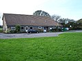 Broomfield and Kingswood village hall - geograph.org.uk - 75689.jpg 640 × 480 ; 100 kio


