Category:Kingwater
Aller à la navigation
Aller à la recherche
civil parish in Carlisle, Cumbria, England  | |||||
| Téléverser des médias | |||||
| Nature de l’élément | |||||
|---|---|---|---|---|---|
| Lieu | cité de Carlisle, Cumbria, Angleterre du Nord-Ouest, Angleterre | ||||
 | |||||
Sous-catégories
Cette catégorie comprend 3 sous-catégories, dont les 3 ci-dessous.
Média dans la catégorie « Kingwater »
Cette catégorie comprend 966 fichiers, dont les 200 ci-dessous.
(page précédente) (page suivante)-
 "Arm" of the sheepfold by Spur Rigg - geograph.org.uk - 2179009.jpg 640 × 480 ; 153 kio
-
 'Rust in peace', Palmer Hill - geograph.org.uk - 5127057.jpg 540 × 720 ; 126 kio
-
-
 A bridge over the River Irthing - geograph.org.uk - 2935293.jpg 800 × 600 ; 136 kio
-
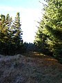
 A forest track near Spadeadam - geograph.org.uk - 2935038.jpg 800 × 600 ; 103 kio
-

-
 A private by-pass and cattle grid - geograph.org.uk - 2935138.jpg 800 × 600 ; 87 kio
-
 A private cattle grid near Wileysike House - geograph.org.uk - 6197835.jpg 2 592 × 1 944 ; 1,48 Mio
-
 Aerial view near Low King Hill, NY6172 - geograph.org.uk - 2646920.jpg 640 × 488 ; 141 kio
-
 Another shieling in the valley of King Water - geograph.org.uk - 2169702.jpg 640 × 480 ; 78 kio
-
 Approaching Butterburn - geograph.org.uk - 5606420.jpg 2 000 × 1 500 ; 577 kio
-
 Ash Crag - geograph.org.uk - 2665088.jpg 640 × 479 ; 72 kio
-
 Ash Crag close to Highstead Ash - geograph.org.uk - 1847547.jpg 600 × 450 ; 253 kio
-
 Ash Moss (2) - geograph.org.uk - 2866014.jpg 640 × 480 ; 74 kio
-
 Ash Moss - geograph.org.uk - 2656097.jpg 640 × 480 ; 72 kio
-
 B6318 - geograph.org.uk - 2764010.jpg 3 888 × 2 592 ; 1,89 Mio
-
 B6318 - geograph.org.uk - 3179485.jpg 1 024 × 768 ; 157 kio
-
 Barns at Spadeadam Farm - geograph.org.uk - 2656063.jpg 640 × 480 ; 63 kio
-
 Barnsley - geograph.org.uk - 2173788.jpg 640 × 480 ; 49 kio
-
 Barnsley - geograph.org.uk - 2764247.jpg 3 570 × 2 325 ; 1,05 Mio
-
 Be careful ^^ - geograph.org.uk - 5779554.jpg 2 592 × 1 944 ; 1,32 Mio
-
 Bend in the track to Potsloan - geograph.org.uk - 914277.jpg 640 × 480 ; 118 kio
-
 Berry Rigg - geograph.org.uk - 2162981.jpg 640 × 480 ; 84 kio
-
 Berry Rigg - geograph.org.uk - 2167820.jpg 640 × 480 ; 87 kio
-
 Berry Rigg - geograph.org.uk - 873225.jpg 640 × 480 ; 82 kio
-
 Beside the Butter Burn - geograph.org.uk - 6197955.jpg 2 592 × 1 944 ; 1,54 Mio
-
 Birky Shank - geograph.org.uk - 2764227.jpg 3 888 × 2 592 ; 1,72 Mio
-
 Birky Shank - geograph.org.uk - 4256841.jpg 640 × 457 ; 50 kio
-
 Birky Shank - geograph.org.uk - 4256849.jpg 640 × 443 ; 48 kio
-
 Black Cattle on Ash Moss - geograph.org.uk - 5117822.jpg 720 × 540 ; 127 kio
-
 Black Sike - geograph.org.uk - 910849.jpg 480 × 640 ; 120 kio
-

-

-

-

-
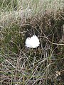 Bog cotton - geograph.org.uk - 879754.jpg 480 × 640 ; 121 kio
-
 Bombing target - geograph.org.uk - 2363146.jpg 2 592 × 1 944 ; 492 kio
-
 Boulder on Standingstone Rigg - geograph.org.uk - 2162971.jpg 640 × 480 ; 104 kio
-
 Boundary Stone - geograph.org.uk - 1285069.jpg 640 × 427 ; 107 kio
-
 Bridge crossing East Sike - geograph.org.uk - 5606464.jpg 2 000 × 1 500 ; 804 kio
-
 Bridge crossing the River Irthing - geograph.org.uk - 5606510.jpg 2 000 × 1 500 ; 543 kio
-
 Bridge over King Water near Snowden Close - geograph.org.uk - 1847564.jpg 600 × 450 ; 322 kio
-
 Bridge over Stour Sike - geograph.org.uk - 2180241.jpg 640 × 480 ; 98 kio
-
 Bridge over the River Irthing - geograph.org.uk - 5570082.jpg 2 000 × 1 500 ; 612 kio
-
 Bridleway above King Water - geograph.org.uk - 2015750.jpg 640 × 480 ; 78 kio
-
 Bridleway in Dumblar Rigg Plantation - geograph.org.uk - 5120178.jpg 720 × 540 ; 162 kio
-
 Bridleway near Rob's Pike Gate - geograph.org.uk - 1847506.jpg 600 × 450 ; 281 kio
-
 Bridleway to Rob's Pike Gate and King Water - geograph.org.uk - 1847007.jpg 600 × 450 ; 301 kio
-
 Bull Crag (2) - geograph.org.uk - 2168425.jpg 640 × 480 ; 77 kio
-
 Bull Crag - geograph.org.uk - 2168071.jpg 640 × 480 ; 76 kio
-
 Bull Crag above King Water - geograph.org.uk - 2126820.jpg 640 × 480 ; 91 kio
-
 Butter Burn (2) - geograph.org.uk - 891682.jpg 640 × 480 ; 76 kio
-
 Butter Burn (2) - geograph.org.uk - 923424.jpg 640 × 480 ; 84 kio
-
 Butter Burn (2) - geograph.org.uk - 926227.jpg 640 × 480 ; 130 kio
-
 Butter Burn - geograph.org.uk - 2764074.jpg 3 779 × 2 431 ; 1,49 Mio
-
 Butter Burn - geograph.org.uk - 2764235.jpg 3 888 × 2 271 ; 1,46 Mio
-
 Butter Burn - geograph.org.uk - 2764238.jpg 3 857 × 2 482 ; 1,76 Mio
-
 Butter Burn - geograph.org.uk - 5606411.jpg 2 000 × 1 500 ; 407 kio
-
 Butter Burn - geograph.org.uk - 5606415.jpg 2 000 × 1 500 ; 550 kio
-
 Butter Burn - geograph.org.uk - 891599.jpg 640 × 480 ; 74 kio
-
 Butter Burn - geograph.org.uk - 923579.jpg 640 × 480 ; 94 kio
-
 Butter Burn crossings - geograph.org.uk - 5606407.jpg 2 000 × 1 500 ; 496 kio
-
 Butterburn - geograph.org.uk - 4256870.jpg 640 × 480 ; 48 kio
-
 Butterburn Bridge - geograph.org.uk - 4144401.jpg 1 066 × 800 ; 279 kio
-
 Butterburn Bridge - geograph.org.uk - 4224055.jpg 2 816 × 1 880 ; 2,51 Mio
-
 Butterburn farmhouse - geograph.org.uk - 6197949.jpg 2 592 × 1 944 ; 1,17 Mio
-
 Butterburn Flow - geograph.org.uk - 6197973.jpg 2 592 × 1 944 ; 1,68 Mio
-
 Butterburn Ford - geograph.org.uk - 3993824.jpg 3 872 × 2 592 ; 4,79 Mio
-
 Butterburn Ford - geograph.org.uk - 4256859.jpg 640 × 467 ; 49 kio
-
 Calf Sike below Little Hen Hill - geograph.org.uk - 2995387.jpg 600 × 450 ; 99 kio
-
 Cattle Grid at Gowk Bank - geograph.org.uk - 4144741.jpg 1 066 × 800 ; 260 kio
-
 Cattle Grid at White Side - geograph.org.uk - 4144753.jpg 1 066 × 800 ; 150 kio
-
 Caud Beck - geograph.org.uk - 2656356.jpg 640 × 480 ; 103 kio
-
 Caud Beck and plantation on Wreay Rigg - geograph.org.uk - 2868866.jpg 640 × 480 ; 92 kio
-
 Caudbeck Flow (2) - geograph.org.uk - 2868823.jpg 640 × 480 ; 73 kio
-
 Caudbeck Flow (2) - geograph.org.uk - 2869835.jpg 640 × 480 ; 56 kio
-
 Caudbeck Flow (3) - geograph.org.uk - 2868824.jpg 640 × 480 ; 70 kio
-
 Caudbeck Flow (3) - geograph.org.uk - 2869838.jpg 640 × 480 ; 51 kio
-
 Caudbeck Flow (4) - geograph.org.uk - 2868827.jpg 640 × 480 ; 74 kio
-
 Caudbeck Flow (4) - geograph.org.uk - 2869843.jpg 640 × 480 ; 59 kio
-
 Caudbeck Flow - geograph.org.uk - 2656523.jpg 640 × 480 ; 63 kio
-
 Caudbeck Flow - geograph.org.uk - 2868820.jpg 640 × 480 ; 70 kio
-
 Chisholm's Cross (2) - geograph.org.uk - 2869817.jpg 640 × 480 ; 73 kio
-
 Chisholm's Cross - geograph.org.uk - 2869814.jpg 640 × 480 ; 66 kio
-
 Clark's Hill - geograph.org.uk - 2764011.jpg 3 793 × 2 453 ; 2,11 Mio
-

-
 Cleared plantation on Berry Rigg - geograph.org.uk - 2162982.jpg 640 × 480 ; 80 kio
-
 Cleared plantation on Berry Rigg - geograph.org.uk - 2167850.jpg 640 × 480 ; 90 kio
-
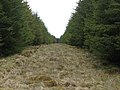
 Cleared plantation on Long Moss - geograph.org.uk - 2172673.jpg 640 × 480 ; 85 kio
-
 Cleared plantation on Spur Rigg (2) - geograph.org.uk - 911711.jpg 640 × 480 ; 95 kio
-
 Cleared plantation on Spur Rigg (3) - geograph.org.uk - 911714.jpg 640 × 480 ; 91 kio
-
 Cleared plantation on Spur Rigg (4) - geograph.org.uk - 911716.jpg 640 × 480 ; 97 kio
-
 Cleared plantation on Spur Rigg - geograph.org.uk - 911709.jpg 640 × 480 ; 91 kio
-
 Cleared plantation on Spur Rigg - geograph.org.uk - 911948.jpg 640 × 480 ; 87 kio
-

-

-
-

-
 Cleared plantation west of Berry Hill - geograph.org.uk - 2162984.jpg 640 × 480 ; 82 kio
-
 Cleared plantation west of Berry Hill - geograph.org.uk - 2167853.jpg 640 × 480 ; 88 kio
-
 Clearing in the plantation below Calf Rigg - geograph.org.uk - 915351.jpg 640 × 480 ; 134 kio
-
 Clearing in the plantation on The Gair - geograph.org.uk - 923473.jpg 640 × 480 ; 113 kio
-
 Cleugh between King Water and Dumblar Rigg - geograph.org.uk - 2015784.jpg 640 × 480 ; 110 kio
-
 Cleugh of a minor tributary of King Water - geograph.org.uk - 2866003.jpg 640 × 480 ; 86 kio
-
-
 Clockey Mill.jpg 1 600 × 749 ; 472 kio
-
 Converted Barn at Highstead Ash - geograph.org.uk - 1847557.jpg 600 × 450 ; 296 kio
-
 Country road near Gowany Knowe - geograph.org.uk - 5570088.jpg 2 000 × 1 500 ; 544 kio
-
 Country road south of Churnside Lodge - geograph.org.uk - 5570085.jpg 2 000 × 1 500 ; 583 kio
-
 Crammel Linn (up close and personal) - geograph.org.uk - 3453612.jpg 600 × 800 ; 201 kio
-
 Crammel Linn - geograph.org.uk - 4589453.jpg 640 × 480 ; 136 kio
-
 Crammel Linn - geograph.org.uk - 4589455.jpg 640 × 480 ; 128 kio
-
 Crammel Linn - geograph.org.uk - 4589461.jpg 640 × 480 ; 116 kio
-
 Crammel Linn - geograph.org.uk - 6121418.jpg 1 024 × 768 ; 414 kio
-

-

-

-

-

-
 Crammel Linn in the gorge of the River Irthing - geograph.org.uk - 4589446.jpg 640 × 480 ; 109 kio
-
 Crammel Linn on the River Irthing - geograph.org.uk - 3450890.jpg 800 × 600 ; 188 kio
-
 Crammel Linn Waterfall - geograph.org.uk - 6121426.jpg 1 024 × 640 ; 377 kio
-
 Crammell Linn on the River Irthing - geograph.org.uk - 4144778.jpg 1 066 × 800 ; 388 kio
-
 Crow Rigg (2) - geograph.org.uk - 2161489.jpg 640 × 480 ; 61 kio
-
 Crow Rigg (2) - geograph.org.uk - 2385911.jpg 640 × 480 ; 67 kio
-
 Crow Rigg (3) - geograph.org.uk - 2161491.jpg 640 × 480 ; 65 kio
-
 Crow Rigg (3) - geograph.org.uk - 2162361.jpg 640 × 480 ; 64 kio
-
 Crow Rigg (4) - geograph.org.uk - 2162372.jpg 640 × 480 ; 64 kio
-
 Crow Rigg - geograph.org.uk - 2160320.jpg 640 × 480 ; 71 kio
-
 Crow Rigg - geograph.org.uk - 2161488.jpg 640 × 480 ; 70 kio
-
 Crow Rigg - geograph.org.uk - 2161666.jpg 640 × 480 ; 63 kio
-
 Crow Rigg - geograph.org.uk - 2162453.jpg 640 × 480 ; 82 kio
-
 Crow Rigg - geograph.org.uk - 2162968.jpg 640 × 480 ; 77 kio
-
 Crow Rigg - geograph.org.uk - 2171946.jpg 640 × 480 ; 66 kio
-
 Crow Rigg and Rashbush Rigg - geograph.org.uk - 2162923.jpg 640 × 480 ; 84 kio
-
 Crowrigg Sike (2) - geograph.org.uk - 2162791.jpg 640 × 480 ; 94 kio
-
 Crowrigg Sike - geograph.org.uk - 2162787.jpg 640 × 480 ; 99 kio
-
 Crying Crag - geograph.org.uk - 2171401.jpg 640 × 480 ; 98 kio
-

-
 Crying Crag, sheepfold and Crow Rigg - geograph.org.uk - 2171433.jpg 640 × 480 ; 68 kio
-
 Culvert for Jamie's Hill Sike - geograph.org.uk - 2664867.jpg 640 × 480 ; 80 kio
-
 Dead tree on Bull Crag above King Water - geograph.org.uk - 2168627.jpg 480 × 640 ; 139 kio
-
 Deer Hill - geograph.org.uk - 834164.jpg 640 × 480 ; 73 kio
-
 Dense trees near Stourcleugh Gair - geograph.org.uk - 5570093.jpg 2 000 × 1 500 ; 662 kio
-
 Downhill towards Gringarry Hill - geograph.org.uk - 2935276.jpg 800 × 600 ; 101 kio
-
 Drainage channel on Crow Rigg (2) - geograph.org.uk - 2162403.jpg 640 × 480 ; 79 kio
-
 Drainage channel on Crow Rigg - geograph.org.uk - 2162401.jpg 640 × 480 ; 82 kio
-
 Dry Sike, Spadeadam Forest - geograph.org.uk - 3601094.jpg 1 066 × 800 ; 235 kio
-
 Dumblar Rigg (2) - geograph.org.uk - 2656291.jpg 640 × 480 ; 72 kio
-
 Dumblar Rigg (2) - geograph.org.uk - 2867231.jpg 640 × 480 ; 62 kio
-
 Dumblar Rigg (3) - geograph.org.uk - 2867003.jpg 640 × 480 ; 80 kio
-
 Dumblar Rigg - geograph.org.uk - 1847538.jpg 600 × 450 ; 274 kio
-
 Dumblar Rigg - geograph.org.uk - 1847542.jpg 600 × 450 ; 306 kio
-
 Dumblar Rigg - geograph.org.uk - 2132289.jpg 640 × 480 ; 90 kio
-
 Dumblar Rigg - geograph.org.uk - 2656251.jpg 640 × 480 ; 81 kio
-
 Dumblar Rigg - geograph.org.uk - 2656276.jpg 640 × 481 ; 69 kio
-
 Dumblar Rigg - geograph.org.uk - 2656312.jpg 640 × 480 ; 74 kio
-
 Dumblar Rigg - geograph.org.uk - 2867224.jpg 640 × 480 ; 75 kio
-
 Dumblar Rigg and Dumblar Rigg Plantation - geograph.org.uk - 2866933.jpg 640 × 480 ; 81 kio
-
 Dumblar Rigg and Nick Hill - geograph.org.uk - 2866998.jpg 640 × 480 ; 78 kio
-
 Dumblar Rigg and Plantation - geograph.org.uk - 2866038.jpg 640 × 480 ; 61 kio
-
 Dumblar Rigg to Highstead Ash track - geograph.org.uk - 5120964.jpg 720 × 540 ; 78 kio
-
 East Sike - geograph.org.uk - 2764085.jpg 3 888 × 2 559 ; 2,07 Mio
-
 East Sike - geograph.org.uk - 4256892.jpg 640 × 480 ; 48 kio
-
 Entering Butterburn - geograph.org.uk - 2935242.jpg 800 × 600 ; 147 kio
-
 Entry into Wark Forest - geograph.org.uk - 6197882.jpg 2 592 × 1 944 ; 1,35 Mio
-

-

-

-
 Farm Buildings at Highstead Ash - geograph.org.uk - 1847551.jpg 600 × 450 ; 257 kio
-
 Farm steading at Horseholme - geograph.org.uk - 5606502.jpg 2 000 × 1 500 ; 453 kio
-
 Farm track off the road to Bewcastle - geograph.org.uk - 4264157.jpg 640 × 480 ; 209 kio
-
 Farmal Sike near Ash Crag - geograph.org.uk - 1847561.jpg 600 × 450 ; 292 kio
-

-
 Felled plantation on Heathery Coonit - geograph.org.uk - 2176186.jpg 640 × 480 ; 82 kio
-
 Felled plantation on Hen Hill (2) - geograph.org.uk - 2176318.jpg 640 × 480 ; 115 kio
-
 Felled plantation on Hen Hill - geograph.org.uk - 2175962.jpg 640 × 480 ; 100 kio
-
 Firebreak in the plantation below Gringarry Hill - geograph.org.uk - 910652.jpg 480 × 640 ; 123 kio
-
 Firebreak in the plantation east of Hen Hill (2) - geograph.org.uk - 2175942.jpg 480 × 640 ; 110 kio
-
 Firebreak in the plantation east of Hen Hill (3) - geograph.org.uk - 2175949.jpg 480 × 640 ; 104 kio
-
-
 Firebreak in the plantation east of Hen Hill - geograph.org.uk - 2175933.jpg 480 × 640 ; 142 kio
-

-

-
 Firebreak in the plantation north of The Gair (2) - geograph.org.uk - 923477.jpg 640 × 480 ; 100 kio
-
 Firebreak in the plantation north of The Gair (3) - geograph.org.uk - 923480.jpg 640 × 480 ; 102 kio
-
 Firebreak in the plantation north of The Gair (4) - geograph.org.uk - 926298.jpg 640 × 480 ; 105 kio
-
 Firebreak in the plantation north of The Gair - geograph.org.uk - 923463.jpg 480 × 640 ; 94 kio
-
 Firebreak in the plantation northwest of Potsloan - geograph.org.uk - 918334.jpg 480 × 640 ; 111 kio
-
 Firebreak in the plantation northwest of The Gair - geograph.org.uk - 923649.jpg 640 × 480 ; 119 kio
-
 Firebreak in the plantation on Tip Hill (2) - geograph.org.uk - 873283.jpg 640 × 480 ; 68 kio
-
 Firebreak in the plantation on Tip Hill (2) - geograph.org.uk - 873322.jpg 640 × 480 ; 94 kio
-
 Firebreak in the plantation on Tip Hill (3) - geograph.org.uk - 873303.jpg 640 × 480 ; 108 kio
-
 Firebreak in the plantation on Tip Hill (3) - geograph.org.uk - 873325.jpg 640 × 480 ; 90 kio
-
 Firebreak in the plantation on Tip Hill (4) - geograph.org.uk - 873398.jpg 640 × 480 ; 97 kio
-
 Firebreak in the plantation on Tip Hill (5) - geograph.org.uk - 873403.jpg 640 × 480 ; 102 kio
-
 Firebreak in the plantation on Tip Hill (6) - geograph.org.uk - 873406.jpg 640 × 480 ; 90 kio
-
 Firebreak in the plantation on Tip Hill - geograph.org.uk - 872631.jpg 640 × 480 ; 102 kio
-
 Firebreak in the plantation on Tip Hill - geograph.org.uk - 873310.jpg 640 × 480 ; 102 kio
-
 Firebreak in the plantation on Tip Hill - geograph.org.uk - 873413.jpg 640 × 480 ; 91 kio


_felled_plantation_west_of_Blackshaws_Hill_-_geograph.org.uk_-_2176150.jpg)


_-_geograph.org.uk_-_2866014.jpg)


_-_geograph.org.uk_-_2176101.jpg)

_-_geograph.org.uk_-_2175336.jpg)


_-_geograph.org.uk_-_2168425.jpg)


_-_geograph.org.uk_-_891682.jpg)
_-_geograph.org.uk_-_923424.jpg)
_-_geograph.org.uk_-_926227.jpg)


_-_geograph.org.uk_-_2868823.jpg)
_-_geograph.org.uk_-_2869835.jpg)
_-_geograph.org.uk_-_2868824.jpg)
_-_geograph.org.uk_-_2869838.jpg)
_-_geograph.org.uk_-_2868827.jpg)
_-_geograph.org.uk_-_2869843.jpg)


_-_geograph.org.uk_-_2869817.jpg)


_-_geograph.org.uk_-_3453612.jpg)


_-_geograph.org.uk_-_4589447.jpg)
_-_geograph.org.uk_-_4306138.jpg)
_-_geograph.org.uk_-_4589449.jpg)
_-_geograph.org.uk_-_4306143.jpg)
_-_geograph.org.uk_-_4589469.jpg)


_-_geograph.org.uk_-_2161489.jpg)
_-_geograph.org.uk_-_2385911.jpg)
_-_geograph.org.uk_-_2161491.jpg)
_-_geograph.org.uk_-_2162361.jpg)
_-_geograph.org.uk_-_2162372.jpg)


_-_geograph.org.uk_-_2162791.jpg)


_-_geograph.org.uk_-_2162403.jpg)


_-_geograph.org.uk_-_2656291.jpg)
_-_geograph.org.uk_-_2867231.jpg)
_-_geograph.org.uk_-_2867003.jpg)


_-_geograph.org.uk_-_2176318.jpg)


_-_geograph.org.uk_-_2175942.jpg)
_-_geograph.org.uk_-_2175949.jpg)
_-_geograph.org.uk_-_2175953.jpg)


_-_geograph.org.uk_-_923477.jpg)
_-_geograph.org.uk_-_923480.jpg)
_-_geograph.org.uk_-_926298.jpg)


_-_geograph.org.uk_-_873283.jpg)
_-_geograph.org.uk_-_873322.jpg)
_-_geograph.org.uk_-_873303.jpg)
_-_geograph.org.uk_-_873325.jpg)
_-_geograph.org.uk_-_873398.jpg)
_-_geograph.org.uk_-_873403.jpg)
_-_geograph.org.uk_-_873406.jpg)


_-_geograph.org.uk_-_911711.jpg)
_-_geograph.org.uk_-_911714.jpg)
_-_geograph.org.uk_-_911716.jpg)
_-_geograph.org.uk_-_2162986.jpg)
_-_geograph.org.uk_-_2167878.jpg)