Category:Kingweston
Aller à la navigation
Aller à la recherche
English: Kingweston is a village and civil parish in Somerset, England, situated north east of Somerton in the South Somerset district. The village has a population of 128.
localité britannique du comté anglais de Somerset  | |||||
| Téléverser des médias | |||||
| Nature de l’élément | |||||
|---|---|---|---|---|---|
| Lieu | South Somerset, Somerset, Angleterre du Sud-Ouest, Angleterre | ||||
 | |||||
Sous-catégories
Cette catégorie comprend 2 sous-catégories, dont les 2 ci-dessous.
A
K
- Kingweston House, Kingweston (3 F)
Média dans la catégorie « Kingweston »
Cette catégorie comprend 51 fichiers, dont les 51 ci-dessous.
-
 Base of cross, Kingweston - geograph.org.uk - 1014234.jpg 640 × 480 ; 128 kio
-
 Cedar Walk Plantation - geograph.org.uk - 2484116.jpg 640 × 480 ; 171 kio
-
 Cedar Walk Plantation - geograph.org.uk - 5650715.jpg 1 024 × 683 ; 626 kio
-
 Christian's Cross - geograph.org.uk - 5377088.jpg 1 024 × 768 ; 170 kio
-
 Combe Lane leaves Keinton Mandeville - geograph.org.uk - 2470634.jpg 640 × 480 ; 80 kio
-
 Conference room, Kingweston - geograph.org.uk - 1014378.jpg 640 × 480 ; 58 kio
-
 Cottage, Kingweston - geograph.org.uk - 1014358.jpg 640 × 461 ; 93 kio
-
 Cottages on the B3153 - geograph.org.uk - 5470182.jpg 1 024 × 768 ; 191 kio
-
 Cottages on the B3153 - geograph.org.uk - 5470188.jpg 1 024 × 768 ; 194 kio
-
 Cultivated field, Kingweston - geograph.org.uk - 2484113.jpg 640 × 480 ; 138 kio
-
 Cultivating, Kingweston - geograph.org.uk - 2484095.jpg 640 × 359 ; 68 kio
-
 Dark clouds over the road to Somerton - geograph.org.uk - 2469489.jpg 640 × 480 ; 73 kio
-

-
 Direction Sign - Signpost opposite Kingweston Road - geograph.org.uk - 6056077.jpg 1 776 × 1 187 ; 198 kio
-
 Farm track near Kingweston - geograph.org.uk - 5469228.jpg 1 024 × 768 ; 219 kio
-
 Farm track, south of the B3153 - geograph.org.uk - 5470179.jpg 1 024 × 812 ; 213 kio
-
 Field of Barley Near Newcombe Farm - geograph.org.uk - 5633750.jpg 640 × 427 ; 174 kio
-
 Kingweston - geograph.org.uk - 165631.jpg 640 × 426 ; 120 kio
-
 Kingweston playing fields - geograph.org.uk - 2483738.jpg 640 × 359 ; 69 kio
-
 Kingweston playing fields - geograph.org.uk - 2484122.jpg 640 × 543 ; 85 kio
-
 Lodge Entrance to Kingweston House and Church - geograph.org.uk - 444054.jpg 640 × 480 ; 192 kio
-
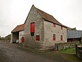
 Lower Farm, Kingweston - geograph.org.uk - 5470194.jpg 1 024 × 785 ; 163 kio
-
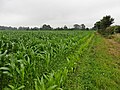 Maize crop near Kingweston - geograph.org.uk - 5469231.jpg 1 024 × 768 ; 228 kio
-

-
 Newcombe Farm - geograph.org.uk - 5634093.jpg 640 × 427 ; 197 kio
-
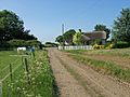
 North Lodge, Kingweston - geograph.org.uk - 5469324.jpg 1 024 × 803 ; 182 kio
-
 Old Barn and Village Notice Board - geograph.org.uk - 3371217.jpg 426 × 640 ; 76 kio
-
 Ordnance Survey Cut Mark - geograph.org.uk - 3928840.jpg 4 000 × 3 000 ; 3,8 Mio
-
 Parkland, Kingweston - geograph.org.uk - 5650711.jpg 1 024 × 683 ; 475 kio
-
 Ploughed field, Kingweston - geograph.org.uk - 2484110.jpg 640 × 359 ; 103 kio
-
 Polo pitch, Kingweston playing fields - geograph.org.uk - 2483730.jpg 640 × 359 ; 89 kio
-
 Road junction at Lower Farm, Kingweston - geograph.org.uk - 5607598.jpg 1 600 × 1 203 ; 767 kio
-
 Road through Cedar Walk Plantation - geograph.org.uk - 5377070.jpg 1 024 × 761 ; 212 kio
-
 Road to Butleigh - geograph.org.uk - 2484127.jpg 640 × 480 ; 133 kio
-
 Staddlecombe Plantation - geograph.org.uk - 5607607.jpg 1 600 × 1 333 ; 915 kio
-
 The lane to Home Farm, Kingweston - geograph.org.uk - 2760847.jpg 800 × 600 ; 138 kio
-
 The Old Court House, Lower Farm, Kingweston - geograph.org.uk - 4461102.jpg 1 632 × 1 232 ; 504 kio
-
 Towards Luns Hill Wood - geograph.org.uk - 5650720.jpg 1 024 × 683 ; 347 kio
-
 Track to Copley Wood - geograph.org.uk - 5607605.jpg 1 600 × 800 ; 535 kio
-
 Tree marking a road junction, Kingweston - geograph.org.uk - 5607601.jpg 1 600 × 1 203 ; 794 kio
-
 Trees on Luns Hill - geograph.org.uk - 5607593.jpg 1 600 × 1 067 ; 672 kio
-
 Wheat field with poppies, near Kingweston - geograph.org.uk - 5469225.jpg 1 024 × 763 ; 287 kio
-
 Bizarre pine tree at Kingweston - geograph.org.uk - 668485.jpg 480 × 640 ; 83 kio
-
 Cornfield - geograph.org.uk - 516100.jpg 640 × 480 ; 97 kio
-

-
 Field near Charlton Mackrell - geograph.org.uk - 668436.jpg 640 × 480 ; 102 kio
-
 Field near Charlton Mackrell - geograph.org.uk - 668446.jpg 640 × 480 ; 84 kio
-
 Harvested field on Windmill Hill - geograph.org.uk - 524966.jpg 640 × 480 ; 113 kio
-
 Railway Combe Lane - geograph.org.uk - 542768.jpg 640 × 480 ; 91 kio
-
 Railway NE from Combe Lane - geograph.org.uk - 542771.jpg 640 × 480 ; 74 kio
-
 Welham Railway Bridge - Welham - geograph.org.uk - 444035.jpg 480 × 640 ; 138 kio


