Category:Kirishima, Kagoshima
Zur Navigation springen
Zur Suche springen
Ort in der Präfektur Kagoshima, Japan | |||||
| Medium hochladen | |||||
| Ist ein(e) | |||||
|---|---|---|---|---|---|
| Ort |
| ||||
| Liegt am oder im Gewässer |
| ||||
| Rechtsform |
| ||||
| Datum der Gründung, Erstellung, Entstehung, Erbauung |
| ||||
| Einwohnerzahl |
| ||||
| Fläche |
| ||||
| Ersetzt |
| ||||
| offizielle Website | |||||
 | |||||
Unterkategorien
Es werden 32 von insgesamt 32 Unterkategorien in dieser Kategorie angezeigt:
In Klammern die Anzahl der enthaltenen Kategorien (K), Seiten (S), Dateien (D)
- Night in Kirishima (1 D)
H
- Hayato-higashi Interchange (3 D)
- Hayato-nishi Interchange (4 D)
- Hiruko-jinja (Kirishima) (3 D)
I
- Inukai Falls (5 D)
J
- JGSDF Camp Kokubu (3 D)
K
- Kirishima City Fire Bureau (7 D)
- Kirishima Police Station (8 D)
- Kirishima Shinwanosato Park (4 D)
- Kirishima-jingu (1 S, 44 D)
- Kokubu Interchange (3 D)
M
- Maruo Falls (6 D)
O
- Ohachi (Kirishimayama) (8 D)
- Onamuji-jinja (Kirishima) (7 D)
P
- Post offices in Kirishima (46 D)
S
- Shiobitashi Onsen (5 D)
T
- Takachiho-gawara (9 D)
- Tsurugi-jinja (Kirishima) (6 D)
Y
- Yokogawa Police Station (3 D)
Ō
- Ōnamiike (8 D)
Medien in der Kategorie „Kirishima, Kagoshima“
Folgende 200 Dateien sind in dieser Kategorie, von 226 insgesamt.
(vorherige Seite) (nächste Seite)-
 Emblem of Kirishima, Kagoshima.jpg 134 × 119; 7 KB
-
 Emblem of Kirishima, Kagoshima.svg 500 × 500; 643 Bytes
-
 Flag of Kirishima Kagoshima.JPG 459 × 274; 16 KB
-
 Flag of Kirishima, Kagoshima.svg 600 × 400; 697 Bytes
-
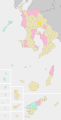
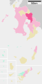 Kirishima in Kagoshima Prefecture Ja.svg 395 × 777; 12 KB
-
 Map Kirishima en.png 1.201 × 801; 34 KB
-
 1930s Japan Travel Poster - 09.jpg 2.029 × 3.000; 1,22 MB
-
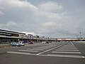
 20181213hyokei01.jpg 2.000 × 1.315; 769 KB
-
 20181213hyokei02.jpg 2.000 × 1.393; 842 KB
-
 20181213hyokei03.jpg 2.000 × 1.307; 795 KB
-
 20181213hyokei04.jpg 2.000 × 1.481; 889 KB
-
 7-Eleven EV.JPG 1.684 × 1.263; 822 KB
-
 A-Z Hayato 01.JPG 1.280 × 720; 259 KB
-
 AEON Hayato-Kokubu (SATY) 2012.JPG 1.684 × 1.263; 625 KB
-
 Alcohol brewery - panoramio.jpg 1.024 × 768; 256 KB
-
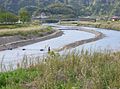 Amorigawa Ayu Fishing.jpg 1.386 × 1.030; 339 KB
-
 Amorigawa Karakunidake.jpg 1.373 × 1.020; 264 KB
-
 Amorigawa NoguchiBridge to south.jpg 1.280 × 960; 470 KB
-
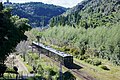
 Amorigawa River from train of Nippo Main Line.jpg 4.032 × 3.024; 1,32 MB
-
 Amorigawa ShinkawaBridge to north.jpg 1.280 × 960; 471 KB
-
 Chez house near Kagoshima airport - panoramio.jpg 1.024 × 768; 303 KB
-
 Cookey Supermarket Kokubu-kita.JPG 1.024 × 768; 257 KB
-
 Crater of Ohachi.jpg 2.000 × 1.500; 476 KB
-
 Daiichi Institute of Technology 2014-04-17 17-47.jpg 960 × 516; 124 KB
-
 Daiichi Junior College of Infant Education.JPG 3.072 × 2.304; 1,92 MB
-
 Daiwa Supermarket Kokubu-kita 2018.JPG 2.121 × 1.591; 945 KB
-
 Emblem of Hayato, Kagoshima (1969–2005).svg 200 × 200; 645 Bytes
-
 Emblem of Hayato, Kagoshima.gif 193 × 165; 4 KB
-
 Ferris wheel in Shiroyama Park at Kirishima.JPG 3.648 × 2.736; 4,78 MB
-
 Flag of Hayato Kagoshima.png 370 × 222; 9 KB
-
 Flag of Hayato, Kagoshima (1969–2005).svg 600 × 400; 675 Bytes
-
 Flower G-clef.jpg 2.000 × 1.500; 793 KB
-
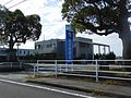
 FM Kirishima Studio 2013.JPG 1.305 × 993; 428 KB
-
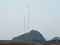
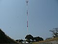
 FM Kirishima Yokogawa Repeater.JPG 3.024 × 4.032; 3,31 MB
-
 Fragment of a Landscape.jpg 5.184 × 3.888; 4,62 MB
-
 Frespo Kokubu.JPG 3.072 × 2.304; 2,3 MB
-
 Fukuyama Town Bus 1869.jpg 3.520 × 2.052; 1,45 MB
-
 Gokuraku Bus Stop Mizobe Kagoshima.JPG 1.263 × 1.684; 927 KB
-
 Graves in Uchi, Hayatocho, Kirishima, Kagoshima.jpg 6.016 × 4.000; 6,36 MB
-
 Hamanoichi Hayato 2011.JPG 1.280 × 720; 317 KB
-
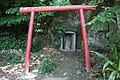
 Haraedo-jinja (Kirishima), torii.jpg 5.976 × 3.938; 10,95 MB
-
 Haraido Shrine.JPG 3.648 × 2.736; 5,59 MB
-
 Hayato Main Branch of Japan Agricultural Coorperatives Aira.jpg 4.032 × 3.024; 1,98 MB
-
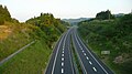
 Hayato Road 497km May 2022.jpg 4.032 × 3.024; 2,88 MB
-
 Hayato Road 497km Oct 2022.jpg 4.032 × 2.268; 2,55 MB
-
 Hayato Route 497km.jpg 1.920 × 1.080; 504 KB
-
 Hayato Station Park 20170320-1.jpg 4.032 × 3.024; 3,54 MB
-
 Hayato Station Park 20170320-2.jpg 4.032 × 3.024; 2,68 MB
-
 Hayato Station Park 20170320-3.jpg 4.032 × 3.024; 2,42 MB
-
 Hayatonokaze01bs.jpg 4.050 × 2.700; 5,98 MB
-
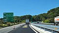
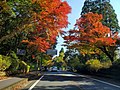
 HigashiKyushu EXPWY Kirishima Fukuyama 01.jpg 1.920 × 1.080; 767 KB
-
 Himekijou Kagoshima Japan.jpg 1.387 × 1.035; 217 KB
-
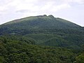
 Hinatayama Kagoshima Japan.jpg 780 × 960; 149 KB
-
 Hope & Meditate.jpg 5.184 × 3.888; 6,85 MB
-
 Hotel Kyocera, Hayato, Kirishima - Sep 20, 2019 (1).jpg 4.208 × 3.120; 5,21 MB
-
 Hotel Kyocera.JPG 3.648 × 2.736; 736 KB
-
 Iwaryujin - panoramio.jpg 1.800 × 1.200; 1,01 MB
-
 JA Aira building.jpg 6.000 × 4.000; 15,33 MB
-
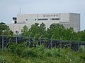
 JMSDF Kagoshima testing laboratory 2011.JPG 1.920 × 1.080; 691 KB
-
 Joyama Park (Kirishima), zenkei.jpg 6.016 × 4.000; 7,58 MB
-
 JR-Kyushu-Bus 534-2987K.jpg 1.312 × 916; 599 KB
-
 Kagoshima 20160827153403 (31382419423).jpg 3.264 × 2.448; 2,17 MB
-
 Kagoshima Bay from train for Kagoshima-Chuo Station 2.jpg 3.925 × 2.944; 1,63 MB
-
 Kagoshima P473 in Asahi, Hayato-cho, Kirishima.jpg 6.016 × 4.000; 11,07 MB
-
 Kagoshima Pref Road 471 Kokubu-Noguchi 2012.JPG 1.684 × 1.263; 646 KB
-
 Kagoshima Pref Road 472 Kokubu 01.JPG 1.664 × 1.248; 827 KB
-
 Kagoshima Pref Road 472 Shinmachi-sen 2023.jpg 4.032 × 3.024; 1,79 MB
-
 Kagoshima Pref Road 491 Kokubu-Kawauchi.JPG 1.684 × 1.263; 1,42 MB
-
 Kagoshima Pref Road 50 Yokogawa 01.JPG 1.440 × 810; 477 KB
-
 Kagoshima pref road 58 at Hayato.JPG 3.072 × 2.304; 2,03 MB
-
 Kagoshima Pref Road 60 at Kirishima-Jingu.JPG 1.684 × 1.263; 902 KB
-
 Kagoshima Prefectural Road 471 near Hayato Mound.jpg 3.968 × 2.976; 3,42 MB
-
 Kagoshima Prefectural Road 473 near Hayato Station.jpg 4.002 × 3.002; 3,35 MB
-
 Kagoshima Prefectural Road No.473 in front of Hayato Station.jpg 4.032 × 3.024; 2,9 MB
-
 Kagoshima Prefectural Road No.473 near Hayato Mound.jpg 3.939 × 2.955; 2,77 MB
-
 Kagoshima Prefectural Road No.473 near Hayato Post Office.jpg 4.032 × 3.024; 2,66 MB
-
 Kagoshima Prefectural Road No.473 near Hayato Station.jpg 4.032 × 3.024; 2,33 MB
-
 Kagoshima prefectural roads 446-3.JPG 3.264 × 2.448; 3,04 MB
-
 Kagoshima prefectural roads 470.JPG 3.264 × 2.448; 2,1 MB
-
 Kagoshima prefectural roads 50.JPG 3.264 × 2.448; 2,03 MB
-
 Kagoshima prefectural roads 55.JPG 3.264 × 2.448; 2,14 MB
-
 Kagoshima prefectural roads 56.JPG 3.264 × 2.448; 1,87 MB
-
 Kagoshima-Airport South Bus Stop West.JPG 1.684 × 1.263; 794 KB
-
 Kareigawa Bento.JPG 1.280 × 960; 529 KB
-
 Kareigawa Fureai Hall 20180505.jpg 3.987 × 2.990; 3,47 MB
-
 Kareigawa Station Park.jpg 4.032 × 3.024; 5,34 MB
-
 Kareigawa station, Kirishima, Kagoshima, Japan - panoramio (3).jpg 3.264 × 2.448; 3,9 MB
-
 Kareigawa, Kirishima, Kagoshima, Japan - panoramio (1).jpg 3.264 × 2.448; 3,69 MB
-
 Kareigawa, Kirishima, Kagoshima, Japan - panoramio (2).jpg 3.264 × 2.448; 3,82 MB
-
 Kareigawa, Kirishima, Kagoshima, Japan - panoramio (3).jpg 3.264 × 2.448; 3,73 MB
-
 Kareigawa, Kirishima, Kagoshima, Japan - panoramio.jpg 3.264 × 2.448; 3,71 MB
-
 Keirin Satellite Mizobe.JPG 3.264 × 2.448; 2,12 MB
-
 Kirishima city main areas Aerial photograph.2013.jpg 5.686 × 5.435; 12,38 MB
-
 Kirishima city map 1.png 8.544 × 11.163; 2,94 MB
-
 Kirishima city map 2.png 8.544 × 11.163; 3,16 MB
-
 Kirishima from Maruoka 2.jpg 3.522 × 1.226; 607 KB
-
 Kirishima from Maruoka 3.jpg 3.522 × 1.226; 1,65 MB
-
 Kirishima from Maruoka.jpg 3.522 × 1.226; 549 KB
-
 Kirishima Fureai Bus.JPG 3.264 × 2.448; 1,71 MB
-
 Kirishima Golf Club, Kirishima Kagoshima Aerial photograph.1976.jpg 1.665 × 2.221; 1,74 MB
-
 Kirishima International Music Festival.jpg 5.184 × 3.888; 6,76 MB
-
 Kirishima Iwasaki Hotel.jpg 2.592 × 1.740; 692 KB
-
 Kirishima montage.png 480 × 684; 707 KB
-
 Kirishima Mountains J.jpg 1.800 × 900; 280 KB
-
 Kirishima Mountains.jpg 1.800 × 900; 226 KB
-
 Kirishima Park Line 104 01.JPG 2.592 × 1.944; 3,83 MB
-
 Kirishima Park Line 480.JPG 2.592 × 1.944; 3,87 MB
-
 Kirishima pavement art.jpg 3.120 × 2.827; 2,81 MB
-
 Kirishima Shin-moedake.jpg 2.816 × 2.112; 3,68 MB
-
 Kirishima street art 2.jpg 4.160 × 3.120; 3,2 MB
-
 Kirishima-CCI 2014.JPG 1.684 × 1.263; 1,02 MB
-
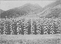
 Kirishimacha plantation - panoramio.jpg 1.200 × 1.800; 972 KB
-
 Kokubu PA.JPG 3.648 × 2.052; 3,38 MB
-
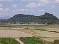
 Kokubu Plain.jpg 3.645 × 1.940; 662 KB
-
 Kokubu Stadium 1.JPG 3.648 × 2.736; 1,8 MB
-
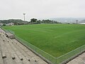 Kokubu Stadium 2.JPG 3.648 × 2.736; 1,82 MB
-
 Kokubu Stadium 3.JPG 3.648 × 2.736; 2,35 MB
-
 Kyocera Kagoshima Kokubu.JPG 2.410 × 1.805; 779 KB
-
 Landing place of Sakamoto Ryoma in Port of Hayato-2.jpg 6.016 × 4.000; 9,2 MB
-
 Landing place of Sakamoto Ryoma in Port of Hayato.jpg 5.976 × 3.938; 11 MB
-
 Location of Fukuyama, Kagoshima, Japan.svg 395 × 777; 260 KB
-
 Location of Hayato, Kagoshima, Japan.svg 395 × 777; 260 KB
-
 Location of Kirishima(old), Kagoshima, Japan.svg 395 × 777; 260 KB
-
 Location of Kokubu, Kagoshima, Japan.svg 395 × 777; 261 KB
-
 Location of Makizono, Kagoshima, Japan.svg 395 × 777; 260 KB
-
 Location of Mizobe, Kagoshima, Japan.svg 395 × 777; 260 KB
-
 Location of Yokogawa, Kagoshima, Japan.svg 395 × 777; 260 KB
-
 Makinohara Route69 Sign Kagoshima.JPG 538 × 398; 84 KB
-
 Manhole cover of Kokubu & Hayato, Kirishima, Kagoshima.jpg 3.925 × 2.944; 5,51 MB
-
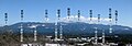
 MBC JOCF AM Radio Tower 2024.jpg 8.160 × 6.120; 8,01 MB
-
 MBC Kirishima Branch 2015.JPG 2.121 × 1.591; 1,39 MB
-
 MBC-JOCF Hayato 2015.JPG 1.591 × 2.121; 806 KB
-
 MBC-JOCF.jpg 2.396 × 1.796; 690 KB
-
 Minami-nippon Shimbun Kokubu Center.JPG 1.632 × 1.224; 879 KB
-
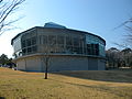 Miyama Conceru.JPG 3.264 × 2.448; 1,85 MB
-
 Miyama Conseru Guide Map.jpg 5.184 × 3.888; 3,69 MB
-
 Miyama Conseru Main Hall.jpg 5.184 × 3.888; 4,64 MB
-
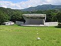 Miyama Conseru Open Air Concert Arena.jpg 5.184 × 3.888; 5,32 MB
-
 Miyama Conseru.jpg 5.184 × 3.888; 3,94 MB
-
 Miyauchibaru Aqueduct near Hayato Mound 2.jpg 3.995 × 2.997; 3,4 MB
-
 Miyauchibaru Aqueduct near Hayato Mound 3.jpg 4.032 × 3.024; 3,8 MB
-
 Miyauchibaru Aqueduct near Hayato Mound 4.jpg 4.014 × 3.011; 2,71 MB
-
 Miyauchibaru Aqueduct near Hayato Mound.jpg 3.995 × 2.996; 3,41 MB
-
 Miyaura-Guu Fukuyama Kagoshima 2013.JPG 1.296 × 972; 869 KB
-
 Miyazaki 20160828100749 (31817811460).jpg 2.048 × 1.536; 1.007 KB
-
 Miyazaki 20160828101922 (31817811890).jpg 2.048 × 1.536; 1,39 MB
-
 Miyazaki 20160828102340 (31817812290).jpg 1.536 × 2.048; 690 KB
-
 Miyazaki Kagoshima prefectural route 1 MakizonoCho Shintoko.jpg 1.168 × 776; 456 KB
-
 Miyazaki prefectural roads and Kagoshima prefectural roads 1.JPG 3.264 × 2.448; 2,53 MB
-
 Miyazaki prefectural roads and Kagoshima prefectural roads 2 Kirishima-Soo border.JPG 3.264 × 2.448; 2,02 MB
-
 Mizobe PA.JPG 3.648 × 2.736; 1,33 MB
-
 Myoken hydropower station.jpg 1.228 × 921; 414 KB
-
 Myoken Tunnel.JPG 1.846 × 1.270; 800 KB
-
 NDL-DC 762376 0331 0011crd-KokubuTabakoBatake.jpg 560 × 412; 65 KB
-
 NHK-JOHG.jpg 3.072 × 2.304; 1.001 KB
-
 Nihon fūkei senshū, Ōsumi Anraku onsen by Kawase Hasui.jpg 1.194 × 1.600; 489 KB
-
 Nippo Main Line and Hayato Station from Hayatozuka Crossing.jpg 4.032 × 3.024; 3,98 MB
-
 Nosaka Interchange.JPG 3.648 × 2.736; 3,26 MB
-
 Oonaminoike Kagoshima Japan.jpg 1.500 × 1.500; 468 KB
-
 Osumi Kokufu-ato, sekihi.jpg 5.958 × 3.912; 10,56 MB
-
 Past and Future.jpg 5.184 × 3.888; 2,94 MB
-
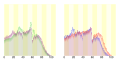 Population distribution of Kirishima, Kagoshima, Japan.svg 512 × 256; 22 KB
-
 Port of Hayato, zenkei.jpg 6.016 × 4.000; 7,23 MB
-
 Producing Black Vinegar at Fukuyama.jpg 3.648 × 2.736; 1,75 MB
-
 Road side station Kirishima , 道の駅 霧島 - panoramio.jpg 5.279 × 900; 478 KB
-
 Roadside Station Kirishima.jpg 2.816 × 2.112; 3,57 MB
-
 Route 10 ja Kagoshima Kamewari Pass 2015.JPG 1.632 × 1.224; 625 KB
-
 Route 220 at Shikine.JPG 3.648 × 2.736; 4,02 MB
-
 Route 504 Ja Kagoshima Airport.JPG 1.684 × 1.263; 687 KB
-
 Route10 Aira-Kirishima border.JPG 3.264 × 2.448; 2,19 MB
-
 Route10 Kirishima-Aira border.JPG 3.264 × 2.448; 825 KB
-
 Route10 Kirishima-Soo border.JPG 3.264 × 2.448; 1,89 MB
-
 Route10 Soo-Kirishima border.JPG 3.264 × 2.448; 2,02 MB
-
 Route223 Ja Kirishima-Taguchi 2021 Nov.jpg 2.016 × 1.512; 1,94 MB
-
 Route223 Miyakonojo 01.JPG 1.920 × 1.080; 855 KB
-
 Ryujin mountain - panoramio.jpg 1.200 × 1.800; 917 KB
-
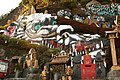
 Sekitai-jinja, haiden.jpg 6.010 × 3.990; 10,35 MB
-
 Shikine-batoukannon.JPG 4.272 × 2.848; 4,7 MB
-
 Shinichi Nakashige 20181213.jpg 566 × 755; 171 KB
-
 Shiobitashi Power Station.jpg 3.648 × 2.736; 2,28 MB
-
 Shiroyama park at Kirishima.jpg 1.280 × 720; 586 KB
-
 Sony Kokubu.JPG 1.280 × 960; 439 KB
-
 Sony kokubu.jpg 2.868 × 2.151; 5,32 MB
-
 SunAmuse Kokubu 2015.JPG 2.121 × 1.591; 1 MB
-
 Tachibanakijou.jpg 2.805 × 2.104; 749 KB
-
 Takaya-jinja (Kirishima), shaden.jpg 4.000 × 2.652; 5,22 MB
-
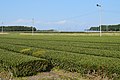
 Tea Plantation in Jusanzukabaru.jpg 3.580 × 2.685; 2,17 MB
-
 Tea Plantation near Kagoshima Airport.jpg 4.265 × 2.839; 5,22 MB
-
 The Miyama Conseru Main entrance.jpg 5.184 × 3.888; 3,83 MB
-
 Tomb of Shimazu Yoshihisa in Tokujian-ato.jpg 6.014 × 3.996; 11,26 MB
-
 Tree and village - 1930s Japan Travel Poster - 09 (cropped).jpg 802 × 1.682; 364 KB
-
 View from overpass of Hayato Station (south).jpg 4.004 × 3.003; 3,36 MB
-
 View from overpass of Kokubu Station (north).jpg 4.032 × 3.024; 2,62 MB
-
 View in front of Hayato Station 2.jpg 4.032 × 3.024; 2,74 MB
-
 View in front of Hayato Station.jpg 3.941 × 2.956; 2,55 MB
-
 View in front of Kareigawa Station.jpg 4.008 × 3.006; 3,74 MB
-
 View near Hayato Mound.jpg 4.032 × 3.024; 3,55 MB
-
 View of Kareigawa Station Park.jpg 3.988 × 2.991; 4,13 MB
-
 View on west side of Hayato Station.jpg 3.984 × 2.988; 3,77 MB
-
 Village Vanguard Hayato.JPG 1.684 × 1.263; 844 KB


_2012.JPG)


.jpg)
.jpg)
.jpg)


.jpg)
.jpg)
.jpg)


.svg)
.svg)
,_torii.jpg)
.jpg)
,_zenkei.jpg)
.jpg)
.jpg)
.jpg)
.jpg)
.jpg)
,_Kagoshima,_Japan.svg)
,_shaden.jpg)