Category:Kirk Ireton
Aller à la navigation
Aller à la recherche
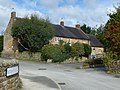
English: Kirk Ireton is a village in Derbyshire, England. It is located 4 miles south of Wirksworth nestling on a hillside, 700ft above sea level. The village is believed to mean 'Church of Irish Enclosure' and the village is possibly where Celtic missionaries originally settled.
village britannique  | |||||
| Téléverser des médias | |||||
| Nature de l’élément | |||||
|---|---|---|---|---|---|
| Lieu | Derbyshire Dales, Derbyshire, Midlands de l'Est, Angleterre | ||||
| Réputé identique à | Kirk Ireton (page en doublon, paroisse civile) | ||||
 | |||||
Sous-catégories
Cette catégorie comprend 4 sous-catégories, dont les 4 ci-dessous.
Média dans la catégorie « Kirk Ireton »
Cette catégorie comprend 162 fichiers, dont les 162 ci-dessous.
-
 "Isn't it good" - geograph.org.uk - 1129020.jpg 640 × 480 ; 72 kio
-
 "So, I lit a fire" - geograph.org.uk - 1129010.jpg 640 × 480 ; 72 kio
-
 A view towards Kirk Ireton - geograph.org.uk - 2244120.jpg 3 648 × 2 736 ; 6,3 Mio
-
 Amenities building at Carsington Water - geograph.org.uk - 3183963.jpg 600 × 800 ; 140 kio
-
 An inlet of Carsington Water - geograph.org.uk - 3093984.jpg 1 024 × 806 ; 321 kio
-
 At Carsington Water on the eastern shore - geograph.org.uk - 3554010.jpg 3 648 × 2 736 ; 2,31 Mio
-
 Avenue of Trees, Carsington, Derbyshire UK - geograph.org.uk - 6030073.jpg 2 400 × 1 589 ; 2,18 Mio
-
 Badger scraping - geograph.org.uk - 2246491.jpg 3 648 × 2 736 ; 5,99 Mio
-
 Barley Mow Inn, Kirk Ireton - geograph.org.uk - 5801524.jpg 427 × 640 ; 106 kio
-
 Barn conversions at Upperfield Farm - geograph.org.uk - 5471673.jpg 1 600 × 1 200 ; 606 kio
-
 Bay at Millfields, southern end of Carsington Water reservoir - geograph.org.uk - 3187198.jpg 4 000 × 3 000 ; 2,24 Mio
-
 Bench at the southern end of Carsington Water - geograph.org.uk - 3553991.jpg 3 648 × 2 736 ; 2,31 Mio
-
 Bigginmill Lane, footpath sign and stile - geograph.org.uk - 2246494.jpg 3 648 × 2 736 ; 5,95 Mio
-
 Bird box near path around Carsington Water reservoir - geograph.org.uk - 3187230.jpg 4 000 × 2 500 ; 2,29 Mio
-
 Blackwall Farmhouse. - geograph.org.uk - 290257.jpg 640 × 480 ; 125 kio
-
 Blackwall House - geograph.org.uk - 290294.jpg 640 × 480 ; 119 kio
-
 Blackwall House Barn - geograph.org.uk - 290299.jpg 480 × 640 ; 122 kio
-
 Blackwall House Entrance. - geograph.org.uk - 290292.jpg 640 × 480 ; 123 kio
-
 Blackwall Lane - geograph.org.uk - 3171891.jpg 2 560 × 1 920 ; 1,56 Mio
-
 Blackwall Plantation - geograph.org.uk - 5471651.jpg 1 600 × 1 200 ; 466 kio
-
 Blind Lane - geograph.org.uk - 3578128.jpg 640 × 480 ; 83 kio
-
 Blind Lane at Moor Lane - geograph.org.uk - 2440251.jpg 800 × 600 ; 309 kio
-
 Blind Lane at Oldfield Lane - geograph.org.uk - 2440242.jpg 800 × 600 ; 359 kio
-
 Boggy Field - geograph.org.uk - 290251.jpg 640 × 480 ; 124 kio
-
 Bottom Lons, Broadway and Top Lons - geograph.org.uk - 2244135.jpg 3 648 × 2 736 ; 5,78 Mio
-
 Broad Way and view to Kirk Ireton - geograph.org.uk - 3400471.jpg 750 × 563 ; 106 kio
-
 Broad Way Road Junction. - geograph.org.uk - 290256.jpg 640 × 480 ; 121 kio
-
 Broom Lane - geograph.org.uk - 1470173.jpg 640 × 480 ; 102 kio
-
 Bullhill on Broadway - geograph.org.uk - 2244124.jpg 3 648 × 2 736 ; 4,21 Mio
-
 Buxton Hall, Kirk Ireton.jpg 4 000 × 3 000 ; 1,56 Mio
-
 Carsington Water - geograph.org.uk - 3171899.jpg 4 000 × 3 000 ; 4,79 Mio
-
 Carsington Water - geograph.org.uk - 3183968.jpg 800 × 600 ; 79 kio
-
 Carsington Water - geograph.org.uk - 5838029.jpg 1 024 × 677 ; 195 kio
-
 Carsington Water - south end - geograph.org.uk - 1890002.jpg 640 × 480 ; 110 kio
-
 Carsington Water Caravan Club Site, Millfields Lane, Kirk Ireton - geograph.org.uk - 3971424.jpg 2 048 × 1 360 ; 1,01 Mio
-
 Carsington Water Draw Off Tower - geograph.org.uk - 3183958.jpg 800 × 600 ; 89 kio
-
 Carsington Water foot and cycle path - geograph.org.uk - 3183965.jpg 800 × 600 ; 192 kio
-
 Carsington Water foot and cycle path - geograph.org.uk - 3183975.jpg 800 × 600 ; 149 kio
-
 Carsington Water towards Upperfield Farm - geograph.org.uk - 3093996.jpg 1 024 × 691 ; 221 kio
-
 Church Farm, Kirk Ireton.jpg 4 000 × 3 000 ; 4,64 Mio
-
 Churchside House.jpg 4 000 × 3 000 ; 1,58 Mio
-
 Closure on path round Carsington Water reservoir - geograph.org.uk - 3187205.jpg 4 000 × 3 000 ; 3,62 Mio
-
 Cobbled viewing area to the south of Carsington Water - geograph.org.uk - 3553998.jpg 3 648 × 2 736 ; 2,38 Mio
-
 Cottage in Hemp Yard, Kirk Ireton.jpg 4 000 × 3 000 ; 4,73 Mio
-
 Cottages at Townend Farm, Kirk Ireton.jpg 4 000 × 3 000 ; 4,7 Mio
-
 Cottages beside the path - geograph.org.uk - 1890022.jpg 640 × 480 ; 129 kio
-
 Crossroads, Wapentake Lane and Tinkerley Lane - geograph.org.uk - 1753294.jpg 640 × 480 ; 133 kio
-
 Cyclists turn left, pedestrians straight on. - geograph.org.uk - 1890011.jpg 640 × 480 ; 159 kio
-
 Dead trees on the shoreline of Carsington Water - geograph.org.uk - 4800668.jpg 800 × 563 ; 142 kio
-
 Derbyshire UK parish map highlighting Kirk Ireton.svg 888 × 1 308 ; 2,34 Mio
-
 Derelict Barn - geograph.org.uk - 290253.jpg 640 × 480 ; 120 kio
-
 Don't say you haven't been warned - geograph.org.uk - 1129004.jpg 640 × 480 ; 65 kio
-
 Draw Off Tower on Carsington Water - geograph.org.uk - 3553994.jpg 3 521 × 2 641 ; 1,66 Mio
-
 Entrance to Caravan Club Site, Blackwall Plantation - geograph.org.uk - 3171877.jpg 4 000 × 3 000 ; 4,92 Mio
-
 Entrance to Kirk Ireton - geograph.org.uk - 3578114.jpg 640 × 449 ; 104 kio
-
 Farm entrance in Hays Lane - geograph.org.uk - 6207878.jpg 4 608 × 3 456 ; 7,61 Mio
-
 Farm track to Kirk Ireton - geograph.org.uk - 3401090.jpg 750 × 563 ; 155 kio
-
 Field by Topshill Farm - geograph.org.uk - 3401107.jpg 750 × 563 ; 86 kio
-
 Field Lane - geograph.org.uk - 3578119.jpg 640 × 480 ; 125 kio
-
 Fields and views near Field Farm - geograph.org.uk - 3401083.jpg 750 × 563 ; 100 kio
-
 Fields near Bullhill - geograph.org.uk - 3400429.jpg 750 × 563 ; 144 kio
-
 Fields near Kirk Ireton - geograph.org.uk - 3172007.jpg 2 886 × 2 976 ; 3,19 Mio
-
 Footbridge and stream below Carsington dam - geograph.org.uk - 3093969.jpg 1 024 × 616 ; 293 kio
-
 Footpath round Carsington water reservoir - geograph.org.uk - 3187217.jpg 4 000 × 3 000 ; 3,31 Mio
-
 Gorsey Lane - Passing Point - geograph.org.uk - 1470142.jpg 640 × 480 ; 67 kio
-
 Grassland and Woodland near Carsington Water - geograph.org.uk - 3890431.jpg 3 996 × 2 994 ; 1,6 Mio
-
 Green Farm, Kirk Ireton.jpg 4 000 × 3 000 ; 4,74 Mio
-
 Hays Farm, by Biggin - geograph.org.uk - 2246485.jpg 3 648 × 2 736 ; 4,42 Mio
-
 Hays Lane in the Afternoon - geograph.org.uk - 6207877.jpg 4 608 × 3 456 ; 7,7 Mio
-
 Hays Lane in the Afternoon - geograph.org.uk - 6207881.jpg 3 456 × 4 608 ; 6,4 Mio
-
 Hays Lane near Kirk Ireton, Derbyshire - geograph.org.uk - 2167314.jpg 2 640 × 1 980 ; 757 kio
-
 Hillside fields and trees - geograph.org.uk - 3401080.jpg 750 × 563 ; 107 kio
-
 Hillside Meadow - geograph.org.uk - 6207885.jpg 4 608 × 3 456 ; 7,15 Mio
-
 Houses at Blackwall - geograph.org.uk - 2244155.jpg 3 648 × 2 736 ; 5,64 Mio
-
 Ingwell and Brook Cottages, Kirk Ireton.jpg 4 000 × 3 000 ; 5,04 Mio
-
 Inlet of Carsington Water - geograph.org.uk - 3554012.jpg 3 648 × 2 736 ; 2,19 Mio
-
 Inside a stone hut at Carsington Water - geograph.org.uk - 4800630.jpg 800 × 600 ; 107 kio
-
 Island - Carsington Water - geograph.org.uk - 3171910.jpg 4 000 × 2 118 ; 2,21 Mio
-
 Sundial - geograph.org.uk - 290302.jpg 640 × 480 ; 123 kio
-
 Kirk Ireton - geograph.org.uk - 251001.jpg 640 × 480 ; 76 kio
-
 Kirk Ireton - geograph.org.uk - 252470.jpg 640 × 480 ; 72 kio
-
 Kirk Ireton - geograph.org.uk - 5819352.jpg 640 × 427 ; 73 kio
-
 Kirk Ireton Methodist Chapel.jpg 4 000 × 3 000 ; 4,87 Mio
-
 Kirk Ireton primary school - geograph.org.uk - 3401099.jpg 750 × 563 ; 108 kio
-
 Kirk Ireton village scene - geograph.org.uk - 3401094.jpg 750 × 495 ; 81 kio
-
 Lakeside Path - Carsington Water - geograph.org.uk - 3171987.jpg 4 000 × 3 000 ; 4,47 Mio
-
 Lane Junction between Kirk Ireton and Carsington - geograph.org.uk - 3890423.jpg 3 798 × 2 710 ; 1,35 Mio
-

-
 Looking up Top Lons - geograph.org.uk - 5823018.jpg 2 000 × 1 333 ; 3,57 Mio
-
 Lukes Cottage, Kirk Ireton.jpg 3 000 × 4 000 ; 1,5 Mio
-
 Main Street, Kirk Ireton - geograph.org.uk - 3401098.jpg 750 × 563 ; 117 kio
-
 Manor House, Kirk Ireton.jpg 4 000 × 3 000 ; 4,82 Mio
-
 Memorial at Carsington Water - geograph.org.uk - 4800413.jpg 709 × 800 ; 224 kio
-
 Moorside Cottage.jpg 4 000 × 3 000 ; 1,85 Mio
-
 Northfield Farmhouse.jpg 4 000 × 3 000 ; 4,95 Mio
-
 Old Railway Goods Van - geograph.org.uk - 291301.jpg 640 × 480 ; 125 kio
-
 On Blackwall Lane - geograph.org.uk - 2244138.jpg 3 648 × 2 736 ; 5,67 Mio
-
 Outskirts of Kirk Ireton - geograph.org.uk - 252463.jpg 640 × 480 ; 69 kio
-
 Overlooking Biggin from The Mountain - geograph.org.uk - 3401077.jpg 750 × 563 ; 103 kio
-
 Path and Cycle Route near Upperfield Farm - geograph.org.uk - 4339930.jpg 4 000 × 3 000 ; 2,71 Mio
-

-
 Path bends around inlet of Carsington Water - geograph.org.uk - 3554014.jpg 2 736 × 3 648 ; 2,29 Mio
-
 Path leading towards Millfields, Carsington Water - geograph.org.uk - 3554005.jpg 3 648 × 2 736 ; 2,46 Mio
-
 Path near Bullhill - geograph.org.uk - 3400442.jpg 750 × 563 ; 123 kio
-
 Paths at Carsington Water - geograph.org.uk - 4800514.jpg 800 × 499 ; 124 kio
-
 Paths leading to Idridgehay - geograph.org.uk - 2244104.jpg 3 648 × 2 736 ; 5,76 Mio
-
 Paving beside Carsington Water - geograph.org.uk - 3183960.jpg 800 × 600 ; 146 kio
-
 Picnic area at Millfields - Carsington Water - geograph.org.uk - 5470680.jpg 1 600 × 1 200 ; 674 kio
-
 Picnic area by Carsington Water - geograph.org.uk - 3093976.jpg 916 × 1 024 ; 159 kio
-
 Prospect House, Kirk Ireton 01.jpg 4 000 × 3 000 ; 4,9 Mio
-
 Prospect House, Kirk Ireton 02.jpg 4 000 × 3 000 ; 5,15 Mio
-
 Public Footpath Joining Broad Way - geograph.org.uk - 2489347.jpg 3 296 × 2 472 ; 1,08 Mio
-
 Public Footpath near The Mountain - geograph.org.uk - 2489346.jpg 3 296 × 2 472 ; 1,14 Mio
-
 Remains of a small quarry - geograph.org.uk - 2244147.jpg 3 648 × 2 736 ; 5,73 Mio
-
 Rose Bank.jpg 4 000 × 3 000 ; 5,11 Mio
-
 Sheep pasture above Carsington Water - geograph.org.uk - 5472401.jpg 1 600 × 1 200 ; 431 kio
-
 Small island in Carsington Water - geograph.org.uk - 3772598.jpg 4 912 × 3 264 ; 6,94 Mio
-
 Small Island in Carsington Water - geograph.org.uk - 6207884.jpg 4 608 × 3 456 ; 7,66 Mio
-
 Stable Shop, Kirk Ireton.jpg 4 000 × 3 000 ; 4,86 Mio
-
 Still The Promised Land - geograph.org.uk - 2246478.jpg 3 648 × 2 736 ; 5,78 Mio
-
 Stone hut at Carsington Water - geograph.org.uk - 4800622.jpg 682 × 800 ; 201 kio
-
 Stone hut beside Carsington Water - geograph.org.uk - 5243102.jpg 1 280 × 853 ; 528 kio
-
 Tall Pine Trees in the Evening Sun - geograph.org.uk - 6207889.jpg 4 608 × 3 456 ; 6,25 Mio
-
 The Disused Mill. - geograph.org.uk - 290281.jpg 640 × 480 ; 125 kio
-
 The end of Oldfield Lane - geograph.org.uk - 4800672.jpg 800 × 595 ; 200 kio
-

-
 The fork in Gibfield Lane - geograph.org.uk - 6153859.jpg 2 000 × 1 330 ; 2,93 Mio
-
 The junction of Broom Lane and Gibfield Lane - geograph.org.uk - 2440231.jpg 800 × 600 ; 317 kio
-
 The new footbridge. - geograph.org.uk - 290283.jpg 480 × 640 ; 119 kio
-
 The path at the end of the creek - geograph.org.uk - 1890037.jpg 640 × 480 ; 120 kio
-
 The road to the reservoir - geograph.org.uk - 6153865.jpg 2 000 × 1 330 ; 2,61 Mio
-
 The southern end of Carsington Water - geograph.org.uk - 4800478.jpg 800 × 600 ; 141 kio
-
 The valve tower at Carsington Water - geograph.org.uk - 4800473.jpg 800 × 600 ; 96 kio
-
 Topshill Lane and farm - geograph.org.uk - 3401104.jpg 750 × 377 ; 87 kio
-

-
 Town End in Kirk Ireton - geograph.org.uk - 2489345.jpg 3 296 × 2 472 ; 1,04 Mio
-
 Track around Carsington Water - geograph.org.uk - 3094002.jpg 768 × 1 024 ; 359 kio
-
 Track from Winneyhill - geograph.org.uk - 3400396.jpg 750 × 563 ; 100 kio
-
 Tree Trunk Shadows - geograph.org.uk - 6204259.jpg 4 608 × 3 456 ; 7,12 Mio
-
 Trees at field edge, with buzzard - geograph.org.uk - 1754449.jpg 586 × 640 ; 108 kio
-
 Unsuitable for HGV's - geograph.org.uk - 5823016.jpg 2 000 × 1 333 ; 2,99 Mio
-
 Upperfield Farm.jpg 4 000 × 3 000 ; 5,01 Mio
-
 Upperfields Bay at Carsington Water - geograph.org.uk - 4800646.jpg 800 × 596 ; 110 kio
-
 Upperfields Bay at Carsington Water - geograph.org.uk - 4800652.jpg 800 × 566 ; 136 kio
-
 Valve tower at Carsington Water - geograph.org.uk - 5474512.jpg 1 600 × 1 200 ; 384 kio
-
 View north across Carsington Water - geograph.org.uk - 4798769.jpg 800 × 708 ; 178 kio
-
 View of Kirk Ireton from the southeast - geograph.org.uk - 3400412.jpg 750 × 563 ; 104 kio
-
 View over Lendow Wood to Carsington Water reservoir - geograph.org.uk - 3187209.jpg 3 968 × 2 144 ; 2,04 Mio
-
 View south across Upperfields Bay - geograph.org.uk - 4800674.jpg 800 × 560 ; 122 kio
-
 Viewing area at Carsington Water - geograph.org.uk - 4800466.jpg 800 × 490 ; 126 kio
-
 Wapentake Lane - Approaching Crossroads - geograph.org.uk - 1470119.jpg 640 × 480 ; 88 kio
-
 Wapentake Lane - geograph.org.uk - 3401108.jpg 750 × 563 ; 135 kio
-
 Water Tower at Carsington Reservoir, Derbyshire, UK - geograph.org.uk - 6030069.jpg 2 400 × 1 590 ; 1,32 Mio
-
 Water treatment plant below Carsington Water reservoir - geograph.org.uk - 3187180.jpg 4 000 × 3 000 ; 1,88 Mio
-
 Well Banks, Kirk Ireton.jpg 4 000 × 3 000 ; 4,61 Mio
-
 What's left of Oldfield Lane, Carsington Reservoir, Derbyshire - geograph.org.uk - 2031723.jpg 1 980 × 2 640 ; 1,37 Mio
-
 Winneyhill Farm - geograph.org.uk - 2244111.jpg 3 648 × 2 736 ; 5,51 Mio
-
 Wirksworth Road from Kirk Ireton - geograph.org.uk - 3401102.jpg 750 × 563 ; 145 kio
-
 Woodland Path - geograph.org.uk - 6204232.jpg 3 456 × 4 608 ; 7,06 Mio
-
 Woodland Trees in the Evening Sun - geograph.org.uk - 6204209.jpg 3 456 × 4 608 ; 6,56 Mio
-
 Footpath Near Alton Hall - geograph.org.uk - 251010.jpg 640 × 480 ; 82 kio
-
 Lane Near Tinkerley Farm - geograph.org.uk - 251013.jpg 640 × 480 ; 109 kio


