Category:Kirkburn
Vai alla navigazione
Vai alla ricerca
English: Kirkburn is a small village and civil parish in the East Riding of Yorkshire, England. It is situated about 3 miles (4.8 km) south west of Driffield town centre and is on the A614 road.
village and civil parish in East Riding of Yorkshire, UK  | |||||
| Carica un file multimediale | |||||
| Istanza di | |||||
|---|---|---|---|---|---|
| Luogo | East Riding of Yorkshire, Yorkshire e Humber, Inghilterra | ||||
 | |||||
Sottocategorie
Questa categoria contiene le 7 sottocategorie indicate di seguito, su un totale di 7.
E
- Eastburn Beck (4 F)
K
- Kirkburn Sword (4 F)
R
- RAF Driffield (43 F)
S
- Southburn (17 F)
- St Mary's Church, Kirkburn (5 F)
File nella categoria "Kirkburn"
Questa categoria contiene 200 file, indicati di seguito, su un totale di 233.
(pagina precedente) (pagina successiva)-

-
 A Green Lane towards Garton Balk (track) - geograph.org.uk - 3909700.jpg 800 × 532; 185 KB
-
 A Green Lane towards Garton Balk (track) - geograph.org.uk - 3910361.jpg 800 × 532; 188 KB
-

-
 A wind break west of Kirkburn - geograph.org.uk - 1013213.jpg 640 × 427; 233 KB
-
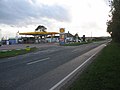
 A614 - geograph.org.uk - 5429788.jpg 640 × 426; 50 KB
-
 A614 Driffield by-pass - geograph.org.uk - 4368040.jpg 640 × 480; 89 KB
-
 A614 heading south west - geograph.org.uk - 4368069.jpg 640 × 480; 60 KB
-
 A614 towards Driffield - geograph.org.uk - 1351300.jpg 640 × 480; 69 KB
-
 A614 towards Goole - geograph.org.uk - 4357269.jpg 640 × 480; 95 KB
-
 A614 towards Goole - geograph.org.uk - 4357275.jpg 640 × 480; 110 KB
-
 A614 towards Goole - geograph.org.uk - 4362435.jpg 640 × 480; 96 KB
-
 A614 towards Goole - geograph.org.uk - 4368064.jpg 640 × 480; 64 KB
-
 A614 towards Goole - geograph.org.uk - 4371577.jpg 640 × 480; 66 KB
-
 A614, Eastburn - geograph.org.uk - 5429786.jpg 640 × 426; 66 KB
-
 Alongside a boundary plantation - geograph.org.uk - 4320889.jpg 1 024 × 768; 185 KB
-
 Alongside Wellsprings Drain - geograph.org.uk - 5252706.jpg 1 024 × 768; 194 KB
-
 Anaerobic Digestion Facility GWE Biogas Ltd - geograph.org.uk - 4767146.jpg 4 526 × 3 346; 6,57 MB
-
 And they are off - geograph.org.uk - 2921820.jpg 800 × 600; 102 KB
-
 Approaching Kelleythorpe Roundabout - geograph.org.uk - 4357231.jpg 640 × 480; 70 KB
-
 At the ready with camera in hand - geograph.org.uk - 2921808.jpg 800 × 600; 110 KB
-
 Auchinleck Close, near Driffield - geograph.org.uk - 5042575.jpg 640 × 480; 585 KB
-
 Barn, Kelleythorpe - geograph.org.uk - 4357234.jpg 640 × 480; 116 KB
-
 Battleburn.jpg 640 × 482; 126 KB
-

-
 Bridge over Eastburn Beck, Kirkburn - geograph.org.uk - 3187090.jpg 1 024 × 768; 260 KB
-
 Bridleway at Low Wood - geograph.org.uk - 2195127.jpg 4 000 × 3 000; 3,96 MB
-
 Building, former RAF Driffield - geograph.org.uk - 4357264.jpg 640 × 480; 74 KB
-
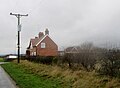
 Burn House, Kirkburn - geograph.org.uk - 1013206.jpg 640 × 427; 248 KB
-
 Bus shelter on the A614 - geograph.org.uk - 3468447.jpg 800 × 600; 145 KB
-
 Bus stop on the A614 - geograph.org.uk - 4357251.jpg 640 × 480; 75 KB
-
 Called a track more a footpath - geograph.org.uk - 4767151.jpg 4 520 × 3 336; 7,52 MB
-
 Clearing in the Woods - geograph.org.uk - 454258.jpg 640 × 480; 92 KB
-
 Cottages, Kirkburn - geograph.org.uk - 3190873.jpg 1 024 × 768; 125 KB
-
 Course of the former railway to Driffield - geograph.org.uk - 5252703.jpg 1 024 × 768; 134 KB
-
 Crop field and hedgerow - geograph.org.uk - 4357348.jpg 640 × 480; 94 KB
-
 Crop field and hedgerow - geograph.org.uk - 4362437.jpg 640 × 480; 107 KB
-
 Crop field and hedgerow - geograph.org.uk - 4362441.jpg 640 × 480; 104 KB
-
 Crop field and hedgerow - geograph.org.uk - 4368065.jpg 640 × 433; 61 KB
-
 Crop field east of Station Road - geograph.org.uk - 4357373.jpg 640 × 480; 92 KB
-
 Crop field near Eastburn Warren Farm - geograph.org.uk - 4357353.jpg 640 × 480; 73 KB
-
 Crop field near Eastburn Warren Farm - geograph.org.uk - 4368085.jpg 640 × 480; 69 KB
-

-

-

-
 Cross Country Driving Circuit - geograph.org.uk - 454209.jpg 640 × 480; 77 KB
-
 Cross Country Driving Obstacle - geograph.org.uk - 454269.jpg 640 × 480; 58 KB
-
 Cycle path beside the A614 - geograph.org.uk - 4357239.jpg 640 × 480; 121 KB
-
 Cycle path beside the A614 - geograph.org.uk - 4371576.jpg 640 × 480; 52 KB
-
 Danger sign, near Eastburn - geograph.org.uk - 5042552.jpg 457 × 640; 483 KB
-
 Driffield Camp - geograph.org.uk - 4357258.jpg 640 × 391; 62 KB
-
 Driffield RUFC from the showground - geograph.org.uk - 4113108.jpg 640 × 480; 89 KB
-
 Driffield RUFC, Kelleythorpe, Driffield - geograph.org.uk - 3927949.jpg 1 600 × 1 064; 406 KB
-
 Driffield Showground - geograph.org.uk - 5042593.jpg 640 × 432; 315 KB
-
 Driffield Showground, aerial - geograph.org.uk - 3138942.jpg 640 × 427; 93 KB
-

-
 East of Kirkburn - geograph.org.uk - 784456.jpg 640 × 404; 78 KB
-
 Eastburn Beck - geograph.org.uk - 5042363.jpg 640 × 480; 583 KB
-
 Eastburn Warren Farm - geograph.org.uk - 110611.jpg 640 × 480; 184 KB
-
 Eastburn Warren Farm - geograph.org.uk - 1374162.jpg 640 × 480; 56 KB
-
 Eastburn Warren Farm - geograph.org.uk - 1832648.jpg 640 × 480; 77 KB
-
 Eastburn Warren Farm - geograph.org.uk - 3468506.jpg 800 × 600; 141 KB
-
 Eastburn Warren Farm - geograph.org.uk - 4357336.jpg 640 × 480; 67 KB
-
 Eastburn Warren Farm - geograph.org.uk - 4362447.jpg 640 × 480; 58 KB
-
 Entering Kirkburn, A614 - geograph.org.uk - 5429787.jpg 640 × 426; 105 KB
-
 Entering Southburn, East Yorkshire - geograph.org.uk - 2261151.jpg 800 × 600; 303 KB
-
 Entrance to former RAF Driffield - geograph.org.uk - 4357262.jpg 640 × 420; 45 KB
-
 Exhibition halls, Driffield Showground - geograph.org.uk - 6152709.jpg 800 × 517; 110 KB
-
 Farm buildings at Eastburn - geograph.org.uk - 5042515.jpg 499 × 640; 577 KB
-
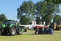
 Farm Machinery on the A164, Driffield - geograph.org.uk - 3927967.jpg 1 600 × 1 064; 570 KB
-
 Farm track near Tibthorpe - geograph.org.uk - 5831374.jpg 683 × 1 024; 887 KB
-
 Farmland and Wellsprings Drain - geograph.org.uk - 1832635.jpg 640 × 410; 85 KB
-
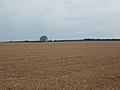
 Farmland at SE970578 - geograph.org.uk - 110631.jpg 640 × 480; 160 KB
-
 Farmland near Eastburn Warren Farm - geograph.org.uk - 4357343.jpg 640 × 480; 73 KB
-
 Farmland near Eastburn Warren Farm - geograph.org.uk - 4370497.jpg 640 × 480; 81 KB
-
 Farmland North of Gravelpit Lane - geograph.org.uk - 1351335.jpg 640 × 480; 87 KB
-
 Farmland towards Craike Hill - geograph.org.uk - 4357376.jpg 640 × 480; 101 KB
-

-
 Field entrance near Kirkburn - geograph.org.uk - 4357288.jpg 640 × 480; 72 KB
-
 Fields near Kirkburn Grange - geograph.org.uk - 1830960.jpg 640 × 480; 51 KB
-
 Figure on screen, St. Mary's, Kirkburn, East Riding - geograph.org.uk - 2300472.jpg 1 200 × 1 600; 513 KB
-
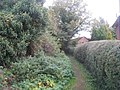 Footpath at Kirkburn - geograph.org.uk - 3187130.jpg 1 024 × 768; 281 KB
-
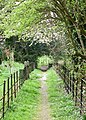
 Footpath from the church, Kirkburn - geograph.org.uk - 3190553.jpg 1 024 × 768; 263 KB
-
 Gate on the Drove Road - geograph.org.uk - 1203453.jpg 640 × 480; 65 KB
-
 Getting ready for the off - geograph.org.uk - 3410212.jpg 800 × 600; 308 KB
-
 Getting ready for the show, Driffield - geograph.org.uk - 5042588.jpg 640 × 431; 426 KB
-
 Gravelpit Lane, Kirkburn - geograph.org.uk - 1351332.jpg 640 × 480; 77 KB
-
 Grazing east of the A614 - geograph.org.uk - 4357229.jpg 640 × 480; 75 KB
-
 Green Lane - geograph.org.uk - 4292013.jpg 1 024 × 768; 131 KB
-
 Green Lane south of Elmswell, E Yorks - geograph.org.uk - 5831370.jpg 683 × 1 024; 858 KB
-
 High Battleburn - geograph.org.uk - 1832642.jpg 640 × 480; 73 KB
-
 High Battleburn - geograph.org.uk - 784437.jpg 640 × 471; 126 KB
-
 Horses at Southburn - geograph.org.uk - 5042297.jpg 640 × 468; 441 KB
-
 House on the A614, Eastburn - geograph.org.uk - 4357277.jpg 640 × 480; 84 KB
-
 Houses at High Battle Burn - geograph.org.uk - 3468455.jpg 800 × 600; 141 KB
-
 Houses at High Battle Burn - geograph.org.uk - 4357297.jpg 640 × 480; 91 KB
-

-
 Isolated bin, near Driffield - geograph.org.uk - 5042565.jpg 640 × 469; 394 KB
-
 Keep to the edge - geograph.org.uk - 2195142.jpg 4 000 × 3 000; 3,42 MB
-
 Kelleythorpe Gate House, Driffield - geograph.org.uk - 3927961.jpg 1 600 × 1 064; 579 KB
-
 Kirkburn - Electricity Sub Station - geograph.org.uk - 110604.jpg 640 × 480; 87 KB
-
 Kirkburn Cross 1.jpg 640 × 447; 92 KB
-
 Kirkburn Cross the parish church beyond - geograph.org.uk - 4767044.jpg 4 608 × 3 456; 4,6 MB
-
 Kirkburn Cross.jpg 640 × 426; 197 KB
-
 Kirkburn crossroads - geograph.org.uk - 2105037.jpg 4 000 × 3 000; 2,39 MB
-
 Kirkburn Farmland - geograph.org.uk - 110606.jpg 640 × 480; 164 KB
-
 Kirkburn Filling Station - geograph.org.uk - 73590.jpg 640 × 480; 72 KB
-
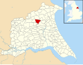 Kirkburn UK parish locator map.svg 1 425 × 1 107; 1,68 MB
-
 Kirkburn Village Hall - geograph.org.uk - 822093.jpg 640 × 427; 68 KB
-
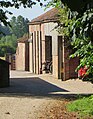
 Kirkburn, St. Mary's Church - geograph.org.uk - 6294097.jpg 5 958 × 3 972; 4,82 MB
-
 Kirkburn, St. Mary's Church - geograph.org.uk - 6294102.jpg 6 020 × 4 013; 5,27 MB
-

-

-

-

-
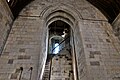
 Kirkburn, St. Mary's Church, Norman south doorway - geograph.org.uk - 6294105.jpg 4 544 × 6 815; 6,4 MB
-
 Kirkburn, St. Mary's Church, Norman south doorway capitals 1 - geograph.org.uk - 6294106.jpg 6 948 × 4 632; 6,95 MB
-
 Kirkburn, St. Mary's Church, Norman south doorway capitals 2 - geograph.org.uk - 6294108.jpg 6 836 × 4 557; 7,27 MB
-
 Kirkburn, St. Mary's Church, North door into the chancel - geograph.org.uk - 6294152.jpg 5 875 × 3 916; 5,26 MB
-

-
-
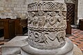
 Kirkburn, St. Mary's Church, The Norman font - geograph.org.uk - 6294112.jpg 7 040 × 4 694; 6,39 MB
-
 Kirkburn, St. Mary's Church, The Norman font - geograph.org.uk - 6294113.jpg 6 984 × 4 656; 6,07 MB
-
 Kirkburn, St. Mary's Church, The Norman font - geograph.org.uk - 6294115.jpg 6 791 × 4 527; 5,91 MB
-
 Kirkburn, St. Mary's Church, The Norman font - geograph.org.uk - 6294118.jpg 7 340 × 4 894; 7,5 MB
-

-

-

-

-

-

-

-
 Kirkburn, St. Mary's Church, The pulpit - geograph.org.uk - 6294163.jpg 7 161 × 4 774; 5,77 MB
-

-

-

-

-

-

-

-

-
 Lane from Southburn to Hutton - geograph.org.uk - 5042293.jpg 640 × 470; 456 KB
-
 Lane in Southburn - geograph.org.uk - 5042309.jpg 640 × 451; 529 KB
-
 Lane towards Sand Pit cottages - geograph.org.uk - 1831554.jpg 640 × 480; 42 KB
-
 Layby on the A614 opposite Driffield showground - geograph.org.uk - 4497614.jpg 1 024 × 768; 124 KB
-

-
 Looking towards Eastburn Warren Farm - geograph.org.uk - 3468500.jpg 800 × 600; 120 KB
-
 Main Pavilion at Driffield Showground - geograph.org.uk - 2420375.jpg 3 264 × 2 448; 1,37 MB
-
 Main Street Kilburn - geograph.org.uk - 4767051.jpg 4 534 × 3 356; 4,3 MB
-
 Middle Hill, Eastburn Warren - geograph.org.uk - 784442.jpg 640 × 477; 159 KB
-
 Minor road near Eastburn Warren Farm - geograph.org.uk - 4362446.jpg 640 × 480; 125 KB
-
 Minor road south of Kirkburn - geograph.org.uk - 2104411.jpg 4 000 × 3 000; 2,94 MB
-
 Minor road to Kirkburn - geograph.org.uk - 2105019.jpg 4 000 × 3 000; 3,55 MB
-
 Minor Road Towards Craike Hill - geograph.org.uk - 1374191.jpg 640 × 480; 55 KB
-

-

-
-

-

-

-

-
-
 Minor Road Towards Southburn - geograph.org.uk - 1351299.jpg 640 × 480; 102 KB
-
 Minor road, Eastburn Warren Farm - geograph.org.uk - 4357338.jpg 640 × 480; 89 KB
-
 Minor road, High Battleburn - geograph.org.uk - 4370495.jpg 640 × 480; 59 KB
-
 New Pavilion at Driffield Showground - geograph.org.uk - 4437470.jpg 4 608 × 3 456; 3,42 MB
-
 Off Road Driving Obstacle - geograph.org.uk - 454359.jpg 640 × 480; 60 KB
-
 Old Vicarage, Southburn - geograph.org.uk - 5042307.jpg 640 × 480; 444 KB
-
 Pavilion, Driffield Showground - geograph.org.uk - 6152707.jpg 640 × 359; 48 KB
-
 Potato Boxes in Southburn - geograph.org.uk - 1832637.jpg 640 × 531; 77 KB
-
 Project Emily Trig Pillar - geograph.org.uk - 3845006.jpg 680 × 1 024; 358 KB
-
 Ramsden Close near Alamein Barracks - geograph.org.uk - 3468439.jpg 800 × 600; 160 KB
-
 Ramsden Close, near Driffield - geograph.org.uk - 5042558.jpg 640 × 477; 496 KB
-
 Ready for the off - geograph.org.uk - 2421328.jpg 800 × 600; 319 KB
-
 Road to Southburn - geograph.org.uk - 5252705.jpg 1 024 × 768; 116 KB
-
 Rugby pitch - geograph.org.uk - 4321235.jpg 1 024 × 768; 108 KB
-
 Sand Pit Cottage near Craike Hill - geograph.org.uk - 4766999.jpg 2 988 × 2 184; 2,02 MB
-
 Sand Pit Cottages, near Garton-on-the-Wolds - geograph.org.uk - 5830951.jpg 1 024 × 796; 710 KB
-

-

-
 Sheep at Eastburn - geograph.org.uk - 5042509.jpg 640 × 458; 428 KB
-
 Shelter off the A614 - geograph.org.uk - 4357279.jpg 640 × 480; 96 KB
-
 South Doorway, St. Mary's church, Kirkburn - geograph.org.uk - 3190526.jpg 768 × 1 024; 135 KB
-
 South to Kirkburn - geograph.org.uk - 2105733.jpg 4 000 × 3 000; 4,35 MB
-
 Southburn Road - geograph.org.uk - 5252697.jpg 1 024 × 768; 204 KB
-
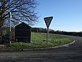
 Southburn Road Junction - geograph.org.uk - 1832640.jpg 640 × 480; 45 KB
-

-
 Sports fields near Driffield - geograph.org.uk - 4368062.jpg 640 × 480; 47 KB
-
 St Mary's Church Kirkburn - geograph.org.uk - 2105731.jpg 4 000 × 3 000; 2,21 MB
-
 St Mary's, Kirkburn - geograph.org.uk - 784485.jpg 457 × 640; 169 KB
-
 St Mary, Kirkburn - carved figure - geograph.org.uk - 5534069.jpg 640 × 480; 456 KB
-

-
 St Mary, Kirkburn - chancel screen (detail) - geograph.org.uk - 5533421.jpg 1 024 × 768; 793 KB
-
 St Mary, Kirkburn - font - geograph.org.uk - 5533413.jpg 800 × 600; 94 KB
-
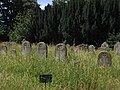 St Mary, Kirkburn - graveyard - geograph.org.uk - 5533431.jpg 1 024 × 768; 1,04 MB
-
 St Mary, Kirkburn - lych gate - geograph.org.uk - 5533355.jpg 1 024 × 768; 936 KB
-
 St Mary, Kirkburn - lych gate carving - geograph.org.uk - 5533392.jpg 1 024 × 768; 607 KB
-
 St Mary, Kirkburn - sanctuary - geograph.org.uk - 5533422.jpg 800 × 600; 137 KB
-
 St Mary, Kirkburn - south door - geograph.org.uk - 5533403.jpg 600 × 800; 116 KB
-
 St Mary, Kirkburn - south side - geograph.org.uk - 5533399.jpg 1 024 × 768; 771 KB

_-_geograph.org.uk_-_3909700.jpg)
_-_geograph.org.uk_-_3910361.jpg)


_-_geograph.org.uk_-_6294183.jpg)


_1_-_geograph.org.uk_-_6294125.jpg)
_2_-_geograph.org.uk_-_6294128.jpg)
_3_-_geograph.org.uk_-_6294133.jpg)
_4_-_geograph.org.uk_-_6294136.jpg)
_5_-_geograph.org.uk_-_6294140.jpg)
_6_-_geograph.org.uk_-_6294141.jpg)
_7_-_geograph.org.uk_-_6294145.jpg)
_8_-_geograph.org.uk_-_6294170.jpg)


_-_geograph.org.uk_-_5533421.jpg)


