Category:Kirkintilloch
Vai alla navigazione
Vai alla ricerca
città della Scozia  Eglwys y Santes Fair, Kirkintilloch | |||||
| Carica un file multimediale | |||||
| Istanza di |
| ||||
|---|---|---|---|---|---|
| Luogo |
| ||||
| Popolazione |
| ||||
 | |||||
Sottocategorie
Questa categoria contiene le 17 sottocategorie indicate di seguito, su un totale di 17.
A
- Adamslie Park (2 F)
- Auld Aisle Cemetery (2 F)
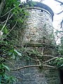
- Auld Kirk, Kirkintilloch (7 F)
B
- Broomhill Hospital (4 F)
C
F
H
K
- Kirkintilloch footbridge (3 F)
- Kirkintilloch Town Hall (4 F)
L
P
R
S
T
- Townhead, Kirkintilloch (5 F)
W
File nella categoria "Kirkintilloch"
Questa categoria contiene 200 file, indicati di seguito, su un totale di 237.
(pagina precedente) (pagina successiva)-
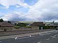
 23-27 Townhead, Kirkintilloch - geograph.org.uk - 6364754.jpg 1 314 × 1 600; 482 KB
-
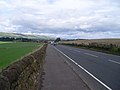
 A803 at Kirkintilloch - geograph.org.uk - 4229203.jpg 640 × 481; 49 KB
-
 Adamslie Crescent, Hayston - geograph.org.uk - 1479306.jpg 640 × 480; 117 KB
-
 Approaching Wester Gartshore - geograph.org.uk - 2733893.jpg 640 × 480; 92 KB
-
 B8023 towards Kilsyth - geograph.org.uk - 5337516.jpg 640 × 480; 80 KB
-
 B8048 in Kirkintilloch - geograph.org.uk - 3036710.jpg 640 × 480; 94 KB
-
 B8048 leaving Kirkintilloch - geograph.org.uk - 4229231.jpg 640 × 481; 65 KB
-
 Back o' Loch Halt, Kirkintilloch - geograph.org.uk - 434123.jpg 640 × 480; 185 KB
-
 Barbeth Farm - geograph.org.uk - 128799.jpg 640 × 444; 62 KB
-
 Bin day, Eastside - geograph.org.uk - 2972206.jpg 640 × 480; 266 KB
-
 Boghead Road, High Gallowhill - geograph.org.uk - 5337036.jpg 640 × 480; 68 KB
-
 Boghead Road, looking SSW - geograph.org.uk - 2539457.jpg 4 000 × 3 000; 6,11 MB
-
 Boghead Wood, Kirkintilloch - geograph.org.uk - 3771914.jpg 1 600 × 1 067; 812 KB
-
 Braes of Yetts - geograph.org.uk - 3823492.jpg 640 × 480; 237 KB
-

-
 Bridge Over Bothlin Burn - geograph.org.uk - 1573451.jpg 640 × 480; 117 KB
-
 Bridge over the canal - geograph.org.uk - 6364344.jpg 1 600 × 1 067; 409 KB
-
 Bridge over the Luggie Water - geograph.org.uk - 6368335.jpg 1 600 × 1 067; 488 KB
-
 Bridgeway Road - geograph.org.uk - 1573460.jpg 640 × 465; 93 KB
-
 Building under construction, Townhead, Kirkintilloch - geograph.org.uk - 6364581.jpg 1 600 × 1 067; 349 KB
-
 Bungalows on Gallowhill Road - geograph.org.uk - 5337041.jpg 640 × 386; 47 KB
-
 Bus stop on Gallowhill Road - geograph.org.uk - 5337044.jpg 640 × 480; 54 KB
-
 By Drumbreck - geograph.org.uk - 5245130.jpg 1 024 × 683; 474 KB
-
 Campsie Branch Bridge, Kirkintilloch - geograph.org.uk - 439088.jpg 640 × 427; 119 KB
-
 Campsie Fells appear beyond Redbrae Road - geograph.org.uk - 1478251.jpg 640 × 480; 112 KB
-
 Campsie Fells from Glasgow Road - geograph.org.uk - 1479296.jpg 640 × 480; 105 KB
-
 Campsie View, Kirkintilloch - geograph.org.uk - 1479302.jpg 640 × 480; 119 KB
-
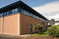
 Canalside campus - geograph.org.uk - 6364428.jpg 1 600 × 1 067; 400 KB
-
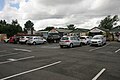 Car park and entrance to Caulders Garden Centre - geograph.org.uk - 5016489.jpg 3 504 × 2 336; 2,85 MB
-
 Car sales on Kilsyth Road - geograph.org.uk - 5337508.jpg 640 × 480; 68 KB
-
 Caulders Garden Centre, Kilsyth Road, Kirkintilloch - geograph.org.uk - 5016476.jpg 3 504 × 2 336; 3,6 MB
-
 Caulders Garden Centre, Kilsyth Road, Kirkintilloch - geograph.org.uk - 5016482.jpg 3 504 × 2 336; 3,37 MB
-
 Chryston Road - geograph.org.uk - 5764318.jpg 640 × 320; 117 KB
-
 Cleared Rhododendrons - geograph.org.uk - 6368402.jpg 1 600 × 823; 369 KB
-
 Clocktower building, Woodilee - geograph.org.uk - 4684549.jpg 1 024 × 683; 143 KB
-
 Construction site, Kirkintilloch - geograph.org.uk - 6397967.jpg 1 600 × 1 059; 369 KB
-
 Construction site, Kirkintilloch - geograph.org.uk - 6397989.jpg 1 600 × 993; 367 KB
-
 Cowgate Kirkintilloch.jpg 640 × 405; 86 KB
-
 Cowgate, Kirkintilloch - geograph.org.uk - 1459468.jpg 640 × 480; 75 KB
-
 Cowgate, Kirkintilloch - geograph.org.uk - 4592121.jpg 2 048 × 1 536; 818 KB
-

-
 Donaldson Street, Kirkintilloch - geograph.org.uk - 5337051.jpg 640 × 480; 55 KB
-
 Donaldson Street, Kirkintilloch - geograph.org.uk - 5347301.jpg 2 848 × 2 136; 1,33 MB
-
 Drydock001.jpg 600 × 394; 43 KB
-
 Dryfield Sewage Works Kirkintilloch 1.jpg 3 968 × 2 976; 8,44 MB
-
 Dryfield Sewage Works Kirkintilloch 2.jpg 3 968 × 2 976; 6,93 MB
-
 Dryfield Sewage Works Kirkintilloch 3.jpg 3 968 × 2 976; 6,6 MB
-
 Dryfield Sewage Works Kirkintilloch 4.jpg 3 968 × 2 976; 6,24 MB
-
 Dryfield Sewage Works Kirkintilloch 5.jpg 3 968 × 2 976; 6,27 MB
-
 Dryfield Sewage Works Kirkintilloch 6.jpg 3 968 × 2 976; 6,44 MB
-
 Duntiblae - geograph.org.uk - 2745640.jpg 640 × 480; 287 KB
-

-
 Ebenezer Hall, Kirkintilloch - geograph.org.uk - 434132.jpg 640 × 480; 81 KB
-
 Empty properties, Townhead, Kirkintilloch - geograph.org.uk - 6364596.jpg 1 600 × 1 073; 323 KB
-
 Entering Kirkintilloch from the East - geograph.org.uk - 3036702.jpg 640 × 480; 93 KB
-
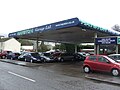
 Esso, Waterside Road - geograph.org.uk - 1476233.jpg 640 × 480; 111 KB
-

-
 Fauldhead from the west - geograph.org.uk - 2733540.jpg 640 × 480; 98 KB
-
 Fields near Wester Gartshore - geograph.org.uk - 5345027.jpg 640 × 421; 40 KB
-
 Fields off Chryston Road - geograph.org.uk - 2745636.jpg 640 × 480; 266 KB
-
 Fields west of Kirkintilloch - geograph.org.uk - 1479314.jpg 640 × 480; 115 KB
-
 Flats on Southbank Drive, Kirkintilloch - geograph.org.uk - 5016402.jpg 3 504 × 2 336; 2,9 MB
-
 Flats on Townhead, Kirkintilloch - geograph.org.uk - 5337048.jpg 640 × 480; 56 KB
-
 Flats overlooking the canal - geograph.org.uk - 6364451.jpg 1 600 × 1 084; 538 KB
-
 Flooded Field Near Kirkintilloch - geograph.org.uk - 144232.jpg 640 × 480; 149 KB
-
 Florist Gump - geograph.org.uk - 1473973.jpg 640 × 480; 118 KB
-
 Footbridge over the Kelvin - geograph.org.uk - 1886213.jpg 800 × 600; 170 KB
-

-

-
 Footpath to Glasgow Road, Kirkintilloch - geograph.org.uk - 4592161.jpg 1 247 × 1 528; 534 KB
-
 Former toll house, Kirkintilloch - geograph.org.uk - 5337069.jpg 640 × 406; 49 KB
-
 Forth ^ Clyde Canal, Kirkintilloch - geograph.org.uk - 6368122.jpg 1 600 × 1 017; 376 KB
-
 Gaertshore Estate (2) Derelict - geograph.org.uk - 3300899.jpg 1 024 × 768; 168 KB
-
-
 Gartshore Estate (3) (derelict) - geograph.org.uk - 3300919.jpg 4 320 × 3 240; 1,79 MB
-
 Gartshore Estate (4) avenue (derelict) - geograph.org.uk - 3300922.jpg 1 024 × 768; 145 KB
-
 Gartshore Estate (5) Dovecote (derelict) - geograph.org.uk - 3300972.jpg 1 920 × 1 440; 558 KB
-
 Gartshore Estate (6) derelict - geograph.org.uk - 3300988.jpg 1 024 × 768; 243 KB
-
 Gartshore Estate (7) derelict - geograph.org.uk - 3301008.jpg 4 320 × 3 240; 3,81 MB
-
 Gartshore Estate (8) derelict - geograph.org.uk - 3301015.jpg 1 920 × 2 560; 927 KB
-
 Gartshore Estate (9) - geograph.org.uk - 3301018.jpg 1 920 × 1 440; 315 KB
-
 Gartshore Estate (derelict) - geograph.org.uk - 3284885.jpg 1 024 × 768; 203 KB
-
 Gas Installation - geograph.org.uk - 3806538.jpg 640 × 480; 70 KB
-
 Gate, Gartshore - geograph.org.uk - 2972725.jpg 480 × 640; 376 KB
-
 George V postbox on Donaldson Street, Kirkintilloch - geograph.org.uk - 5347298.jpg 1 981 × 2 666; 1,14 MB
-
 George VI postbox on Glenwood Road, High Gallowhill - geograph.org.uk - 5347306.jpg 2 136 × 2 848; 1,37 MB
-
 Glasgow Road (A803), Kirkintilloch - geograph.org.uk - 5337083.jpg 640 × 480; 72 KB
-
 Glasgow Road (A803), Kirkintilloch - geograph.org.uk - 5337504.jpg 640 × 480; 75 KB
-
 Glasgow Road, Hayston - geograph.org.uk - 5758618.jpg 640 × 360; 78 KB
-
 Glasgow Road, Kirkintilloch - geograph.org.uk - 1475280.jpg 640 × 480; 116 KB
-

-
 Glenwood Road, High Gallowhill - geograph.org.uk - 5347309.jpg 2 848 × 2 136; 1,14 MB
-
 Graffitied sign - geograph.org.uk - 6368442.jpg 1 600 × 1 177; 478 KB
-
 Grassland beyond the A803 - geograph.org.uk - 4592055.jpg 2 048 × 1 536; 863 KB
-
 Grassland, Wester Gartshore - geograph.org.uk - 4091648.jpg 1 600 × 879; 339 KB
-
 Grazing land beside the Kelvin - geograph.org.uk - 2745451.jpg 640 × 480; 269 KB
-
 Grazing near Drumbreck - geograph.org.uk - 5649257.jpg 640 × 480; 30 KB
-
 Grazing near Waterside - geograph.org.uk - 5345032.jpg 640 × 403; 50 KB
-
 Grazing near Waterside - geograph.org.uk - 5346510.jpg 640 × 419; 38 KB
-
 Harestanes Aqueduct - geograph.org.uk - 422509.jpg 640 × 480; 118 KB
-
 Holmfield - geograph.org.uk - 1476229.jpg 640 × 480; 134 KB
-
 House in Victoria St, Kirkintilloch - geograph.org.uk - 2882680.jpg 4 320 × 3 240; 2,81 MB
-

-
 Houses beside the Luggie Water - geograph.org.uk - 6368480.jpg 1 600 × 1 000; 350 KB
-

-
 Houses on Gallowhill Road - geograph.org.uk - 5337045.jpg 640 × 480; 80 KB
-
 Housing alongside Redbrae Road - geograph.org.uk - 1475256.jpg 640 × 480; 116 KB
-
 Housing, Belmont Court, Kirkintilloch - geograph.org.uk - 6368300.jpg 1 600 × 985; 253 KB
-
 Inchbelle Landfill Site - geograph.org.uk - 164074.jpg 640 × 480; 142 KB
-
 Inchbelly on the Forth and Clyde - geograph.org.uk - 422504.jpg 640 × 480; 118 KB
-
 Inchterf 'Secret' Bunker, Kirkintilloch - geograph.org.uk - 418888.jpg 640 × 480; 110 KB
-
 Joe's Wharf, according to the sign - geograph.org.uk - 898146.jpg 640 × 480; 128 KB
-
 K6 telephone kiosk - geograph.org.uk - 6364543.jpg 1 600 × 1 239; 386 KB
-
 Kelvin Court, Kirkintilloch - geograph.org.uk - 5337062.jpg 640 × 480; 64 KB
-
 Kilsyth Road (A803) - geograph.org.uk - 5337511.jpg 640 × 480; 67 KB
-
 Kirikintilloch, Luggie Water - geograph.org.uk - 2404506.jpg 1 024 × 768; 162 KB
-
 KirkieBhouseOut.jpg 1 843 × 1 382; 201 KB
-
 Kirkintilloch and the Campsie Fells - geograph.org.uk - 1478258.jpg 640 × 480; 148 KB
-
 Kirkintilloch banner fountain.jpg 2 100 × 300; 213 KB
-
 Kirkintilloch Fire Station - geograph.org.uk - 1479150.jpg 640 × 480; 136 KB
-
 Kirkintilloch Fire Station - geograph.org.uk - 5337080.jpg 640 × 480; 73 KB
-
 Kirkintilloch fountain.jpg 2 128 × 2 832; 2,15 MB
-
 Kirkintilloch from the A806 - geograph.org.uk - 4229211.jpg 640 × 481; 45 KB
-
 Kirkintilloch High School (geograph 3036718).jpg 640 × 480; 74 KB
-
 Kirkintilloch Library - geograph.org.uk - 5337059.jpg 640 × 480; 75 KB
-
 Kirkintilloch main road1.jpg 2 128 × 2 832; 2,14 MB
-
 Kirkintilloch Police Office - geograph.org.uk - 5016395.jpg 3 504 × 2 336; 3,32 MB
-
 Kirkintilloch Road - geograph.org.uk - 1479492.jpg 640 × 480; 106 KB
-
 Kirkintilloch Skate Park - geograph.org.uk - 6368390.jpg 1 600 × 1 199; 542 KB
-
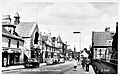
 Kirkintilloch town centre - geograph.org.uk - 881110.jpg 640 × 423; 98 KB
-
 Kirkintilloch War Memorial - WWI - geograph.org.uk - 1885810.jpg 1 024 × 768; 660 KB
-
 Kirkintilloch War Memorial - WWII - geograph.org.uk - 1885820.jpg 1 024 × 768; 673 KB
-
 Kirkintilloch War Memorial, Peel Park, East Dunbartonshire.jpg 1 920 × 1 080; 832 KB
-
 Kirkintilloch, Bryars Road - geograph.org.uk - 2404657.jpg 1 024 × 768; 203 KB
-
 Kirkintilloch, confluence - geograph.org.uk - 2404574.jpg 1 024 × 768; 198 KB
-
 Kirkintilloch, Peel Park bandstand - geograph.org.uk - 2404683.jpg 1 024 × 768; 150 KB
-
 Kirkintilloch, Peel Park fountain - geograph.org.uk - 2404676.jpg 1 024 × 768; 230 KB
-
 Kirkintilloch, private road - geograph.org.uk - 2404646.jpg 1 024 × 768; 185 KB
-
 Kirkintilloch, River Kelvin - geograph.org.uk - 2404549.jpg 1 024 × 768; 207 KB
-
 Kirkintilloch, River Kelvin - geograph.org.uk - 2404554.jpg 1 024 × 768; 173 KB
-
 Kirkintilloch, West Bar - geograph.org.uk - 2404640.jpg 1 024 × 768; 106 KB
-
 Kirkintilloch, West High Street - geograph.org.uk - 2404605.jpg 1 024 × 768; 101 KB
-
 Langmuir Road - geograph.org.uk - 1911492.jpg 800 × 600; 126 KB
-
 Langmuir Road - geograph.org.uk - 3823496.jpg 640 × 480; 221 KB
-
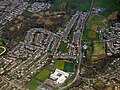
 Lenzie and Kirkintilloch from the air (geograph 2965815).jpg 640 × 433; 221 KB
-
 Loch Road - geograph.org.uk - 3623651.jpg 640 × 480; 241 KB
-
 Luggie Bridge, Kirkintilloch - geograph.org.uk - 5953274.jpg 3 776 × 2 520; 3,29 MB
-
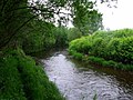
 Luggie Water - geograph.org.uk - 1479144.jpg 640 × 480; 147 KB
-
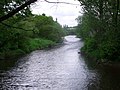
 Luggie Water - geograph.org.uk - 6368369.jpg 1 600 × 1 067; 373 KB
-
 Luggie Water - geograph.org.uk - 6368379.jpg 1 600 × 1 048; 369 KB
-
 Luggie Water, Kirkintilloch - geograph.org.uk - 1886019.jpg 690 × 800; 153 KB
-
 Luggie Water, Kirkintilloch - geograph.org.uk - 2032404.jpg 800 × 600; 171 KB
-
 Luggie Water, Kirkintilloch - geograph.org.uk - 434129.jpg 640 × 480; 115 KB
-
 Market Road Bridge - geograph.org.uk - 1573486.jpg 640 × 480; 151 KB
-
 Meeting of the Waters - geograph.org.uk - 1573475.jpg 640 × 480; 124 KB
-
 Memorial by the Luggie Water - geograph.org.uk - 1478259.jpg 480 × 640; 144 KB
-
 Memorial to Hazelton Robert Robson - geograph.org.uk - 3036535.jpg 480 × 640; 83 KB
-
 Modern milestone, Kirkintilloch - geograph.org.uk - 6365286.jpg 1 600 × 1 036; 467 KB
-
 Old Doorway to the Gartshore Estate - geograph.org.uk - 3240796.jpg 800 × 521; 174 KB
-
 Old Gateway to the Gartshore Estate - geograph.org.uk - 4229241.jpg 640 × 481; 103 KB
-
 Open ground beside Southbank Drive, Kirkintilloch - geograph.org.uk - 5016391.jpg 3 428 × 2 223; 2,21 MB
-
 Ordnance Survey One-inch Sheet 60 Glasgow, Published 1957.jpg 8 171 × 9 912; 12,02 MB
-
 Ordnance Survey One-Inch Sheet 60 Glasgow, Published 1965.jpg 8 238 × 9 844; 13,58 MB
-
 Overbridge, Kirkintilloch - geograph.org.uk - 1885848.jpg 800 × 600; 171 KB
-
 Oxgang Place - geograph.org.uk - 1476226.jpg 640 × 480; 126 KB
-
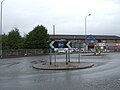
 Oxgang Roundabout - geograph.org.uk - 1476250.jpg 640 × 480; 111 KB
-
 Park, Redbrae Road - geograph.org.uk - 2972199.jpg 640 × 480; 272 KB
-
 Path beside the Luggie Water - geograph.org.uk - 6368412.jpg 1 600 × 1 000; 343 KB
-
 Path leading to Meiklehill Road - geograph.org.uk - 1478253.jpg 640 × 480; 114 KB
-
 Peel Park Roundabout - geograph.org.uk - 1475277.jpg 640 × 480; 122 KB
-
 Peel Park Roundabout - geograph.org.uk - 3036405.jpg 640 × 480; 61 KB
-
 Peel Park Roundabout, Kirkintilloch - geograph.org.uk - 4592075.jpg 2 048 × 1 536; 778 KB
-
 Plaque commemorating Archibald Scott Couper - geograph.org.uk - 6368214.jpg 1 600 × 956; 358 KB
-
 Plaque depicting The Unique Bridge - geograph.org.uk - 6397564.jpg 1 600 × 1 067; 519 KB
-
 Railway Bridge at Drumbreck - geograph.org.uk - 3806531.jpg 640 × 480; 137 KB
-
 Railwayside pond - geograph.org.uk - 5105755.jpg 640 × 480; 134 KB
-
 Redbrae Road, Kirkintilloch - geograph.org.uk - 1476255.jpg 640 × 480; 117 KB
-
 Refurbished telephone kiosk - geograph.org.uk - 6368224.jpg 1 083 × 1 600; 329 KB
-
 Refurbished telephone kiosk - geograph.org.uk - 6368227.jpg 898 × 1 600; 287 KB
-
 Refurbished telephone kiosk - geograph.org.uk - 6368231.jpg 1 087 × 1 600; 357 KB
-
 Refurbished telephone kiosk - geograph.org.uk - 6368238.jpg 1 030 × 1 600; 324 KB
-
 Registrar's office, Kirkintilloch - geograph.org.uk - 1442194.jpg 640 × 480; 108 KB
-

-
 River Kelvin - geograph.org.uk - 5337518.jpg 640 × 480; 79 KB
-
 River Kelvin near Bridgend Farm - geograph.org.uk - 5337513.jpg 640 × 480; 90 KB
-
 Road bridge over the canal - geograph.org.uk - 6364519.jpg 1 600 × 1 067; 441 KB
-
 Road Bridge over the Luggie Water - geograph.org.uk - 3036515.jpg 640 × 480; 77 KB
-
 Road junction, Kirkintilloch - geograph.org.uk - 6364733.jpg 1 600 × 1 058; 274 KB
-
 Road to Inchbelle Farm - geograph.org.uk - 164070.jpg 480 × 640; 169 KB
-
 Road to sewage works near Kirkintilloch - geograph.org.uk - 1475286.jpg 640 × 480; 127 KB
-
 Romanwallinscotl00macduoft raw 0399Kirkintilloch2185.png 1 230 × 600; 1,54 MB
-
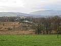
 Rosebank from the air - geograph.org.uk - 5178299.jpg 640 × 480; 200 KB
-
 Rosebank from the air - geograph.org.uk - 5178303.jpg 640 × 480; 211 KB
-
-
 Roundabout on the A806 - geograph.org.uk - 6368311.jpg 1 600 × 1 018; 368 KB
-

-
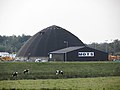 Salt dome - geograph.org.uk - 3292200.jpg 640 × 480; 68 KB
-

-
 Scrub, Langmuir Road - geograph.org.uk - 3825133.jpg 640 × 480; 224 KB
-


_Derelict_-_geograph.org.uk_-_3300899.jpg)

_(derelict)_-_geograph.org.uk_-_3300919.jpg)
_avenue_(derelict)_-_geograph.org.uk_-_3300922.jpg)
_Dovecote_(derelict)_-_geograph.org.uk_-_3300972.jpg)
_derelict_-_geograph.org.uk_-_3300988.jpg)
_derelict_-_geograph.org.uk_-_3301008.jpg)
_derelict_-_geograph.org.uk_-_3301015.jpg)
_-_geograph.org.uk_-_3301018.jpg)
_-_geograph.org.uk_-_3284885.jpg)


,_Kirkintilloch_-_geograph.org.uk_-_5337083.jpg)
,_Kirkintilloch_-_geograph.org.uk_-_5337504.jpg)


,_Kirkintilloch_-_geograph.org.uk_-_5337087.jpg)


_-_geograph.org.uk_-_5337511.jpg)


.jpg)


.jpg)


