Category:Kirtlington
Vai alla navigazione
Vai alla ricerca
village and civil parish in Cherwell district, Oxfordshire, England  Église paroissiale de Kirtlington | |||||
| Carica un file multimediale | |||||
| Istanza di | |||||
|---|---|---|---|---|---|
| Luogo | Cherwell, Oxfordshire, Sud Est dell'Inghilterra, Inghilterra | ||||
| Popolazione |
| ||||
| Superficie |
| ||||
| sito web ufficiale | |||||
 | |||||
Sottocategorie
Questa categoria contiene le 10 sottocategorie indicate di seguito, su un totale di 10.
D
- Dashwood Arms, Kirtlington (2 F)
- Dashwood Lock (3 F)
H
- Kirtlington Park (4 F)
K
- Kirtlington Village Hall (2 F)
M
O
- Oxford Canal Bridge 208 (2 F)
- Oxford Canal Bridge 211 (2 F)
- Oxford Canal Bridge 213 (4 F)
P
V
File nella categoria "Kirtlington"
Questa categoria contiene 200 file, indicati di seguito, su un totale di 263.
(pagina precedente) (pagina successiva)-
 'Oxford Lodge', Bletchingdon Road - geograph.org.uk - 5673996.jpg 1 024 × 669; 220 KB
-
 'The Forge' - geograph.org.uk - 5660436.jpg 1 024 × 673; 163 KB
-
 A house on Church Lane - geograph.org.uk - 4657658.jpg 1 500 × 1 125; 208 KB
-
 A lane to the church - geograph.org.uk - 4657670.jpg 1 125 × 1 500; 307 KB
-
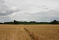
 A4095 eastbound - geograph.org.uk - 4354491.jpg 640 × 480; 116 KB
-
 A4095 turns right to Bicester - geograph.org.uk - 3397342.jpg 3 473 × 2 495; 1,03 MB
-
 Akeman Street heading east - geograph.org.uk - 4752660.jpg 1 500 × 1 125; 126 KB
-
 Akeman Street heading east - geograph.org.uk - 4752661.jpg 1 500 × 1 125; 172 KB
-
 Akeman Street heading east - geograph.org.uk - 4752663.jpg 1 500 × 1 125; 169 KB
-
 Akeman Street heading east - geograph.org.uk - 4752665.jpg 1 500 × 1 125; 102 KB
-
 Akeman Street heading east over Gallos Brook - geograph.org.uk - 4752667.jpg 1 500 × 1 125; 158 KB
-
 Akeman Street, Roman Road - geograph.org.uk - 4354623.jpg 640 × 480; 77 KB
-
 Akeman Street, Roman Road - geograph.org.uk - 4354628.jpg 640 × 480; 76 KB
-
 Aves Ditch - geograph.org.uk - 417917.jpg 640 × 480; 133 KB
-
 Aves Ditch crosses the Port Way - geograph.org.uk - 4657632.jpg 1 500 × 1 125; 265 KB
-
 Barges passing on the Oxford Canal - geograph.org.uk - 4225557.jpg 1 889 × 1 046; 1,91 MB
-
 Benchmark on 'Oxford Lodge', Bletchingdon Road - geograph.org.uk - 5673988.jpg 1 024 × 786; 171 KB
-
 Benchmark on 'Red Rose Cottage', Oxford Road - geograph.org.uk - 5667699.jpg 1 024 × 683; 332 KB
-
 Benchmark on 'The Forge' - geograph.org.uk - 5660434.jpg 1 024 × 665; 241 KB
-
 Benchmark on Flight's Mill House - geograph.org.uk - 3204935.jpg 683 × 1 024; 215 KB
-
 Benchmark on Heyford Road house - geograph.org.uk - 5667722.jpg 683 × 1 024; 281 KB
-
 Benchmark on Oxford Canal Bridge 213 - geograph.org.uk - 5667680.jpg 662 × 1 024; 314 KB
-
 Benchmark on Pigeon Lock bridge - geograph.org.uk - 3205131.jpg 683 × 1 024; 295 KB
-
 Benchmark on Springwell Hill wall - geograph.org.uk - 5674002.jpg 1 024 × 683; 309 KB
-
 Benchmark on St Mary's Church - geograph.org.uk - 5657498.jpg 683 × 1 024; 313 KB
-
 Benchmark on The Kennels Cottage - geograph.org.uk - 6103014.jpg 1 024 × 647; 263 KB
-
 Benchmark on ^3 Foxtownsend Cottages - geograph.org.uk - 5668650.jpg 683 × 1 024; 260 KB
-
 Benchmark on ^3 Northbrook Cottages - geograph.org.uk - 6102979.jpg 683 × 1 024; 250 KB
-
 Benchmarked DIS post beside the Oxford Canal - geograph.org.uk - 3203518.jpg 683 × 1 024; 224 KB
-
 Bletchingdon Road in Kirtlington - geograph.org.uk - 4657691.jpg 1 500 × 1 125; 318 KB
-
 Bletchingdon Road in Kirtlington - geograph.org.uk - 4657694.jpg 1 500 × 1 125; 218 KB
-
 Bletchingdon Road out of Kirtlington - geograph.org.uk - 4657696.jpg 1 500 × 1 125; 195 KB
-
 Bletchingdon Road, Kirtlington - geograph.org.uk - 4322686.jpg 1 600 × 1 200; 529 KB
-
 Bletchington Road meets the Oxford Road - geograph.org.uk - 3397325.jpg 3 648 × 2 736; 1,63 MB
-
 Bletchington Road passes South End Cottages - geograph.org.uk - 3395799.jpg 3 589 × 2 675; 1,99 MB
-
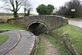
 Bridge 209, Dashwood's Bridge - geograph.org.uk - 4520731.jpg 1 024 × 797; 335 KB
-
 Bridge 210, Northbrook Bridge - geograph.org.uk - 4520750.jpg 1 024 × 723; 301 KB
-
 Bridge 211, New Brighton Bridge - geograph.org.uk - 4520774.jpg 1 024 × 773; 274 KB
-
 Bridge 212, Old Brighton Bridge - geograph.org.uk - 4520779.jpg 1 024 × 715; 311 KB
-
 Bridge 212, Old Brighton Bridge - geograph.org.uk - 4521585.jpg 1 024 × 768; 330 KB
-
 Bridge 213, Pigeon Bridge - geograph.org.uk - 4521637.jpg 1 024 × 732; 303 KB
-
 Bridge 215, Caravan Lift Bridge - geograph.org.uk - 4521671.jpg 978 × 1 024; 386 KB
-
 Bridge over Oxford Canal at Pigeon Lock - geograph.org.uk - 3205145.jpg 1 024 × 683; 214 KB
-

-
 Bridleway - geograph.org.uk - 4354431.jpg 640 × 480; 101 KB
-
 Bridleway - geograph.org.uk - 4354437.jpg 640 × 480; 61 KB
-
 Bridleway - geograph.org.uk - 4354496.jpg 640 × 480; 131 KB
-
 Bridleway heading to Manor Farm - geograph.org.uk - 1602493.jpg 640 × 480; 73 KB
-
 Bridleway to Northbrook - geograph.org.uk - 1602482.jpg 640 × 480; 106 KB
-
 Buttercup meadow near New Brighton Bridge - geograph.org.uk - 4520775.jpg 781 × 1 024; 356 KB
-

-
 Carpark of Kirtlington Golf Club - geograph.org.uk - 1477339.jpg 640 × 480; 71 KB
-
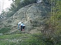
 Cliff in Kirtlington quarry - geograph.org.uk - 636277.jpg 640 × 480; 126 KB
-
 Cows in a field next to the Oxford Canal - geograph.org.uk - 4521688.jpg 1 024 × 795; 294 KB
-
 Crowcastle Lane, Kirtlington - geograph.org.uk - 2038985.jpg 640 × 427; 67 KB
-

-
 East face of Kirtlington quarry geograph org uk.jpg 2 560 × 1 443; 2,54 MB
-
 Exceed And Excel-Ffestiniog colt foal (9329015731).jpg 2 269 × 1 859; 1,83 MB
-
 Farm building at Northbrook - geograph.org.uk - 6102970.jpg 1 024 × 668; 228 KB
-
 Field gateway from Mill Lane - geograph.org.uk - 5660899.jpg 1 024 × 683; 227 KB
-
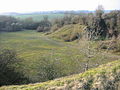
 Fields north of Kirtlington Quarry - geograph.org.uk - 4324496.jpg 1 600 × 1 058; 637 KB
-
 Flax field No 1 - geograph.org.uk - 2511664.jpg 7 792 × 1 624; 3,29 MB
-
 Flax field No 2 - geograph.org.uk - 2511669.jpg 6 937 × 1 624; 3,2 MB
-
 Flight's Mill House - geograph.org.uk - 3204943.jpg 1 024 × 683; 230 KB
-
 Footpath through arable field towards Slade Farm - geograph.org.uk - 6102022.jpg 1 024 × 683; 186 KB
-
 Fossils in Kirtlington Quarry - geograph.org.uk - 4318029.jpg 3 332 × 2 820; 3,74 MB
-
 Foxtownsend Cottages, Heyford Road - geograph.org.uk - 5668687.jpg 1 024 × 683; 167 KB
-
 Gable and Vine Cottages, South Green, Kirtlington, Oxfordshire.jpg 2 968 × 1 781; 2,03 MB
-
 Gallos Brook - geograph.org.uk - 4354478.jpg 640 × 480; 159 KB
-
 Gates across Crowcastle Lane at Peter's Cross - geograph.org.uk - 5660444.jpg 1 024 × 683; 134 KB
-
 Header tank, Kirtlington cement plant - geograph.org.uk - 4225571.jpg 470 × 640; 208 KB
-
 Herd of cows next to the Oxford Canal - geograph.org.uk - 4520336.jpg 1 024 × 768; 277 KB
-

-
 Houses on Heyford Road - geograph.org.uk - 5667735.jpg 1 024 × 710; 151 KB
-
 Houses on South Green - geograph.org.uk - 4657653.jpg 1 500 × 1 125; 160 KB
-
 Junction between Port Way and Aves Ditch - geograph.org.uk - 3397354.jpg 3 648 × 2 736; 2,27 MB
-

-

-
 Canal Side - geograph.org.uk - 1602388.jpg 640 × 480; 92 KB
-
 Dashwood Mews, Kirtlington - geograph.org.uk - 1040915.jpg 640 × 480; 111 KB
-
 Floating teashop - geograph.org.uk - 1772499.jpg 800 × 600; 180 KB
-
 Large House, Kirtlington - geograph.org.uk - 1416350.jpg 640 × 444; 47 KB
-
 Narrowboat cat and dog - geograph.org.uk - 1772505.jpg 800 × 584; 195 KB
-

-
 Kirtlington C of E School - geograph.org.uk - 1416347.jpg 640 × 442; 96 KB
-
 Kirtlington Golf Club - geograph.org.uk - 1477342.jpg 640 × 480; 60 KB
-
 Kirtlington Golf Club near the Oxford Canal - geograph.org.uk - 4521651.jpg 1 024 × 768; 206 KB
-

-
 Kirtlington Polo Ground, Kirtlington - geograph.org.uk - 1473597.jpg 640 × 480; 71 KB
-

-
 Kirtlington Quarry - geograph.org.uk - 4225257.jpg 2 560 × 1 920; 2,91 MB
-
 Kirtlington quarry - geograph.org.uk - 636272.jpg 640 × 480; 99 KB
-
 Kirtlington quarry - geograph.org.uk - 636275.jpg 640 × 480; 113 KB
-
 Kirtlington Quarry - geograph.org.uk - 647261.jpg 640 × 480; 106 KB
-
 Kirtlington Stud staff (7997710761).jpg 2 324 × 1 811; 1,83 MB
-
 Lay-by, A4095 - geograph.org.uk - 4354486.jpg 640 × 480; 42 KB
-
 Lince Lane to Kirtlington - geograph.org.uk - 5913859.jpg 1 500 × 1 125; 159 KB
-
 Lince Lane to Kirtlington - geograph.org.uk - 5913863.jpg 2 700 × 2 025; 373 KB
-
 Main Face, Kirtlington Quarry - geograph.org.uk - 4225281.jpg 2 560 × 1 920; 2,89 MB
-
 Meeting of the ways - geograph.org.uk - 4354459.jpg 640 × 480; 76 KB
-

-

-
 Molly Minns Lane to Bletchingdon Road - geograph.org.uk - 4657666.jpg 1 500 × 1 125; 395 KB
-
 Narrowboats moored along the Oxford Canal - geograph.org.uk - 4521622.jpg 1 024 × 763; 369 KB
-
 New barn and gateway beside Mill Lane - geograph.org.uk - 5660902.jpg 1 024 × 683; 195 KB
-
 New Stone Wall, Kirtlington Park - geograph.org.uk - 4322647.jpg 3 944 × 2 868; 3,73 MB
-
 Nice life (7997709835).jpg 2 816 × 1 880; 1,97 MB
-
 Nice weather for ducks - geograph.org.uk - 4354627.jpg 640 × 480; 70 KB
-
 North Green, Kirtlington - geograph.org.uk - 4225579.jpg 2 560 × 1 923; 2,81 MB
-
 Northbrook Bridge - geograph.org.uk - 1801227.jpg 800 × 600; 336 KB
-
 Northbrook Cottages - geograph.org.uk - 6102988.jpg 1 024 × 662; 202 KB
-
 Northbrook Farm - geograph.org.uk - 1040919.jpg 640 × 480; 66 KB
-
 Northbrook farm yard. - geograph.org.uk - 1770479.jpg 2 272 × 1 704; 1,25 MB
-
 Old Toll House, Oxford Road, Kirklington - geograph.org.uk - 6114407.jpg 640 × 458; 157 KB
-
 Old Wharf at Kirtlington - geograph.org.uk - 4324506.jpg 3 608 × 2 920; 3,33 MB
-
 Old Wharf at Kirtlington Quarry - geograph.org.uk - 2083442.jpg 640 × 360; 62 KB
-
 Oxford Canal - geograph.org.uk - 125262.jpg 640 × 480; 100 KB
-
 Oxford Canal - geograph.org.uk - 125263.jpg 320 × 240; 27 KB
-
 Oxford Canal - geograph.org.uk - 1602429.jpg 640 × 480; 93 KB
-
 Oxford Canal Bridge 213 - geograph.org.uk - 2059843.jpg 640 × 480; 101 KB
-
 Oxford Canal Bridge 213 at Pigeon Lock - geograph.org.uk - 5667694.jpg 1 024 × 683; 254 KB
-
 Oxford Canal Bridge 215 - geograph.org.uk - 2059856.jpg 640 × 480; 85 KB
-
 Oxford Canal NE of Pigeon Lock - geograph.org.uk - 3203529.jpg 1 024 × 683; 261 KB
-
 Oxford Canal next to Bridge 213, Pigeon Bridge - geograph.org.uk - 4521641.jpg 1 024 × 699; 247 KB
-
 Oxford Canal towards New Brighton Bridge No 211 - geograph.org.uk - 4520778.jpg 1 024 × 842; 354 KB
-
 Oxford Canal Walk, heading for Banbury - geograph.org.uk - 611699.jpg 640 × 480; 159 KB
-

-

-
-
 Path at the site of the Kirtlington cement plant - geograph.org.uk - 4225348.jpg 2 560 × 1 920; 2,95 MB
-
 Path in Kirtlington Quarry - geograph.org.uk - 4225270.jpg 2 560 × 1 920; 2,73 MB
-
 Pigeon Lock on the Oxford Canal - geograph.org.uk - 3417871.jpg 4 288 × 2 848; 6,32 MB
-
 Pigeon's Lock No 39 on the Oxford Canal - geograph.org.uk - 4521635.jpg 952 × 1 024; 294 KB
-
 Pines by the Path - geograph.org.uk - 2878445.jpg 1 600 × 1 200; 435 KB
-
 Polo Ground - geograph.org.uk - 4354630.jpg 640 × 480; 118 KB
-
 Port Way flirts with the boundary - geograph.org.uk - 3397374.jpg 3 405 × 2 488; 959 KB
-
 Port Way heading south - geograph.org.uk - 4657621.jpg 1 500 × 1 125; 181 KB
-
 Port Way heading south - geograph.org.uk - 4657634.jpg 1 500 × 1 125; 195 KB
-
 Port Way into Kirtlington - geograph.org.uk - 4657642.jpg 1 500 × 1 125; 206 KB
-
 Port Way junction with un-named road to Northbrook - geograph.org.uk - 3397366.jpg 3 490 × 2 583; 888 KB
-
 Port Way to Kirtlington - geograph.org.uk - 4657617.jpg 1 500 × 1 125; 206 KB
-
 Port Way to Kirtlington - geograph.org.uk - 4657626.jpg 1 500 × 1 125; 195 KB
-
 Port Way to Kirtlington - geograph.org.uk - 4657630.jpg 1 500 × 1 125; 168 KB
-
 Port Way to Kirtlington - geograph.org.uk - 4657638.jpg 1 500 × 1 125; 196 KB
-
 Railway bridge near the Oxford Canal - geograph.org.uk - 4521647.jpg 1 024 × 718; 352 KB
-
 Red Bush by the Pond - geograph.org.uk - 4322632.jpg 1 600 × 1 200; 595 KB
-
 Red Rose Cottage, Oxford Road - geograph.org.uk - 5667707.jpg 1 024 × 759; 198 KB
-

-
 Repairs to bridge 215, Caravan Lift Bridge - geograph.org.uk - 4521676.jpg 1 024 × 632; 265 KB
-
 River Cherwell west of Kirtlington - geograph.org.uk - 2038924.jpg 640 × 427; 114 KB
-
 River Cherwell west of Kirtlington - geograph.org.uk - 2038941.jpg 427 × 640; 99 KB
-
 Road junction - geograph.org.uk - 4354442.jpg 640 × 480; 43 KB
-
 Road junction - geograph.org.uk - 4354454.jpg 640 × 480; 62 KB
-
 Road junction - geograph.org.uk - 4354483.jpg 640 × 480; 56 KB
-
 Road, Slade Farm - geograph.org.uk - 4354466.jpg 640 × 480; 68 KB
-
 Signpost on the Green - geograph.org.uk - 4322638.jpg 1 600 × 1 203; 490 KB
-
 Site of Kirtlington cement plant - geograph.org.uk - 4225360.jpg 2 560 × 1 920; 2,5 MB
-
 Springwell Hill to Bletchingdon - geograph.org.uk - 4657697.jpg 1 500 × 1 125; 273 KB
-
 St Mary the Virgin parish church - geograph.org.uk - 4657661.jpg 1 500 × 1 125; 218 KB
-
 St Mary the Virgin parish church - geograph.org.uk - 4657663.jpg 1 500 × 1 125; 203 KB
-
 St Mary's Church - geograph.org.uk - 5657517.jpg 1 024 × 683; 162 KB
-
 St Mary, Kirtlington, altar (a) - geograph.org.uk - 4796850.jpg 640 × 480; 55 KB
-
 St Mary, Kirtlington, altar (b) - geograph.org.uk - 4796852.jpg 640 × 480; 74 KB
-
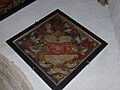
 St Mary, Kirtlington, banner - geograph.org.uk - 4796442.jpg 480 × 640; 61 KB
-
 St Mary, Kirtlington, choir stalls - geograph.org.uk - 4796846.jpg 640 × 480; 67 KB
-
 St Mary, Kirtlington, churchyard (I) - geograph.org.uk - 4796445.jpg 640 × 480; 58 KB
-

-

-

-

-
 St Mary, Kirtlington, churchyard (V) - geograph.org.uk - 4796449.jpg 640 × 480; 67 KB
-

-

-

-
 St Mary, Kirtlington, font - geograph.org.uk - 4796464.jpg 480 × 640; 38 KB
-

-
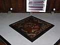
 St Mary, Kirtlington, hatchment (a) - geograph.org.uk - 4796781.jpg 640 × 480; 55 KB
-
 St Mary, Kirtlington, hatchment (b) - geograph.org.uk - 4796783.jpg 640 × 480; 57 KB
-
 St Mary, Kirtlington, hatchment (c) - geograph.org.uk - 4796788.jpg 640 × 480; 49 KB
-
 St Mary, Kirtlington, hatchment (d) - geograph.org.uk - 4796792.jpg 640 × 478; 73 KB
-
 St Mary, Kirtlington, hatchment (e) - geograph.org.uk - 4796794.jpg 640 × 480; 62 KB
-
 St Mary, Kirtlington, hatchment (f) - geograph.org.uk - 4796790.jpg 640 × 480; 51 KB
-
 St Mary, Kirtlington, hatchments (g) - geograph.org.uk - 4796847.jpg 640 × 474; 70 KB
-

-
 St Mary, Kirtlington, lectern - geograph.org.uk - 4796844.jpg 480 × 640; 47 KB
-

-
 St Mary, Kirtlington, memorial (I) - geograph.org.uk - 4796706.jpg 640 × 445; 45 KB
-
 St Mary, Kirtlington, memorial (II) - geograph.org.uk - 4796776.jpg 640 × 480; 38 KB
-
 St Mary, Kirtlington, memorial (III) - geograph.org.uk - 4796799.jpg 475 × 640; 44 KB
-
 St Mary, Kirtlington, memorial (IV) - geograph.org.uk - 4796806.jpg 480 × 640; 69 KB
-
 St Mary, Kirtlington, memorial (IX) - geograph.org.uk - 4796823.jpg 480 × 640; 54 KB
-
 St Mary, Kirtlington, memorial (V) - geograph.org.uk - 4796810.jpg 640 × 480; 53 KB
-
 St Mary, Kirtlington, memorial (VI) - geograph.org.uk - 4796812.jpg 640 × 463; 51 KB
-
 St Mary, Kirtlington, memorial (VII) - geograph.org.uk - 4796815.jpg 476 × 640; 49 KB
-

-
 St Mary, Kirtlington, memorial (X) - geograph.org.uk - 4796831.jpg 640 × 480; 77 KB
-
 St Mary, Kirtlington, memorial (XI) - geograph.org.uk - 4796834.jpg 640 × 480; 60 KB
-
 St Mary, Kirtlington, memorial (XII) - geograph.org.uk - 4796836.jpg 640 × 467; 63 KB
-

-
 St Mary, Kirtlington, memorial (XIV) - geograph.org.uk - 4796835.jpg 640 × 433; 52 KB


.jpg)


_-_geograph.org.uk_-_1473608.jpg)


.jpg)


.jpg)


_beside_Oxford_Canal_hidden_in_brambles_-_geograph.org.uk_-_5660870.jpg)


_-_geograph.org.uk_-_4796850.jpg)
_-_geograph.org.uk_-_4796852.jpg)


_-_geograph.org.uk_-_4796445.jpg)
_-_geograph.org.uk_-_4796446.jpg)
_-_geograph.org.uk_-_4796447.jpg)
_-_geograph.org.uk_-_4796459.jpg)
_-_geograph.org.uk_-_4796462.jpg)
_-_geograph.org.uk_-_4796449.jpg)
_-_geograph.org.uk_-_4796450.jpg)
_-_geograph.org.uk_-_4796461.jpg)
_-_geograph.org.uk_-_4796451.jpg)


_-_geograph.org.uk_-_4796781.jpg)
_-_geograph.org.uk_-_4796783.jpg)
_-_geograph.org.uk_-_4796788.jpg)
_-_geograph.org.uk_-_4796792.jpg)
_-_geograph.org.uk_-_4796794.jpg)
_-_geograph.org.uk_-_4796790.jpg)
_-_geograph.org.uk_-_4796847.jpg)


_-_geograph.org.uk_-_4796706.jpg)
_-_geograph.org.uk_-_4796776.jpg)
_-_geograph.org.uk_-_4796799.jpg)
_-_geograph.org.uk_-_4796806.jpg)
_-_geograph.org.uk_-_4796823.jpg)
_-_geograph.org.uk_-_4796810.jpg)
_-_geograph.org.uk_-_4796812.jpg)
_-_geograph.org.uk_-_4796815.jpg)
_-_geograph.org.uk_-_4796822.jpg)
_-_geograph.org.uk_-_4796831.jpg)
_-_geograph.org.uk_-_4796834.jpg)
_-_geograph.org.uk_-_4796836.jpg)
_-_geograph.org.uk_-_4796837.jpg)
_-_geograph.org.uk_-_4796835.jpg)