Category:Knebworth
Vai alla navigazione
Vai alla ricerca
Deutsch: Mit dem Namen Knebworth verbindet sich ein Dorf in Hertfordshire, England. Wesentlich berühmter ist „Knebworth“ jedoch für die dort immer wieder stattfindenden Rock- und Popkonzerte. Diese Open-Air-Konzerte finden nicht im Dorf statt, sondern auf dem Gelände von Knebworth House.
English: Knebworth is a village and civil parish in the north of Hertfordshire, England immediately south of Stevenage.
Français : Knebworth est un village situé dans le comté de Hertfordshire, Angleterre. Il est situé sur la Grande Route du Nord (A1 Road) entre Stevenage et Woolmer Green.
Italiano: Knebworth è un villaggio inglese situato nell'Hertfordshire settentrionale, poco più a sud di Stevenage. È una civil parish (parrocchia civile).
Polski: Knebworth - wieś w Wielkiej Brytanii, w Anglii, położona w regionie East of England, w hrabstwie Hertfordshire.
village in the United Kingdom  L'église de Knebworth | |||||
| Carica un file multimediale | |||||
| Istanza di | |||||
|---|---|---|---|---|---|
| Luogo | North Hertfordshire, Hertfordshire, Est dell'Inghilterra, Inghilterra | ||||
| Considerato essere uguale a | Knebworth (pagina Wikimedia duplicata, parrocchia civile dell'Inghilterra) | ||||
 | |||||
Sottocategorie
Questa categoria contiene le 8 sottocategorie indicate di seguito, su un totale di 8.
H
- Homewood, Hertfordshire (1 F)
K
- Knebworth Golf Club (5 F)
- Knebworth railway station (5 F)
- Knebworth Woods (2 F)
L
- Lytton Mausoleum (1 F)
M
File nella categoria "Knebworth"
Questa categoria contiene 200 file, indicati di seguito, su un totale di 253.
(pagina precedente) (pagina successiva)-
 "Lytton Arms" public house, Old Knebworth - geograph.org.uk - 2106396.jpg 2 290 × 1 608; 1,21 MB
-

-
 60163 Tornado 7 Feb 2009 pic 1.jpg 3 872 × 2 592; 2,33 MB
-
 60163 Tornado 7 Feb 2009 pic 2.jpg 3 872 × 2 592; 3,18 MB
-
 60163 Tornado 7 Feb 2009 pic 3.jpg 3 872 × 2 592; 4,03 MB
-
 60163 Tornado 7 Feb 2009 pic 4.jpg 3 872 × 2 452; 2,52 MB
-
 A lane with no apparent name - geograph.org.uk - 5392064.jpg 640 × 480; 163 KB
-
 A1(M) - facing north - geograph.org.uk - 97316.jpg 482 × 640; 81 KB
-
 A1(M) - southbound - geograph.org.uk - 2458359.jpg 640 × 424; 38 KB
-
 A1(M) bridge over Old Knebworth Lane - geograph.org.uk - 3860040.jpg 640 × 480; 77 KB
-
 A1(M) northbound - geograph.org.uk - 2513680.jpg 640 × 480; 39 KB
-
 A1(M) northbound - geograph.org.uk - 5682985.jpg 640 × 428; 91 KB
-
 A1(M) northbound - geograph.org.uk - 5683003.jpg 640 × 428; 104 KB
-
 A1(M) northbound - geograph.org.uk - 5683058.jpg 640 × 428; 90 KB
-
 A1(M) northbound near Knebworth - geograph.org.uk - 2513671.jpg 640 × 480; 56 KB
-
 A1(M), northbound - geograph.org.uk - 4653666.jpg 640 × 372; 48 KB
-

-
 Abandoned bulldozer near Pigeonswick Cottage, Knebworth - geograph.org.uk - 5895717.jpg 2 000 × 1 500; 1,24 MB
-

-
 Approaching J7, A1(M) - geograph.org.uk - 4985592.jpg 640 × 397; 52 KB
-
 Archway between the North Lodges, Knebworth Estate - geograph.org.uk - 6108069.jpg 2 048 × 1 536; 1,31 MB
-
 Avenue of trees, Old Knebworth - geograph.org.uk - 6372154.jpg 2 000 × 1 500; 1,22 MB
-
 B656 heading south - geograph.org.uk - 3859926.jpg 640 × 480; 100 KB
-
 Baines's Spring - geograph.org.uk - 97164.jpg 640 × 482; 200 KB
-
 Baines's Spring Copse - geograph.org.uk - 97176.jpg 640 × 482; 157 KB
-
 Bluebells in "Winter Wood" - geograph.org.uk - 19024.jpg 597 × 400; 137 KB
-
 Brash new House in Couch Green - geograph.org.uk - 45318.jpg 640 × 480; 31 KB
-

-
 Bury Lane at the junction of Baines Lane - geograph.org.uk - 5531043.jpg 2 048 × 1 536; 1,49 MB
-
 Bus in Car Park, Knebworth House, Hertfordshire - geograph.org.uk - 2776196.jpg 1 024 × 683; 327 KB
-
 By the East Coast Main Line - geograph.org.uk - 4152378.jpg 640 × 388; 41 KB
-
 Canalised stream downstream of the lake, Knebworth Estate - geograph.org.uk - 6106873.jpg 2 000 × 1 500; 1,46 MB
-
 Cattle grid and path to North Lodges - geograph.org.uk - 3109838.jpg 1 600 × 1 067; 512 KB
-
 Cenotaph, Knebworth Country Park - geograph.org.uk - 3122799.jpg 1 833 × 2 614; 1 002 KB
-
 Chimney by Swangley's Lane - geograph.org.uk - 5531070.jpg 2 048 × 1 536; 1,5 MB
-
 Clump of trees in Three Houses Lane - geograph.org.uk - 45297.jpg 640 × 480; 23 KB
-
 Cobnuts knebworth.jpg 2 930 × 1 818; 6,23 MB
-
 Codicote, Three Houses Lane - geograph.org.uk - 562458.jpg 640 × 480; 85 KB
-
 Cottage at Knebworth, fig 6 (Modern Homes, 1909).jpg 1 509 × 789; 254 KB
-
 Cottage in Rusling End - geograph.org.uk - 45336.jpg 640 × 480; 21 KB
-

-
 Countryside north of Knebworth - geograph.org.uk - 4177965.jpg 640 × 337; 40 KB
-
 Crop field near Knebworth - geograph.org.uk - 3857981.jpg 640 × 480; 75 KB
-
 Crop field off Three Houses Lane - geograph.org.uk - 3859900.jpg 640 × 480; 117 KB
-
 Crop field off Three Houses Lane - geograph.org.uk - 3859912.jpg 640 × 480; 62 KB
-
 Crop field towards the A1(M) - geograph.org.uk - 3860034.jpg 640 × 480; 59 KB
-
 Crouch Green Wood - geograph.org.uk - 562448.jpg 640 × 480; 154 KB
-
 Deard's End Lane, Knebworth - geograph.org.uk - 3857988.jpg 640 × 480; 74 KB
-
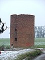 Derelict building - windmill^ - geograph.org.uk - 97184.jpg 482 × 640; 100 KB
-

-
 Easthall Farm Combine Harvester - geograph.org.uk - 45340.jpg 480 × 640; 56 KB
-
 Entering Knebworth - geograph.org.uk - 3857984.jpg 640 × 480; 94 KB
-
 Entering Old Knebworth - geograph.org.uk - 3860010.jpg 640 × 480; 76 KB
-

-
 Entrance to Knebworth House - geograph.org.uk - 6106847.jpg 2 000 × 1 500; 892 KB
-

-
 Farmhouse Three Houses Farm - geograph.org.uk - 45307.jpg 640 × 480; 32 KB
-
 Farmland north-west of Three Houses Lane - geograph.org.uk - 5392124.jpg 640 × 480; 160 KB
-
 Field by Bragbury Lane - geograph.org.uk - 5536314.jpg 2 048 × 1 536; 1 MB
-
 Fields by London Road near Old Knebworth - geograph.org.uk - 2971902.jpg 1 600 × 1 200; 504 KB
-
 Flooded footpath off Spinney Lane, Knebworth - geograph.org.uk - 6372340.jpg 2 000 × 1 500; 1,6 MB
-

-
 Footpath direction discs, Knebworth - geograph.org.uk - 3124733.jpg 2 000 × 3 008; 1,05 MB
-
 Footpath off Old Knebworth Lane - geograph.org.uk - 3860038.jpg 640 × 480; 66 KB
-
 Footpath on a forestry track in Graffridge Wood - geograph.org.uk - 5119410.jpg 1 767 × 2 000; 1,49 MB
-
 Footpath to Pigeonswick Cottage - geograph.org.uk - 3298342.jpg 1 600 × 1 069; 424 KB
-
 Formal Garden, Knebworth House, Hertfordshire - geograph.org.uk - 2776207.jpg 1 024 × 683; 313 KB
-
 Formal Garden, Knebworth House, Hertfordshire - geograph.org.uk - 2776218.jpg 1 024 × 683; 441 KB
-

-
 Fountain in the Golden Garden, Knebworth - geograph.org.uk - 3415144.jpg 640 × 480; 150 KB
-
 Fountain, Knebworth House, Hertfordshire - geograph.org.uk - 2776224.jpg 1 024 × 683; 576 KB
-

-
 Gate into Wintergreen Wood - geograph.org.uk - 3109826.jpg 1 600 × 1 067; 667 KB
-
 Gate on the public footpath through the Knebworth Estate - geograph.org.uk - 6106856.jpg 2 000 × 1 487; 1,34 MB
-
 Gazebo in the gardens of Knebworth - geograph.org.uk - 2973772.jpg 640 × 428; 102 KB
-
 Grazing, Old Knebworth - geograph.org.uk - 3860009.jpg 640 × 480; 85 KB
-
 Grazing, Old Knebworth - geograph.org.uk - 3860012.jpg 640 × 480; 72 KB
-
 Grazing, Old Knebworth - geograph.org.uk - 3860029.jpg 640 × 480; 80 KB
-
 Harwood Park Crematorium. - geograph.org.uk - 83643.jpg 640 × 482; 76 KB
-
 Having a Rest, Knebworth House, Hertfordshire - geograph.org.uk - 2776273.jpg 1 024 × 717; 489 KB
-
 Hertfordshire, Knebworth House - geograph.org.uk - 4432981.jpg 4 234 × 3 131; 6,6 MB
-
 Hertfordshire, Knebworth House - geograph.org.uk - 4432994.jpg 4 047 × 2 848; 5,82 MB
-
 Hertfordshire, Knebworth station - geograph.org.uk - 4432703.jpg 4 320 × 3 240; 7,73 MB
-
 Horses grazing - geograph.org.uk - 5222020.jpg 640 × 426; 49 KB
-
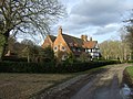
 House in the middle of nowhere - geograph.org.uk - 45326.jpg 640 × 480; 35 KB
-
 Housing in Knebworth - geograph.org.uk - 3673003.jpg 640 × 480; 207 KB
-
 Jubilee Lodge East, Old Knebworth (circa 1890) - geograph.org.uk - 2106370.jpg 2 416 × 1 812; 1,62 MB
-
 Jubilee Lodges, Old Knebworth (1) (5650352458).jpg 2 640 × 1 980; 1,19 MB
-

-

-

-

-
 Knebworth (4969181467).jpg 2 639 × 1 980; 1,16 MB
-
 Knebworth , "The Station" public house - geograph.org.uk - 6075632.jpg 1 600 × 1 158; 462 KB
-
 Knebworth - estate on the edge. - geograph.org.uk - 97329.jpg 640 × 482; 120 KB
-
 Knebworth from Swangleys Lane - geograph.org.uk - 1276357.jpg 640 × 480; 33 KB
-
 Knebworth Golf Course - geograph.org.uk - 5191399.jpg 640 × 426; 67 KB
-

-
 Knebworth House - geograph.org.uk - 5252254.jpg 3 008 × 2 000; 2,42 MB
-
 Knebworth Post Office - geograph.org.uk - 3125428.jpg 2 176 × 2 959; 1,05 MB
-
 Knebworth Post Office - geograph.org.uk - 3857998.jpg 640 × 480; 68 KB
-
 Knebworth Primary and Nursery School - geograph.org.uk - 1603699.jpg 640 × 480; 53 KB
-
 Knebworth Reformed Church - geograph.org.uk - 24286.jpg 640 × 480; 23 KB
-
 Knebworth Station - geograph.org.uk - 5673463.jpg 1 280 × 960; 350 KB
-
 Knebworth Station - geograph.org.uk - 5673507.jpg 1 280 × 960; 321 KB
-
 Knebworth telephone exchange - geograph.org.uk - 97188.jpg 640 × 482; 135 KB
-
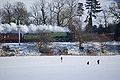
 Knebworth Up ECML coal train at Woolmer Green Box geograph-2757985-by-Ben-Brooksbank.jpg 2 394 × 1 251; 744 KB
-

-
 Knebworth, Haygarth - geograph.org.uk - 1606273.jpg 640 × 480; 91 KB
-

-

-
 Knebworth, The 'Station' public house - geograph.org.uk - 4432711.jpg 4 320 × 3 240; 7,17 MB
-
 Lake in the Knebworth Estate - geograph.org.uk - 6106866.jpg 2 000 × 1 500; 1,4 MB
-

-

-
 Lane, Rustling End - geograph.org.uk - 5392164.jpg 640 × 480; 192 KB
-
 Large house, Crouch Green - geograph.org.uk - 3859917.jpg 640 × 480; 99 KB
-
 Layby on the B656, Knebworth - geograph.org.uk - 5571157.jpg 2 048 × 1 536; 1,49 MB
-
 London Road (B197) - geograph.org.uk - 3858010.jpg 640 × 480; 86 KB
-
 London Road Knebworth - geograph.org.uk - 2535754.jpg 1 600 × 1 200; 571 KB
-
 London Road Knebworth - geograph.org.uk - 2535780.jpg 1 600 × 1 200; 504 KB
-
 London Road Knebworth - geograph.org.uk - 2536087.jpg 1 600 × 1 200; 572 KB
-
 London Road Knebworth - geograph.org.uk - 2536146.jpg 1 600 × 1 200; 516 KB
-
 London Road near Old Knebworth - geograph.org.uk - 2971899.jpg 1 600 × 1 200; 489 KB
-
 London Road, Knebworth - geograph.org.uk - 3857996.jpg 640 × 480; 78 KB
-
 Looking to Stevenage Rd - geograph.org.uk - 5098053.jpg 640 × 426; 48 KB
-
 Looking up the lake in the Knebworth Estate - geograph.org.uk - 6106885.jpg 2 000 × 1 500; 1 001 KB
-
 Lytton Almshouses, Old Knebworth - geograph.org.uk - 2106433.jpg 2 640 × 1 980; 1,4 MB
-
 Lytton Almshouses, Old Knebworth - geograph.org.uk - 2106458.jpg 3 000 × 3 945; 1,68 MB
-
 Mansion at Crouch Green - geograph.org.uk - 45312.jpg 640 × 480; 33 KB
-
 Middle Easthall Farm - geograph.org.uk - 45348.jpg 640 × 480; 20 KB
-
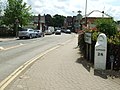
 Milestone, Knebworth - geograph.org.uk - 6372450.jpg 2 000 × 1 500; 940 KB
-
 Minor road between Whitwell and Codicote near Hoo Park - geograph.org.uk - 3434035.jpg 4 320 × 3 240; 4,44 MB
-
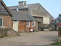 More Buildings at Burleigh Farm - geograph.org.uk - 47695.jpg 640 × 480; 20 KB
-
 Muddy track leading to railway bridge - geograph.org.uk - 97675.jpg 640 × 482; 169 KB
-
 Mulberry Cottages, Old Knebworth - geograph.org.uk - 6372126.jpg 2 000 × 1 353; 787 KB
-
 Narrow footpath, Old Knebworth - geograph.org.uk - 6372281.jpg 1 500 × 2 000; 1,3 MB
-
 Neglected milestone - geograph.org.uk - 97676.jpg 482 × 640; 161 KB
-
 New footpath through the Knebworth Estate - geograph.org.uk - 6106913.jpg 2 000 × 1 500; 1,42 MB
-
 New footpath through the Knebworth estate - geograph.org.uk - 6106920.jpg 2 000 × 1 500; 1,49 MB
-
 New footpath through the Knebworth Estate - geograph.org.uk - 6108056.jpg 2 000 × 1 500; 1,39 MB
-
 North of Knebworth - geograph.org.uk - 4177961.jpg 640 × 361; 40 KB
-
 Novotel - Knebworth Park. - geograph.org.uk - 29363.jpg 640 × 480; 65 KB
-
 Nup End near Knebworth - geograph.org.uk - 24292.jpg 640 × 480; 13 KB
-
 Old Knebworth (5558407777).jpg 1 760 × 1 320; 665 KB
-
 Old Knebworth , 'The Lytton Arms" public house - geograph.org.uk - 6075567.jpg 1 531 × 1 600; 620 KB
-
 Old Knebworth Lane - A1(M) - geograph.org.uk - 97671.jpg 640 × 482; 107 KB
-
 Old Knebworth Lane - geograph.org.uk - 3860032.jpg 640 × 480; 89 KB
-
 Old Knebworth Lane - geograph.org.uk - 3860036.jpg 640 × 480; 81 KB
-
 Old Knebworth, Houses - geograph.org.uk - 4432719.jpg 4 320 × 3 240; 7,65 MB
-
 Old Knebworth, Road junction - geograph.org.uk - 4432740.jpg 3 600 × 2 700; 7,17 MB
-
 Old Knebworth, St. Mary's Church - geograph.org.uk - 4432986.jpg 2 811 × 2 103; 5,83 MB
-
 Old Knebworth, St. Mary's Church - geograph.org.uk - 4433129.jpg 3 584 × 2 688; 7,74 MB
-
 Old Knebworth, The 'Lytton Arms' - geograph.org.uk - 4433176.jpg 3 840 × 2 880; 6,65 MB
-
 Old Knebworth, The Green - geograph.org.uk - 4433168.jpg 3 328 × 2 496; 7,19 MB
-
 Old Knebworth, War Memorial and Jubilee Lodge - geograph.org.uk - 4433138.jpg 3 942 × 2 700; 7,61 MB
-
 Old Milepost - geograph.org.uk - 3507260.jpg 768 × 1 024; 240 KB
-
 Old Milepost - geograph.org.uk - 3507261.jpg 1 024 × 768; 226 KB
-
 Old Milestone - geograph.org.uk - 3507253.jpg 768 × 1 024; 295 KB
-
 Old Milestone - geograph.org.uk - 3507258.jpg 1 024 × 768; 326 KB
-
 Old sign on the post office, Knebworth - geograph.org.uk - 6372439.jpg 2 000 × 2 000; 864 KB
-
 Ornamental lake in Knebworth gardens - geograph.org.uk - 2973782.jpg 640 × 427; 128 KB
-
 Pair of cottages at Bennington Park, Knebworth.png 735 × 703; 609 KB
-
 Park Lane and Knebworth - geograph.org.uk - 1276344.jpg 640 × 480; 78 KB
-
 Park Lane Bridge, A1(M) - geograph.org.uk - 4985578.jpg 640 × 395; 41 KB
-
 Park Lane Overbridge, A1(M) - geograph.org.uk - 4646751.jpg 640 × 426; 60 KB
-
 Park Lane to Old Knebworth - geograph.org.uk - 1276369.jpg 640 × 480; 71 KB
-
 Park Lane, Old Knebworth - geograph.org.uk - 3860023.jpg 640 × 480; 97 KB
-
 Park Lane, Old Knebworth - geograph.org.uk - 6372120.jpg 2 000 × 1 501; 1,13 MB
-
 Passing through Knebworth Station - geograph.org.uk - 5222022.jpg 640 × 426; 47 KB
-
 Passion for Christ Church and Post Office - geograph.org.uk - 6372435.jpg 2 000 × 1 377; 879 KB
-
 Path along the edge of woodland, Knebworth - geograph.org.uk - 5992460.jpg 1 500 × 2 000; 1,51 MB
-
 Path in New Wood, Old Knebworth - geograph.org.uk - 6372242.jpg 2 000 × 1 500; 1,11 MB
-
 Path through Graffridge Wood, Knebworth - geograph.org.uk - 5119421.jpg 1 500 × 2 000; 1,42 MB
-
 Path to Pigeonswick Cottage, Knebworth - geograph.org.uk - 5895706.jpg 2 000 × 1 500; 1,07 MB
-
 Pond at Knebworth Gardens - geograph.org.uk - 3415179.jpg 640 × 480; 134 KB
-
 Ponds at Knebworth Gardens - geograph.org.uk - 3415178.jpg 640 × 480; 134 KB
-
 Post Office sign, Knebworth - geograph.org.uk - 3125502.jpg 2 340 × 1 436; 803 KB
-
 Private farm track to Graffidge Wood - geograph.org.uk - 3298348.jpg 1 600 × 1 067; 408 KB
-
 Project 365 Day 137 Hole (5731302950).jpg 2 640 × 1 980; 807 KB
-
 Project 365 Day 146 Football (5761588285).jpg 2 641 × 1 979; 1,06 MB
-
 Project 365 Day 149 Moonsun (5772323969).jpg 2 499 × 1 875; 516 KB
-
 Public footpath off Spinney Lane, Knebworth - geograph.org.uk - 6372344.jpg 2 000 × 1 500; 1,87 MB
-
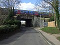 Railway bridge over Gun Road - geograph.org.uk - 3858013.jpg 640 × 480; 100 KB
-

-
 Railway bridges over Station Road - geograph.org.uk - 1323966.jpg 640 × 465; 71 KB
-
 Railway heading south east - geograph.org.uk - 3857975.jpg 640 × 480; 88 KB
-
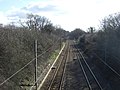
 Railway Line - geograph.org.uk - 2509702.jpg 1 024 × 768; 303 KB
-
 Road junction at Larch How, Old Knebworth - geograph.org.uk - 6372291.jpg 2 000 × 1 497; 1,2 MB
-
 Roundabout on London Road Knebworth - geograph.org.uk - 2536158.jpg 1 600 × 1 200; 531 KB
-

-
 Rusling End Farm - geograph.org.uk - 45330.jpg 640 × 480; 31 KB
-
 Rusling End Farm - geograph.org.uk - 562421.jpg 640 × 480; 102 KB
-
 Rusling End, Bridleway towards Langley - geograph.org.uk - 562416.jpg 640 × 480; 100 KB
-
 Rusling End, Graffridge Wood - geograph.org.uk - 562437.jpg 640 × 480; 146 KB
-
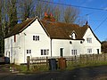
 Rye End cottages - geograph.org.uk - 2913820.jpg 640 × 480; 94 KB
-
 Rye-end Cottages, Knebworth (8367244517).jpg 3 469 × 2 605; 3,32 MB
-

-
 Sculpture, Knebworth House, Hertfordshire - geograph.org.uk - 2776238.jpg 1 024 × 683; 600 KB
-
 Shadow across the B656, Knebworth - geograph.org.uk - 5571156.jpg 2 048 × 1 536; 1,48 MB


_-_facing_north_-_geograph.org.uk_-_97316.jpg)
_-_southbound_-_geograph.org.uk_-_2458359.jpg)
_bridge_over_Old_Knebworth_Lane_-_geograph.org.uk_-_3860040.jpg)
_northbound_-_geograph.org.uk_-_2513680.jpg)
_northbound_-_geograph.org.uk_-_5682985.jpg)
_northbound_-_geograph.org.uk_-_5683003.jpg)
_northbound_-_geograph.org.uk_-_5683058.jpg)
_northbound_near_Knebworth_-_geograph.org.uk_-_2513671.jpg)
,_northbound_-_geograph.org.uk_-_4653666.jpg)


_-_geograph.org.uk_-_4985592.jpg)


.jpg)


_-_geograph.org.uk_-_3860034.jpg)


_-_geograph.org.uk_-_2106370.jpg)
_(5650352458).jpg)


.jpg)


_-_geograph.org.uk_-_3858010.jpg)


.jpg)

_-_geograph.org.uk_-_97671.jpg)


_-_geograph.org.uk_-_4985578.jpg)
_-_geograph.org.uk_-_4646751.jpg)


.jpg)
.jpg)
.jpg)


_(14597265880).jpg)


.jpg)


