Category:Knowsley, Merseyside
Aller à la navigation
Aller à la recherche
village au Royaume-Uni  | |||||
| Téléverser des médias | |||||
| Nature de l’élément | |||||
|---|---|---|---|---|---|
| Lieu | district métropolitain de Knowsley, Merseyside, Angleterre du Nord-Ouest, Angleterre | ||||
| site officiel | |||||
 | |||||

Sous-catégories
Cette catégorie comprend 7 sous-catégories, dont les 7 ci-dessous.
Média dans la catégorie « Knowsley, Merseyside »
Cette catégorie comprend 138 fichiers, dont les 138 ci-dessous.
-
 A bridleway alongside the M57 - geograph.org.uk - 4236811.jpg 4 457 × 2 736 ; 7,71 Mio
-
 A car approaches the junction of Knowsley Lane with Sugar Lane - geograph.org.uk - 3260869.jpg 4 592 × 2 652 ; 6,83 Mio
-
 A glimpse of green - geograph.org.uk - 4912501.jpg 6 480 × 4 320 ; 7,12 Mio
-
 A sealion at Knowsley - geograph.org.uk - 5340371.jpg 4 592 × 3 056 ; 7,56 Mio
-
 All the fun of the fair - geograph.org.uk - 1911799.jpg 2 848 × 2 136 ; 3,09 Mio
-
 An antelope at Knowsley Safari Park - geograph.org.uk - 5339996.jpg 4 592 × 2 322 ; 7,79 Mio
-
 Antelope - geograph.org.uk - 5340021.jpg 3 643 × 2 016 ; 4,37 Mio
-
 Big Dam, Taylor Park, St Helens, from the air - geograph.org.uk - 5026044.jpg 1 024 × 681 ; 214 kio
-
 Boode Croft at end of the road - geograph.org.uk - 2011841.jpg 640 × 480 ; 81 kio
-
 Bridge over the M57 - geograph.org.uk - 3145378.jpg 4 590 × 1 851 ; 2,08 Mio
-
 Bridge to Fluker's Brook Farm from the M57 - geograph.org.uk - 3145371.jpg 3 825 × 1 544 ; 1,42 Mio
-
 Cabbage White - geograph.org.uk - 20189.jpg 640 × 633 ; 89 kio
-
 Car park quagmire - geograph.org.uk - 1907887.jpg 2 848 × 2 136 ; 3,21 Mio
-
 Cattle Grid on the Knowsley Estate - geograph.org.uk - 882104.jpg 640 × 425 ; 439 kio
-

-
 Croxteth Lane bridge over the M57 - geograph.org.uk - 2459162.jpg 640 × 481 ; 35 kio
-
 Croxteth Lodge - geograph.org.uk - 3260809.jpg 4 592 × 2 055 ; 5,99 Mio
-
 Delph Cottage, Hewitts Lane, Moss Side - geograph.org.uk - 123507.jpg 640 × 480 ; 61 kio
-
 Disused Building in Knowsley Park, near Knowsley Lane, Merseysde, England..jpg 4 320 × 3 240 ; 4,77 Mio
-
 East Lancashire Road looking west - geograph.org.uk - 2011883.jpg 640 × 480 ; 62 kio
-
 East side of Eccleston from the air - geograph.org.uk - 5026049.jpg 1 024 × 681 ; 180 kio
-
 Entrance to Coach Road from A580 - geograph.org.uk - 2011882.jpg 640 × 480 ; 72 kio
-
 Entrance to Knowsley Safari Park - geograph.org.uk - 5498311.jpg 3 840 × 2 160 ; 2,62 Mio
-
 European bison - geograph.org.uk - 5340180.jpg 4 152 × 1 967 ; 5,56 Mio
-
 Factory units - geograph.org.uk - 4912496.jpg 6 480 × 4 320 ; 6,49 Mio
-
 Field on Knoswley Lane, Knowsley Village.jpg 4 320 × 3 240 ; 4 Mio
-
 Flukers Brook Lane, Knowsley Village.jpg 4 320 × 3 240 ; 5,35 Mio
-
 George Hale Avenue crosses the M57 - geograph.org.uk - 3145390.jpg 4 416 × 2 162 ; 2,09 Mio
-
 Green Sward - geograph.org.uk - 118151.jpg 640 × 480 ; 123 kio
-
 I've seen it all before - geograph.org.uk - 5340194.jpg 3 326 × 2 395 ; 5,42 Mio
-
 Keane - Knowsley Hall - June 2007 - geograph.org.uk - 3731602.jpg 2 848 × 2 136 ; 2,8 Mio
-
 Keane in concert, Knowsley Music Festival - 24th June 2007 - geograph.org.uk - 3243805.jpg 2 848 × 2 136 ; 2,76 Mio
-
 Knowsley Brook at School Lane.jpg 3 240 × 4 320 ; 5,46 Mio
-
 Knowsley Business Park by the A580 - geograph.org.uk - 3144865.jpg 4 148 × 2 327 ; 1,6 Mio
-
 Knowsley Business Park from the air - geograph.org.uk - 5026054.jpg 1 024 × 681 ; 193 kio
-
 Knowsley Lane - geograph.org.uk - 2011855.jpg 640 × 480 ; 68 kio
-
 Knowsley Lane at Liverpool Road roundabout - geograph.org.uk - 2011858.jpg 640 × 480 ; 77 kio
-
 Knowsley Lane crosses the M57 - geograph.org.uk - 3145384.jpg 4 168 × 2 636 ; 1,95 Mio
-
 Knowsley Lane roundabout under repair - geograph.org.uk - 2011884.jpg 640 × 480 ; 63 kio
-
 Knowsley Park from the "wrong" side - geograph.org.uk - 2193546.jpg 4 533 × 3 017 ; 4,79 Mio
-
 Knowsley Safari Park - geograph.org.uk - 2028745.jpg 1 381 × 797 ; 515 kio
-
 Knowsley sister stone at Knowsley Village.jpg 3 240 × 4 320 ; 3,97 Mio
-
 Knowsley Trigpoint and "The Stand" - geograph.org.uk - 171484.jpg 480 × 640 ; 79 kio
-
 Chapel Cottage, School Lane, Knowsley - geograph.org.uk - 126106.jpg 640 × 480 ; 59 kio
-
 Copse at end of Ormskirk Road, Knowsley Village - geograph.org.uk - 337442.jpg 525 × 394 ; 108 kio
-
 Industrial Estate Canteen - geograph.org.uk - 82994.jpg 640 × 426 ; 113 kio
-
 Knowsley - Village Green.jpg 640 × 480 ; 88 kio
-
 Quarry Cottage, School Lane, Knowsley - geograph.org.uk - 126103.jpg 640 × 480 ; 60 kio
-
 Roundabout on Knowsley Industrial Estate - geograph.org.uk - 126111.jpg 640 × 480 ; 62 kio
-
 The Village - geograph.org.uk - 83622.jpg 640 × 426 ; 63 kio
-
 Knowsley Village sign, Knowsley Lane.jpg 3 240 × 4 320 ; 3,42 Mio
-
 KnowsleyLCP.jpg 460 × 288 ; 41 kio
-
 Lady Henrietta's Wood - geograph.org.uk - 881670.jpg 640 × 425 ; 83 kio
-
 Larkin's Community Farm - geograph.org.uk - 3583775.jpg 800 × 600 ; 102 kio
-
 Looking for trouble - geograph.org.uk - 5340990.jpg 4 592 × 3 056 ; 6,34 Mio
-
 Lord Derby's back door^ - geograph.org.uk - 2193690.jpg 4 406 × 2 932 ; 5,9 Mio
-
 M57 approaching junction 2 - geograph.org.uk - 3145396.jpg 4 226 × 2 147 ; 1,6 Mio
-
 M57 at junction 4 - geograph.org.uk - 2884552.jpg 639 × 453 ; 125 kio
-
 M57 at Meakin's Pits - geograph.org.uk - 2884505.jpg 638 × 455 ; 125 kio
-
 M57 at The Roughs - geograph.org.uk - 2884502.jpg 637 × 451 ; 95 kio
-
 M57 crossing the A580 - geograph.org.uk - 2884564.jpg 640 × 453 ; 120 kio
-
 M57 motorway - Croxteth Lane bridge - geograph.org.uk - 2884496.jpg 638 × 455 ; 111 kio
-
-
 M57 motorway - Fluker's Brook Lane bridge - geograph.org.uk - 2884499.jpg 639 × 454 ; 106 kio
-
 M57 motorway - George Hale Avenue bridge - geograph.org.uk - 2884467.jpg 639 × 453 ; 162 kio
-
 M57 motorway - Knowsley Lane bridge - geograph.org.uk - 2884487.jpg 636 × 452 ; 140 kio
-
 M57 motorway - northbound at junction 4 - geograph.org.uk - 2884548.jpg 639 × 453 ; 135 kio
-
 Madness - Knowsley Hall - June 2007 - geograph.org.uk - 3731593.jpg 2 848 × 2 136 ; 2,77 Mio
-
 Millbrook Manor, Knowsley Village.jpg 4 320 × 3 240 ; 2,85 Mio
-
 Monkey closed eyes (Unsplash).jpg 4 256 × 2 832 ; 7,6 Mio
-

-
 Mouldering ruins - geograph.org.uk - 119645.jpg 640 × 426 ; 173 kio
-
 Newsprinters, Knowsley Industrial Park - geograph.org.uk - 4944122.jpg 640 × 480 ; 326 kio
-
 OK, you're the boss - geograph.org.uk - 5340164.jpg 4 592 × 3 056 ; 7,68 Mio
-
 Ostriches Ahead^ - geograph.org.uk - 5117258.jpg 4 554 × 3 058 ; 2,5 Mio
-
 Ostriches at Knowsley Safari Park - geograph.org.uk - 5116710.jpg 4 916 × 3 648 ; 4,72 Mio
-
 Parkside, Knowsley Estate - geograph.org.uk - 163484.jpg 640 × 480 ; 58 kio
-
 Path in Knowsley Park - geograph.org.uk - 881400.jpg 640 × 387 ; 56 kio
-
 Path on Knowsley Estate - geograph.org.uk - 882134.jpg 640 × 425 ; 339 kio
-
 Peacock Enclosure Knowsley Safari Park - geograph.org.uk - 2028737.jpg 1 381 × 797 ; 741 kio
-

-
 Relax, it's not that serious - geograph.org.uk - 5340211.jpg 3 876 × 2 308 ; 7,1 Mio
-
 Ribbler's Lane, Knowsley - geograph.org.uk - 5542839.jpg 2 000 × 1 500 ; 794 kio
-
 Roundabout on School Lane - geograph.org.uk - 2011887.jpg 640 × 480 ; 76 kio
-
 School Lane, Knowsley Village.jpg 4 320 × 3 240 ; 3,74 Mio
-
 Secluded pond - geograph.org.uk - 882129.jpg 640 × 591 ; 544 kio
-
 Shops, Knowsley Village (1).jpg 4 320 × 3 240 ; 2,55 Mio
-
 Stanley Lodge - geograph.org.uk - 3260891.jpg 4 556 × 3 032 ; 6 Mio
-
 Stobart truck in Knowsley, Merseyside, 15 November 2010.jpg 1 600 × 1 198 ; 296 kio
-
 Stockbridge Lane approaching Knowsley Lane - geograph.org.uk - 2011850.jpg 640 × 480 ; 52 kio
-
 Stockbridge Village Square - geograph.org.uk - 3583978.jpg 800 × 600 ; 100 kio
-
 Sugar Lane-Ormskirk Road junction - geograph.org.uk - 3020720.jpg 640 × 480 ; 61 kio
-
 Suites Hotel, Knowsley.jpg 4 320 × 3 240 ; 2,97 Mio
-
 Sunset and nightlight at Knowsley Manor Care Home - geograph.org.uk - 3260729.jpg 4 592 × 2 351 ; 6,57 Mio
-
 Sunset over Cantril Farm - geograph.org.uk - 3260772.jpg 4 249 × 2 231 ; 5,94 Mio
-
 The approach to Rose Cottage - geograph.org.uk - 3260908.jpg 4 592 × 2 405 ; 5,74 Mio
-
 The continuation of the Coach Road from the gatehouse - geograph.org.uk - 2928917.jpg 4 592 × 3 056 ; 7,39 Mio
-
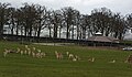 The deer park - geograph.org.uk - 5340135.jpg 4 473 × 2 618 ; 7,86 Mio
-
 The entrance to Knowsley Hall - geograph.org.uk - 3260705.jpg 4 592 × 3 056 ; 6,94 Mio
-
 The entrance to Knowsley Safari Park - geograph.org.uk - 2852956.jpg 4 192 × 2 791 ; 6,91 Mio
-
 The Entrance to Knowsley Safari Park - geograph.org.uk - 3465360.jpg 2 798 × 2 006 ; 1,45 Mio
-
 The entrance to Nursery Farm - geograph.org.uk - 3260746.jpg 4 592 × 3 056 ; 5,69 Mio
-
 The first turn for Kirkby - geograph.org.uk - 2193719.jpg 4 592 × 3 056 ; 5,15 Mio
-
 The Great Wall of Knowsley running outside the paddocks - geograph.org.uk - 3260507.jpg 4 589 × 2 907 ; 6,77 Mio
-
 The Holiday Inn, Ribbler's Lane, Knowsley - geograph.org.uk - 5542816.jpg 2 000 × 1 472 ; 928 kio
-
 The king of the jungle - geograph.org.uk - 5340243.jpg 3 858 × 2 228 ; 6,99 Mio
-
 The lodge - geograph.org.uk - 2928988.jpg 4 348 × 2 112 ; 5,75 Mio
-
 The M57 at Howard's Pits - geograph.org.uk - 3145362.jpg 3 128 × 1 856 ; 1,19 Mio
-
 The M57 from Fluker's Lane Bridge - geograph.org.uk - 4236706.jpg 4 089 × 2 721 ; 6,32 Mio
-
 The Nine Elms - geograph.org.uk - 1129182.jpg 640 × 338 ; 49 kio
-
 The road into Knowsley Park from Paddock Lodge - geograph.org.uk - 3260492.jpg 4 298 × 2 640 ; 5,83 Mio
-
 The road into the Knowsley Estate from Croxteth Lodge - geograph.org.uk - 3260843.jpg 4 592 × 3 056 ; 7,51 Mio
-
 The track to Knowsley Lane Farm - geograph.org.uk - 3260529.jpg 4 592 × 3 056 ; 5,71 Mio
-
 The Village Inn, Stockbridge Village - geograph.org.uk - 4236837.jpg 4 217 × 2 422 ; 4,45 Mio
-
 Think twice before you call anyone else king^ - geograph.org.uk - 5340274.jpg 3 408 × 2 886 ; 6,82 Mio
-
 Time for Lunch - geograph.org.uk - 5116713.jpg 4 564 × 3 550 ; 4,04 Mio
-
 Tithebarn Lane - geograph.org.uk - 3583667.jpg 800 × 600 ; 128 kio
-
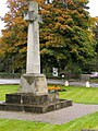
 Village Green and War Memorial, Knowsley - geograph.org.uk - 2011885.jpg 640 × 480 ; 96 kio
-
 Village green with war memorial - geograph.org.uk - 5509131.jpg 1 200 × 1 600 ; 927 kio
-
 Waterpark Drive-Seth Powell Way roundabout - geograph.org.uk - 2011846.jpg 640 × 480 ; 64 kio
-
 Welcome to Knowsley Safari Park - geograph.org.uk - 5339975.jpg 4 592 × 2 153 ; 6,51 Mio
-
 Welcome to the Knowsley Festival 2007 - geograph.org.uk - 1907892.jpg 2 848 × 2 136 ; 3,17 Mio
-
 Where's all the grass gone^ - geograph.org.uk - 1907901.jpg 2 848 × 2 136 ; 2,85 Mio
-
 White rhino at Knowsley Safari Park - geograph.org.uk - 5116707.jpg 4 229 × 3 371 ; 3,65 Mio
-
 Woods on the Knowsley Estate - geograph.org.uk - 882084.jpg 640 × 425 ; 475 kio
-
 Blooming Marvellous^ - geograph.org.uk - 1443338.jpg 640 × 480 ; 100 kio
-
 Croxteth Lodge, Knowsley - geograph.org.uk - 83607.jpg 640 × 426 ; 162 kio
-
 Croxteth Park, from the M57 - geograph.org.uk - 125388.jpg 640 × 421 ; 52 kio
-
 Zebra at Knowsley - geograph.org.uk - 5340031.jpg 4 259 × 2 328 ; 7,94 Mio
-
 Home Farm Lodge, Knowsley Park - geograph.org.uk - 282275.jpg 640 × 480 ; 107 kio
-
 Home Farm, Knowsley Estate - geograph.org.uk - 282265.jpg 640 × 480 ; 110 kio
-
 Huyton Industrial Estate, Wilson Road - geograph.org.uk - 113667.jpg 640 × 480 ; 58 kio
-
 Knowsley Lane Farm - geograph.org.uk - 280164.jpg 640 × 480 ; 106 kio
-
 Knowsley Lane Farm - geograph.org.uk - 83610.jpg 640 × 426 ; 64 kio
-
 Knowsley Park - geograph.org.uk - 131510.jpg 640 × 421 ; 164 kio
-
 Lord Derby's Footpath - geograph.org.uk - 20176.jpg 640 × 480 ; 121 kio
-
 The Earl of Derby's walled garden - geograph.org.uk - 83102.jpg 640 × 426 ; 75 kio
-
 Wilson Road Industrial Estate - geograph.org.uk - 43844.jpg 640 × 480 ; 58 kio


.jpg)


.jpg)


