Category:Kolk lakes
Zur Navigation springen
Zur Suche springen
stiller Strudeltopf hinter einem Deichbruch | |||||
| Medium hochladen | |||||
| |||||
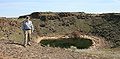
A Kolk lake (German: Wehl or Brack; Dutch: Wiel or Weel, Danish: Kolk or Høl) is a small lake formed after a dike has broken and flood has flown in.
NB: For Wehl, a municipality in the province of Gelderland, Netherlands, see Category:Wehl.
Unterkategorien
Diese Kategorie enthält folgende Unterkategorie:
In Klammern die Anzahl der enthaltenen Kategorien (K), Seiten (S), Dateien (D)
Medien in der Kategorie „Kolk lakes“
Folgende 13 Dateien sind in dieser Kategorie, von 13 insgesamt.
-
 2013-05-03 Fotoflug Leer Papenburg DSCF7262.jpg 2.500 × 1.673; 3,03 MB
-
 Aerial - Lincoln County, WA with part of Sprague Lake 01 - white balanced (9795150695).jpg 4.288 × 2.848; 7,71 MB
-
 Das Dammloch in Büderich (Meerbusch)1.jpg 3.264 × 2.448; 5,63 MB
-
 Das Dammloch in Büderich (Meerbusch)2.jpg 3.264 × 2.448; 5,3 MB
-
 Kolk plucked pothole.jpg 3.831 × 1.881; 1,7 MB
-
 Kolkschema.svg 1.152 × 648; 19 KB
-
 Lakewood Bay Oswego Lake.jpg 2.731 × 2.049; 3,44 MB
-
 Oswego Banner.jpg 2.731 × 390; 1,15 MB
-
 Papenbrack.jpg 2.816 × 2.112; 1,12 MB
-
 Rock cut basin, River Nith, Carron Bridge, Dumfries & Galloway.jpg 4.440 × 2.589; 6,49 MB
-
 Rock cut basins, Clapham Beck, Ingleborough, North Yorkshire.jpg 4.896 × 2.752; 2,51 MB
-
 Rock cut basins, River Nith, Carron Bridge, Dumfries & Galloway.jpg 4.608 × 3.456; 6,98 MB
-
 Schlitz Auenverbund Fulda LPA 378401 Schlitz River Kolk Uetzhausen.png 5.208 × 3.476; 29,45 MB

.jpg)
1.jpg)
2.jpg)


