Category:Lühesand
Zur Navigation springen
Zur Suche springen

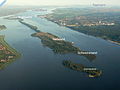
Binneninsel in der Elbe südöstlich von Stade  | |||||
| Medium hochladen | |||||
| Ist ein(e) | |||||
|---|---|---|---|---|---|
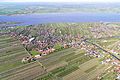
| Ort | Steinkirchen, Samtgemeinde Lühe, Landkreis Stade, Niedersachsen, Deutschland | ||||
| Liegt am oder im Gewässer | |||||
| Breite |
| ||||
| Länge |
| ||||
| Fläche |
| ||||
| Einzugsgebiet | |||||
 | |||||
Unterkategorien
Es werden 2 von insgesamt 2 Unterkategorien in dieser Kategorie angezeigt:
In Klammern die Anzahl der enthaltenen Kategorien (K), Seiten (S), Dateien (D)
E
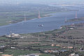
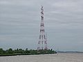
- Elbekreuzung 1 (26 D)
- Elbekreuzung 2 (59 D)
Medien in der Kategorie „Lühesand“
Folgende 39 Dateien sind in dieser Kategorie, von 39 insgesamt.
-
 Aerial photograph 400D 2012 05 05 8380 DxO.jpg 3.888 × 2.592; 2,11 MB
-
 Aerial photograph 400D 2012 05 05 8387 DxO.jpg 3.888 × 2.592; 3 MB
-
 Aerial photograph 400D 2012 05 05 8388 DxO.jpg 3.888 × 2.592; 2,29 MB
-
 Aerial photograph 400D 2012 05 05 8389 DxO.jpg 3.888 × 2.592; 2,7 MB
-
 Aerial photograph 400D 2012 05 05 8390 DxO.jpg 3.888 × 2.592; 2,56 MB
-
 Aerial photograph 400D 2012 05 05 8391 DxO.jpg 3.888 × 2.592; 2,28 MB
-
 Aerial photograph 400D 2012 05 05 8409 DxO.jpg 3.888 × 2.592; 2,72 MB
-
 Aerial photograph 400D 2012 05 05 8411 DxO.jpg 3.888 × 2.592; 2,63 MB
-
 Aerial photograph 400D 2012 05 05 8413 DxO.jpg 3.888 × 2.592; 1,8 MB
-
 Aerial photograph 400D 2012 05 05 8414 DxO.jpg 3.888 × 2.592; 9,48 MB
-
 Aerial photograph 400D 2012 05 05 8419 DxO.jpg 3.888 × 2.592; 2,88 MB
-
 Aerial photograph 8321 DxO.jpg 5.184 × 3.456; 3,7 MB
-
 Aerial photograph 8323 DxO.jpg 5.184 × 3.456; 3,93 MB
-
 Aerial photograph 8325 DxO.jpg 5.184 × 3.456; 3,53 MB
-
 Aerial photograph 8326 DxO.jpg 5.184 × 3.456; 3,93 MB
-
 Aerial photograph 8344 DxO.jpg 5.184 × 3.456; 3,4 MB
-
 Aerial photograph 8346 DxO.jpg 5.184 × 3.456; 4,07 MB
-
 Aerial photograph 8347 DxO.jpg 5.184 × 3.456; 3,48 MB
-
 CSCL Indian Ocean vor Lühesand (24882560275).jpg 2.000 × 1.333; 1,35 MB
-
 CSCL Indian Ocean vor Lühesand (24882567935).jpg 2.000 × 1.333; 1,17 MB
-
 Elbekreuzung 2 durchfahrt.jpg 1.600 × 1.200; 772 KB
-
 Elbekreuzung-2-seitlich.jpg 1.599 × 600; 249 KB
-
 Elbeüberquerung 1.jpg 4.048 × 3.040; 1,46 MB
-
 Elbsaende2009.JPG 2.131 × 1.599; 1,75 MB
-
 Hollern-Twielenfleth Fähre nach Lühesand.jpg 2.048 × 1.536; 734 KB
-

-
 Luftaufnahmen Nordseekueste 2012-05-by-RaBoe-578.jpg 4.000 × 2.657; 9,55 MB
-
 Luftaufnahmen Nordseekueste 2012-05-by-RaBoe-579.jpg 4.000 × 2.406; 7,81 MB
-
 Luftaufnahmen Nordseekueste 2012-05-by-RaBoe-580.jpg 3.594 × 2.387; 6,88 MB
-
 Luftaufnahmen Nordseekueste 2012-05-by-RaBoe-581.jpg 4.000 × 2.285; 7,43 MB
-
 Luftaufnahmen Nordseekueste 2012-05-by-RaBoe-582.jpg 4.000 × 2.657; 8,76 MB
-
 Luftaufnahmen Nordseekueste 2012-05-by-RaBoe-587.jpg 3.790 × 2.515; 7,76 MB
-
 Luftaufnahmen Nordseekueste 2012-05-by-RaBoe-599.jpg 4.000 × 2.657; 8,39 MB
-
 Luftaufnahmen Nordseekueste 2012-05-by-RaBoe-600.jpg 4.000 × 2.657; 8,35 MB
-
 Luftaufnahmen Nordseekueste 2012-05-by-RaBoe-605.jpg 4.000 × 2.657; 7,97 MB
-
 Luftaufnahmen Nordseekueste 2012-05-by-RaBoe-606.jpg 4.000 × 2.657; 7,9 MB
-
 Luftaufnahmen Nordseekueste-Mojenhörn - 2012-05-by-RaBoe-578.jpg 1.542 × 904; 1,64 MB
-
 Lühesand.jpg 1.628 × 1.880; 933 KB
-
 Stade-Stadersand Stromtrasse-Lühesand Dez-2017 DSC 0240.JPG 4.928 × 3.264; 4,7 MB


.jpg)
.jpg)


