Category:La Vega Province
Vai alla navigazione
Vai alla ricerca
Provinces of the Dominican Republic: Azua · Bahoruco · Barahona · Dajabón · Duarte · El Seibo · Elías Piña · Espaillat · Hato Mayor · Hermanas Mirabal · Independencia · La Altagracia · La Romana · La Vega · María Trinidad Sánchez · Monseñor Nouel · Monte Cristi · Monte Plata · Pedernales · Peravia · Puerto Plata · Samaná · San Cristóbal · San José de Ocoa · San Juan · San Pedro de Macorís · Sánchez Ramírez · Santiago · Santiago Rodríguez · Santo Domingo · Valverde · Distrito Nacional
provincia dominicana     | |||||
| Carica un file multimediale | |||||
| Istanza di | |||||
|---|---|---|---|---|---|
| Luogo | Repubblica Dominicana | ||||
| Capitale | |||||
| Data di fondazione o creazione |
| ||||
| Popolazione |
| ||||
| Superficie |
| ||||
| Altezza sul mare |
| ||||
 | |||||
Sottocategorie
Questa categoria contiene le 3 sottocategorie indicate di seguito, su un totale di 3.
M
- Maps of La Vega Province (2 F)
V
- Valle Nuevo National Park (13 F)
File nella categoria "La Vega Province"
Questa categoria contiene 30 file, indicati di seguito, su un totale di 30.
-
 Escudo de la Provincia La Vega.png 295 × 301; 23 KB
-
 BatallaVegaReal1.jpg 250 × 339; 38 KB
-
 Countryside around Jarabacoa - Dominican Republic.jpg 1 704 × 2 272; 1,77 MB
-
 El Mamey 41000, Dominican Republic - panoramio.jpg 2 048 × 1 536; 500 KB
-
 Gero midaz society.jpg 4 032 × 3 024; 4,91 MB
-
 Recesión de micabaña resot - panoramio.jpg 2 304 × 1 728; 1,01 MB
-
 Rio Jimenoa, looking southeast, July 2009 - panoramio.jpg 1 600 × 1 200; 917 KB
-
 Rio Yaque del Norte, looking south, July 2009 - panoramio.jpg 1 600 × 1 200; 1,4 MB
-
 Rio Yaque del Norte, zoom to bend in river, looking south, July 2009 - panoramio.jpg 1 600 × 1 200; 1,18 MB
-
 Roca 1.jpg 2 576 × 1 932; 1,45 MB
-
 Small corner park, looking south, July 2009 - panoramio.jpg 1 600 × 1 200; 1,25 MB
-

-
 The avenida, looking north, July 2009 - panoramio.jpg 1 600 × 1 200; 1,11 MB
-
 The distant hills, looking east, December 2008 - panoramio.jpg 2 048 × 1 536; 1,27 MB
-
 The distant hills, looking southeast along the Jimenoa, July 2009 - panoramio.jpg 1 600 × 1 200; 585 KB
-
 The divided road ends here, looking south, July 2009 - panoramio.jpg 1 600 × 1 200; 1,11 MB
-
 The far bank of the Jimenoa, looking up (and north), July 2009 - panoramio.jpg 1 200 × 1 600; 1,22 MB
-
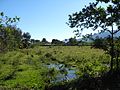 The field is wet, looking east, January 2009 - panoramio.jpg 2 048 × 1 536; 2,26 MB
-
 The lane toward Rancho Ruiseñor, looking west, January 2009 - panoramio.jpg 2 048 × 1 536; 2,53 MB
-
 The main road to La Joya, looking east, January 2009 - panoramio.jpg 2 048 × 1 536; 2,62 MB
-
 The road continues north to the confluencia, July 2009 - panoramio.jpg 1 600 × 1 200; 1,39 MB
-
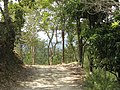
 The road looking north, January 2009 - panoramio.jpg 2 048 × 1 536; 2,3 MB
-
 The road looking south, January 2009 - panoramio.jpg 2 048 × 1 536; 2,1 MB
-
 The road nears its end, looking south, January 2009 - panoramio.jpg 2 048 × 1 536; 2,61 MB
-
 The road, looking west from the Monte Verde entrance, February 2010 - panoramio.jpg 1 600 × 1 200; 1,49 MB
-
 Trabajadores de la tierra - panoramio.jpg 3 072 × 2 304; 3,16 MB
-
 Vista de la cosecha de contanza - panoramio.jpg 2 304 × 1 728; 1 MB
-
 Vista desde la montaña de los barrios de Constanza - panoramio.jpg 3 072 × 2 304; 3,01 MB
-
 Доминиканская Республика - panoramio (17).jpg 4 288 × 2 848; 7,8 MB
-
 Доминиканская Республика - panoramio (19).jpg 3 794 × 2 135; 4,92 MB


,_July_2009_-_panoramio.jpg)


.jpg)
.jpg)