Category:Lamport, Northamptonshire
Aller à la navigation
Aller à la recherche
English: Lamport is a village and civil parish in the West Northamptonshire district of the county of Northamptonshire in England. Nearby are Lamport Hall and the Northampton & Lamport Railway.
village britannique  | |||||
| Téléverser des médias | |||||
| Nature de l’élément | |||||
|---|---|---|---|---|---|
| Lieu | West Northamptonshire, Northamptonshire, Midlands de l'Est, Angleterre | ||||
| Population |
| ||||
| Superficie |
| ||||
 | |||||
Sous-catégories
Cette catégorie comprend 5 sous-catégories, dont les 5 ci-dessous.
Média dans la catégorie « Lamport, Northamptonshire »
Cette catégorie comprend 129 fichiers, dont les 129 ci-dessous.
-
 A cycle race near Lamport - geograph.org.uk - 5690862.jpg 2 000 × 1 333 ; 1,99 Mio
-
 All Hallows church - geograph.org.uk - 5639245.jpg 640 × 480 ; 39 kio
-
 All Hallows Church Lamport - geograph.org.uk - 5353097.jpg 2 048 × 1 360 ; 1,87 Mio
-
 Brampton Valley - geograph.org.uk - 3544368.jpg 640 × 478 ; 62 kio
-
 Brampton Valley Way - geograph.org.uk - 3544390.jpg 640 × 478 ; 110 kio
-
 Brampton Valley Way - geograph.org.uk - 4503631.jpg 480 × 640 ; 109 kio
-
 Brampton Valley Way - Houghton Crossing - geograph.org.uk - 4503627.jpg 480 × 640 ; 99 kio
-
 Brampton Valley Way - Houghton Crossing - geograph.org.uk - 4503628.jpg 480 × 640 ; 108 kio
-
 Brampton Valley Way at Houghton Crossing - geograph.org.uk - 5864015.jpg 1 024 × 768 ; 281 kio
-
 Brampton Valley Way at Lamport station site - geograph.org.uk - 5863263.jpg 1 024 × 768 ; 222 kio
-
 Brampton Valley Way crossing a small stream - geograph.org.uk - 5318259.jpg 800 × 615 ; 195 kio
-
 Brampton Valley Way near Brixworth - geograph.org.uk - 5864026.jpg 1 024 × 768 ; 206 kio
-
 Brampton Valley Way near Lamport - geograph.org.uk - 5864011.jpg 1 024 × 768 ; 172 kio
-
 Bridleway to Faxton - geograph.org.uk - 3540752.jpg 4 320 × 3 240 ; 5,41 Mio
-
 Clint Hill - geograph.org.uk - 3544362.jpg 640 × 478 ; 72 kio
-
 Clint Hill Fox Covert - geograph.org.uk - 5318364.jpg 800 × 533 ; 109 kio
-
 Countryside view north of Lamport - geograph.org.uk - 5321043.jpg 800 × 603 ; 146 kio
-
 Derelict building along the Brampton Valley Way - geograph.org.uk - 5318338.jpg 800 × 501 ; 167 kio
-
 Disused building on the Brampton Valley Way - geograph.org.uk - 5196209.jpg 640 × 640 ; 122 kio
-
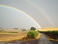 Double rainbow over Manor Road, near Lamport (geograph 5863277).jpg 1 024 × 768 ; 100 kio
-
 Entrance to Lamport Hall - geograph.org.uk - 5196203.jpg 640 × 640 ; 120 kio
-
 Farm and House near A508 and A14 - geograph.org.uk - 395083.jpg 640 × 480 ; 51 kio
-
 Farm buildings at Lamport - geograph.org.uk - 5321034.jpg 800 × 538 ; 104 kio
-
 Farmland near Hanging Houghton - geograph.org.uk - 3544107.jpg 640 × 478 ; 67 kio
-
 Farmland near Hanging Houghton - geograph.org.uk - 3544112.jpg 640 × 478 ; 59 kio
-
 Farmland near Hanging Houghton - geograph.org.uk - 3544380.jpg 640 × 478 ; 96 kio
-
 Farmland near Lamport - geograph.org.uk - 4160132.jpg 497 × 640 ; 190 kio
-
 Farmland next to the Brampton Valley Way - geograph.org.uk - 5318351.jpg 800 × 560 ; 117 kio
-
 Farmland north of the village of Lamport - geograph.org.uk - 5321780.jpg 800 × 578 ; 106 kio
-
 Farmland north of the village of Lamport - geograph.org.uk - 5321843.jpg 800 × 533 ; 116 kio
-
 Faxton Grange near Lamport - geograph.org.uk - 5321029.jpg 800 × 497 ; 128 kio
-
 Field view - geograph.org.uk - 4503643.jpg 640 × 480 ; 54 kio
-
 Field view - geograph.org.uk - 4503644.jpg 640 × 480 ; 46 kio
-
 Field view - geograph.org.uk - 4503647.jpg 640 × 480 ; 60 kio
-
 Fields in Brampton Valley - geograph.org.uk - 395048.jpg 640 × 480 ; 85 kio
-
 Fordson Tractor at Lamport Country Show - Flickr - mick - Lumix.jpg 3 055 × 2 035 ; 1,85 Mio
-
 Fordson Tractor At Lamport Hall - Flickr - mick - Lumix.jpg 3 752 × 2 671 ; 3,17 Mio
-
 Foxhall, Northamptonshire - geograph.org.uk - 5861189.jpg 1 024 × 768 ; 236 kio
-
 Hanging Houghton - geograph.org.uk - 3544348.jpg 640 × 478 ; 83 kio
-
 Harborough Road - geograph.org.uk - 2667091.jpg 640 × 427 ; 114 kio
-
 Harborough Road, Hanging Houghton - geograph.org.uk - 6296440.jpg 1 921 × 1 420 ; 1,97 Mio
-
 Harborough Road, Hanging Houghton - geograph.org.uk - 6365327.jpg 1 976 × 1 446 ; 1,39 Mio
-
 Harborough Road, Lamport - geograph.org.uk - 6201447.jpg 2 030 × 1 520 ; 1,6 Mio
-
 Heading south along the Brampton Valley Way - geograph.org.uk - 5318343.jpg 800 × 626 ; 178 kio
-
 Heading to Blueberry Farm - geograph.org.uk - 4503636.jpg 480 × 640 ; 80 kio
-
 Heading towards Blueberry Lodge - geograph.org.uk - 4503640.jpg 640 × 480 ; 95 kio
-
 Houghton Crossing on the Brampton Valley Way - geograph.org.uk - 5196207.jpg 640 × 640 ; 146 kio
-
 Houghton Crossing, Brampton Valley Way - geograph.org.uk - 5196211.jpg 640 × 640 ; 149 kio
-
 Lamport - geograph.org.uk - 325090.jpg 640 × 480 ; 129 kio
-
 Lamport junction - geograph.org.uk - 5492268.jpg 480 × 640 ; 109 kio
-
 Lamport Parish Church - geograph.org.uk - 5196204.jpg 640 × 640 ; 86 kio
-
 Lamport Parish Church - geograph.org.uk - 5692845.jpg 2 048 × 1 360 ; 614 kio
-
 Lamport station site geograph-3742636-by-Ben-Brooksbank.jpg 2 324 × 1 507 ; 3,51 Mio
-
 Lamport view - geograph.org.uk - 2667089.jpg 640 × 427 ; 90 kio
-
 Lane heading south to Lamport - geograph.org.uk - 5321832.jpg 800 × 493 ; 139 kio
-
 Lodge and gates, Lamport - geograph.org.uk - 4160122.jpg 640 × 381 ; 195 kio
-
 Lodge house on the edge of Lamport Hall estate - geograph.org.uk - 3540769.jpg 4 320 × 3 240 ; 3,02 Mio
-
 Looking back towards Brampton Valley Way - geograph.org.uk - 4503637.jpg 480 × 640 ; 59 kio
-
 Manor Road - geograph.org.uk - 3543763.jpg 640 × 478 ; 115 kio
-
 Manor Road - geograph.org.uk - 3544095.jpg 640 × 478 ; 94 kio
-
 Manor Road - geograph.org.uk - 3544371.jpg 640 × 478 ; 118 kio
-
 Manor Road, Hanging Houghton - geograph.org.uk - 4160110.jpg 473 × 640 ; 277 kio
-
 Public bridleway to Faxton - geograph.org.uk - 5321023.jpg 800 × 513 ; 157 kio
-
 Red Massey Ferguson tractor at the Lamport Country Show.jpg 3 137 × 1 982 ; 1,55 Mio
-
 Road junction near Loddington, Northamptonshire - geograph.org.uk - 5861170.jpg 1 024 × 768 ; 362 kio
-
 Road junction near Orton, Northamptonshire - geograph.org.uk - 5861178.jpg 1 024 × 768 ; 203 kio
-
 Road north from Mawlsey Village - geograph.org.uk - 6192622.jpg 1 024 × 684 ; 474 kio
-
 Road north from Mawlsey Village - geograph.org.uk - 6192628.jpg 1 024 × 684 ; 363 kio
-
 Road towards Foxall - geograph.org.uk - 6192640.jpg 1 024 × 684 ; 361 kio
-
 Rural road in Northamptonshire - geograph.org.uk - 5861167.jpg 1 024 × 768 ; 346 kio
-
 Rural road near Mawsley, Northamptonshire - geograph.org.uk - 5861163.jpg 1 024 × 768 ; 211 kio
-
 Seat along the Brampton Valley Way - geograph.org.uk - 5318368.jpg 800 × 600 ; 181 kio
-
 Seats along the Brampton Valley Way - geograph.org.uk - 5318330.jpg 800 × 563 ; 208 kio
-
 Sir Charles Isham circa 1850.jpg 500 × 612 ; 92 kio
-
 Site of Lamport railway station - geograph.org.uk - 5863266.jpg 1 024 × 768 ; 300 kio
-
 Station house - geograph.org.uk - 5639254.jpg 640 × 480 ; 31 kio
-
 Station House next to the Brampton Valley Way - geograph.org.uk - 5318265.jpg 800 × 518 ; 133 kio
-
 The Brampton Valley Way - geograph.org.uk - 5361172.jpg 480 × 640 ; 137 kio
-
 The Brampton Valley Way - geograph.org.uk - 5361173.jpg 480 × 640 ; 96 kio
-
 The Brampton Valley Way - geograph.org.uk - 5361174.jpg 480 × 640 ; 109 kio
-
 The Brampton Valley Way - geograph.org.uk - 5361176.jpg 480 × 640 ; 95 kio
-
 The Brampton Valley Way - geograph.org.uk - 5361178.jpg 480 × 640 ; 126 kio
-
 The Brampton Valley Way - geograph.org.uk - 5361179.jpg 640 × 480 ; 92 kio
-
 The lane to Draughton - geograph.org.uk - 5321044.jpg 800 × 600 ; 173 kio
-
 The lane to Draughton - geograph.org.uk - 5321045.jpg 800 × 600 ; 125 kio
-
 The Long Path to Scaldwell. - geograph.org.uk - 456882.jpg 640 × 480 ; 118 kio
-
 The Swan Business Centre, Lamport - geograph.org.uk - 5196202.jpg 640 × 640 ; 97 kio
-
 The way we came. - geograph.org.uk - 456914.jpg 640 × 480 ; 105 kio
-
 Towards Draughton - geograph.org.uk - 5492270.jpg 480 × 640 ; 94 kio
-
 Towards Draughton - geograph.org.uk - 5492271.jpg 480 × 640 ; 98 kio
-
 Towards Foxhall - geograph.org.uk - 5492265.jpg 480 × 640 ; 70 kio
-
 Towards Lamport - geograph.org.uk - 5492267.jpg 480 × 640 ; 94 kio
-
 Towards the lost village of Faxton - geograph.org.uk - 5536705.jpg 640 × 640 ; 93 kio
-
 Townsend Cottages in Lamport - geograph.org.uk - 5321040.jpg 800 × 600 ; 166 kio
-
 Townsend Cottages, Lamport - geograph.org.uk - 388023.jpg 640 × 501 ; 76 kio
-

-
 Tree by Harborough Road, Hanging Houghton - geograph.org.uk - 6365330.jpg 1 290 × 1 872 ; 1,55 Mio
-
 Trees along the lane to Draughton - geograph.org.uk - 5321848.jpg 800 × 600 ; 212 kio
-
 View across valley to Sandy Hill Farm. - geograph.org.uk - 365601.jpg 640 × 480 ; 82 kio
-
 View towards Harrington Lodge. - geograph.org.uk - 365573.jpg 640 × 480 ; 91 kio
-
 West Hill House along the A508 Harborough Road - geograph.org.uk - 5318271.jpg 800 × 525 ; 109 kio
-
 Woods by Harborough Road, Hanging Houghton - geograph.org.uk - 6296441.jpg 2 034 × 1 526 ; 3 Mio
-
 A508 Lamport - geograph.org.uk - 377157.jpg 640 × 495 ; 76 kio
-
 A508 northbound - geograph.org.uk - 377172.jpg 640 × 452 ; 73 kio
-
 A508 northbound - geograph.org.uk - 377197.jpg 640 × 480 ; 84 kio
-
 Barns at Blueberry Lodge - geograph.org.uk - 446601.jpg 640 × 477 ; 101 kio
-
 Copse near Dale Farm - geograph.org.uk - 446510.jpg 640 × 477 ; 141 kio
-
 Copse on Clint Hill - geograph.org.uk - 395053.jpg 640 × 480 ; 123 kio
-
 Corner of the Rape Field. - geograph.org.uk - 444057.jpg 640 × 480 ; 130 kio
-
 Country Road Junction. - geograph.org.uk - 365546.jpg 640 × 480 ; 86 kio
-
 Country Road. - geograph.org.uk - 365633.jpg 640 × 480 ; 91 kio
-
 Curious Spectators. - geograph.org.uk - 444058.jpg 640 × 480 ; 104 kio
-
 Farm Building and Machinery - geograph.org.uk - 60964.jpg 640 × 480 ; 135 kio
-

-
 Fields near Dale Farm - geograph.org.uk - 446509.jpg 640 × 477 ; 79 kio
-
 Hillside in SP7472 - geograph.org.uk - 395039.jpg 640 × 480 ; 68 kio
-
 Lamport - geograph.org.uk - 325067.jpg 640 × 480 ; 117 kio
-
 Lamport - geograph.org.uk - 325494.jpg 640 × 480 ; 106 kio
-
 Lollipops - geograph.org.uk - 395105.jpg 640 × 480 ; 71 kio
-
 Maidwell - geograph.org.uk - 325045.jpg 640 × 480 ; 123 kio
-
 Maidwell telephone exchange - geograph.org.uk - 446496.jpg 640 × 477 ; 77 kio
-
 Manor Farm, Lamport - geograph.org.uk - 388013.jpg 640 × 337 ; 83 kio
-
 Mill Farm - geograph.org.uk - 446502.jpg 640 × 477 ; 71 kio
-
 Pond near Blueberry Lodge - geograph.org.uk - 446608.jpg 640 × 477 ; 100 kio
-
 Rectory Farm - geograph.org.uk - 60990.jpg 640 × 480 ; 135 kio
-
 The walk into Scaldwell - geograph.org.uk - 456920.jpg 640 × 480 ; 91 kio
-
 View towards Blueberry Lodge. - geograph.org.uk - 437873.jpg 640 × 480 ; 80 kio
-
 View towards Clint Hill. - geograph.org.uk - 457696.jpg 640 × 480 ; 80 kio
-
 Works Entrance at Sandy Hill Farm. - geograph.org.uk - 365638.jpg 640 × 480 ; 91 kio


.jpg)


