Category:Laneast
Vai alla navigazione
Vai alla ricerca
village and civil parish in Cornwall, UK  Eglwys Sant Sidwell, Laneast | |||||
| Carica un file multimediale | |||||
| Istanza di | |||||
|---|---|---|---|---|---|
| Luogo | Cornwall, Cornovaglia, Sud Ovest dell'Inghilterra, Inghilterra | ||||
 | |||||
English: Laneast is a civil parish and small village near Launceston, in Cornwall, England, United Kingdom.
Sottocategorie
Questa categoria contiene le 3 sottocategorie indicate di seguito, su un totale di 3.
B
- Badgall (19 F)
C
File nella categoria "Laneast"
Questa categoria contiene 59 file, indicati di seguito, su un totale di 59.
-
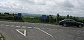
 A395 road junction on Laneast Downs - geograph.org.uk - 6261645.jpg 1 600 × 800; 473 KB
-
 A395 west of Downhead - geograph.org.uk - 6261637.jpg 1 600 × 1 162; 805 KB
-
 An house alongside the A395 - geograph.org.uk - 3527273.jpg 1 024 × 768; 205 KB
-
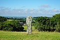
 Ancient Cross and High Hall - geograph.org.uk - 437316.jpg 475 × 640; 97 KB
-
 Ancient stone cross on Laneast Downs - geograph.org.uk - 819827.jpg 640 × 480; 58 KB
-
 Approaching Moorview Garage - geograph.org.uk - 2017131.jpg 2 862 × 2 397; 2,09 MB
-
 Badgall Hamlet - geograph.org.uk - 1903423.jpg 640 × 425; 85 KB
-
 Bus stop, Laneast - geograph.org.uk - 4700798.jpg 1 920 × 1 422; 892 KB
-
 Cross on Laneast Downs - geograph.org.uk - 719648.jpg 640 × 480; 97 KB
-
 Cross roads on A395 - geograph.org.uk - 437313.jpg 640 × 308; 42 KB
-
 Field access track near Trespearne - geograph.org.uk - 4431183.jpg 1 920 × 1 440; 830 KB
-
 Hedge and trees near Laneast - geograph.org.uk - 699971.jpg 640 × 480; 90 KB
-
 Hillside near St Clether - geograph.org.uk - 4449280.jpg 1 920 × 1 376; 759 KB
-
 Hillside, Laneast - geograph.org.uk - 4431288.jpg 1 920 × 1 440; 1,07 MB
-
 Junction, Laneast - geograph.org.uk - 4440636.jpg 1 920 × 1 440; 863 KB
-
 Lane at Trespearne - geograph.org.uk - 4440331.jpg 1 920 × 1 535; 731 KB
-
 Lane from Trespearne - geograph.org.uk - 4440622.jpg 1 920 × 1 440; 1,06 MB
-
 Lane to Downend - geograph.org.uk - 4440631.jpg 1 920 × 1 311; 555 KB
-
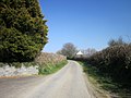 Lane to Laneast - geograph.org.uk - 4439207.jpg 1 920 × 1 440; 563 KB
-
 Laneast - geograph.org.uk - 3563406.jpg 640 × 480; 83 KB
-
 Laneast Downs - geograph.org.uk - 1083788.jpg 640 × 480; 200 KB
-
 Laneast Downs - geograph.org.uk - 1889979.jpg 640 × 427; 79 KB
-

-
 Laneast, Moorview Garage - geograph.org.uk - 1466604.jpg 640 × 480; 72 KB
-
 Lidcott Farm - geograph.org.uk - 1083785.jpg 640 × 480; 197 KB
-

-
 Moorview Garage - geograph.org.uk - 1083796.jpg 640 × 480; 200 KB
-
 Moorview Garage by A395 - geograph.org.uk - 6261640.jpg 1 600 × 639; 450 KB
-
-
 Ordnance Survey Flush Bracket G3676 - geograph.org.uk - 4728186.jpg 4 000 × 3 000; 3,92 MB
-
 Ordnance Survey Flush Bracket G3678 - geograph.org.uk - 4728199.jpg 4 000 × 3 000; 3,98 MB
-
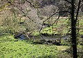 River Inny below Laneast - geograph.org.uk - 4700813.jpg 1 920 × 1 345; 1,08 MB
-
 River Inny valley, Laneast - geograph.org.uk - 3564916.jpg 640 × 480; 71 KB
-

-

-
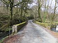 Road Bridge over the River Inny near Laneast - geograph.org.uk - 4728200.jpg 4 000 × 3 000; 4,49 MB
-
 Road crossing Laneast Downs - geograph.org.uk - 6261653.jpg 1 600 × 1 200; 643 KB
-
 Row of coppiced beech - geograph.org.uk - 1083799.jpg 640 × 414; 179 KB
-
 Sheep tunnel - geograph.org.uk - 1083783.jpg 640 × 480; 203 KB
-
 Slopes of the Inny valley - geograph.org.uk - 4700820.jpg 1 920 × 1 440; 940 KB
-
 Stone cross on Laneast downs - geograph.org.uk - 2002536.jpg 3 872 × 2 592; 4,31 MB
-
 The A395 a Downhead - geograph.org.uk - 3527265.jpg 1 024 × 768; 214 KB
-
 The A395 at Laneast Downs - geograph.org.uk - 3527243.jpg 1 024 × 768; 200 KB
-
 The A395 at Napp's Moor - geograph.org.uk - 3527308.jpg 1 024 × 768; 183 KB
-
 The A395 towards Cold Northcott - geograph.org.uk - 3527235.jpg 1 024 × 768; 224 KB
-
 The A395 towards Cold Northcott - geograph.org.uk - 3527277.jpg 1 024 × 768; 263 KB
-
 The A395 towards Cold Northcott - geograph.org.uk - 3527282.jpg 1 024 × 768; 233 KB
-
 Track through Lodge Plantation - geograph.org.uk - 6261663.jpg 1 600 × 1 200; 1 004 KB
-
 Tresmeer Road across Laneast downs - geograph.org.uk - 1889986.jpg 640 × 416; 54 KB
-
 Trespearne - geograph.org.uk - 4440607.jpg 1 920 × 1 358; 720 KB
-
 Warning sign for a bend ahead on A395 - geograph.org.uk - 6261632.jpg 1 600 × 1 200; 683 KB
-
 Woodland and moorland by A395 on Laneast Downs - geograph.org.uk - 6261649.jpg 1 600 × 886; 589 KB
-
 Altarnun, above Landinner - geograph.org.uk - 511697.jpg 640 × 427; 184 KB
-
 Field at Torrpark - geograph.org.uk - 719735.jpg 640 × 480; 115 KB
-
 Field on Tregeare Down - geograph.org.uk - 719028.jpg 640 × 424; 92 KB
-
 Heathland, Laneast Downs - geograph.org.uk - 699974.jpg 640 × 480; 114 KB
-
 High Hall - geograph.org.uk - 719669.jpg 640 × 480; 103 KB
-
 Laneast Downs - geograph.org.uk - 719690.jpg 640 × 480; 129 KB
-
 Trevenn - geograph.org.uk - 699969.jpg 640 × 471; 73 KB


_-_geograph.org.uk_-_3563410.jpg)


