Category:Langford, Bedfordshire
Aller à la navigation
Aller à la recherche
village britannique  | |||||
| Téléverser des médias | |||||
| Nature de l’élément | |||||
|---|---|---|---|---|---|
| Lieu | Central Bedfordshire, Bedfordshire, Angleterre de l'Est, Angleterre | ||||
| site officiel | |||||
 | |||||
Sous-catégories
Cette catégorie comprend 2 sous-catégories, dont les 2 ci-dessous.
H
Média dans la catégorie « Langford, Bedfordshire »
Cette catégorie comprend 120 fichiers, dont les 120 ci-dessous.
-
 'Anonymous' Class 66, 66740 passes Langford, Bedfordshire. - panoramio.jpg 1 163 × 769 ; 1,19 Mio
-
 A 125 heading for Langford Level Crossing - geograph.org.uk - 5441767.jpg 4 000 × 3 000 ; 4,88 Mio
-
 A Hull Train at Langford Level Crossing - geograph.org.uk - 5441788.jpg 4 000 × 3 000 ; 4,99 Mio
-
 Beans and barbed-wire - geograph.org.uk - 474620.jpg 640 × 492 ; 97 kio
-
 Bedfordshire Prairie in the mist - geograph.org.uk - 2392818.jpg 640 × 353 ; 24 kio
-
 Bench and tortured tree - geograph.org.uk - 2894087.jpg 480 × 640 ; 128 kio
-
 Biggleswade Wind Farm - geograph.org.uk - 4653872.jpg 640 × 426 ; 45 kio
-
 Brick building on the south side of Edworth Road - geograph.org.uk - 2955105.jpg 640 × 480 ; 121 kio
-
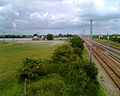
 Bridge over the East Coast Main Line - geograph.org.uk - 799359.jpg 640 × 480 ; 135 kio
-
 Bridleway past the fishing lakes, Langfoerd - geograph.org.uk - 5822296.jpg 2 000 × 1 500 ; 1,21 Mio
-
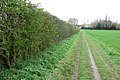
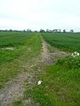
 Bridleway to Henlow - geograph.org.uk - 2894070.jpg 640 × 427 ; 67 kio
-
 Bridleway towards Henlow - geograph.org.uk - 4616990.jpg 640 × 480 ; 82 kio
-
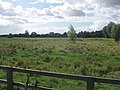
 Cattle grazing at Langford Meadows - geograph.org.uk - 3660699.jpg 640 × 480 ; 83 kio
-
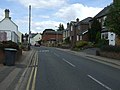
 Church Street (B659) - geograph.org.uk - 4618977.jpg 640 × 480 ; 62 kio
-
 Clock Tower War Memorial, Langford - geograph.org.uk - 4618970.jpg 640 × 480 ; 62 kio
-
 Copse south of Edworth Road - geograph.org.uk - 799375.jpg 640 × 359 ; 61 kio
-
 Cottages on Langford Road - geograph.org.uk - 2971970.jpg 1 600 × 1 200 ; 507 kio
-
 Cottages on Langford Road - geograph.org.uk - 4616997.jpg 640 × 480 ; 67 kio
-
 Ditch at Langford Meadows - geograph.org.uk - 3660698.jpg 640 × 480 ; 84 kio
-
 Ditch at Langford Meadows - geograph.org.uk - 3660703.jpg 640 × 480 ; 96 kio
-
 Edworth Road - geograph.org.uk - 2955080.jpg 640 × 480 ; 116 kio
-
 Edworth Road towards Langford - geograph.org.uk - 2955103.jpg 640 × 480 ; 85 kio
-
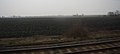
 Electrified Main Line - geograph.org.uk - 799366.jpg 640 × 480 ; 105 kio
-
 Entering Langford - geograph.org.uk - 4618962.jpg 640 × 480 ; 78 kio
-
 Farm track (Footpath) off Langford Road - geograph.org.uk - 4618986.jpg 640 × 480 ; 77 kio
-
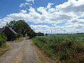
 Farm track north of Edworth Road - geograph.org.uk - 799378.jpg 640 × 480 ; 125 kio
-
 Farm track off Langford Road (B659) - geograph.org.uk - 4616981.jpg 640 × 480 ; 80 kio
-
 Farmland and hedgerow, Langford - geograph.org.uk - 4618963.jpg 640 × 480 ; 85 kio
-
 Farmland near Langford - geograph.org.uk - 3099174.jpg 800 × 513 ; 62 kio
-
 Farmland near Langford - geograph.org.uk - 3099175.jpg 800 × 490 ; 46 kio
-
 Farmland near Langford - geograph.org.uk - 4187459.jpg 640 × 430 ; 40 kio
-
 Farmland off Langford Road (B659) - geograph.org.uk - 4618958.jpg 640 × 480 ; 57 kio
-
 Farmland south of Langford - geograph.org.uk - 4187458.jpg 640 × 430 ; 47 kio
-
 Field off Langford Road (B659) - geograph.org.uk - 4618957.jpg 640 × 480 ; 70 kio
-
 Field off Langford Road - geograph.org.uk - 4618985.jpg 640 × 480 ; 99 kio
-
 Fields and solar panels south of Langford - geograph.org.uk - 4718251.jpg 1 600 × 623 ; 117 kio
-
 Fields by the Railway - geograph.org.uk - 3021116.jpg 2 256 × 1 496 ; 852 kio
-
 Fishing lake near Henlow - geograph.org.uk - 2894041.jpg 640 × 427 ; 94 kio
-

-
 Flat farmland near Langford - geograph.org.uk - 3099177.jpg 800 × 547 ; 61 kio
-
 Footbridge over the railway - geograph.org.uk - 2894064.jpg 640 × 426 ; 98 kio
-
 Footpath towards Holme Green - geograph.org.uk - 3804289.jpg 4 320 × 3 240 ; 4,24 Mio
-
 Graffiti on the bridge - geograph.org.uk - 474618.jpg 640 × 512 ; 68 kio
-
 High Street, Langford (B659) - geograph.org.uk - 4618964.jpg 640 × 480 ; 66 kio
-
 High Street, Langford - geograph.org.uk - 4362205.jpg 1 378 × 1 091 ; 568 kio
-
 High Street, Langford - geograph.org.uk - 5822329.jpg 2 000 × 1 185 ; 781 kio
-
 High Street, Langford - geograph.org.uk - 5822342.jpg 2 000 × 1 500 ; 1 012 kio
-
 Honesty egg sale - geograph.org.uk - 4869353.jpg 1 600 × 1 066 ; 445 kio
-
 Horse stile on bridleway, Langford - geograph.org.uk - 5822305.jpg 2 000 × 1 500 ; 1,13 Mio
-
 Langford Level Crossing - geograph.org.uk - 5441318.jpg 4 000 × 3 000 ; 4,57 Mio
-
 Langford Level Crossing - geograph.org.uk - 5441762.jpg 4 000 × 3 000 ; 4,63 Mio
-
 Langford Level Crossing - geograph.org.uk - 5441771.jpg 4 000 × 3 000 ; 4,57 Mio
-
 Langford Meadows - geograph.org.uk - 3660720.jpg 640 × 480 ; 75 kio
-
 Langford Methodist Church (geograph 3801095).jpg 4 320 × 3 240 ; 3,81 Mio
-
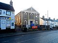
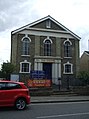 Langford Methodist Church - geograph.org.uk - 4618968.jpg 478 × 640 ; 67 kio
-
 Langford Mill - geograph.org.uk - 612850.jpg 640 × 480 ; 90 kio
-
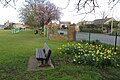 Langford Park - geograph.org.uk - 4869347.jpg 1 600 × 1 067 ; 607 kio
-
 Langford Pits, Beds - geograph.org.uk - 51098.jpg 640 × 480 ; 323 kio
-
 Langford Post Office and Store - geograph.org.uk - 4618965.jpg 640 × 453 ; 59 kio
-
 Langford Road (B659) - geograph.org.uk - 4618982.jpg 640 × 480 ; 67 kio
-
 Langford Road (B659) - geograph.org.uk - 4618988.jpg 640 × 480 ; 62 kio
-
 Langford Road at the junction of East Road - geograph.org.uk - 2971216.jpg 1 600 × 1 200 ; 492 kio
-
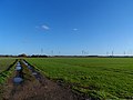
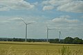
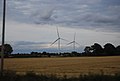
 Langford Wind Farm - geograph.org.uk - 4187504.jpg 640 × 430 ; 36 kio
-
 Langford Wind Farm - geograph.org.uk - 4187506.jpg 640 × 430 ; 38 kio
-
 Langford Wind Farm - geograph.org.uk - 4653874.jpg 621 × 640 ; 48 kio
-
 Langford Wind Farm - geograph.org.uk - 4653879.jpg 640 × 426 ; 36 kio
-
 Langford Wind Farm - geograph.org.uk - 4653882.jpg 640 × 426 ; 43 kio
-
 Langford Wind Farm - geograph.org.uk - 4988030.jpg 640 × 359 ; 32 kio
-
 Langford Wind Farm - geograph.org.uk - 4988031.jpg 640 × 426 ; 42 kio
-
 Langford wind farm from the footpath - geograph.org.uk - 4868763.jpg 1 600 × 1 066 ; 488 kio
-
 Level crossing by Balls Farm - geograph.org.uk - 4868764.jpg 1 600 × 1 066 ; 359 kio
-
 Looking beyond Langford Level Crossing - geograph.org.uk - 5441809.jpg 4 000 × 3 000 ; 4,96 Mio
-
 Looking down the line from Langford Level Crossing - geograph.org.uk - 5441802.jpg 4 000 × 3 000 ; 4,71 Mio
-
 Mill Lane at the junction of Langford Road - geograph.org.uk - 2971225.jpg 1 600 × 1 200 ; 639 kio
-
 Mill Lane looking towards Langford Road - geograph.org.uk - 2971222.jpg 1 600 × 1 200 ; 427 kio
-
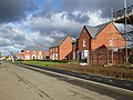 New housing, Langford - geograph.org.uk - 5598752.jpg 640 × 480 ; 113 kio
-
 Path to Henlow - geograph.org.uk - 2894047.jpg 640 × 427 ; 103 kio
-
 Path toward Greenways along the hedgerow - geograph.org.uk - 2894059.jpg 640 × 426 ; 102 kio
-
 Path toward Langford - geograph.org.uk - 2894688.jpg 480 × 640 ; 95 kio
-
 Path towards the footbridge over the railway - geograph.org.uk - 2894051.jpg 640 × 427 ; 62 kio
-
 Playing field, Langford - geograph.org.uk - 4618975.jpg 640 × 480 ; 57 kio
-
 Ploughed field by the ECML, Bedfordshire - geograph.org.uk - 2392807.jpg 640 × 400 ; 30 kio
-
 Ploughed land by the ECML near Langford - geograph.org.uk - 2392810.jpg 640 × 286 ; 23 kio
-
 Railway at Langford - geograph.org.uk - 457753.jpg 640 × 426 ; 90 kio
-
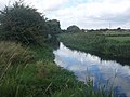
 River Ivel below Langford Mill - geograph.org.uk - 3660706.jpg 640 × 480 ; 85 kio
-
 River Ivel in Langford - geograph.org.uk - 612859.jpg 640 × 480 ; 87 kio
-
 River Ivel Langford Meadows - geograph.org.uk - 3660712.jpg 640 × 480 ; 70 kio
-
 River Ivel Langford Meadows - geograph.org.uk - 3660714.jpg 640 × 480 ; 80 kio
-
 River Ivel Navigation. - geograph.org.uk - 138290.jpg 482 × 640 ; 56 kio
-
 Riverside living at Water End - geograph.org.uk - 2894093.jpg 640 × 426 ; 85 kio
-
 Rustic looking farm shop - geograph.org.uk - 2894077.jpg 640 × 426 ; 67 kio
-
 Service station, Langford - geograph.org.uk - 4618969.jpg 640 × 480 ; 58 kio
-
 Sign for the Plough, Langford - geograph.org.uk - 4618981.jpg 473 × 640 ; 61 kio
-
 Sign for the Wrestlers pub, Langford - geograph.org.uk - 4616995.jpg 569 × 640 ; 57 kio
-
 St Andrew's Langford - geograph.org.uk - 4869344.jpg 1 600 × 1 066 ; 478 kio
-
 St.Andrew's Church, Langford - geograph.org.uk - 4618979.jpg 640 × 480 ; 70 kio
-
 Stubble field near Langford - geograph.org.uk - 4616988.jpg 640 × 480 ; 70 kio
-
 The corner of Mill Lane and Langford Road - geograph.org.uk - 2971223.jpg 1 600 × 1 200 ; 550 kio
-
 The green field here was full of Carrion Crows - geograph.org.uk - 2513241.jpg 1 024 × 768 ; 121 kio
-
 The Plough, Langford - geograph.org.uk - 4618980.jpg 640 × 480 ; 53 kio
-
 The Plough, Langford - geograph.org.uk - 5598763.jpg 640 × 428 ; 93 kio
-
 The River Ivel, Langford - geograph.org.uk - 4616985.jpg 640 × 480 ; 69 kio
-
 The Wrestlers pub, Langford - geograph.org.uk - 4616994.jpg 640 × 480 ; 59 kio
-
 Track beyond Langford Level Crossing - geograph.org.uk - 5441795.jpg 4 000 × 3 000 ; 4,77 Mio
-
 Track off the north side of Edworth Road - geograph.org.uk - 2955087.jpg 480 × 640 ; 78 kio
-
 Track off the south side of Edworth Road - geograph.org.uk - 2955084.jpg 640 × 480 ; 125 kio
-
 View from a Bridge - geograph.org.uk - 474609.jpg 640 × 512 ; 82 kio
-
 View from a Peterborough-London train - fields near Boot End - geograph.org.uk - 5298552.jpg 1 600 × 1 143 ; 310 kio
-

-
 View from a Peterborough-London train - Langford - geograph.org.uk - 5298493.jpg 1 600 × 1 143 ; 472 kio
-

-
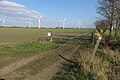
 View towards Langford Wind Farm - geograph.org.uk - 4187503.jpg 640 × 430 ; 35 kio
-
 Village sign detail, Langford, Beds - geograph.org.uk - 187382.jpg 640 × 480 ; 378 kio
-
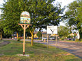 Village sign, Langford, Beds - geograph.org.uk - 187381.jpg 640 × 477 ; 471 kio
-
 War memorial clock tower, Langford - geograph.org.uk - 3801101.jpg 2 978 × 4 136 ; 3,68 Mio
-
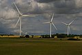
 Wind farm, Langford - geograph.org.uk - 4575249.jpg 1 600 × 1 064 ; 295 kio
-
 Wind farm, Langford - geograph.org.uk - 4718248.jpg 1 600 × 1 064 ; 286 kio
-
 Wind turbines at Langford - geograph.org.uk - 4868760.jpg 1 066 × 1 600 ; 327 kio
-
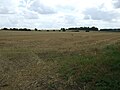
 Bedfordshire prairie - geograph.org.uk - 799372.jpg 640 × 480 ; 136 kio
-
 Water End, Langford, Beds - geograph.org.uk - 50741.jpg 640 × 480 ; 286 kio


_-_geograph.org.uk_-_4618977.jpg)


_off_Langford_Road_-_geograph.org.uk_-_4618986.jpg)

_-_geograph.org.uk_-_4616981.jpg)


_-_geograph.org.uk_-_4618958.jpg)

_-_geograph.org.uk_-_4618957.jpg)


_-_geograph.org.uk_-_4618964.jpg)


.jpg)


_-_geograph.org.uk_-_4618982.jpg)
_-_geograph.org.uk_-_4618988.jpg)


