Category:Langriville
Aller à la navigation
Aller à la recherche
English: Langriville is a civil parish in the East Lindsey district, in the county of Lincolnshire, England.

localité britannique du comté anglais de Lincolnshire  | |||||
| Téléverser des médias | |||||
| Nature de l’élément | |||||
|---|---|---|---|---|---|
| Lieu | East Lindsey, Lincolnshire, Midlands de l'Est, Angleterre | ||||
 | |||||
Sous-catégories
Cette catégorie comprend 5 sous-catégories, dont les 5 ci-dessous.
Média dans la catégorie « Langriville »
Cette catégorie comprend 93 fichiers, dont les 93 ci-dessous.
-
 A postbox at Champion Farm Cottages - geograph.org.uk - 2575881.jpg 800 × 600 ; 340 kio
-
 Armtree Road (B1184) towards Langrick - geograph.org.uk - 2914499.jpg 1 055 × 729 ; 535 kio
-
 B1192 and Clover Farm, near Langrick - geograph.org.uk - 2580510.jpg 1 181 × 890 ; 778 kio
-
 B1192 Heading south - geograph.org.uk - 3678007.jpg 640 × 480 ; 104 kio
-
 B1192 Heading south - geograph.org.uk - 3678205.jpg 640 × 480 ; 82 kio
-
 Beech House Farm - geograph.org.uk - 459370.jpg 640 × 480 ; 59 kio
-
 Bench beside National Cycle Route 1 - geograph.org.uk - 4363442.jpg 640 × 480 ; 80 kio
-
 Castedyke Bank - geograph.org.uk - 4851999.jpg 4 160 × 2 340 ; 4,79 Mio
-
 Castle Dike - geograph.org.uk - 3242958.jpg 3 088 × 2 056 ; 846 kio
-
 Castle Dike - geograph.org.uk - 3598602.jpg 640 × 480 ; 100 kio
-
 Castle Dike - geograph.org.uk - 3598609.jpg 640 × 480 ; 81 kio
-
 Castle Dike - geograph.org.uk - 3598615.jpg 640 × 480 ; 85 kio
-
 Castle Dike - geograph.org.uk - 3677990.jpg 640 × 480 ; 63 kio
-
 Castle Dike - geograph.org.uk - 6265151.jpg 1 024 × 768 ; 267 kio
-
 Castle Dike and track alongside a small area of woodland - geograph.org.uk - 6265175.jpg 1 024 × 768 ; 275 kio
-
 Castle Dike, Gipsey Bridge - geograph.org.uk - 3431053.jpg 1 024 × 687 ; 183 kio
-
 Castle Dike, Gipsey Bridge - geograph.org.uk - 3431059.jpg 1 024 × 687 ; 236 kio
-
 Castle Dyke - geograph.org.uk - 460902.jpg 640 × 480 ; 69 kio
-
 Cleaned roadside drain at Anton's Gowt - geograph.org.uk - 6265170.jpg 1 024 × 768 ; 265 kio
-
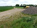
 Crop field, Castledyke Bank - geograph.org.uk - 3598605.jpg 640 × 480 ; 81 kio
-
 Cut Dike - geograph.org.uk - 2914496.jpg 1 280 × 853 ; 407 kio
-
 Cyclist's resting point, with a view of the Witham - geograph.org.uk - 5069549.jpg 3 776 × 2 520 ; 4,25 Mio
-
 Drain at Anton's Gowt - geograph.org.uk - 2233627.jpg 800 × 531 ; 81 kio
-
 Drain near Holme Farm - geograph.org.uk - 6265148.jpg 1 024 × 768 ; 241 kio
-
 Drain near Laburnum House - geograph.org.uk - 3678207.jpg 640 × 480 ; 89 kio
-
 Electricity pole in a field - geograph.org.uk - 2823761.jpg 1 024 × 768 ; 169 kio
-
 Entering East Lindsey (geograph 3678250).jpg 640 × 480 ; 82 kio
-
 Entrance to Meer Booth Farm - geograph.org.uk - 2916757.jpg 1 280 × 853 ; 418 kio
-
 Evening over Castle Dike - geograph.org.uk - 3238201.jpg 3 079 × 2 049 ; 3,49 Mio
-
 Ex Lincolnshire Loop Line - geograph.org.uk - 2233625.jpg 800 × 531 ; 143 kio
-
 Ex Lincolnshire Loop Line - geograph.org.uk - 2233626.jpg 800 × 531 ; 164 kio
-
 Farm building, Laburnum House - geograph.org.uk - 3678210.jpg 640 × 480 ; 52 kio
-
 Farm buildings, Anton's Gowt - geograph.org.uk - 4363463.jpg 640 × 480 ; 82 kio
-
 Farm track near Meer Booth Farm - geograph.org.uk - 3238209.jpg 3 088 × 2 056 ; 1,41 Mio
-
 Farmland near Champion Farm - geograph.org.uk - 3678003.jpg 640 × 604 ; 91 kio
-
 Farmland near Holland Fen (1) - geograph.org.uk - 1533842.jpg 640 × 480 ; 131 kio
-
 Farmland near Holland Fen (2) - geograph.org.uk - 1533857.jpg 640 × 480 ; 121 kio
-
 Farmland north of the River Witham - geograph.org.uk - 4362280.jpg 640 × 480 ; 64 kio
-
 Farmland, Beech House Farm - geograph.org.uk - 3678019.jpg 640 × 480 ; 79 kio
-
 Farmland, Castle Dyke Farm - geograph.org.uk - 3598611.jpg 640 × 480 ; 67 kio
-
 First sign of change - geograph.org.uk - 459374.jpg 640 × 480 ; 72 kio
-
 Former Railway, Langrick - geograph.org.uk - 814981.jpg 640 × 480 ; 98 kio
-
 Former Railway, Langrick - geograph.org.uk - 814982.jpg 640 × 480 ; 88 kio
-
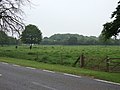
 Grazing, Langrick Grange - geograph.org.uk - 3678222.jpg 640 × 480 ; 94 kio
-
 Haven Bank - geograph.org.uk - 2821022.jpg 1 024 × 768 ; 182 kio
-
 Haven Bank track, near Langrick - geograph.org.uk - 2578981.jpg 1 280 × 960 ; 789 kio
-
 Hay, process No1 - geograph.org.uk - 460909.jpg 640 × 480 ; 89 kio
-
 Junction of Haven Bank and B1192 - geograph.org.uk - 2581958.jpg 1 280 × 960 ; 418 kio
-
 Laburnum House - geograph.org.uk - 459366.jpg 640 × 480 ; 66 kio
-
 Lane to Meer Booth Farm - geograph.org.uk - 372958.jpg 640 × 427 ; 61 kio
-
 Langrick Church Hall - geograph.org.uk - 2821476.jpg 1 024 × 768 ; 123 kio
-
 Langrick Station Cafe - geograph.org.uk - 5067090.jpg 3 776 × 2 520 ; 4,09 Mio
-
 Langriville Farm - geograph.org.uk - 2575891.jpg 800 × 600 ; 211 kio
-
 Leagate road in the setting sun - geograph.org.uk - 3239546.jpg 3 088 × 2 056 ; 1,02 Mio
-
 Leagate Road over Sharp's Bridge - geograph.org.uk - 3238231.jpg 3 088 × 2 056 ; 1,18 Mio
-
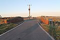
 Lock on Anton's Gowt - geograph.org.uk - 5069568.jpg 3 776 × 2 520 ; 4,33 Mio
-
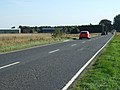
 Main Road (B1192) - geograph.org.uk - 3678215.jpg 640 × 480 ; 142 kio
-
 Main Road (B1192) - geograph.org.uk - 3678228.jpg 640 × 480 ; 76 kio
-
 National Cycle Route 1 (geograph 4362276).jpg 640 × 480 ; 75 kio
-
 National Cycle Route 1 (geograph 4362277).jpg 640 × 480 ; 97 kio
-
 National Cycle Route 1 alongside the River Witham - geograph.org.uk - 5069531.jpg 3 776 × 2 520 ; 3,92 Mio
-
-

-

-

-
-

-

-

-

-
 National Cycle Route 1, near Anton's Gowt - geograph.org.uk - 4365959.jpg 640 × 480 ; 93 kio
-
 Pipe across Castle Dike - geograph.org.uk - 6265244.jpg 1 024 × 768 ; 228 kio
-
 River Witham - geograph.org.uk - 782313.jpg 640 × 427 ; 98 kio
-
 River Witham on Boston Rowing Marathon Day - geograph.org.uk - 4676946.jpg 4 608 × 3 072 ; 5,85 Mio
-
 River Witham, Anton's Gowt - geograph.org.uk - 4851997.jpg 4 160 × 2 340 ; 3,82 Mio
-
 Site of Langrick station, 2000 - geograph.org.uk - 5490586.jpg 2 349 × 1 159 ; 2,03 Mio
-

-
 The B1192 at Castle Dyke Lane - geograph.org.uk - 2575903.jpg 800 × 600 ; 280 kio
-
 The churchyard shed - geograph.org.uk - 2821469.jpg 1 024 × 768 ; 342 kio
-
 The River Witham - geograph.org.uk - 4363445.jpg 640 × 480 ; 66 kio
-
 The River Witham - geograph.org.uk - 4363460.jpg 640 × 480 ; 73 kio
-
 The River Witham east of Langrick Bridge - geograph.org.uk - 4362292.jpg 640 × 480 ; 57 kio
-
 The River Witham east of Langrick Bridge - geograph.org.uk - 4362297.jpg 640 × 480 ; 62 kio
-
 The River Witham near Boston - geograph.org.uk - 4365948.jpg 640 × 480 ; 78 kio
-
 The River Witham west of Anton's Gowt - geograph.org.uk - 4365954.jpg 640 × 480 ; 76 kio
-
 The road to Haven Bank - geograph.org.uk - 2575885.jpg 800 × 600 ; 296 kio
-
 The Witham and Blues (geograph 3678246).jpg 640 × 480 ; 84 kio
-
 The Witham below Langrick Bridge - geograph.org.uk - 5069519.jpg 3 776 × 2 520 ; 4,05 Mio
-
 Track to Beech House Farm - geograph.org.uk - 3678203.jpg 640 × 518 ; 76 kio
-
 Track to Beech house Farm off B1192 - geograph.org.uk - 2914494.jpg 1 280 × 853 ; 304 kio
-
 View toward's Champion Farm - geograph.org.uk - 2823748.jpg 1 024 × 768 ; 195 kio
-
 Witham and the Blues (geograph 5174646).jpg 640 × 480 ; 67 kio
-


_towards_Langrick_-_geograph.org.uk_-_2914499.jpg)


.jpg)


_-_geograph.org.uk_-_1533842.jpg)
_-_geograph.org.uk_-_1533857.jpg)


_-_geograph.org.uk_-_3678215.jpg)
_-_geograph.org.uk_-_3678228.jpg)
.jpg)
.jpg)


.jpg)


.jpg)
