Category:Langtree
Aller à la navigation
Aller à la recherche
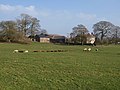
English: Langtree is a village and parish in north Devon, England, situated about 4 miles south-west of Great Torrington and 8 miles south of Bideford. Its name means "tall tree". Torridge District Council and Devon County Council are responsible for local government, while for religious administrative purposes it is part of the Archdeaconry of Barnstaple and the Diocese of Exeter.
village britannique  | |||||
| Téléverser des médias | |||||
| Nature de l’élément | |||||
|---|---|---|---|---|---|
| Lieu | Torridge, Devon, Angleterre du Sud-Ouest, Angleterre | ||||
 | |||||
Sous-catégories
Cette catégorie comprend 2 sous-catégories, dont les 2 ci-dessous.
L
- All Saints church, Langtree (3 F)
S
- Stibb Cross (5 F)
Média dans la catégorie « Langtree »
Cette catégorie comprend 125 fichiers, dont les 125 ci-dessous.
-
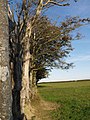
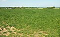
 A hedge topping Triangulation Pillar near Berry Cross - geograph.org.uk - 4741085.jpg 4 000 × 3 000 ; 2,96 Mio
-
 All Saints Church at Langtree - geograph.org.uk - 3702359.jpg 4 000 × 3 000 ; 1,89 Mio
-
 An assortment of poles - geograph.org.uk - 4109236.jpg 1 024 × 627 ; 122 kio
-
 Approaching Wonders Corner - geograph.org.uk - 3623048.jpg 1 024 × 584 ; 89 kio
-
 Approaching Wonders Corner - geograph.org.uk - 5802571.jpg 4 288 × 2 848 ; 1,74 Mio
-
 B3227 at Stibb Cross - geograph.org.uk - 5785409.jpg 3 305 × 2 293 ; 492 kio
-
 B3227 at Withacott - geograph.org.uk - 5802681.jpg 4 288 × 2 848 ; 2,15 Mio
-
 B3227 heading north-northeast - geograph.org.uk - 3409627.jpg 838 × 621 ; 126 kio
-
 B3227 heading north-northeast - geograph.org.uk - 3409644.jpg 979 × 734 ; 142 kio
-
 B3227 south bound - geograph.org.uk - 3127210.jpg 640 × 480 ; 81 kio
-
 Barn and Chapels - geograph.org.uk - 700846.jpg 640 × 274 ; 41 kio
-
 Beech trees near Collacott - geograph.org.uk - 700856.jpg 480 × 640 ; 121 kio
-
 Beeches at Rivaton - geograph.org.uk - 575354.jpg 640 × 451 ; 119 kio
-
 Beeches at Rivaton - geograph.org.uk - 578126.jpg 480 × 640 ; 167 kio
-
 Beeches fringing Common Moor - geograph.org.uk - 577856.jpg 480 × 640 ; 122 kio
-
 Berry cross - geograph.org.uk - 4309252.jpg 640 × 480 ; 52 kio
-
 Berry Cross - geograph.org.uk - 575361.jpg 640 × 357 ; 58 kio
-
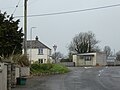 Bus shelter and notices at the heart of Stibb Cross - geograph.org.uk - 6103268.jpg 1 600 × 1 200 ; 828 kio
-
 Chapel at road junction, Stibb Cross - geograph.org.uk - 6103271.jpg 1 600 × 808 ; 528 kio
-
 Chapel at Stibb Cross - geograph.org.uk - 1880959.jpg 640 × 480 ; 59 kio
-
 Chapels and the B3227 - geograph.org.uk - 692210.jpg 640 × 499 ; 95 kio
-
 Cherrywood Park junction - geograph.org.uk - 3623030.jpg 1 024 × 514 ; 71 kio
-
 Collacott Cross - geograph.org.uk - 700859.jpg 482 × 640 ; 80 kio
-
 Common Moor - geograph.org.uk - 575337.jpg 640 × 451 ; 93 kio
-
 Common Moor - geograph.org.uk - 575350.jpg 640 × 478 ; 147 kio
-
 Common Moor - geograph.org.uk - 577686.jpg 640 × 480 ; 140 kio
-
 Common Moor - geograph.org.uk - 577717.jpg 640 × 458 ; 172 kio
-
 Cottage near Langtree Week - geograph.org.uk - 700950.jpg 640 × 444 ; 57 kio
-
 Crossroads at Stibb Cross - geograph.org.uk - 3409560.jpg 750 × 562 ; 102 kio
-
 Cudemoor cross - geograph.org.uk - 4309236.jpg 640 × 480 ; 43 kio
-
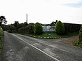
 East Browns Farm - geograph.org.uk - 1198593.jpg 640 × 480 ; 82 kio
-
 Entrance to Langtree - geograph.org.uk - 3127186.jpg 640 × 447 ; 64 kio
-
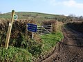
 Entrance to Stibb Cross - geograph.org.uk - 3127198.jpg 640 × 480 ; 45 kio
-
 Entrance to Stibb Cross - geograph.org.uk - 3288724.jpg 640 × 480 ; 54 kio
-
 Farmland near Wonders Corner - geograph.org.uk - 5802582.jpg 4 288 × 2 848 ; 1,69 Mio
-
 Farmland southeast of Stibb Cross - geograph.org.uk - 6189558.jpg 3 264 × 1 832 ; 1,29 Mio
-
 Field at East Stibb Farm - geograph.org.uk - 5802919.jpg 4 254 × 2 602 ; 2,59 Mio
-
 Field at East Stibb Farm - geograph.org.uk - 5803016.jpg 4 143 × 2 597 ; 2,23 Mio
-
 Field boundary, on East Brown's Farm - geograph.org.uk - 1196523.jpg 640 × 480 ; 90 kio
-
 Flock of Starlings, at East Browns Farm - geograph.org.uk - 1198598.jpg 640 × 461 ; 49 kio
-
 Forches cross - geograph.org.uk - 4309217.jpg 640 × 480 ; 80 kio
-
 Fore Street (B3227) - geograph.org.uk - 3409612.jpg 967 × 706 ; 131 kio
-
 Fore Street (B3227) through Langtree - geograph.org.uk - 3409597.jpg 750 × 562 ; 105 kio
-
 Former chapel, Stibb Cross - geograph.org.uk - 5802858.jpg 4 233 × 2 786 ; 842 kio
-
 Former chapel, Stibb Cross - geograph.org.uk - 5802867.jpg 4 041 × 2 145 ; 1,66 Mio
-
 Furrowed field - geograph.org.uk - 575373.jpg 640 × 480 ; 165 kio
-
 Gap in wall, Langtree Week - geograph.org.uk - 700879.jpg 480 × 640 ; 96 kio
-
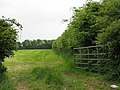 Gateway into field by Hill Ash Farm - geograph.org.uk - 1881295.jpg 640 × 480 ; 98 kio
-
 Green lane at Little Comfort - geograph.org.uk - 701138.jpg 640 × 480 ; 110 kio
-
 Green lane at Little Comfort - geograph.org.uk - 701160.jpg 468 × 640 ; 119 kio
-
 Green lane to Gortlage - geograph.org.uk - 701193.jpg 640 × 451 ; 81 kio
-
 Heading south from Stibb Cross - geograph.org.uk - 4109240.jpg 800 × 509 ; 109 kio
-
 Hillside Bungalow - geograph.org.uk - 571801.jpg 640 × 477 ; 139 kio
-
 Holwell Farm Ford - geograph.org.uk - 5924890.jpg 4 032 × 3 024 ; 5,93 Mio
-
 Lane at Withacott - geograph.org.uk - 5802670.jpg 4 288 × 2 663 ; 1,63 Mio
-
 Lane below Smallridge - geograph.org.uk - 700838.jpg 640 × 588 ; 164 kio
-
 Lane junction near Ashbury - geograph.org.uk - 979649.jpg 640 × 480 ; 128 kio
-
 Lane to Langtree Common - geograph.org.uk - 700850.jpg 480 × 640 ; 103 kio
-
 Lane to Little Comfort - geograph.org.uk - 701053.jpg 640 × 451 ; 80 kio
-
 Lane to Withacott - geograph.org.uk - 5802574.jpg 4 288 × 2 848 ; 2,26 Mio
-
 Lane to Wonders Corner - geograph.org.uk - 5802658.jpg 4 089 × 2 537 ; 2 Mio
-
 Langtree Lake valley - geograph.org.uk - 701046.jpg 640 × 480 ; 93 kio
-
 Langtree Week - geograph.org.uk - 4309249.jpg 640 × 480 ; 70 kio
-
 Langtree Week - geograph.org.uk - 700887.jpg 640 × 480 ; 75 kio
-
 Langtree Week - geograph.org.uk - 700894.jpg 640 × 480 ; 82 kio
-
 Langtree Week wood with Tarka Trail - geograph.org.uk - 2751392.jpg 600 × 800 ; 484 kio
-
 Lone tree south of Stibb Cross - geograph.org.uk - 6103256.jpg 1 600 × 1 200 ; 898 kio
-
 Minor road in Vinney Copse - geograph.org.uk - 2751412.jpg 600 × 800 ; 512 kio
-
 Muddy lane - Stibb Cross - geograph.org.uk - 4109232.jpg 1 024 × 685 ; 126 kio
-
 Northern approach to Stibb Cross - geograph.org.uk - 4109227.jpg 1 024 × 628 ; 150 kio
-

-
 Ordnance Survey Cut Mark - geograph.org.uk - 3720949.jpg 4 000 × 3 000 ; 3,71 Mio
-
 Ordnance Survey Flush Bracket G3671 - geograph.org.uk - 4741066.jpg 4 000 × 3 000 ; 2,42 Mio
-
 Out of the Woods - geograph.org.uk - 4261747.jpg 1 024 × 768 ; 424 kio
-
 Pasture by Charman's Barn - geograph.org.uk - 660184.jpg 640 × 480 ; 77 kio
-
 Ploughed field at Rivaton - geograph.org.uk - 578137.jpg 640 × 480 ; 140 kio
-
 Putshole Lane - geograph.org.uk - 1198586.jpg 640 × 480 ; 92 kio
-
 Putshole Lane - geograph.org.uk - 575357.jpg 640 × 480 ; 112 kio
-
 Road junction - geograph.org.uk - 4309214.jpg 640 × 480 ; 84 kio
-
 Road junction - geograph.org.uk - 4309228.jpg 640 × 480 ; 80 kio
-
 Road junction - geograph.org.uk - 4309230.jpg 640 × 480 ; 73 kio
-
 Road past Stibb Hollow Farm - geograph.org.uk - 6192612.jpg 3 264 × 1 832 ; 872 kio
-
 Road to Stibb Cross - geograph.org.uk - 5802914.jpg 4 213 × 2 583 ; 1,42 Mio
-
 Sandlane cross - geograph.org.uk - 4309244.jpg 640 × 480 ; 52 kio
-
 Sandylane Cross - geograph.org.uk - 692104.jpg 640 × 421 ; 72 kio
-
 Shallow valley west of Stibb Cross - geograph.org.uk - 3623087.jpg 1 024 × 631 ; 129 kio
-
 Shebbear cross - geograph.org.uk - 4309240.jpg 640 × 480 ; 62 kio
-
 Southcott Cross - geograph.org.uk - 700844.jpg 640 × 480 ; 64 kio
-
 Statue Seats, Tarka Trail - geograph.org.uk - 3870573.jpg 2 400 × 1 545 ; 3,92 Mio
-
 Stibb Cross - geograph.org.uk - 5802770.jpg 4 288 × 2 848 ; 1,95 Mio
-
 Stibb Cross - geograph.org.uk - 5802781.jpg 4 222 × 2 231 ; 947 kio
-
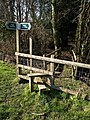 Stile and bridge near Langtree - geograph.org.uk - 700556.jpg 480 × 640 ; 146 kio
-
 Stream and muddy field edge - geograph.org.uk - 700548.jpg 640 × 480 ; 130 kio
-
 Stream at Watergate Bridge - geograph.org.uk - 2751376.jpg 800 × 600 ; 520 kio
-
 Stream junction - geograph.org.uk - 700573.jpg 480 × 640 ; 110 kio
-
 T-junction at Stibb Cross - geograph.org.uk - 1880951.jpg 640 × 480 ; 39 kio
-
 Taking a Break - geograph.org.uk - 4261735.jpg 1 024 × 768 ; 475 kio
-
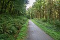
 Tarka Trail - geograph.org.uk - 5138082.jpg 1 600 × 1 067 ; 912 kio
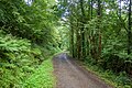
-
 Tarka Trail - geograph.org.uk - 5138095.jpg 1 600 × 1 067 ; 860 kio
-
 Tarka Trail - geograph.org.uk - 5138110.jpg 1 600 × 1 067 ; 941 kio
-
 Tarka Trail - geograph.org.uk - 5138122.jpg 1 600 × 1 067 ; 795 kio
-
 Tarka Trail crossing small stream near Stowford - geograph.org.uk - 2751422.jpg 800 × 600 ; 547 kio
-
 Tarka Trail crossing Stowford Moor - geograph.org.uk - 2751429.jpg 800 × 600 ; 527 kio
-
 Tarka Trail in Langtree Week wood - geograph.org.uk - 2751386.jpg 600 × 800 ; 508 kio
-

-
 Tarka Trail passing Smytham Manor - geograph.org.uk - 2751405.jpg 800 × 600 ; 526 kio
-
 Tarka Trail, Lambert Moor - geograph.org.uk - 71788.jpg 480 × 640 ; 75 kio
-
 Terracettes above lane near Birchill Farm - geograph.org.uk - 692055.jpg 640 × 480 ; 103 kio
-
 Thatton - geograph.org.uk - 578261.jpg 640 × 329 ; 68 kio
-
 The bridge at Barley Hayes - geograph.org.uk - 2751397.jpg 600 × 800 ; 504 kio
-
 The Tarka Trail and a Rough Track - geograph.org.uk - 4261214.jpg 1 024 × 768 ; 482 kio
-
 The Tarka Trail near Smytham Manor - geograph.org.uk - 415344.jpg 640 × 426 ; 158 kio
-
 Track from Putshole Farm - geograph.org.uk - 6192331.jpg 3 264 × 1 832 ; 1,41 Mio
-
 Track near East Badworthy farm - geograph.org.uk - 577882.jpg 640 × 480 ; 148 kio
-
 Track to Stibb Hollow Farm - geograph.org.uk - 571787.jpg 627 × 480 ; 154 kio
-
 Tree by green lane - geograph.org.uk - 701170.jpg 470 × 640 ; 86 kio
-
 Tree shaped by the wind north of Stibb Cross - geograph.org.uk - 3623061.jpg 1 024 × 620 ; 99 kio
-
 Valley at Southcott - geograph.org.uk - 700832.jpg 640 × 348 ; 73 kio
-
 Valley north of Langtree - geograph.org.uk - 692258.jpg 640 × 480 ; 93 kio
-
 View near Wonders Corner - geograph.org.uk - 5802650.jpg 4 288 × 2 848 ; 2,82 Mio
-
 Watergate - geograph.org.uk - 701209.jpg 640 × 480 ; 91 kio
-
 Week Farm - geograph.org.uk - 692130.jpg 640 × 480 ; 91 kio
-
 West Ford Farm Ford - geograph.org.uk - 5925819.jpg 3 663 × 3 024 ; 6,36 Mio
-
 Wonders Corner - geograph.org.uk - 571841.jpg 640 × 478 ; 173 kio
-
 Wooded valley south of Stibb Cross - geograph.org.uk - 6103253.jpg 1 600 × 1 200 ; 799 kio


_-_geograph.org.uk_-_3409612.jpg)
_through_Langtree_-_geograph.org.uk_-_3409597.jpg)


