Category:Langwathby
Aller à la navigation
Aller à la recherche
English: Langwathby is a village in northern Cumbria, England. It is situated about 5 miles (8 km) north-east of Penrith on the A686 road. The village lies on the banks of the River Eden.
localité britannique du comté anglais de Cumbria  | |||||
| Téléverser des médias | |||||
| Nature de l’élément | |||||
|---|---|---|---|---|---|
| Lieu | Eden, Cumbria, Angleterre du Nord-Ouest, Angleterre | ||||
| Réputé identique à | Langwathby (page en doublon, paroisse civile) | ||||
 | |||||
Sous-catégories
Cette catégorie comprend 4 sous-catégories, dont les 4 ci-dessous.
Média dans la catégorie « Langwathby »
Cette catégorie comprend 146 fichiers, dont les 146 ci-dessous.
-
 47002 at Staingills.jpg 1 024 × 768 ; 244 kio
-
 A686 heading north at Barbary Plains - geograph.org.uk - 6397338.jpg 1 024 × 683 ; 216 kio
-
 A686 passing Slatequarry Wood - geograph.org.uk - 6397131.jpg 1 024 × 683 ; 292 kio
-
 AMP Clean Energy's High Mill, Langwathby - geograph.org.uk - 6046966.jpg 2 560 × 1 920 ; 2,34 Mio
-

-
 Barn Conversion - Langwathby - geograph.org.uk - 6198468.jpg 4 329 × 2 585 ; 4,16 Mio
-
 Bench on Storey Bank, Langwathby - geograph.org.uk - 6046968.jpg 2 560 × 1 920 ; 2,51 Mio
-
 Benchmark bracket on St Peter's Church - geograph.org.uk - 6395288.jpg 666 × 1 024 ; 329 kio
-
 Benchmark on building at Home Farm - geograph.org.uk - 6395944.jpg 683 × 1 024 ; 299 kio
-
 Benchmark on Edenhall Cottage - geograph.org.uk - 6395297.jpg 1 024 × 668 ; 222 kio
-
 Benchmark on gatepost at entrance to Crosspots Wood - geograph.org.uk - 6396791.jpg 683 × 1 024 ; 258 kio
-
 Benchmark on gatepost at entrance to Robinsfield - geograph.org.uk - 6397353.jpg 683 × 1 024 ; 323 kio
-

-

-

-
 Benchmark on gatepost on SE side of A686 - geograph.org.uk - 6397372.jpg 683 × 1 024 ; 298 kio
-

-

-
 Benchmark on gatepost on SW side of the B6412 - geograph.org.uk - 6395124.jpg 1 024 × 683 ; 250 kio
-

-

-

-
 Benchmark on The Old School House - geograph.org.uk - 6395583.jpg 683 × 1 024 ; 280 kio
-
 Benchmark on West Lodge - geograph.org.uk - 6396108.jpg 1 024 × 683 ; 286 kio
-
 Benchmark on ^7 The Courtyard - geograph.org.uk - 6395740.jpg 1 024 × 683 ; 328 kio
-
 Bend in the A686 - geograph.org.uk - 6198462.jpg 4 438 × 2 659 ; 3,69 Mio
-
 Bend of minor road approaching Edenhall - geograph.org.uk - 6335020.jpg 2 000 × 1 276 ; 2,5 Mio
-
 Bungalow on NW side of road at Stoneygarth - geograph.org.uk - 6395922.jpg 1 024 × 683 ; 167 kio
-
 Cattle on Langwathby Moor - geograph.org.uk - 6041861.jpg 2 560 × 1 920 ; 2,42 Mio
-
 Covered reservoir, east of Langwathby - geograph.org.uk - 6042249.jpg 1 600 × 1 200 ; 385 kio
-
 Development land for sale, off Salkeld Road - geograph.org.uk - 6047846.jpg 1 600 × 1 200 ; 385 kio
-
 Direction Sign - Signpost by the A686, north of Edenhall - geograph.org.uk - 6099171.jpg 1 152 × 1 715 ; 140 kio
-
 Eastern boundary of a small wood - geograph.org.uk - 6042223.jpg 2 437 × 1 828 ; 1,29 Mio
-
 Edenhall Cottage on NW side at A686 - geograph.org.uk - 6395302.jpg 1 024 × 683 ; 122 kio
-
 Edenhall Cross - geograph.org.uk - 5981001.jpg 1 186 × 1 600 ; 446 kio
-
 Edenhall war memorial on a frosty day - geograph.org.uk - 6335123.jpg 1 999 × 1 334 ; 2,42 Mio
-
 End of the pavement, edge of the village - geograph.org.uk - 6047850.jpg 2 297 × 1 724 ; 693 kio
-
 Entering Langwathby on A686 - geograph.org.uk - 3479455.jpg 640 × 368 ; 39 kio
-
 Entrance archway into The Courtyard - geograph.org.uk - 6395755.jpg 683 × 1 024 ; 120 kio
-
 Entrance driveway to Robinsfield from A686 - geograph.org.uk - 6397356.jpg 1 024 × 683 ; 305 kio
-
 Entrance road to Winsfield - geograph.org.uk - 6397034.jpg 1 024 × 683 ; 194 kio
-
 Entrance to The Courtyard - geograph.org.uk - 6395734.jpg 1 024 × 683 ; 110 kio
-
 Entrance track to Folly Cottages - geograph.org.uk - 6397139.jpg 683 × 1 024 ; 302 kio
-
 Farmland north of Langwathby Moor - geograph.org.uk - 6042239.jpg 2 475 × 1 856 ; 1,04 Mio
-
 Farmland, Edenhall, Langwathby - geograph.org.uk - 4335584.jpg 640 × 480 ; 201 kio
-
 Farmland, Langwathby - geograph.org.uk - 4335589.jpg 640 × 480 ; 191 kio
-
 Farmland, Langwathby - geograph.org.uk - 4336853.jpg 640 × 480 ; 140 kio
-
 Field gateway from minor road opposite Crosspots Wood - geograph.org.uk - 6396675.jpg 1 024 × 683 ; 192 kio
-
 Field gateway off SE side of A686 at Barbary Plains - geograph.org.uk - 6397389.jpg 1 024 × 683 ; 251 kio
-
 Field gateway off southwest side of the B6412 - geograph.org.uk - 6395133.jpg 1 024 × 683 ; 177 kio
-
 Field gateway off SW side of road opposite Thorn Bank - geograph.org.uk - 6395867.jpg 1 024 × 683 ; 101 kio
-
 Field gateway on NE side of road NW of Edenhall Cottage - geograph.org.uk - 6395527.jpg 1 024 × 683 ; 248 kio
-
 Field gateway on SW side of rural road - geograph.org.uk - 6395357.jpg 1 024 × 683 ; 115 kio
-
 Field on Langwathby Moor - geograph.org.uk - 6041871.jpg 1 600 × 1 200 ; 380 kio
-
 Fields Near Langwathby - geograph.org.uk - 5713101.jpg 640 × 370 ; 81 kio
-
 Footpath passing Rosehill Cottage - geograph.org.uk - 6395606.jpg 1 024 × 683 ; 194 kio
-
 Footpath to Briggle Bridge - geograph.org.uk - 225977.jpg 640 × 480 ; 209 kio
-
 Frosted trees and bushes alongside River Eden - geograph.org.uk - 6335126.jpg 2 000 × 830 ; 1,4 Mio
-
 Frosted trees on the way to Edenhall - geograph.org.uk - 6336893.jpg 2 000 × 1 308 ; 2,48 Mio
-
 Frozen field, east of Langwathby - geograph.org.uk - 6041391.jpg 2 560 × 1 920 ; 2,42 Mio
-
 Gateway into Slatequarry Wood - geograph.org.uk - 6397089.jpg 1 024 × 683 ; 329 kio
-
 High Barn Farm - geograph.org.uk - 5713095.jpg 640 × 360 ; 71 kio
-
 High Barn, seen from the railway - geograph.org.uk - 6275104.jpg 1 024 × 683 ; 113 kio
-
 High Mill, Storey Bank, Langwathby - geograph.org.uk - 6042261.jpg 2 560 × 1 920 ; 2,49 Mio
-
 House with disused external staircase, Langwathby - geograph.org.uk - 6048419.jpg 1 739 × 1 304 ; 375 kio
-
 Housing at road junction near Town Head Farm - geograph.org.uk - 6394775.jpg 683 × 1 024 ; 193 kio
-
 Icy puddles on the track to Appleside Hill - geograph.org.uk - 6041863.jpg 1 600 × 1 200 ; 562 kio
-
 Junction of A686 and minor road to Edenhall - geograph.org.uk - 6396955.jpg 1 024 × 683 ; 146 kio
-
 Junction of Salkeld Road and Meadow Court, Langwathby - geograph.org.uk - 6046987.jpg 2 560 × 1 920 ; 2,28 Mio
-
 Junction on a track, north of Langwathby's High Mill - geograph.org.uk - 6042268.jpg 1 600 × 1 200 ; 394 kio
-
 Junction on the Penrith to Alston road - geograph.org.uk - 1373266.jpg 640 × 426 ; 92 kio
-
 Langwathby - geograph.org.uk - 259485.jpg 640 × 480 ; 120 kio
-
 Langwathby Bridge - geograph.org.uk - 5980958.jpg 1 600 × 1 196 ; 528 kio
-
 Langwathby Bridge - geograph.org.uk - 6372822.jpg 4 320 × 3 240 ; 5,09 Mio
-
 Langwathby down freight on Settle - Carlisle line geograph-2791527-by-Ben-Brooksbank.jpg 2 241 × 1 348 ; 1,6 Mio
-
 Langwathby Methodist Church - geograph.org.uk - 6198469.jpg 2 900 × 2 042 ; 2,12 Mio
-
 Langwathby Moor in winter - geograph.org.uk - 6041869.jpg 2 560 × 1 920 ; 2,33 Mio
-
 Langwathby Post Office and Stores - geograph.org.uk - 259494.jpg 640 × 480 ; 101 kio
-
 Langwathby village green - geograph.org.uk - 1745471.jpg 640 × 480 ; 104 kio
-
 Langwathby village green - geograph.org.uk - 4696008.jpg 2 592 × 1 944 ; 1,26 Mio
-
 Langwathby Village Green - geograph.org.uk - 50149.jpg 640 × 480 ; 101 kio
-
 Langwathby, war memorial (geograph 2958413).jpg 1 024 × 754 ; 240 kio
-
 Large barn on SE side of road at Home Farm - geograph.org.uk - 6395956.jpg 1 024 × 683 ; 179 kio
-
 Leaving Langwathby - geograph.org.uk - 5713107.jpg 640 × 390 ; 89 kio
-
 Little Selkeld Viaduct.jpg 1 066 × 800 ; 148 kio
-
 Looking West along A686 - geograph.org.uk - 242234.jpg 640 × 426 ; 123 kio
-
 Low Farm, Langwathby - geograph.org.uk - 6046977.jpg 2 503 × 1 877 ; 692 kio
-
 Minor road heading north towards Edenhall Cottage - geograph.org.uk - 6395558.jpg 1 024 × 683 ; 166 kio
-
 Minor road heading NW passing Thorn Bank - geograph.org.uk - 6395531.jpg 1 024 × 683 ; 183 kio
-
 Minor road heading SW past Crosspots Wood - geograph.org.uk - 6396802.jpg 1 024 × 683 ; 339 kio
-
 North end of the village green, Langwathby - geograph.org.uk - 6048554.jpg 2 560 × 1 920 ; 2,37 Mio
-

-

-
 Old wall, new fence on Langwathby Moor - geograph.org.uk - 6041868.jpg 1 600 × 1 200 ; 441 kio
-
 Paddock, north of Langwathby's High Mill - geograph.org.uk - 6046952.jpg 1 024 × 768 ; 249 kio
-
 Pasture, Edenhall - geograph.org.uk - 640915.jpg 640 × 480 ; 136 kio
-
 Powley Farm - geograph.org.uk - 5713791.jpg 640 × 368 ; 67 kio
-
 Public footpath to Winskill - geograph.org.uk - 6042273.jpg 2 560 × 1 920 ; 2,34 Mio
-
 River Eden at Langwathby - geograph.org.uk - 6335133.jpg 2 000 × 1 500 ; 2,49 Mio
-
 River Eden View - geograph.org.uk - 5713086.jpg 640 × 382 ; 79 kio
-
 Road junction under cloud on the A686 - geograph.org.uk - 5696871.jpg 640 × 480 ; 103 kio
-
 Rural road at junction NW of Langwathby - geograph.org.uk - 6394793.jpg 683 × 1 024 ; 85 kio
-
 Rural road passing Thorn Bank woodland - geograph.org.uk - 6395488.jpg 683 × 1 024 ; 300 kio
-
 Sheep feeding on unearthed swedes - geograph.org.uk - 6088261.jpg 1 600 × 1 059 ; 666 kio
-
 Sheep grazing, north of Langwathby's High Mill - geograph.org.uk - 6046951.jpg 2 560 × 1 920 ; 2,3 Mio
-
 Sheep on Langwathby Moor - geograph.org.uk - 6041865.jpg 1 600 × 1 200 ; 600 kio
-
 Sheep on Langwathby Moor in winter - geograph.org.uk - 6041858.jpg 2 083 × 1 563 ; 1,03 Mio
-
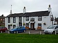 Shepherd's Inn, Langwathby.jpg 4 320 × 3 240 ; 4,11 Mio
-
 Sign and lay-by on the A686 east of Langwathby - geograph.org.uk - 6041373.jpg 1 600 × 1 200 ; 453 kio
-
 Small wood full of boulders, west of Hopehill Woods - geograph.org.uk - 6042230.jpg 1 951 × 1 463 ; 1,27 Mio
-
 Snowdrops and a dusting of snow, near High Mill - geograph.org.uk - 6046964.jpg 1 600 × 1 200 ; 591 kio
-
 Sowyers Beck, from Sowyersteps Bridge - geograph.org.uk - 6041874.jpg 1 024 × 768 ; 300 kio
-
 Sowyersteps Bridge, from the west - geograph.org.uk - 6041873.jpg 1 600 × 1 200 ; 703 kio
-
 St Peter's Church - geograph.org.uk - 6395291.jpg 1 024 × 683 ; 193 kio
-
 The A686 at Barbary Plains - geograph.org.uk - 6198459.jpg 2 715 × 2 558 ; 2,44 Mio
-
 The A686, Langwathby - geograph.org.uk - 640873.jpg 640 × 480 ; 138 kio
-
 The eastern edge of Langwathby - geograph.org.uk - 6041366.jpg 1 600 × 1 200 ; 265 kio
-
 The Eden floodplain near Desert Plantation - geograph.org.uk - 5980986.jpg 1 600 × 1 189 ; 586 kio
-
 The Old School House and Rosehill Cottage - geograph.org.uk - 6395599.jpg 1 024 × 683 ; 142 kio
-
 The River Eden from Langwathby Bridge - geograph.org.uk - 5980968.jpg 1 600 × 1 188 ; 376 kio
-
 The road to Skirwith on a cold winter's afternoon - geograph.org.uk - 6041856.jpg 1 600 × 1 200 ; 310 kio
-
 Thin snow in the shadow of a wall, Langwathby - geograph.org.uk - 6048201.jpg 2 455 × 1 842 ; 1,11 Mio
-
 Town Head Farm, Langwathby - geograph.org.uk - 6275102.jpg 1 024 × 683 ; 173 kio
-
 Track heading east from Salkeld Road - geograph.org.uk - 6047873.jpg 1 428 × 1 904 ; 753 kio
-
 Track heading south-east to Appleside Hill - geograph.org.uk - 6041860.jpg 2 560 × 1 920 ; 2,44 Mio
-
 Track heading south-east to Storey Bank - geograph.org.uk - 6046960.jpg 1 600 × 1 200 ; 454 kio
-
 Tree on a field boundary, near Langwathby's High Mill - geograph.org.uk - 6046957.jpg 1 600 × 1 200 ; 454 kio
-
 Unknown infrastructure hidden by a circular drystone wall - geograph.org.uk - 6041387.jpg 1 600 × 1 200 ; 474 kio
-
 War memorial on the village green, Langwathby - geograph.org.uk - 6048809.jpg 2 249 × 1 687 ; 663 kio
-
 West Lodge at SW end of The Avenue - geograph.org.uk - 6396182.jpg 1 024 × 683 ; 176 kio
-
 Winter farmland, east of Langwathby - geograph.org.uk - 6041855.jpg 1 600 × 1 200 ; 523 kio
-
 Winter feed for sheep, north-east of Langwathby - geograph.org.uk - 6046950.jpg 1 600 × 1 200 ; 349 kio
-
 Back Lane, Langwathby - geograph.org.uk - 640852.jpg 640 × 480 ; 117 kio
-
 Back Lane, Langwathby - geograph.org.uk - 640861.jpg 640 × 480 ; 115 kio
-
 Barbary Plains Brick Factory - geograph.org.uk - 55085.jpg 640 × 480 ; 105 kio
-
 Edenhall Grange - geograph.org.uk - 242244.jpg 640 × 426 ; 115 kio
-
 Gate - geograph.org.uk - 225963.jpg 640 × 480 ; 183 kio
-
 Gate - geograph.org.uk - 225979.jpg 640 × 480 ; 152 kio
-
 Sandstone Quarry above Barbary Plains - geograph.org.uk - 55086.jpg 640 × 480 ; 130 kio
-
 Sandstone Quarry above Barbary Plains - geograph.org.uk - 55088.jpg 640 × 480 ; 154 kio
-
 Settle to Carlisle Railway - geograph.org.uk - 225924.jpg 640 × 480 ; 207 kio
-
 The Road to Greenlands Farm - geograph.org.uk - 225919.jpg 640 × 480 ; 191 kio
-
 The Settle to Carlisle Railway - geograph.org.uk - 225926.jpg 640 × 480 ; 192 kio
-
 Track - geograph.org.uk - 225964.jpg 640 × 480 ; 163 kio
-
 Track to Edenhall Grange - geograph.org.uk - 242238.jpg 640 × 426 ; 120 kio
-
 Williekeld Sike - geograph.org.uk - 225976.jpg 640 × 480 ; 99 kio


.jpg)


